
The Vitagraph
1277 E 14th St,
Brooklyn, NY 11230
$3,707 - $4,000
3 Beds


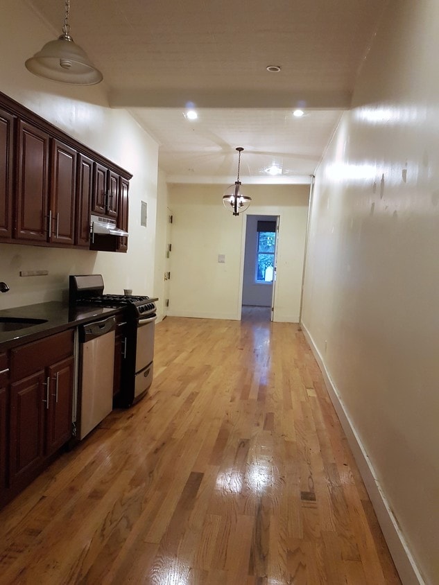
776 Hart St offers a mixture of comfort and quality. This property is situated at 780 Hart St in the 11237 area of Brooklyn. The professional leasing team is eager for your visit. It's time to love where you live. Stop by for a visit today.
776 Hart St is an apartment community located in Kings County and the 11237 ZIP Code. This area is served by the New York City Geographic District #32 attendance zone.
Neighboring Williamsburg to the east, Bushwick is a vibrant Brooklyn neighborhood known for its incredible street art, local shops, and diverse cuisine. Bushwick has historically served as a haven for immigrants, and now attracts scores of creative types to its many galleries and converted loft spaces.
In addition to a host of new local businesses, Bushwick offers residents exciting nightlife options and easy subway access. Colorful apartment buildings line quiet residential streets in Bushwick as well, providing plenty of rental opportunities to the community. Numerous neighborhood parks offer a tranquil reprieve from the big-city bustle.
Learn more about living in Bushwick| Colleges & Universities | Distance | ||
|---|---|---|---|
| Colleges & Universities | Distance | ||
| Drive: | 8 min | 2.5 mi | |
| Drive: | 8 min | 2.7 mi | |
| Drive: | 13 min | 4.0 mi | |
| Drive: | 11 min | 4.9 mi |


Transportation options available in Brooklyn include Central Avenue, located 0.3 mile from 776 Hart St. 776 Hart St is near LaGuardia, located 7.2 miles or 16 minutes away, and John F Kennedy International, located 11.4 miles or 19 minutes away.
| Transit / Subway | Distance | ||
|---|---|---|---|
| Transit / Subway | Distance | ||
|
|
Walk: | 5 min | 0.3 mi |
|
|
Walk: | 6 min | 0.4 mi |
|
|
Walk: | 8 min | 0.4 mi |
|
|
Walk: | 9 min | 0.5 mi |
|
|
Walk: | 12 min | 0.7 mi |
| Commuter Rail | Distance | ||
|---|---|---|---|
| Commuter Rail | Distance | ||
|
|
Drive: | 7 min | 2.7 mi |
|
|
Drive: | 9 min | 2.9 mi |
|
|
Drive: | 11 min | 3.9 mi |
|
|
Drive: | 12 min | 4.3 mi |
|
|
Drive: | 11 min | 4.5 mi |
| Airports | Distance | ||
|---|---|---|---|
| Airports | Distance | ||
|
LaGuardia
|
Drive: | 16 min | 7.2 mi |
|
John F Kennedy International
|
Drive: | 19 min | 11.4 mi |
Time and distance from 776 Hart St.
| Shopping Centers | Distance | ||
|---|---|---|---|
| Shopping Centers | Distance | ||
| Drive: | 3 min | 1.1 mi | |
| Drive: | 6 min | 2.1 mi | |
| Drive: | 6 min | 2.6 mi |
| Parks and Recreation | Distance | ||
|---|---|---|---|
| Parks and Recreation | Distance | ||
|
Maria Hernandez Park
|
Walk: | 4 min | 0.2 mi |
|
Martinez Playground
|
Drive: | 5 min | 1.8 mi |
|
Sternberg Park
|
Drive: | 5 min | 1.9 mi |
|
Hattie Carthan Garden
|
Drive: | 6 min | 2.2 mi |
|
St. John's Park
|
Drive: | 8 min | 2.4 mi |
| Hospitals | Distance | ||
|---|---|---|---|
| Hospitals | Distance | ||
| Walk: | 9 min | 0.5 mi | |
| Drive: | 3 min | 1.2 mi | |
| Drive: | 7 min | 2.4 mi |
| Military Bases | Distance | ||
|---|---|---|---|
| Military Bases | Distance | ||
| Drive: | 20 min | 7.5 mi | |
| Drive: | 30 min | 11.7 mi |
What Are Walk Score®, Transit Score®, and Bike Score® Ratings?
Walk Score® measures the walkability of any address. Transit Score® measures access to public transit. Bike Score® measures the bikeability of any address.
What is a Sound Score Rating?
A Sound Score Rating aggregates noise caused by vehicle traffic, airplane traffic and local sources
780 Hart St
Brooklyn, NY 11237


