$7,300 / Month
75 Bourne St Unit 2
Auburndale, MA 02466
2 Weeks Ago
Favorites
-
Bedrooms
4
-
Bathrooms
3.5
-
Square Feet
3,975 sq ft
Highlights
- Furnished
- Basement
75 Bourne St Unit 2

Favorites
About This Home
12 Month Lease,
$7,300 deposit
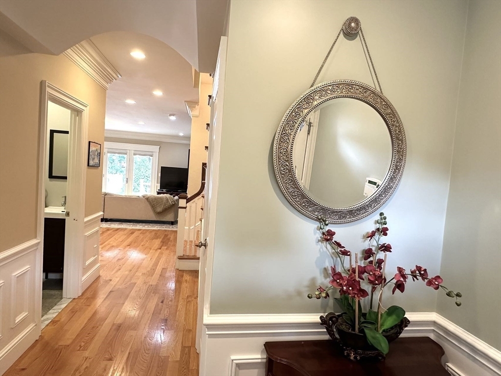
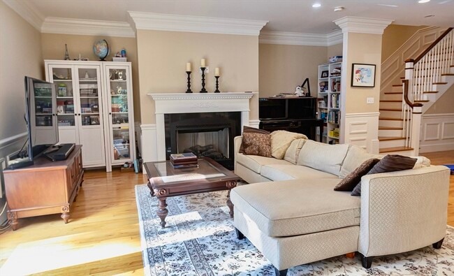
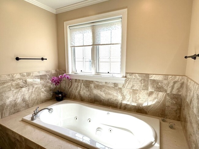
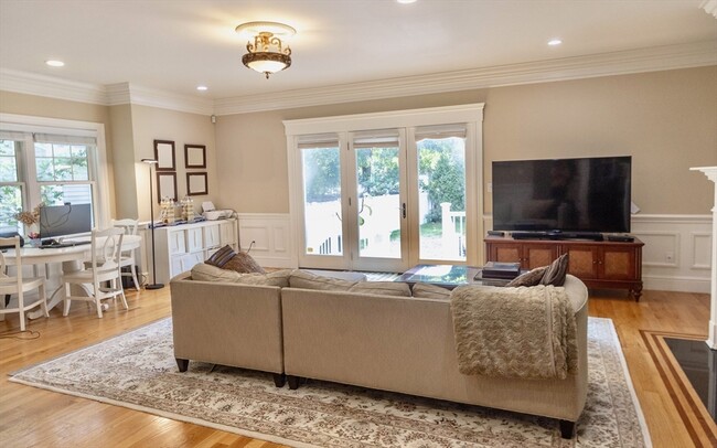
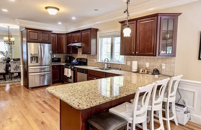
2 oversized bedrooms and full bath on thrid floor, each can fit a king size bed and an office area. Finished basement is ideal for recreation or gym with its own bathroom. Price furnished, price unfurnished available. Water/sewer included.
75 Bourne St is an apartment community located in Middlesex County and the 02466 ZIP Code. This area is served by the Newton attendance zone.
* Price shown is base rent and may not include non-optional fees and utilities.
Price, availability, fees, and any applicable rent special are subject to change without notice.
* Square footage definitions vary. Displayed square footage is approximate.
Apartment Features
- Basement
- Office
- Furnished
- Furnished Units Available
Fees and Policies
The fees below are based on community-supplied data and may exclude additional fees and utilities.
- Parking
-
Other--
Details
Property Information
-
2 units
-
Furnished Units Available
Location
Get Directions
Auburndale, affectionately referred to as “The Dale” by locals, is one of 13 villages in the City of Newton. Situated near the intersection of Interstates 90 and 95, the Dale is surrounded by the City of Waltham and the Charles River as well as three other Newton villages including West Newton, Waban, and Newton Lower Falls. Getting around from the Dale is simple with access to the MBTA commuter rail.
The western end of Auburndale is well known for containing two historic parks, Norumbega Park and the Auburndale Cove Park and Playground, which offer plenty of options for outdoor recreation. The Auburndale Historic District is comprised of about 275 properties, many of which are on the National Register of Historic Places. Treasured resources like the Auburndale Community Library and Lasell College provide learning opportunities for the community.
Learn more about living in Auburndale
Education
| Colleges & Universities | Distance | ||
|---|---|---|---|
| Colleges & Universities | Distance | ||
| Drive: | 6 min | 2.4 mi | |
| Drive: | 10 min | 4.3 mi | |
| Drive: | 12 min | 5.6 mi | |
| Drive: | 10 min | 5.6 mi |
75 Bourne St Unit 2 is within 6 minutes or 2.4 miles from Brandeis University. It is also near Bentley University and Babson College.
Schools


Public Elementary School
Grades PK-5
383 Students
Nearby
Public Elementary School
Grades K-5
368 Students
Attendance Zone
Public Middle School
Grades 6-8
920 Students
Attendance Zone
Public High School
Grades 9-12
2,099 Students
Attendance Zone
Private Elementary, Middle & High School
Grades 3-12
161 Students
Nearby
Private Elementary & Middle School
Grades PK-8
320 Students
Nearby
School data provided by
 The GreatSchools Rating helps parents compare schools within a state based on a variety of school quality indicators and provides a helpful picture of how effectively each school serves all of its students. Ratings are on a scale of 1 (below average) to 10 (above average) and can include test scores, college readiness, academic progress, advanced courses, equity, discipline and attendance data. We also advise parents to visit schools, consider other information on school performance and programs, and consider family needs as part of the school selection process.
View GreatSchools Rating Methodology
View GreatSchools Rating Methodology
Transportation options available in Auburndale include Riverside Station, located 0.9 mile from 75 Bourne St Unit 2. 75 Bourne St Unit 2 is near General Edward Lawrence Logan International, located 14.5 miles or 23 minutes away, and Worcester Regional, located 38.2 miles or 54 minutes away.
| Transit / Subway | Distance | ||
|---|---|---|---|
| Transit / Subway | Distance | ||
|
|
Walk: | 17 min | 0.9 mi |
|
|
Drive: | 4 min | 2.0 mi |
|
|
Drive: | 6 min | 3.1 mi |
|
|
Drive: | 8 min | 3.9 mi |
|
|
Drive: | 8 min | 4.4 mi |
| Commuter Rail | Distance | ||
|---|---|---|---|
| Commuter Rail | Distance | ||
|
|
Drive: | 4 min | 2.0 mi |
| Drive: | 6 min | 2.6 mi | |
|
|
Drive: | 6 min | 2.9 mi |
|
|
Drive: | 11 min | 6.7 mi |
|
|
Drive: | 12 min | 7.5 mi |
| Airports | Distance | ||
|---|---|---|---|
| Airports | Distance | ||
|
General Edward Lawrence Logan International
|
Drive: | 23 min | 14.5 mi |
|
Worcester Regional
|
Drive: | 54 min | 38.2 mi |
Time and distance from 75 Bourne St Unit 2.
| Shopping Centers | Distance | ||
|---|---|---|---|
| Shopping Centers | Distance | ||
| Walk: | 13 min | 0.7 mi | |
| Drive: | 4 min | 1.8 mi | |
| Drive: | 5 min | 2.7 mi |
75 Bourne St Unit 2 has 3 shopping centers within 2.7 miles, which is about a 5-minute walk. The miles and minutes will be for the farthest away property.
| Parks and Recreation | Distance | ||
|---|---|---|---|
| Parks and Recreation | Distance | ||
|
Land's Sake Farm
|
Drive: | 7 min | 2.9 mi |
|
Hemlock Gorge Reservation
|
Drive: | 9 min | 4.7 mi |
|
Beaver Brook Reservation
|
Drive: | 10 min | 5.0 mi |
|
Hammond Pond Reservation
|
Drive: | 9 min | 5.0 mi |
|
Cutler Park Reservation
|
Drive: | 9 min | 5.4 mi |
75 Bourne St Unit 2 has 5 parks within 5.4 miles, including Land's Sake Farm, Hemlock Gorge Reservation, and Hammond Pond Reservation.
| Hospitals | Distance | ||
|---|---|---|---|
| Hospitals | Distance | ||
| Drive: | 4 min | 2.0 mi | |
| Drive: | 6 min | 2.9 mi | |
| Drive: | 11 min | 5.4 mi |
75 Bourne St Unit 2 has 3 hospitals within 5.4 miles, the nearest is Newton - Wellesley Hospital which is 2.0 miles away and a 4 minute drive.
| Military Bases | Distance | ||
|---|---|---|---|
| Military Bases | Distance | ||
| Drive: | 16 min | 9.1 mi | |
| Drive: | 17 min | 9.5 mi |
75 Bourne St Unit 2 is 9.1 miles from US Military Reservation, and is convenient to other military bases, including Hanscom Air Force Base.
Amenities
- Basement
- Office
- Furnished
- Furnished Units Available
75 Bourne St Unit 2 Photos
What Are Walk Score®, Transit Score®, and Bike Score® Ratings?
Walk Score® measures the walkability of any address. Transit Score® measures access to public transit. Bike Score® measures the bikeability of any address.
What is a Sound Score Rating?
A Sound Score Rating aggregates noise caused by vehicle traffic, airplane traffic and local sources

75 Bourne St
Auburndale, MA 02466