
Williamsburg
200 W Galbraith Rd,
Cincinnati, OH 45215
$843 - $2,765
Studio - 3 Beds

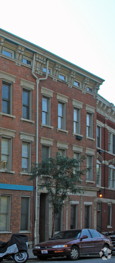
Experience Cincinnati living at 726 State Ave. Situated in Cincinnati's 45204 area, moving to this community gives you a number of nearby experiences to check out. From location to floorplan options, the professional leasing team will assist you in finding your new place. Be sure to check out the current floorplan options. Drop by the leasing office to find out the current pricing.
726 State Ave is an apartment community located in Hamilton County and the 45204 ZIP Code. This area is served by the Cincinnati Public Schools attendance zone.
Filled with historic shotgun houses, South Fairmount was first settled in the early 1800s. This large neighborhood is bordered by Mill Creek, directly west of Downtown Cincinnati and minutes from the University of Cincinnati. With just two miles to downtown, residents of South Fairmount enjoy fast access to all of Cincinnati's attractions, including the Cincinnati Zoo, Paul Brown Stadium (home of the Cincinnati Bengals), and the Cincinnati Music Hall.
Apartments in South Fairmount are near the Ohio River and several riverfront parks, including Embshoff Woods and Nature Preserve and the popular Eden Park, home of the Cincinnati Playhouse and the Cincinnati Art Museum.
Learn more about living in South FairmountCompare neighborhood and city base rent averages by bedroom.
| South Fairmount | Cincinnati, OH | |
|---|---|---|
| Studio | $662 | $1,072 |
| 1 Bedroom | $705 | $1,134 |
| 2 Bedrooms | $916 | $1,422 |
| 3 Bedrooms | $1,247 | $1,733 |
| Colleges & Universities | Distance | ||
|---|---|---|---|
| Colleges & Universities | Distance | ||
| Drive: | 10 min | 4.2 mi | |
| Drive: | 12 min | 4.4 mi | |
| Drive: | 13 min | 5.9 mi | |
| Drive: | 11 min | 6.1 mi |

Transportation options available in Cincinnati include Elm & Liberty Station, located 2.5 miles from 726 State Ave. 726 State Ave is near Cincinnati/Northern Kentucky International, located 15.5 miles or 28 minutes away.
| Transit / Subway | Distance | ||
|---|---|---|---|
| Transit / Subway | Distance | ||
| Drive: | 6 min | 2.5 mi | |
| Drive: | 6 min | 2.5 mi | |
| Drive: | 7 min | 2.7 mi | |
| Drive: | 7 min | 2.7 mi | |
| Drive: | 6 min | 3.0 mi |
| Commuter Rail | Distance | ||
|---|---|---|---|
| Commuter Rail | Distance | ||
|
|
Drive: | 5 min | 2.0 mi |
| Airports | Distance | ||
|---|---|---|---|
| Airports | Distance | ||
|
Cincinnati/Northern Kentucky International
|
Drive: | 28 min | 15.5 mi |
Scores provided by
Traffic
-Airport
-Businesses
-Scores provided by
HowLoud What is a Sound Score Rating? A Sound Score Rating aggregates noise caused by vehicle traffic, airplane traffic and local sources. How It WorksTime and distance from 726 State Ave.
| Shopping Centers | Distance | ||
|---|---|---|---|
| Shopping Centers | Distance | ||
| Drive: | 3 min | 1.2 mi | |
| Drive: | 3 min | 1.2 mi | |
| Drive: | 4 min | 1.9 mi |
| Parks and Recreation | Distance | ||
|---|---|---|---|
| Parks and Recreation | Distance | ||
|
Wilson Commons
|
Drive: | 4 min | 1.4 mi |
|
Museum of Natural History and Science
|
Drive: | 5 min | 2.0 mi |
|
OMNIMAX Theater
|
Drive: | 5 min | 2.0 mi |
|
Duke Energy Children's Museum
|
Drive: | 5 min | 2.0 mi |
|
Cincinnati History Museum
|
Drive: | 5 min | 2.0 mi |
| Hospitals | Distance | ||
|---|---|---|---|
| Hospitals | Distance | ||
| Drive: | 9 min | 4.5 mi | |
| Drive: | 9 min | 5.3 mi | |
| Drive: | 10 min | 5.9 mi |
| Military Bases | Distance | ||
|---|---|---|---|
| Military Bases | Distance | ||
| Drive: | 73 min | 55.7 mi | |
| Drive: | 79 min | 60.7 mi | |
| Drive: | 81 min | 64.0 mi |
What Are Walk Score®, Transit Score®, and Bike Score® Ratings?
Walk Score® measures the walkability of any address. Transit Score® measures access to public transit. Bike Score® measures the bikeability of any address.
What is a Sound Score Rating?
A Sound Score Rating aggregates noise caused by vehicle traffic, airplane traffic and local sources.


