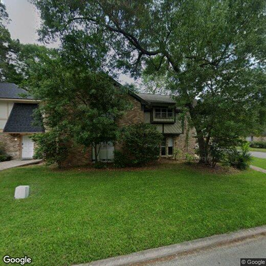
710 Snead Ct
710 Snead Ct
Conroe, TX 77302
Favorites
710 Snead Ct

Favorites
Check Back Soon for Upcoming Availability
| Beds | Baths | Average SF |
|---|---|---|
| 3 Bedrooms 3 Bedrooms 3 Br | 2.5 Baths 2.5 Baths 2.5 Ba | 2,495 SF |
710 Snead Ct,
Conroe,
TX
77302
Located 40 miles north of Houston, Conroe combines small-town atmosphere with contemporary living along the shores of Lake Conroe. The city offers year-round water recreation, including boating and fishing on its namesake lake. Downtown Conroe features the historic Crighton Theatre, built in 1935, which continues to host performances throughout the year. Outdoor enthusiasts appreciate W. Goodrich Jones State Forest, home to walking trails and native wildlife, including the protected red-cockaded woodpecker. Current rental trends show average prices ranging from $1,158 for one-bedroom units to $2,257 for four-bedroom homes, with most properties experiencing slight decreases in rates over the past year.
Housing options span from apartment communities to single-family homes across various neighborhoods, including the historic downtown area, lakefront properties near Lake Conroe, and the expanding west side.
Learn more about living in ConroeBelow are rent ranges for similar nearby apartments
Education
| Colleges & Universities | Distance | ||
|---|---|---|---|
| Colleges & Universities | Distance | ||
| Drive: | 13 min | 6.3 mi | |
| Drive: | 46 min | 35.4 mi | |
| Drive: | 49 min | 36.9 mi | |
| Drive: | 61 min | 45.4 mi |
710 Snead Ct is within 13 minutes or 6.3 miles from Lone Star College. It is also near Sam Houston State University and Univ. of Houston, Downtown.
Walkability Near 710 Snead Ct Conroe, TX 77302
Getting Around
 What do Walkability, Transit, Drivability, and Bikeability mean?
Walkability measures the walking distance to day-to-day needs.
Transit measures access to public transportation.
Drivability measures congestion, parking availability, and access to major roads.
Bikeability measures the suitability for cycling.
How It Works
What do Walkability, Transit, Drivability, and Bikeability mean?
Walkability measures the walking distance to day-to-day needs.
Transit measures access to public transportation.
Drivability measures congestion, parking availability, and access to major roads.
Bikeability measures the suitability for cycling.
How It Works
Not Walkable
Walkability
10
/ 100
Exceptionally Drivable
Drivability
100
/ 100
Fairly Bikeable
Bikeability
40
/ 100
Scores provided by
-
Soundscore™
-
/ 100
Traffic
-Airport
-Businesses
-Scores provided by
HowLoud What is a Sound Score Rating? A Sound Score Rating aggregates noise caused by vehicle traffic, airplane traffic and local sources. How It WorksYou May Also Like
Similar Rentals Nearby
-
-
-
-
3 Beds$2,295+Total Monthly PriceTotal Monthly Price NewPrices include base rent and required monthly fees of $95 - $105. Variable costs based on usage may apply.Base Rent:3 Beds$2,200+
Pets Allowed Pool Dishwasher Refrigerator Kitchen In Unit Washer & Dryer
-
3 Beds$2,013+4 Beds$2,299+Total Monthly PriceTotal Monthly Price NewPrices include base rent and required monthly fees. Variable costs based on usage may apply.2 Months Free
Pets Allowed Fitness Center Pool
-
-
3 Beds$1,665+4 Beds$1,765+Total Monthly Price12 Month LeaseTotal Monthly Price NewPrices include required monthly fees of $115.Base Rent:3 Beds$1,550+4 Beds$1,650+2 Months Free
Pets Allowed Dishwasher Walk-In Closets Tub / Shower Stainless Steel Appliances Online Services Washer & Dryer Hookups
-
-
-
3 Beds$1,765+4 Beds$1,865+Total Monthly Price12 Month LeaseTotal Monthly Price NewPrices include required monthly fees of $115.Base Rent:3 Beds$1,650+4 Beds$1,750+2 Months Free
Pets Allowed Dishwasher Walk-In Closets Tub / Shower Stainless Steel Appliances Online Services Washer & Dryer Hookups


What Are Walk Score®, Transit Score®, and Bike Score® Ratings?
Walk Score® measures the walkability of any address. Transit Score® measures access to public transit. Bike Score® measures the bikeability of any address.
What is a Sound Score Rating?
A Sound Score Rating aggregates noise caused by vehicle traffic, airplane traffic and local sources.

710 Snead Ct
Conroe, TX 77302