
1103 Hampton Way
1103 Hampton Way,
Abington, MA 02351
2 Beds $3,250

Find your new apartment at 30 School St in Holbrook, MA. This community is located in the 2343 area of Holbrook. Let the knowledgeable leasing staff show you everything this community has in store. Select from 0 to 2 bedroom floor plans, then contact us for rent information. Experience a better way of living at 30 School St. Contact us or stop in to see available floor plans.
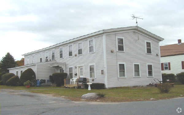
70 Belcher St is an apartment community located in Norfolk County and the 02343 ZIP Code. This area is served by the Holbrook attendance zone.
A hidden gem in southeastern Massachusetts, Holbrook offers beautiful woodlands, small lakes, and welcoming neighborhoods. Located just 18 miles south of Boston, residents enjoy access to everything Boston’s bustling streets have to offer. From historic museums and delicious restaurants to waterfront views and an international airport, Boston has it all.
Though Holbrook is proximal to Boston, it has a definitive suburban charm of its own. Traveling directly south through town, hop on Route 37 to find the best restaurants, bars, local businesses, banks, and convenience stores. With public and private schools in the area, a quality education awaits the students of Holbrook.
Learn more about living in Holbrook| Colleges & Universities | Distance | ||
|---|---|---|---|
| Colleges & Universities | Distance | ||
| Drive: | 14 min | 6.3 mi | |
| Drive: | 15 min | 6.7 mi | |
| Drive: | 19 min | 10.9 mi | |
| Drive: | 22 min | 11.7 mi |


Transportation options available in Holbrook include Braintree Station, located 4.3 miles from 70 Belcher St. 70 Belcher St is near General Edward Lawrence Logan International, located 18.6 miles or 31 minutes away.
| Transit / Subway | Distance | ||
|---|---|---|---|
| Transit / Subway | Distance | ||
|
|
Drive: | 10 min | 4.3 mi |
|
|
Drive: | 12 min | 6.0 mi |
|
|
Drive: | 16 min | 8.3 mi |
|
|
Drive: | 19 min | 9.3 mi |
|
|
Drive: | 19 min | 10.3 mi |
| Commuter Rail | Distance | ||
|---|---|---|---|
| Commuter Rail | Distance | ||
|
|
Drive: | 3 min | 1.5 mi |
|
|
Drive: | 8 min | 4.1 mi |
|
|
Drive: | 8 min | 4.2 mi |
|
|
Drive: | 9 min | 4.5 mi |
| Drive: | 11 min | 5.8 mi |
| Airports | Distance | ||
|---|---|---|---|
| Airports | Distance | ||
|
General Edward Lawrence Logan International
|
Drive: | 31 min | 18.6 mi |
Time and distance from 70 Belcher St.
| Shopping Centers | Distance | ||
|---|---|---|---|
| Shopping Centers | Distance | ||
| Walk: | 10 min | 0.6 mi | |
| Walk: | 15 min | 0.8 mi | |
| Drive: | 4 min | 2.2 mi |
| Parks and Recreation | Distance | ||
|---|---|---|---|
| Parks and Recreation | Distance | ||
|
Ames Nowell State Park
|
Drive: | 6 min | 3.2 mi |
|
Adams National Historical Park
|
Drive: | 15 min | 7.6 mi |
|
Houghton's Pond Recreation Area
|
Drive: | 15 min | 8.8 mi |
|
Blue Hills Reservation
|
Drive: | 15 min | 8.8 mi |
|
Mass Audubon's Mildred Morse Allen Wildlife Sanctuary
|
Drive: | 20 min | 10.4 mi |
| Hospitals | Distance | ||
|---|---|---|---|
| Hospitals | Distance | ||
| Drive: | 7 min | 3.6 mi | |
| Drive: | 11 min | 5.5 mi | |
| Drive: | 12 min | 6.7 mi |
What Are Walk Score®, Transit Score®, and Bike Score® Ratings?
Walk Score® measures the walkability of any address. Transit Score® measures access to public transit. Bike Score® measures the bikeability of any address.
What is a Sound Score Rating?
A Sound Score Rating aggregates noise caused by vehicle traffic, airplane traffic and local sources
70 Belcher St
Holbrook, MA 02343


