$1,600 / Month

678 Main St

,

Port Jefferson, NY 11777

Share Listing
Favorites
678 Main St
Share Listing
Favorites

Check Back Soon for Upcoming Availability

Beds Baths Average SF
2 Bedrooms 2 Bedrooms 2 Br 1 Bath 1 Bath 1 Ba

About This Property

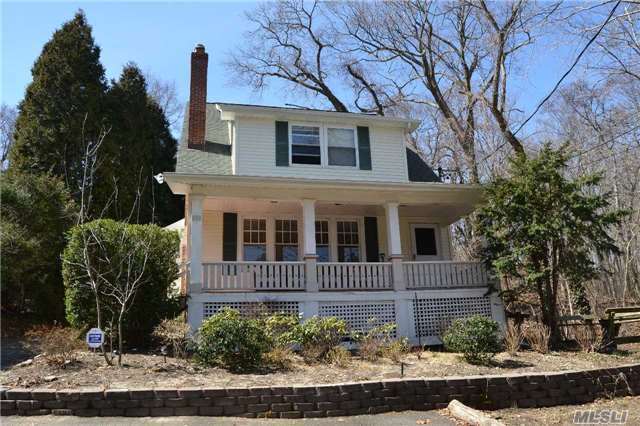
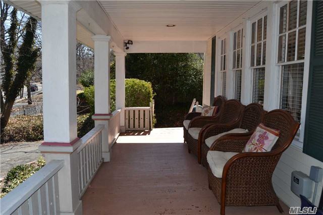
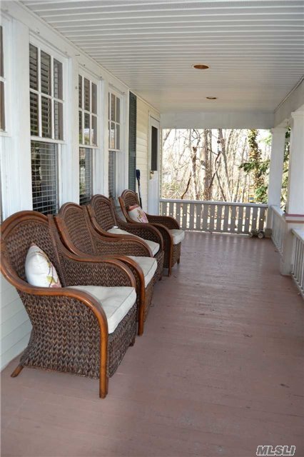
Occupancy Is August 1st. Credit/ Proof Of Ability To Pay Required . No Pets! Adorable 2 Bedroom 2nd Floor Apartment--1/4 Mile From Village Close To All-Shopping-Transportation-Bars-Restaurants-Ferry

678 Main St is an apartment community located in Suffolk County and the 11777 ZIP Code.

Location
678 Main St, Port Jefferson,
NY 11777
Get Directions
| Edit

Under 30 minutes

Commute Time is calculated at rush hour.
City - Port Jefferson

Port Jefferson sits on the North Shore of Long Island, where a working harbor meets a walkable village that feels genuinely removed from the pace of New York City, yet stays connected to it. The village traces its roots to 17th-century settlement and later built its identity around a thriving shipbuilding industry in the 1800s. Today, that maritime past is still visible in the architecture and the active waterfront, which serves as the Long Island terminus for the Bridgeport and Port Jefferson Ferry. Stony Brook University, one of the flagship campuses of the State University of New York system, sits just a few miles west and shapes much of the surrounding region's academic and healthcare presence. The village itself covers only four square miles, so daily life is compact and walkable, with the downtown core, harbor, and residential streets all within easy reach of one another.

Learn more about living in Port Jefferson 
Education
Colleges & Universities Distance
Drive: 10 min 5.9 mi
Drive: 16 min 8.0 mi
Drive: 23 min 13.5 mi
Drive: 30 min 17.5 mi
678 Main St is within 10 minutes or 5.9 miles from Stony Brook University. It is also near SUNY Suffolk Co., Ammerman and St Joseph's Coll., Long Island.
Transportation

678 Main St is near Long Island MacArthur, located 16.6 miles or 28 minutes away, and Tweed/New Haven, located 40.8 miles or 115 minutes away.

Commuter Rail Distance
Walk: 10 min 0.5 mi
Drive: 12 min 6.4 mi
Drive: 16 min 9.2 mi
Drive: 18 min 9.7 mi
Drive: 17 min 11.0 mi
Airports Distance
Airports Distance
Long Island MacArthur
Drive: 28 min 16.6 mi
Tweed/New Haven
Drive: 115 min 40.8 mi

Walkability Near 678 Main St Port Jefferson, NY 11777

Getting Around
Fairly Walkable
Walkability
50 / 100
Some Public Transit
Transit
50 / 100
Exceptionally Drivable
Drivability
100 / 100
Fairly Bikeable
Bikeability
40 / 100

Scores provided by

What do Walkability, Transit, Drivability, and Bikeability mean? Walkability measures the walking distance to day-to-day needs. Transit measures access to public transportation. Drivability measures congestion, parking availability, and access to major roads. Bikeability measures the suitability for cycling. How It Works
-
Soundscore
- / 100

Traffic

-

Airport

-

Businesses

-

Scores provided by

HowLoud What is a Sound Score Rating? A Sound Score Rating aggregates noise caused by vehicle traffic, airplane traffic and local sources. How It Works
Points of Interest

Time and distance from 678 Main St.

Shopping Centers Distance
Walk: 13 min 0.7 mi
Walk: 18 min 0.9 mi
Walk: 20 min 1.1 mi
678 Main St has 3 shopping centers within 1.1 miles, which is about a 20-minute walk. The miles and minutes will be for the farthest away property.
Parks and Recreation Distance
Lake Ronkonkoma
Drive: 18 min 10.3 mi
Cathedral Pines County Park
Drive: 23 min 11.3 mi
Sweetbriar Nature Center
Drive: 19 min 11.8 mi
Nissequogue River State Park
Drive: 27 min 15.4 mi
678 Main St has 4 parks within 15.4 miles, including Cathedral Pines County Park, Lake Ronkonkoma, and Sweetbriar Nature Center.
Hospitals Distance
Hospitals Distance
Walk: 8 min 0.5 mi
Walk: 15 min 0.8 mi
Drive: 19 min 12.5 mi
678 Main St has 3 hospitals within 12.5 miles, the nearest is John T. Mather Memorial Hospital of Port Jefferson which is 0.5 mile away and a 8 minute walk.
Military Bases Distance
Drive: 49 min 27.2 mi
Drive: 69 min 46.7 mi
Drive: 96 min 63.5 mi
678 Main St has 3 military bases within 63.5 miles, the nearest is Eatons Neck CG Station North which is 27.2 miles away and a 49 minute drive.

You May Also Like

Similar Rentals Nearby