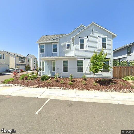

677 Silo St
677 Silo St
Folsom, CA 95630
2 Weeks Ago
|
Edit
Favorites
677 Silo St

Favorites
Check Back Soon for Upcoming Availability
Location
Get Directions
Located in the Sierra Nevada foothills, Folsom combines outdoor recreation with city conveniences. The city features an extensive network of bike trails, including the American River Bike Trail connecting to Sacramento. Folsom Lake and Lake Natoma offer water sports and shoreline activities throughout the year. The historic district along Sutter Street preserves Gold Rush-era architecture, housing local businesses in its well-maintained buildings. Current rental options include both contemporary communities and properties in historic neighborhoods, with average monthly rents at $2,009 for one-bedroom units and $2,403 for two bedrooms.
Folsom's history as a Gold Rush settlement has transformed over time, with Intel Corporation now established as a major employer in the region. The Folsom Cordova Unified School District serves the area, while Folsom Lake College provides higher education opportunities.
Learn more about living in Folsom
Education
| Colleges & Universities | Distance | ||
|---|---|---|---|
| Colleges & Universities | Distance | ||
| Drive: | 11 min | 4.0 mi | |
| Drive: | 23 min | 12.1 mi | |
| Drive: | 24 min | 12.6 mi | |
| Drive: | 23 min | 16.6 mi |
677 Silo St is within 11 minutes or 4.0 miles from Folsom Lake College, Folsom. It is also near Sierra College, Rocklin Campus and American River College.
Transportation options available in Folsom include Glenn, located 0.6 mile from 677 Silo St. 677 Silo St is near Sacramento International, located 32.9 miles or 43 minutes away.
| Transit / Subway | Distance | ||
|---|---|---|---|
| Transit / Subway | Distance | ||
|
|
Walk: | 11 min | 0.6 mi |
|
|
Drive: | 3 min | 1.6 mi |
|
|
Drive: | 4 min | 1.7 mi |
|
|
Drive: | 6 min | 3.3 mi |
|
|
Drive: | 11 min | 6.6 mi |
| Commuter Rail | Distance | ||
|---|---|---|---|
| Commuter Rail | Distance | ||
|
|
Drive: | 25 min | 13.6 mi |
|
|
Drive: | 24 min | 14.4 mi |
| Drive: | 33 min | 21.8 mi | |
|
|
Drive: | 34 min | 21.9 mi |
| Drive: | 30 min | 22.6 mi |
| Airports | Distance | ||
|---|---|---|---|
| Airports | Distance | ||
|
Sacramento International
|
Drive: | 43 min | 32.9 mi |
Time and distance from 677 Silo St.
| Shopping Centers | Distance | ||
|---|---|---|---|
| Shopping Centers | Distance | ||
| Walk: | 10 min | 0.5 mi | |
| Walk: | 11 min | 0.6 mi | |
| Walk: | 13 min | 0.7 mi |
677 Silo St has 3 shopping centers within 0.7 mile, which is about a 13-minute walk. The miles and minutes will be for the farthest away property.
| Parks and Recreation | Distance | ||
|---|---|---|---|
| Parks and Recreation | Distance | ||
|
Folsom Powerhouse State Historic Park
|
Drive: | 6 min | 2.2 mi |
|
Folsom City Zoo Sanctuary
|
Drive: | 6 min | 2.4 mi |
|
Folsom Lake State Recreation Area
|
Drive: | 14 min | 5.3 mi |
|
Sailor Bar County Park
|
Drive: | 12 min | 5.9 mi |
|
Lower Sunrise Recreational Area
|
Drive: | 14 min | 7.9 mi |
677 Silo St has 5 parks within 7.9 miles, including Folsom Powerhouse State Historic Park, Folsom City Zoo Sanctuary, and Folsom Lake State Recreation Area.
| Hospitals | Distance | ||
|---|---|---|---|
| Hospitals | Distance | ||
| Drive: | 6 min | 2.7 mi | |
| Drive: | 18 min | 10.3 mi | |
| Drive: | 18 min | 11.1 mi |
677 Silo St has 3 hospitals within 11.1 miles, the nearest is Mercy Hospital of Folsom which is 2.7 miles away and a 6 minute drive.
| Military Bases | Distance | ||
|---|---|---|---|
| Military Bases | Distance | ||
| Drive: | 35 min | 16.9 mi |
677 Silo St is 16.9 miles and a 35 minute drive from McClellan Air Force Base.
You May Also Like
Similar Rentals Nearby


What Are Walk Score®, Transit Score®, and Bike Score® Ratings?
Walk Score® measures the walkability of any address. Transit Score® measures access to public transit. Bike Score® measures the bikeability of any address.
What is a Sound Score Rating?
A Sound Score Rating aggregates noise caused by vehicle traffic, airplane traffic and local sources