
$3,500
/ Month
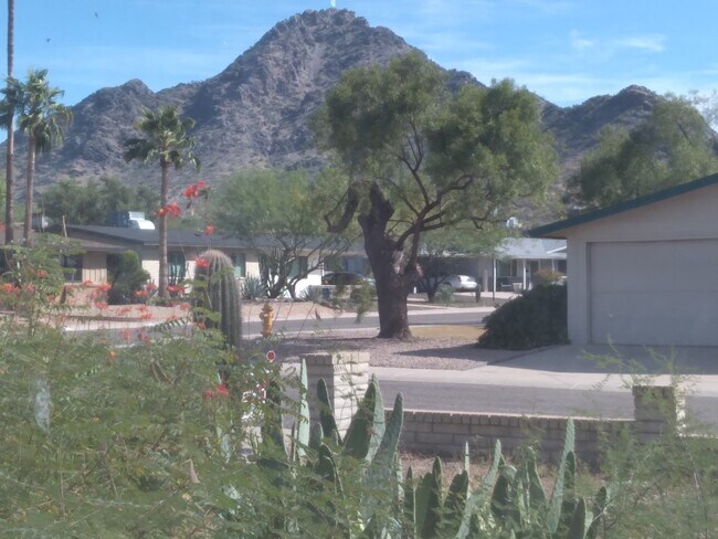
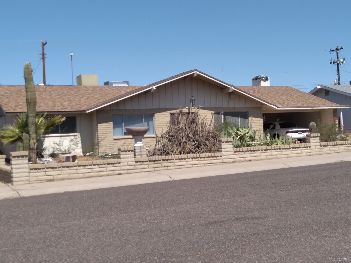
6734 N 19th St
Phoenix, AZ 85016
2 Weeks Ago
Favorites
6734 N 19th St

Favorites
Check Back Soon for Upcoming Availability
| Beds | Baths | Average SF |
|---|---|---|
| 3 Bedrooms 3 Bedrooms 3 Br | 2 Baths 2 Baths 2 Ba | 2,400 SF |
Fees and Policies
The fees below are based on community-supplied data and may exclude additional fees and utilities.
- Dogs Allowed
-
Fees not specified
- Cats Allowed
-
Fees not specified
- Parking
-
Garage--
6734 N 19th St is a house located in Maricopa County and the 85016 ZIP Code.
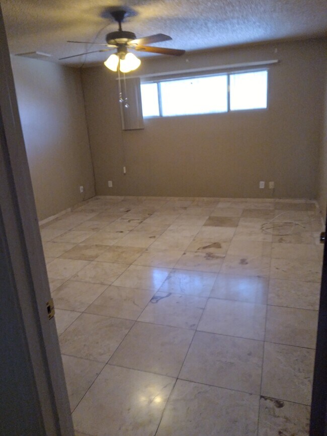
House Features
Air Conditioning
Dishwasher
Washer/Dryer Hookup
Tub/Shower
- Washer/Dryer Hookup
- Air Conditioning
- Ceiling Fans
- Smoke Free
- Storage Space
- Tub/Shower
- Dishwasher
- Disposal
- Range
- Tile Floors
- Dining Room
- Family Room
- Views
- Large Bedrooms
- Patio
Location
Get Directions
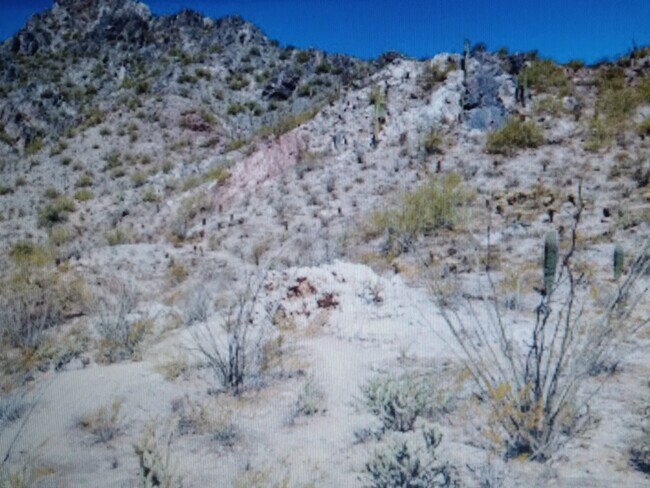
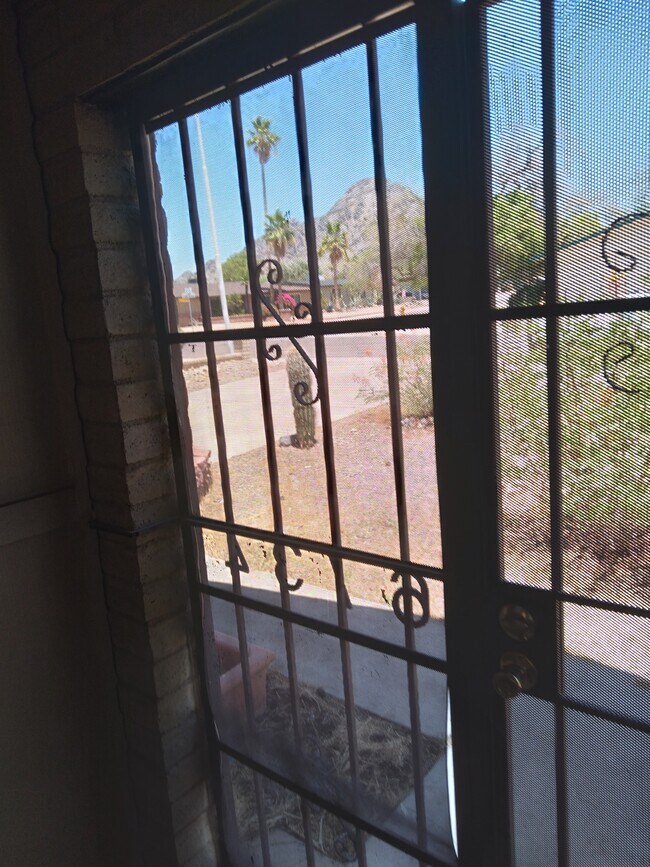
Camelback, sometimes referred to as Camelback East or Camelback East Village, is a sprawling suburb situated between Piestewa Peak and Camelback Mountain. There are a wide variety of rentals available in this diverse community, from luxury apartments to charming houses and everything in between.
Camelback residents enjoy beautiful mountain vistas that are visible throughout the community, including from many of the area’s rentals. Hiking is a popular pastime in the community, with quick access to some of the region’s most iconic trails.
Camelback is also convenient to some of Phoenix’s most renowned attractions, including Papago Park, the Phoenix Zoo, Desert Botanical Garden, and Phoenix Mountains Preserve. Commuting and traveling from Camelback is a breeze with proximity to Highway 51 and Phoenix Sky Harbor International Airport.
Learn more about living in CamelbackBelow are rent ranges for similar nearby apartments
Amenities
- Washer/Dryer Hookup
- Air Conditioning
- Ceiling Fans
- Smoke Free
- Storage Space
- Tub/Shower
- Dishwasher
- Disposal
- Range
- Tile Floors
- Dining Room
- Family Room
- Views
- Large Bedrooms
- Patio
Education
| Colleges & Universities | Distance | ||
|---|---|---|---|
| Colleges & Universities | Distance | ||
| Drive: | 12 min | 5.9 mi | |
| Drive: | 13 min | 6.1 mi | |
| Drive: | 14 min | 6.7 mi | |
| Drive: | 16 min | 7.1 mi |
6734 N 19th St is within 12 minutes or 5.9 miles from DeVry University, Arizona. It is also near Argosy University and Phoenix College.
Transportation options available in Phoenix include Glendale/19Th Ave, located 3.8 miles from 6734 N 19th St. 6734 N 19th St is near Phoenix Sky Harbor International, located 9.9 miles or 16 minutes away, and Phoenix-Mesa Gateway, located 36.7 miles or 49 minutes away.
| Transit / Subway | Distance | ||
|---|---|---|---|
| Transit / Subway | Distance | ||
|
|
Drive: | 7 min | 3.8 mi |
|
|
Drive: | 9 min | 4.5 mi |
|
|
Drive: | 9 min | 4.7 mi |
|
|
Drive: | 9 min | 4.7 mi |
|
|
Drive: | 10 min | 5.1 mi |
| Commuter Rail | Distance | ||
|---|---|---|---|
| Commuter Rail | Distance | ||
|
|
Drive: | 49 min | 37.8 mi |
| Airports | Distance | ||
|---|---|---|---|
| Airports | Distance | ||
|
Phoenix Sky Harbor International
|
Drive: | 16 min | 9.9 mi |
|
Phoenix-Mesa Gateway
|
Drive: | 49 min | 36.7 mi |
Time and distance from 6734 N 19th St.
| Shopping Centers | Distance | ||
|---|---|---|---|
| Shopping Centers | Distance | ||
| Walk: | 16 min | 0.9 mi | |
| Walk: | 17 min | 0.9 mi | |
| Drive: | 2 min | 1.3 mi |
6734 N 19th St has 3 shopping centers within 1.3 miles, which is about a 2-minute walk. The miles and minutes will be for the farthest away property.
| Parks and Recreation | Distance | ||
|---|---|---|---|
| Parks and Recreation | Distance | ||
|
Granada Park
|
Walk: | 10 min | 0.5 mi |
|
Desert Storm Park
|
Drive: | 4 min | 2.3 mi |
|
Tonto National Forest
|
Drive: | 8 min | 4.0 mi |
|
Steele Indian School Park
|
Drive: | 9 min | 5.0 mi |
|
Dreamy Draw Recreation Area
|
Drive: | 8 min | 5.4 mi |
6734 N 19th St has 5 parks within 5.4 miles, including Granada Park, Desert Storm Park, and Dreamy Draw Recreation Area.
| Hospitals | Distance | ||
|---|---|---|---|
| Hospitals | Distance | ||
| Drive: | 6 min | 3.8 mi | |
| Drive: | 8 min | 4.1 mi | |
| Drive: | 8 min | 4.3 mi |
6734 N 19th St has 3 hospitals within 4.3 miles, the nearest is Phoenix Indian Medical Center which is 3.8 miles away and a 6 minute drive.
| Military Bases | Distance | ||
|---|---|---|---|
| Military Bases | Distance | ||
| Drive: | 17 min | 9.8 mi | |
| Drive: | 36 min | 18.1 mi | |
| Drive: | 106 min | 81.4 mi |
6734 N 19th St has 3 military bases within 81.4 miles, the nearest is Phoenix Sky Harbor Airport Air Guard Station which is 9.8 miles away and a 17 minute drive.
You May Also Like
Similar Rentals Nearby
-
-
-
-
-
-
1 / 51

-
-
-
-


What Are Walk Score®, Transit Score®, and Bike Score® Ratings?
Walk Score® measures the walkability of any address. Transit Score® measures access to public transit. Bike Score® measures the bikeability of any address.
What is a Sound Score Rating?
A Sound Score Rating aggregates noise caused by vehicle traffic, airplane traffic and local sources
6734 N 19th St
Phoenix, AZ 85016