
$1,700
/ Month
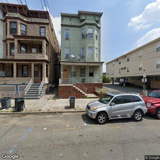
67 Andrew St
Bayonne, NJ 07002
Today
|
Edit
Favorites
-
Bedrooms
2
-
Bathrooms
1
-
Square Feet
--
-
Available
Available Now
Highlight
- Living Room
67 Andrew St

Favorites
About This Home
Available Now
Welcome to this beautifully renovated 2-bedroom apartment in Bayonne, NJ, featuring brand-new flooring and freshly painted walls throughout. This bright, inviting home offers a perfect blend of comfort and convenience, located near local bus transportation, Bayonne High School, and nearby parks for everyday ease. The property is vacant and ready for immediate move-in. Schedule your showing today and make it your new home!
67 Andrew St is an apartment community located in Hudson County and the 07002 ZIP Code.
* Price shown is base rent. Excludes user-selected optional fees and variable or usage-based fees and required charges due at or prior to move-in or at move-out. Price, availability, fees, and any applicable rent special are subject to change without notice.
* Square footage definitions vary. Displayed square footage is approximate.
Home Details
Bedrooms and Bathrooms
2 Main Level Bedrooms
1 Full Bathroom
Interior Spaces
Living Room
Multi-Level Property
Kitchen
Gas Oven or Range
Utilities
Heating System Uses Gas
Cooling System Mounted In Outer Wall Opening
Window Unit Cooling System
Community Details
Contact
- Listed by NATASHA PERSAUD | PROVIDENT LEGACY REAL ESTATE SERVICES LLC
- Contact
-
Source
Hudson County Multiple Listing Service
Copyright © 2026 Hudson County Multiple Listing Service. All rights reserved. All information provided by the listing agent/broker is deemed reliable but is not guaranteed and should be independently verified.
Location
Get Directions
Amenities
- Oven
Also known as Constable's Hook, historic Constable Hook is one of New Jersey and the East Coast’s oldest communities. Nestled between the Hudson River and Newark Bay, Constable Hook consists of the southern portion of Bayonne. Bayonne prides itself on natural conservation and the area is home to several marinas and waterfront greenspaces. Golf fans spend days on the green at the Bayonne Golf Club, while Dennis P. Collins Park is a local favorite for its skatepark and views of the Bayonne Bridge and freight and cruise ships. Along Broadway, residents have access to restaurants, shops, and bars giving the area the feel of a small town. The neighborhood has a relatively low cost of living and has a variety of mid-range to upscale options available for rent.
Learn more about living in Constable Hook
Education
| Colleges & Universities | Distance | ||
|---|---|---|---|
| Colleges & Universities | Distance | ||
| Drive: | 10 min | 4.3 mi | |
| Drive: | 11 min | 5.1 mi | |
| Drive: | 16 min | 6.7 mi | |
| Drive: | 17 min | 9.3 mi |
67 Andrew St is within 10 minutes or 4.3 miles from New Jersey City University. It is also near Coll. of Staten Island, CUNY and Wagner College.
Transportation options available in Bayonne include 22Nd Street, located 0.6 mile from 67 Andrew St. 67 Andrew St is near Newark Liberty International, located 7.4 miles or 13 minutes away, and LaGuardia, located 19.7 miles or 39 minutes away.
| Transit / Subway | Distance | ||
|---|---|---|---|
| Transit / Subway | Distance | ||
|
|
Walk: | 11 min | 0.6 mi |
| Walk: | 12 min | 0.6 mi | |
|
|
Drive: | 4 min | 1.4 mi |
|
|
Drive: | 7 min | 3.2 mi |
|
|
Drive: | 7 min | 3.3 mi |
| Commuter Rail | Distance | ||
|---|---|---|---|
| Commuter Rail | Distance | ||
|
|
Drive: | 18 min | 7.3 mi |
|
|
Drive: | 17 min | 7.6 mi |
|
|
Drive: | 18 min | 7.9 mi |
|
|
Drive: | 18 min | 9.2 mi |
|
|
Drive: | 17 min | 9.8 mi |
| Airports | Distance | ||
|---|---|---|---|
| Airports | Distance | ||
|
Newark Liberty International
|
Drive: | 13 min | 7.4 mi |
|
LaGuardia
|
Drive: | 39 min | 19.7 mi |
Time and distance from 67 Andrew St.
| Shopping Centers | Distance | ||
|---|---|---|---|
| Shopping Centers | Distance | ||
| Walk: | 10 min | 0.5 mi | |
| Walk: | 17 min | 0.9 mi | |
| Drive: | 4 min | 1.1 mi |
67 Andrew St has 3 shopping centers within 1.1 miles, which is about a 4-minute drive. The miles and minutes will be for the farthest away property.
| Parks and Recreation | Distance | ||
|---|---|---|---|
| Parks and Recreation | Distance | ||
|
G. Thomas DiDomenico Park
|
Walk: | 6 min | 0.3 mi |
|
Stephen Gregg Park
|
Drive: | 6 min | 2.4 mi |
|
Faber Park
|
Drive: | 7 min | 3.5 mi |
|
Snug Harbor Cultural Center & Botanical Garden
|
Drive: | 12 min | 5.7 mi |
|
Staten Island Children's Museum
|
Drive: | 12 min | 5.7 mi |
67 Andrew St has 5 parks within 5.7 miles, including G. Thomas DiDomenico Park, Stephen Gregg Park, and Faber Park.
| Hospitals | Distance | ||
|---|---|---|---|
| Hospitals | Distance | ||
| Drive: | 3 min | 1.1 mi | |
| Drive: | 12 min | 5.6 mi | |
| Drive: | 13 min | 6.2 mi |
67 Andrew St has 3 hospitals within 6.2 miles, the nearest is Bayonne Medical Center which is 1.1 miles away and a 3 minute drive.
| Military Bases | Distance | ||
|---|---|---|---|
| Military Bases | Distance | ||
| Drive: | 7 min | 3.0 mi | |
| Drive: | 19 min | 7.5 mi |
67 Andrew St is 3.0 miles from Military Ocean Terminal, and is convenient to other military bases, including Naval Station NY Stapleton Site.
You May Also Like
How do I access Social Services in New Jersey?
Statewide service is free, confidential, multilingual and always open. Three easy ways to reach Social Services in NJ: Dial 2-1-1; text your zip code to 898-211; or chat at https://www.nj211.org
Similar Rentals Nearby


What Are Walk Score®, Transit Score®, and Bike Score® Ratings?
Walk Score® measures the walkability of any address. Transit Score® measures access to public transit. Bike Score® measures the bikeability of any address.
What is a Sound Score Rating?
A Sound Score Rating aggregates noise caused by vehicle traffic, airplane traffic and local sources
67 Andrew St
Bayonne, NJ 07002