662 Pacific St
Brooklyn, NY 11217
-
Bedrooms
Studio
-
Bathrooms
1
-
Square Feet
--
-
Available
Available Now
Highlight
- Controlled Access

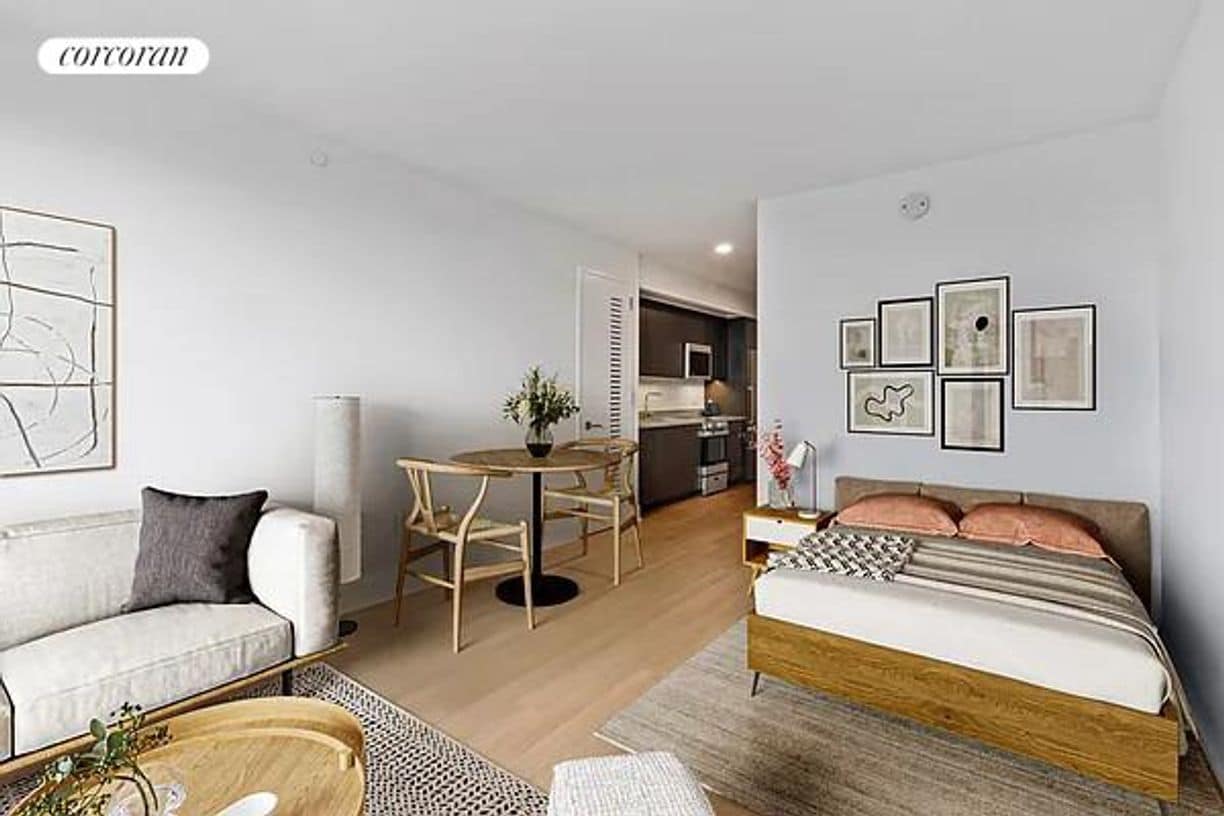
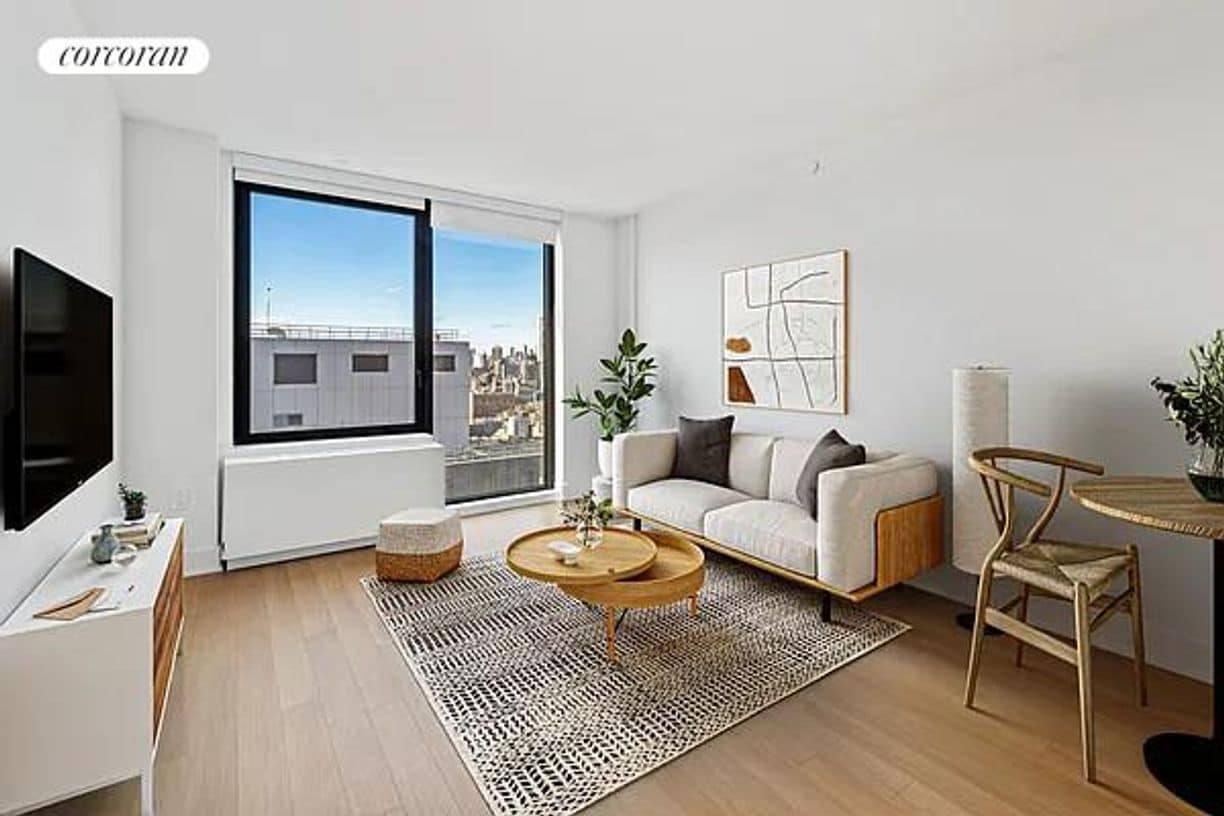
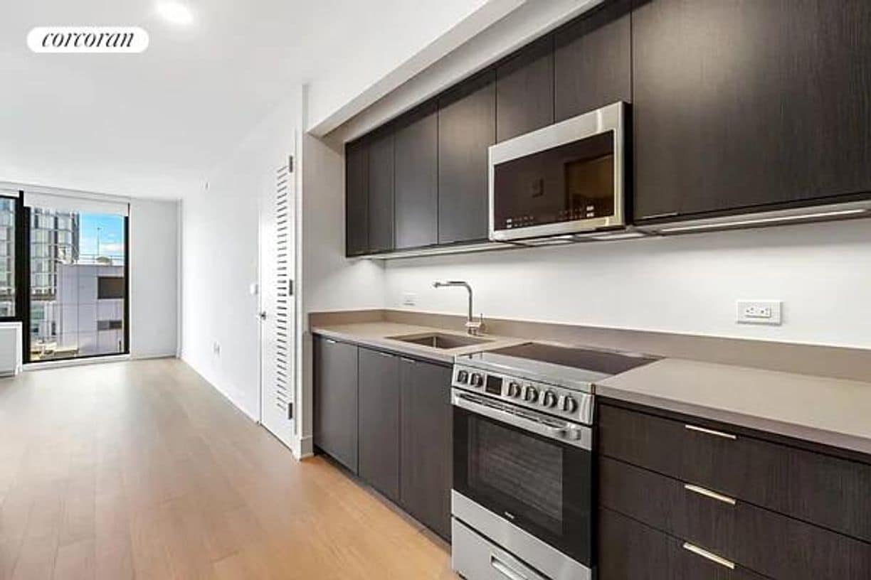
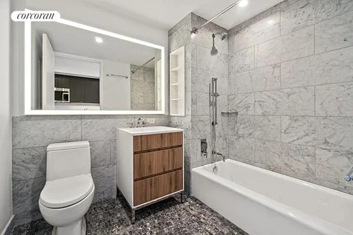
About This Home
Luxury Lovely alcove studio with western exposure featuring generous closets, floor-to-ceiling windows, and an in-home washer/dryer, and dishwasher. Rent listed includes amenities fee and bike storage.Full service doorman buildingLocation...location...location, Plank Road is situated on the southeast corner of Sixth Avenue and Pacific Street, between Pacific and Dean Street in Prospect Heights, Brooklyn. It is in close proximity to Barclay's Center, with Downtown Brooklyn to the northwest and the tree-lined brownstones of Prospect Heights to the southeast. The building is named after the road that once ran through the property during the mid 1800's.Amazing studio.Lowest priced alcove studio in the building.Rent includes use of the amenities.Pool,gym,roof deck.Great building and price.Lease ends June30,2026.
662 Pacific St is an apartment community located in Kings County and the 11217 ZIP Code.
Features
- Air Conditioning
- Package Service
- Laundry Facilities
- Controlled Access
Fees and Policies
The fees below are based on community-supplied data and may exclude additional fees and utilities.
Details
Lease Options
-
12 Months
Contact
- Phone Number
- Website View Property Website
- Contact
-
Source

- Air Conditioning
- Package Service
- Laundry Facilities
- Controlled Access
With its tree-lined streets and welcoming community, Prospect Heights is a wonderful tight-knit community to come home to. The Grand Army Plaza at Mount Prospect Park is probably the first thing you’ll notice, especially the Soldiers’ and Sailors’ Arch monument. The Saturday market is held at the plaza, which makes buying groceries all the more fun!
Across from the arch is the Brooklyn Public Library, one of the community’s iconic buildings. The Brooklyn Museum is close by on Eastern Parkway – the same thoroughfare that holds the West Indian Day Parade on Labor Day. The Botanic Garden is in walking distance of both attractions and features acres of cherry blossoms.
Vanderbilt and Washington Avenues act as the main commercial district, scattered with shops, restaurants, and bars. Locals enjoy the famous lemon ricotta pancakes at Tom’s Restaurant plus sweet treats at Ample Hills Creamery. Prospect Heights has a lot to do and see – like a Nets game at Barclays Center.
Learn more about living in Prospect Heights| Colleges & Universities | Distance | ||
|---|---|---|---|
| Colleges & Universities | Distance | ||
| Walk: | 16 min | 0.9 mi | |
| Walk: | 17 min | 0.9 mi | |
| Drive: | 4 min | 1.2 mi | |
| Drive: | 5 min | 1.4 mi |
Transportation options available in Brooklyn include Bergen Street (2,3 Line), located 0.2 mile from 662 Pacific St. 662 Pacific St is near LaGuardia, located 10.0 miles or 20 minutes away, and Newark Liberty International, located 15.3 miles or 27 minutes away.
| Transit / Subway | Distance | ||
|---|---|---|---|
| Transit / Subway | Distance | ||
|
|
Walk: | 3 min | 0.2 mi |
|
|
Walk: | 5 min | 0.3 mi |
|
|
Walk: | 6 min | 0.3 mi |
|
|
Walk: | 6 min | 0.4 mi |
|
|
Walk: | 7 min | 0.4 mi |
| Commuter Rail | Distance | ||
|---|---|---|---|
| Commuter Rail | Distance | ||
|
|
Walk: | 3 min | 0.2 mi |
|
|
Drive: | 4 min | 1.4 mi |
|
|
Drive: | 13 min | 4.5 mi |
|
|
Drive: | 11 min | 4.5 mi |
|
|
Drive: | 19 min | 7.1 mi |
| Airports | Distance | ||
|---|---|---|---|
| Airports | Distance | ||
|
LaGuardia
|
Drive: | 20 min | 10.0 mi |
|
Newark Liberty International
|
Drive: | 27 min | 15.3 mi |
Time and distance from 662 Pacific St.
| Shopping Centers | Distance | ||
|---|---|---|---|
| Shopping Centers | Distance | ||
| Walk: | 3 min | 0.2 mi | |
| Drive: | 5 min | 1.6 mi |
| Parks and Recreation | Distance | ||
|---|---|---|---|
| Parks and Recreation | Distance | ||
|
Crispus Attucks Playground
|
Walk: | 18 min | 1.0 mi |
|
Fort Greene Park
|
Drive: | 3 min | 1.1 mi |
|
Brooklyn Botanic Garden
|
Drive: | 4 min | 1.4 mi |
|
Commodore Barry Park
|
Drive: | 5 min | 1.5 mi |
|
Gowanus Canal
|
Drive: | 6 min | 1.6 mi |
| Hospitals | Distance | ||
|---|---|---|---|
| Hospitals | Distance | ||
| Walk: | 12 min | 0.6 mi | |
| Drive: | 4 min | 1.5 mi | |
| Drive: | 7 min | 2.1 mi |
| Military Bases | Distance | ||
|---|---|---|---|
| Military Bases | Distance | ||
| Drive: | 14 min | 6.1 mi | |
| Drive: | 16 min | 7.0 mi |
You May Also Like
What Are Walk Score®, Transit Score®, and Bike Score® Ratings?
Walk Score® measures the walkability of any address. Transit Score® measures access to public transit. Bike Score® measures the bikeability of any address.
What is a Sound Score Rating?
A Sound Score Rating aggregates noise caused by vehicle traffic, airplane traffic and local sources

662 Pacific St
Brooklyn, NY 11217