
Harbor Point
24 Oyster Bay Rd,
Boston, MA 02125
$2,617 - $4,486 Total Monthly Price
1-3 Beds

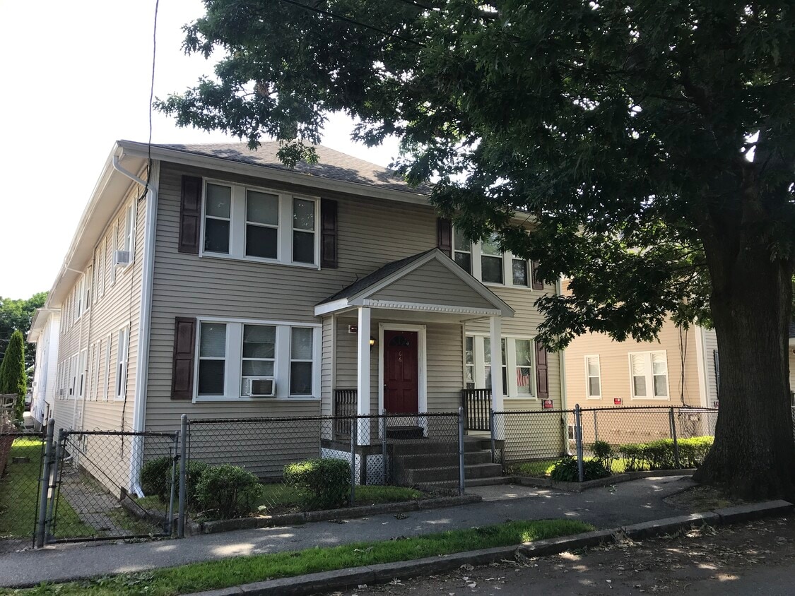
Tastefully renovated, spacious 1.5 bedroom + 1 bath. Prime location! Located at North Quincy/Wollaston -- 8 min walk to T (Red-line Subway Stations); 10 minutes to UMass Boston, 15 min to South Station/Downtown. Close to supermarket, restaurants, schools, park and etc. Apartments feature newly finished hardwood floors, freshly painted walls and ceilings. Pets Welcome: Restrictions Apply. Candidates must have strong credit history and references. The bonus room can be used as a small guest bedroom or home office. This room is also great for a full size walk in closet!
66 Safford St is an apartment community located in Norfolk County and the 02170 ZIP Code. This area is served by the Quincy School District attendance zone.
Across the Neponset River from Downtown Boston lies the Quincy neighborhood of Montclair. Commuters drive eight miles north on Interstate 93 to reach downtown, while residents without a car enjoy easy access using several bus lines or the Red Line's North Quincy subway station. This quiet residential community of apartments and bungalow-style houses provides a small-town atmosphere within a larger urban environment.
There’s a diverse mix of cuisine that belies Montclair’s relatively small size. Most of Montclair's businesses are found along Hancock Street near North Quincy station. Residents gather at Assembly Bar on Sundays for comfort food while watching the New England Patriots.
Learn more about living in MontclairCompare neighborhood and city base rent averages by bedroom.
| Montclair | Quincy, MA | |
|---|---|---|
| Studio | $2,383 | $2,214 |
| 1 Bedroom | $2,728 | $2,527 |
| 2 Bedrooms | $3,440 | $3,051 |
| 3 Bedrooms | - | $4,208 |
| Colleges & Universities | Distance | ||
|---|---|---|---|
| Colleges & Universities | Distance | ||
| Drive: | 10 min | 4.4 mi | |
| Drive: | 15 min | 6.0 mi | |
| Drive: | 13 min | 6.9 mi | |
| Drive: | 13 min | 7.1 mi |


Transportation options available in Quincy include North Quincy Station, located 0.4 mile from 66 Safford St. 66 Safford St is near General Edward Lawrence Logan International, located 9.8 miles or 18 minutes away.
| Transit / Subway | Distance | ||
|---|---|---|---|
| Transit / Subway | Distance | ||
|
|
Walk: | 8 min | 0.4 mi |
|
|
Walk: | 16 min | 0.8 mi |
|
|
Drive: | 6 min | 3.0 mi |
|
|
Drive: | 6 min | 3.0 mi |
|
|
Drive: | 7 min | 3.4 mi |
| Commuter Rail | Distance | ||
|---|---|---|---|
| Commuter Rail | Distance | ||
|
|
Drive: | 5 min | 2.0 mi |
|
|
Drive: | 8 min | 4.2 mi |
| Drive: | 11 min | 4.3 mi | |
| Drive: | 9 min | 4.5 mi | |
| Drive: | 10 min | 4.8 mi |
| Airports | Distance | ||
|---|---|---|---|
| Airports | Distance | ||
|
General Edward Lawrence Logan International
|
Drive: | 18 min | 9.8 mi |
Scores provided by
Traffic
-Airport
-Businesses
-Scores provided by
HowLoud What is a Sound Score Rating? A Sound Score Rating aggregates noise caused by vehicle traffic, airplane traffic and local sources. How It WorksTime and distance from 66 Safford St.
| Shopping Centers | Distance | ||
|---|---|---|---|
| Shopping Centers | Distance | ||
| Walk: | 5 min | 0.3 mi | |
| Drive: | 4 min | 1.2 mi | |
| Drive: | 5 min | 2.3 mi |
| Parks and Recreation | Distance | ||
|---|---|---|---|
| Parks and Recreation | Distance | ||
|
Adams National Historical Park
|
Drive: | 4 min | 1.8 mi |
|
Squantum Point Park
|
Drive: | 8 min | 2.7 mi |
|
Dorchester Shores Reservation
|
Drive: | 9 min | 4.3 mi |
|
Franklin Park Zoo
|
Drive: | 11 min | 6.1 mi |
|
Lower Neponset River Trail
|
Drive: | 11 min | 6.2 mi |
| Hospitals | Distance | ||
|---|---|---|---|
| Hospitals | Distance | ||
| Drive: | 6 min | 3.3 mi | |
| Drive: | 8 min | 3.4 mi | |
| Drive: | 10 min | 5.9 mi |
| Military Bases | Distance | ||
|---|---|---|---|
| Military Bases | Distance | ||
| Drive: | 41 min | 22.1 mi | |
| Drive: | 39 min | 22.3 mi | |
| Drive: | 43 min | 24.5 mi |
Pets Allowed Fitness Center Pool Dishwasher Kitchen In Unit Washer & Dryer
Pets Allowed Fitness Center Pool Dishwasher Refrigerator Kitchen
Pets Allowed Maintenance on site Heat Controlled Access Elevator Laundry Facilities
Pets Allowed Fitness Center Dishwasher Refrigerator Kitchen In Unit Washer & Dryer
Fitness Center Clubhouse Balcony Stainless Steel Appliances Granite Countertops Smoke Free Basketball Court
What Are Walk Score®, Transit Score®, and Bike Score® Ratings?
Walk Score® measures the walkability of any address. Transit Score® measures access to public transit. Bike Score® measures the bikeability of any address.
What is a Sound Score Rating?
A Sound Score Rating aggregates noise caused by vehicle traffic, airplane traffic and local sources.
66 Safford St
Quincy, MA 02170


