
$4,000
Total Monthly Price
66 Parsons St
Boston, MA 02135
2 Weeks Ago
Favorites
-
Bedrooms
4
-
Bathrooms
2
-
Square Feet
--
66 Parsons St

Favorites
About This Home
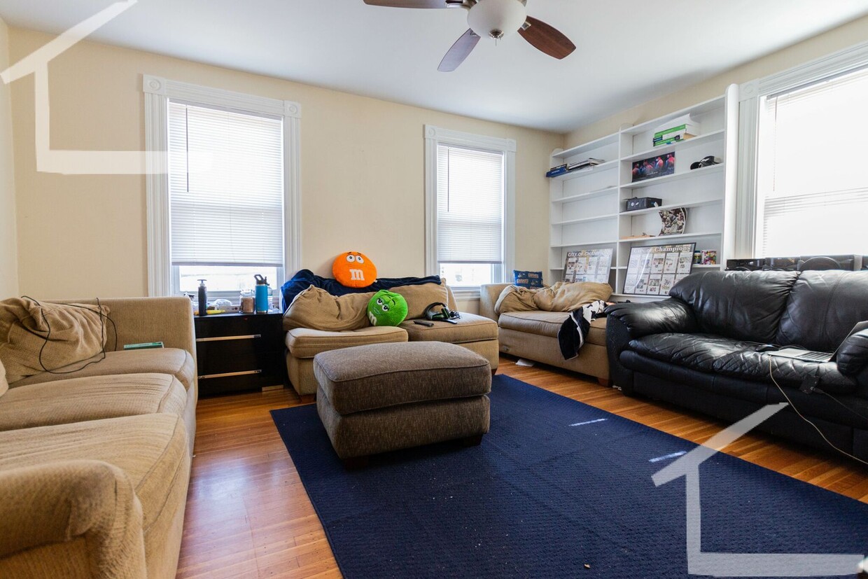
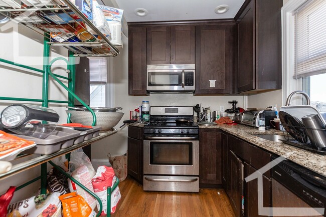
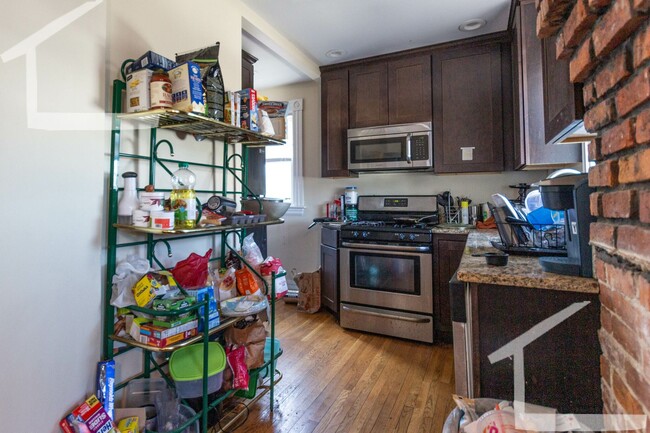
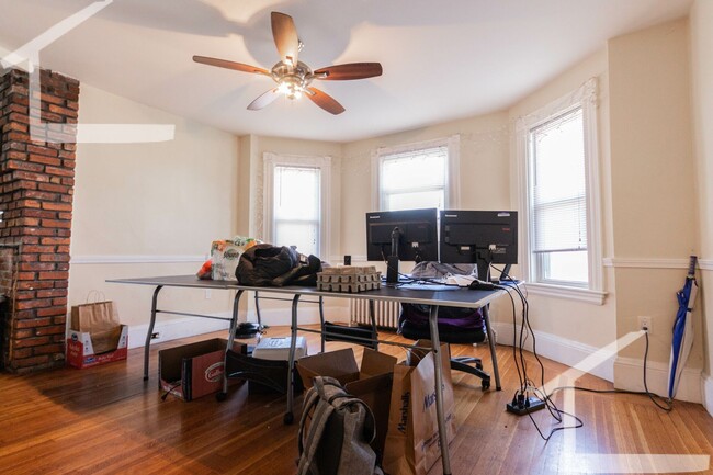
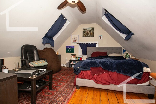
Available SEPTEMBER 1 Huge two-level 4BR/2BA apartment on a side street near Brighton Center, convenient to Boston Landing, St. Elizabeth's, Oak Square, Mass Pike, public transit, grocery stores, parks, shops, restaurants, cafes and more! Unit features: -Hardwood floors -Updated kitchen with stainless steel appliances, gas stove, dishwasher, disposal -Laundry in unit -Large sunny living room -Four large to extra large sized bedrooms -Two full modern baths -Skylight windows -Bonus office/storage room -Exposed brick -High ceilings with ceiling fans -Gas heat -Pets negotiable -Low move in cost (first, 1/2 security, broker fee only)
66 Parsons St is a condo located in Suffolk County and the 02135 ZIP Code.
* Price shown is total price including community-supplied monthly required fees. Price, availability, fees, and any applicable rent special are subject to change without notice.
* Square footage definitions vary. Displayed square footage is approximate.
Contact
- Listed by Modern Real Estate (AD) | Modern Real Estate (AD)
Location
Get Directions
Located about nine miles away from Downtown Brighton, Oak Square is a nature lover’s dream. Spend plenty of warm days outdoors in one of Oak Square's many parks, including Gallagher Park, Foster Street Hill, and Rogers Park. These parks allow you to enjoy sports, take in views of the surrounding historic buildings, or have a picnic. Along with lush parks, Oak Square has an abundance of amenities and parking, which is a hot commodity in the area. Great for students, faculty, and staff, Oak Square is convenient to Harvard University, Boston College, and the Massachusetts Institute of Technology. Perfect for all renters, Oak Square has affordable and upscale rentals available. For more dining, shopping, and entertainment options, simply travel east along Interstate 90 to reach the cultural and economic heart of the city.
Learn more about living in Oak Square
Education
| Colleges & Universities | Distance | ||
|---|---|---|---|
| Colleges & Universities | Distance | ||
| Walk: | 18 min | 0.9 mi | |
| Drive: | 4 min | 1.6 mi | |
| Drive: | 6 min | 2.5 mi | |
| Drive: | 6 min | 2.6 mi |
66 Parsons St is within 18 minutes or 0.9 mile from Boston College, Brighton. It is also near Boston College and Boston University.
Transportation options available in Boston include Warren Street Station, located 0.8 mile from 66 Parsons St. 66 Parsons St is near General Edward Lawrence Logan International, located 9.3 miles or 17 minutes away.
| Transit / Subway | Distance | ||
|---|---|---|---|
| Transit / Subway | Distance | ||
|
|
Walk: | 15 min | 0.8 mi |
|
|
Walk: | 18 min | 1.0 mi |
|
|
Walk: | 19 min | 1.0 mi |
|
|
Walk: | 20 min | 1.0 mi |
|
|
Drive: | 3 min | 1.4 mi |
| Commuter Rail | Distance | ||
|---|---|---|---|
| Commuter Rail | Distance | ||
|
|
Drive: | 6 min | 2.8 mi |
|
|
Drive: | 7 min | 3.4 mi |
| Drive: | 7 min | 3.7 mi | |
|
|
Drive: | 8 min | 3.7 mi |
|
|
Drive: | 9 min | 4.2 mi |
| Airports | Distance | ||
|---|---|---|---|
| Airports | Distance | ||
|
General Edward Lawrence Logan International
|
Drive: | 17 min | 9.3 mi |
Time and distance from 66 Parsons St.
| Shopping Centers | Distance | ||
|---|---|---|---|
| Shopping Centers | Distance | ||
| Walk: | 14 min | 0.7 mi | |
| Walk: | 19 min | 1.0 mi | |
| Drive: | 5 min | 1.8 mi |
66 Parsons St has 3 shopping centers within 1.8 miles, which is about a 5-minute walk. The miles and minutes will be for the farthest away property.
| Parks and Recreation | Distance | ||
|---|---|---|---|
| Parks and Recreation | Distance | ||
|
Chestnut Hill Reservation
|
Drive: | 4 min | 1.4 mi |
|
John Fitzgerald Kennedy National Historic Site
|
Drive: | 4 min | 1.9 mi |
|
Hammond Pond Reservation
|
Drive: | 6 min | 2.7 mi |
|
Frederick Law Olmsted National Historic Site
|
Drive: | 7 min | 3.0 mi |
|
Longfellow National Historic Site
|
Drive: | 7 min | 3.1 mi |
66 Parsons St has 5 parks within 3.1 miles, including Chestnut Hill Reservation, John Fitzgerald Kennedy National Historic Site, and Hammond Pond Reservation.
| Hospitals | Distance | ||
|---|---|---|---|
| Hospitals | Distance | ||
| Walk: | 8 min | 0.4 mi | |
| Walk: | 10 min | 0.6 mi | |
| Drive: | 4 min | 1.9 mi |
66 Parsons St has 3 hospitals within 1.9 miles, the nearest is St. Elizabeth's Medical Center which is 0.4 mile away and a 8 minute walk.
| Military Bases | Distance | ||
|---|---|---|---|
| Military Bases | Distance | ||
| Drive: | 26 min | 12.0 mi | |
| Drive: | 24 min | 13.4 mi |
66 Parsons St is 12.0 miles from Hanscom Air Force Base, and is convenient to other military bases, including US Military Reservation.
You May Also Like
Similar Rentals Nearby


What Are Walk Score®, Transit Score®, and Bike Score® Ratings?
Walk Score® measures the walkability of any address. Transit Score® measures access to public transit. Bike Score® measures the bikeability of any address.
What is a Sound Score Rating?
A Sound Score Rating aggregates noise caused by vehicle traffic, airplane traffic and local sources

66 Parsons St
Boston, MA 02135