
$5,300
Total Monthly Price
659 Massachusetts Ave
Boston, MA 02118
2 Weeks Ago
|
Edit
Favorites
-
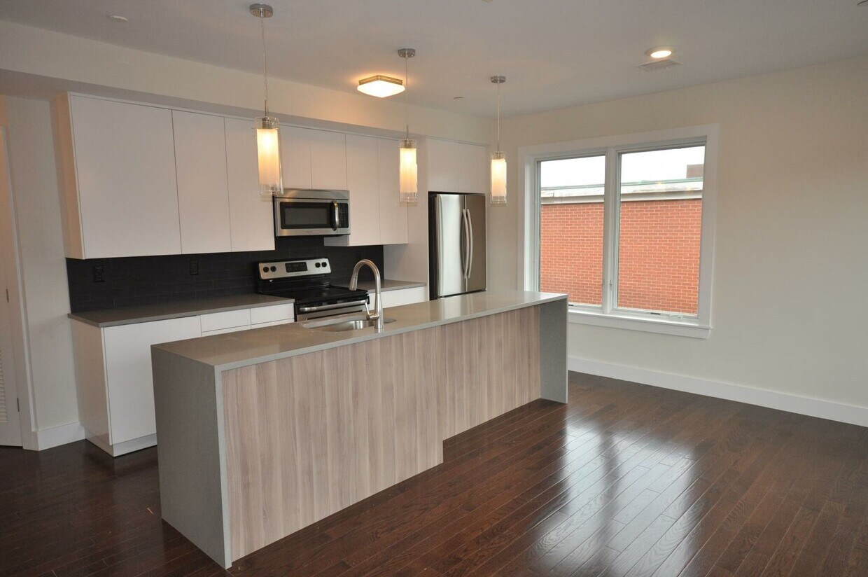
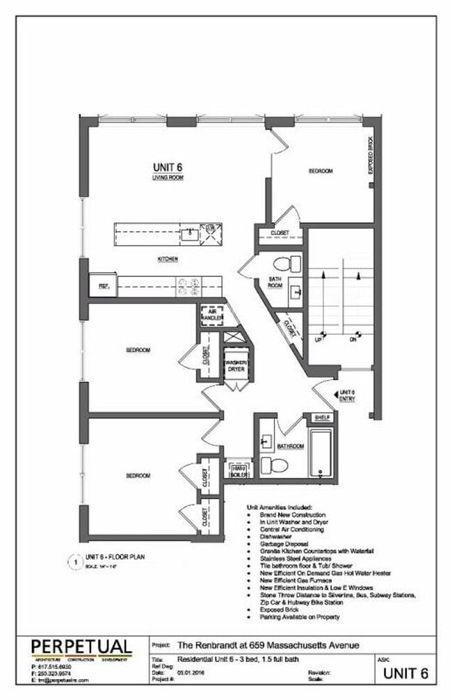
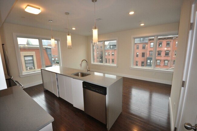
Bedrooms
3
-
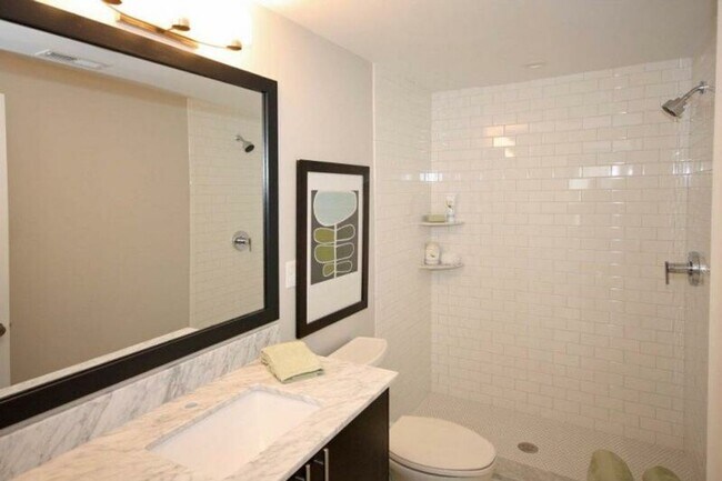
Bathrooms
1.5
-
Square Feet
--
659 Massachusetts Ave

Favorites
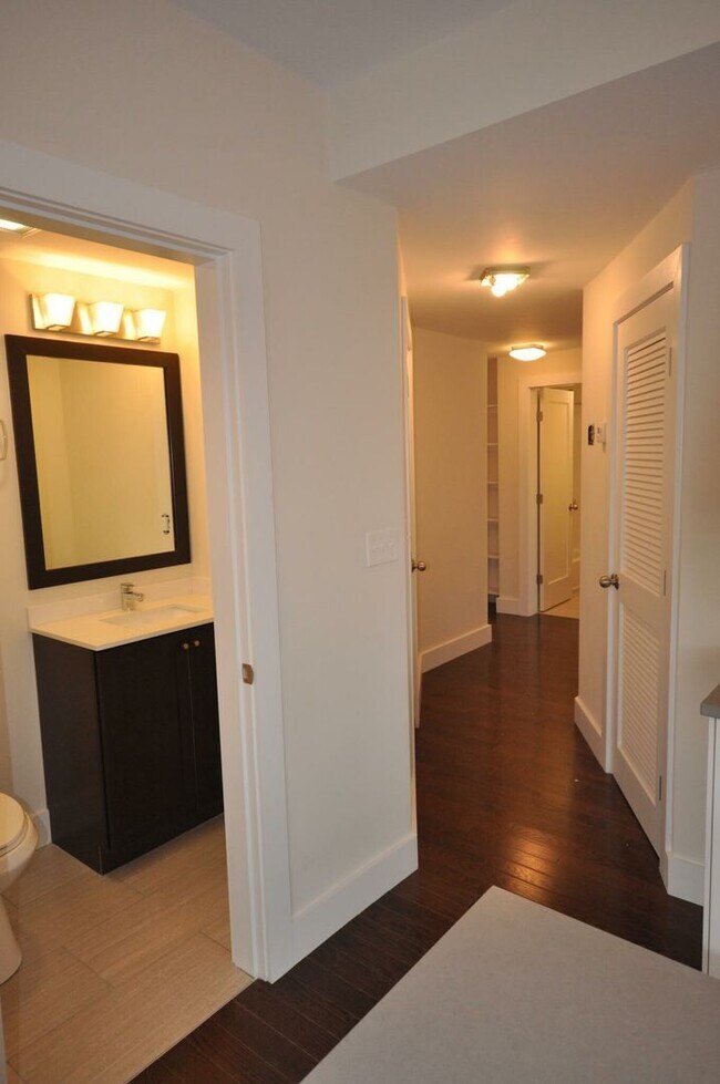
About This Home
The redevelopment of this property has brought The Renbrandt, a historic gem of the South End, back to life. Located near the corner of Massachusetts Avenue and Washington Street, this building is in the heart of restaurant row in Boston's South End! A few of the highly acclaimed restaurants which are located within walking distance include Turo, Terango, Seiyo Wine Sushi, Equator Thai, Stella and Mike's Dinner. Located along the Washington Stop on the Silver Line, and a few blocks from the Massachusetts Avenue orange line train station commuting downtown is made easy!
659 Massachusetts Ave is a condo located in Suffolk County and the 02118 ZIP Code. This area is served by the Boston Public Schools attendance zone.
* Price shown is total price based on community-supplied monthly required fees. Excludes user-selected optional fees and variable or usage-based fees and required charges due at or prior to move-in or at move-out. Price, availability, fees, and any applicable rent special are subject to change without notice.
* Square footage definitions vary. Displayed square footage is approximate.
Contact
- Listed by Gateway Real Estate (AD) | Gateway Real Estate (AD)
Location
Get Directions
Situated between the South End and Dudley Square, Lower Roxbury is a predominantly residential neighborhood brimming with apartments and town houses available for rent. Residents enjoy a walkable urban environment filled with diverse historical architecture.
Warren Street and Washington Street are the neighborhood’s main commercial thoroughfares, touting rows of specialty shops, markets, and eateries in historic buildings. Northeastern University, Wentworth Institute of Technology, and Massachusetts College of Art and Design are all just northwest of Lower Roxbury, offering the community a bevy of cultural and educational amenities. Getting around from Lower Roxbury is easy with access to multiple T stops on the Orange Line.
Learn more about living in Lower Roxbury
Education
| Colleges & Universities | Distance | ||
|---|---|---|---|
| Colleges & Universities | Distance | ||
| Walk: | 15 min | 0.8 mi | |
| Drive: | 4 min | 1.4 mi | |
| Drive: | 3 min | 1.5 mi | |
| Drive: | 3 min | 1.7 mi |
659 Massachusetts Ave is within 15 minutes or 0.8 mile from Northeastern University. It is also near Berklee College of Music and Wentworth Inst. of Technology.
Schools


Public Elementary & Middle School
Grades PK-8
716 Students
Attendance Zone
Public Elementary & Middle School
Grades PK-8
337 Students
Attendance Zone
Public Middle & High School
Grades 6-12
1,518 Students
Attendance Zone
Public Middle & High School
Grades 6-12
50 Students
Attendance Zone
Public High School
Grades 9-12
313 Students
Attendance Zone
Public High School
Grades 9-12
424 Students
Attendance Zone
Private Elementary & Middle School
Grades K-8
Nearby
Private Elementary School
Grades PK-5
142 Students
Nearby
Private Middle & High School
Grades 6-12
292 Students
Nearby
School data provided by
 The GreatSchools Rating helps parents compare schools within a state based on a variety of school quality indicators and provides a helpful picture of how effectively each school serves all of its students. Ratings are on a scale of 1 (below average) to 10 (above average) and can include test scores, college readiness, academic progress, advanced courses, equity, discipline and attendance data. We also advise parents to visit schools, consider other information on school performance and programs, and consider family needs as part of the school selection process.
View GreatSchools Rating Methodology
Data provided by GreatSchools.org © 2026. All rights reserved.
View GreatSchools Rating Methodology
Data provided by GreatSchools.org © 2026. All rights reserved.
Transportation options available in Boston include Massachusetts Ave Station (Orange Line), located 0.6 mile from 659 Massachusetts Ave. 659 Massachusetts Ave is near General Edward Lawrence Logan International, located 5.3 miles or 10 minutes away.
| Transit / Subway | Distance | ||
|---|---|---|---|
| Transit / Subway | Distance | ||
|
|
Walk: | 11 min | 0.6 mi |
|
|
Walk: | 12 min | 0.6 mi |
|
|
Drive: | 3 min | 1.1 mi |
|
|
Drive: | 3 min | 1.2 mi |
|
|
Drive: | 3 min | 1.5 mi |
| Commuter Rail | Distance | ||
|---|---|---|---|
| Commuter Rail | Distance | ||
| Walk: | 18 min | 1.0 mi | |
|
|
Drive: | 4 min | 1.4 mi |
|
|
Drive: | 3 min | 1.5 mi |
|
|
Drive: | 6 min | 1.6 mi |
|
|
Drive: | 8 min | 4.5 mi |
| Airports | Distance | ||
|---|---|---|---|
| Airports | Distance | ||
|
General Edward Lawrence Logan International
|
Drive: | 10 min | 5.3 mi |
Getting Around
 What do Walkability, Transit, Drivability, and Bikeability mean?
Walkability measures the walking distance to day-to-day needs.
Transit measures access to public transportation.
Drivability measures congestion, parking availability, and access to major roads.
Bikeability measures the suitability for cycling.
How It Works
What do Walkability, Transit, Drivability, and Bikeability mean?
Walkability measures the walking distance to day-to-day needs.
Transit measures access to public transportation.
Drivability measures congestion, parking availability, and access to major roads.
Bikeability measures the suitability for cycling.
How It Works
Exceptionally Walkable
Walkability
100
/ 100
Exceptional Public Transit
Transit
100
/ 100
Moderately Drivable
Drivability
60
/ 100
Exceptionally Bikeable
Bikeability
90
/ 100
Scores provided by
Busy
Soundscore™
65
/ 100
Traffic
BusyAirport
CalmBusinesses
BusyScores provided by
HowLoud What is a Sound Score Rating? A Sound Score Rating aggregates noise caused by vehicle traffic, airplane traffic and local sources. How It WorksTime and distance from 659 Massachusetts Ave.
| Shopping Centers | Distance | ||
|---|---|---|---|
| Shopping Centers | Distance | ||
| Drive: | 3 min | 1.3 mi | |
| Drive: | 10 min | 5.4 mi | |
| Drive: | 10 min | 5.6 mi |
659 Massachusetts Ave has 3 shopping centers within 5.6 miles, which is about a 10-minute drive. The miles and minutes will be for the farthest away property.
| Parks and Recreation | Distance | ||
|---|---|---|---|
| Parks and Recreation | Distance | ||
|
Roxbury Heritage State Park
|
Drive: | 3 min | 1.2 mi |
|
Boston Public Garden
|
Drive: | 5 min | 2.0 mi |
|
Charles River Reservation
|
Drive: | 5 min | 2.2 mi |
|
Boston African American National Historic Site
|
Drive: | 6 min | 2.4 mi |
|
Boston Children's Museum
|
Drive: | 5 min | 2.5 mi |
659 Massachusetts Ave has 5 parks within 2.5 miles, including Roxbury Heritage State Park, Boston Public Garden, and Boston African American National Historic Site.
| Hospitals | Distance | ||
|---|---|---|---|
| Hospitals | Distance | ||
| Walk: | 3 min | 0.2 mi | |
| Walk: | 8 min | 0.5 mi | |
| Drive: | 3 min | 1.4 mi |
659 Massachusetts Ave has 3 hospitals within 1.4 miles, the nearest is Boston Medical Center which is 0.2 mile away and a 3 minute walk.
| Military Bases | Distance | ||
|---|---|---|---|
| Military Bases | Distance | ||
| Drive: | 31 min | 16.3 mi |
659 Massachusetts Ave is 16.3 miles and a 31 minute drive from Hanscom Air Force Base.
You May Also Like
Similar Rentals Nearby


What Are Walk Score®, Transit Score®, and Bike Score® Ratings?
Walk Score® measures the walkability of any address. Transit Score® measures access to public transit. Bike Score® measures the bikeability of any address.
What is a Sound Score Rating?
A Sound Score Rating aggregates noise caused by vehicle traffic, airplane traffic and local sources.

659 Massachusetts Ave
Boston, MA 02118