
Parkway Lofts
5 Lawrence St,
Bloomfield, NJ 07003
$1,800 - $3,855
Studio - 2 Beds
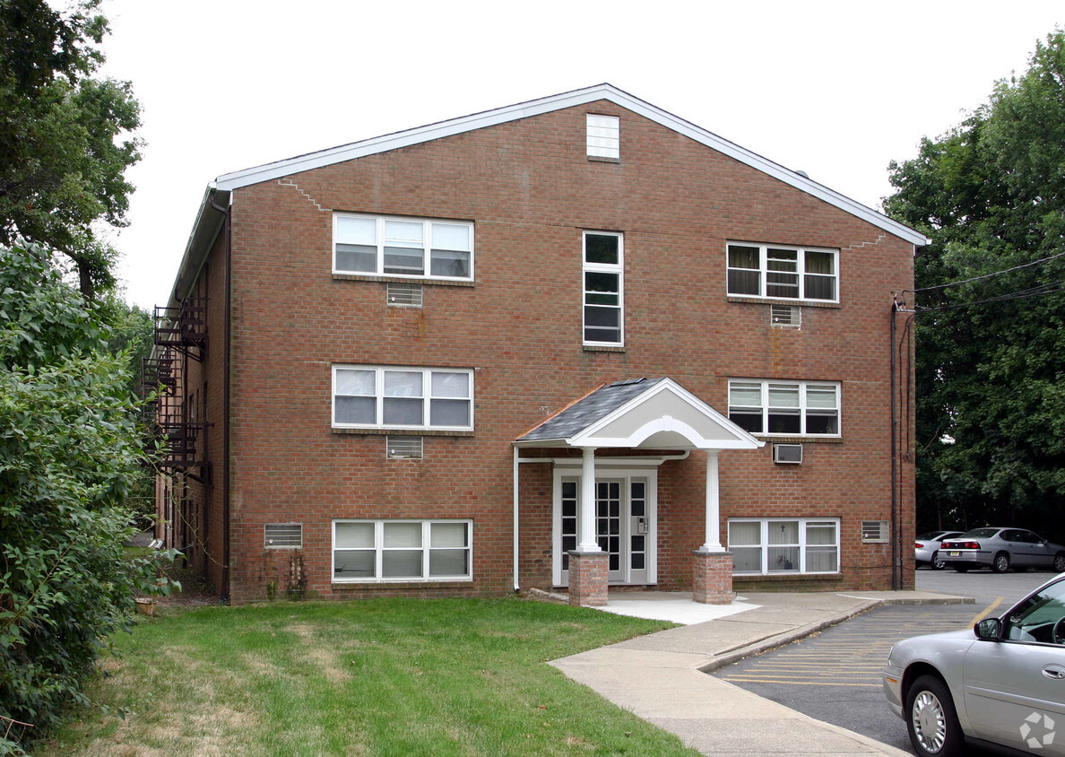

65 James St offers a combination of comfort, quality, and design. This property is situated in the 7003 area of Bloomfield. The professional leasing staff is eager to show you our community. Give us a call now to learn more about our community.
65 James St is an apartment community located in Essex County and the 07003 ZIP Code. This area is served by the Bloomfield Board Of Education attendance zone.
Stretched along the Garden State Parkway, the Township of Bloomfield sits in Essex County adjacent to the Township of Montclair. Bloomfield is regarded as an up-and-coming area, boasting convenient access to New York City via major roadways, highways, buses, trains, commuter rail, and light rail. Bloomfield is also close to two major airports, Newark Liberty International and LaGuardia.
In addition to its central locale, Bloomfield offers residents access to a wide range of amenities and services. Quaint shops, cafes, and restaurants line the downtown area on Broad Street in Bloomfield. Large local parks such as Brookdale and Watsessing provide plenty of options for outdoor recreation as well as the behemoth neighbors of South Mountain Reservation and Eagle Rock Reservation. Bloomfield’s appeal is as diverse as its population and offerings, with the township experiencing record growth in residential, retail, and entertainment venues.
Learn more about living in Bloomfield| Colleges & Universities | Distance | ||
|---|---|---|---|
| Colleges & Universities | Distance | ||
| Walk: | 18 min | 1.0 mi | |
| Drive: | 9 min | 5.0 mi | |
| Drive: | 11 min | 5.2 mi | |
| Drive: | 13 min | 7.4 mi |


Transportation options available in Bloomfield include Grove Street, located 2.3 miles from 65 James St. 65 James St is near Newark Liberty International, located 10.8 miles or 19 minutes away, and LaGuardia, located 24.3 miles or 44 minutes away.
| Transit / Subway | Distance | ||
|---|---|---|---|
| Transit / Subway | Distance | ||
|
|
Drive: | 5 min | 2.3 mi |
|
|
Drive: | 6 min | 2.6 mi |
|
|
Drive: | 6 min | 2.7 mi |
|
|
Drive: | 7 min | 3.1 mi |
|
|
Drive: | 6 min | 3.2 mi |
| Commuter Rail | Distance | ||
|---|---|---|---|
| Commuter Rail | Distance | ||
|
|
Drive: | 3 min | 1.4 mi |
|
|
Drive: | 3 min | 1.5 mi |
|
|
Drive: | 6 min | 1.8 mi |
|
|
Drive: | 4 min | 1.9 mi |
|
|
Drive: | 4 min | 2.2 mi |
| Airports | Distance | ||
|---|---|---|---|
| Airports | Distance | ||
|
Newark Liberty International
|
Drive: | 19 min | 10.8 mi |
|
LaGuardia
|
Drive: | 44 min | 24.3 mi |
Time and distance from 65 James St.
| Shopping Centers | Distance | ||
|---|---|---|---|
| Shopping Centers | Distance | ||
| Drive: | 3 min | 1.4 mi | |
| Drive: | 4 min | 2.1 mi | |
| Drive: | 5 min | 2.2 mi |
| Parks and Recreation | Distance | ||
|---|---|---|---|
| Parks and Recreation | Distance | ||
|
Van Vleck House & Gardens
|
Drive: | 7 min | 3.4 mi |
|
Branch Brook Park
|
Drive: | 8 min | 3.9 mi |
|
Edison National Historic Site
|
Drive: | 11 min | 4.7 mi |
|
Presby Memorial Iris Gardens
|
Drive: | 10 min | 4.8 mi |
|
Kearny Marsh
|
Drive: | 11 min | 5.6 mi |
| Hospitals | Distance | ||
|---|---|---|---|
| Hospitals | Distance | ||
| Drive: | 8 min | 4.2 mi | |
| Drive: | 9 min | 5.0 mi | |
| Drive: | 11 min | 5.6 mi |
| Military Bases | Distance | ||
|---|---|---|---|
| Military Bases | Distance | ||
| Drive: | 24 min | 14.7 mi | |
| Drive: | 32 min | 15.1 mi | |
| Drive: | 40 min | 22.7 mi |
What Are Walk Score®, Transit Score®, and Bike Score® Ratings?
Walk Score® measures the walkability of any address. Transit Score® measures access to public transit. Bike Score® measures the bikeability of any address.
What is a Sound Score Rating?
A Sound Score Rating aggregates noise caused by vehicle traffic, airplane traffic and local sources


