
$1,493 / Month
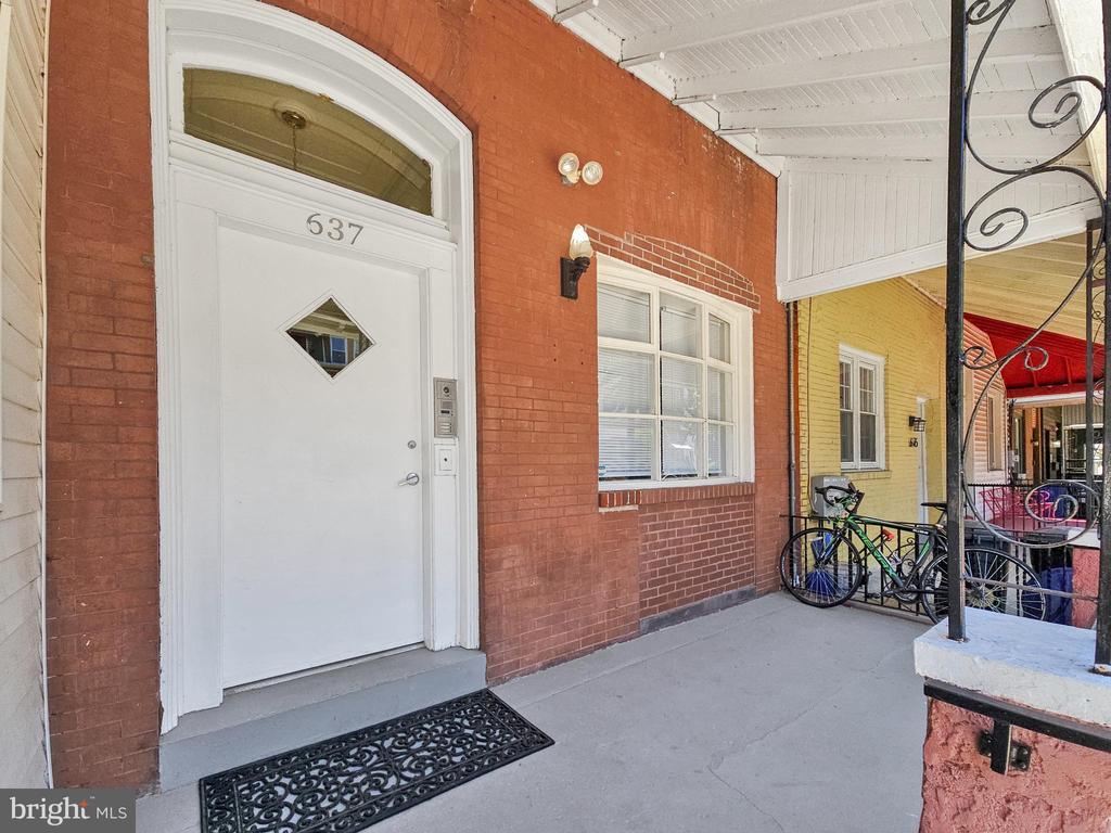
637 N 32nd St
Philadelphia, PA 19104
2 Weeks Ago
Favorites
637 N 32nd St

Favorites
Check Back Soon for Upcoming Availability
| Beds | Baths | Average SF |
|---|---|---|
| 2 Bedrooms 2 Bedrooms 2 Br | 1 Bath 1 Bath 1 Ba | 680 SF |
About This Property
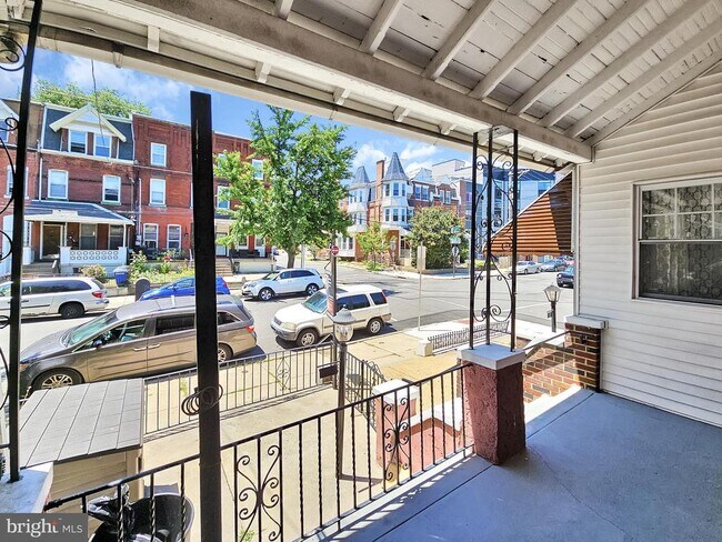
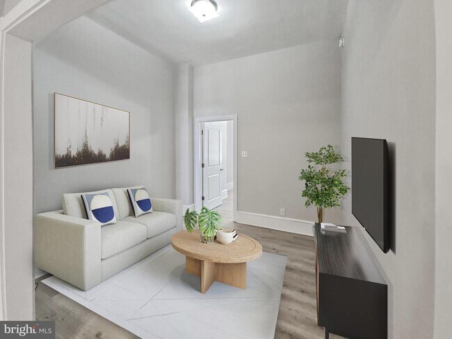
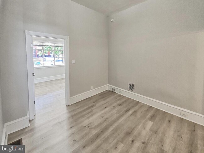
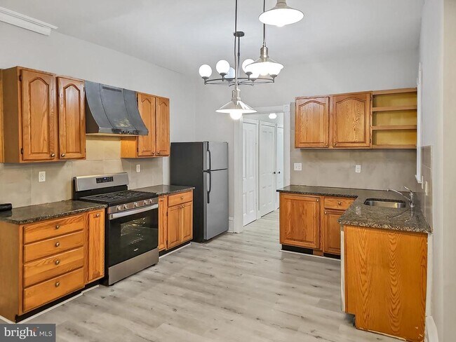
University City: 2 bed, 1 bath, 1st floor with outdoor space and VIEWS OF THE ART MUSEUM and THE SCHUYLKILL RIVER. Kitchen has 2 food prep granite tops, 1 year new stainless appliances: self-clean range, dishwasher, refrigerator & garbage disposer. Enough room for a dining table. LOCATION: 3 blocks N or Spring Garden Bridge. 1 mile to 30th St. Station. 1 mile to UPenn Fisher Fine Arts Library. .7 mile to LeBow College. .5 mile to Sabrina Café. .7 Mile to Hagerty Library. Block party on July 4th is amazing!
637 N 32nd St is a townhome located in Philadelphia County and the 19104 ZIP Code. This area is served by the The School District of Philadelphia attendance zone.
Townhome Features
- Basement
Location
Get Directions
Located in West Philadelphia directly across the Schuylkill River, Mantua is a historic neighborhood on the rise. Mantua has played several important roles in Philly’s rich history, from architecture that captured the world’s attention in the 19th century to being the headquarters for several community and youth organizations. Today, this up-and-coming neighborhood features renovated townhomes, brick rowhouses, apartments, and other rental options for a variety of budgets, although the area is known for its more affordable options. Mantua's art studios and murals showcase its thriving arts scene while parks and the Mantua Urban Peace Garden illustrate the neighborhood’s strong sense of community.
Mantua is gaining popularity because of its incredible location. Mantua sits directly north of Drexel University and the University of Pennsylvania. Fairmount Park, home to the Philadelphia Zoo and a plethora of museums, are just north of Mantua.
Learn more about living in MantuaBelow are rent ranges for similar nearby apartments
| Beds | Average Size | Lowest | Typical | Premium |
|---|---|---|---|---|
| Studio Studio Studio | 393 Sq Ft | $750 | $935 | $1,200 |
| 1 Bed 1 Bed 1 Bed | 697-702 Sq Ft | $650 | $1,291 | $2,700 |
| 2 Beds 2 Beds 2 Beds | 1074-1084 Sq Ft | $955 | $1,562 | $2,150 |
| 3 Beds 3 Beds 3 Beds | 1286-1294 Sq Ft | $1,495 | $2,194 | $3,100 |
| 4 Beds 4 Beds 4 Beds | 1603 Sq Ft | $1,495 | $2,815 | $4,500 |
Amenities
- Basement
Education
| Colleges & Universities | Distance | ||
|---|---|---|---|
| Colleges & Universities | Distance | ||
| Walk: | 12 min | 0.7 mi | |
| Drive: | 3 min | 1.4 mi | |
| Drive: | 5 min | 1.6 mi | |
| Drive: | 4 min | 2.0 mi |
637 N 32nd St is within 12 minutes or 0.7 mile from Drexel Univ., Univ. City Main. It is also near University of Pennsylvania and C.C. of Philadelphia.
Schools


Public Elementary & Middle School
Grades PK-8
294 Students
Attendance Zone
Public High School
Grades 9-12
543 Students
Attendance Zone
Private Elementary & Middle School
Grades PK-8
187 Students
Nearby
Private Elementary School
Grades PK-4
30 Students
Nearby
Private Elementary School
Grades K
19 Students
Nearby
Private High School
Grades 9-12
91 Students
Nearby
School data provided by
 The GreatSchools Rating helps parents compare schools within a state based on a variety of school quality indicators and provides a helpful picture of how effectively each school serves all of its students. Ratings are on a scale of 1 (below average) to 10 (above average) and can include test scores, college readiness, academic progress, advanced courses, equity, discipline and attendance data. We also advise parents to visit schools, consider other information on school performance and programs, and consider family needs as part of the school selection process.
View GreatSchools Rating Methodology
Data provided by GreatSchools.org © 2025. All rights reserved.
View GreatSchools Rating Methodology
Data provided by GreatSchools.org © 2025. All rights reserved.
Transportation options available in Philadelphia include Lancaster Ave & 36Th St, located 0.8 mile from 637 N 32nd St. 637 N 32nd St is near Philadelphia International, located 10.0 miles or 21 minutes away, and Trenton Mercer, located 35.0 miles or 51 minutes away.
| Transit / Subway | Distance | ||
|---|---|---|---|
| Transit / Subway | Distance | ||
|
|
Walk: | 15 min | 0.8 mi |
|
|
Walk: | 15 min | 0.8 mi |
|
|
Walk: | 15 min | 0.8 mi |
|
|
Walk: | 15 min | 0.8 mi |
| Drive: | 3 min | 1.2 mi |
| Commuter Rail | Distance | ||
|---|---|---|---|
| Commuter Rail | Distance | ||
| Walk: | 9 min | 0.5 mi | |
|
|
Drive: | 4 min | 1.3 mi |
| Drive: | 4 min | 1.5 mi | |
|
|
Drive: | 4 min | 1.7 mi |
|
|
Drive: | 5 min | 2.3 mi |
| Airports | Distance | ||
|---|---|---|---|
| Airports | Distance | ||
|
Philadelphia International
|
Drive: | 21 min | 10.0 mi |
|
Trenton Mercer
|
Drive: | 51 min | 35.0 mi |
Time and distance from 637 N 32nd St.
| Shopping Centers | Distance | ||
|---|---|---|---|
| Shopping Centers | Distance | ||
| Walk: | 19 min | 1.0 mi | |
| Drive: | 4 min | 1.9 mi | |
| Drive: | 5 min | 2.2 mi |
637 N 32nd St has 3 shopping centers within 2.2 miles, which is about a 5-minute walk. The miles and minutes will be for the farthest away property.
| Parks and Recreation | Distance | ||
|---|---|---|---|
| Parks and Recreation | Distance | ||
|
Philadelphia Zoo
|
Walk: | 14 min | 0.7 mi |
|
Fels Planetarium
|
Drive: | 3 min | 1.3 mi |
|
Franklin Institute
|
Drive: | 3 min | 1.3 mi |
|
The Academy of Natural Sciences
|
Drive: | 3 min | 1.4 mi |
|
University of Pennsylvania Observatory
|
Drive: | 3 min | 1.4 mi |
637 N 32nd St has 5 parks within 1.4 miles, including Philadelphia Zoo, University of Pennsylvania Observatory, and Fels Planetarium.
| Hospitals | Distance | ||
|---|---|---|---|
| Hospitals | Distance | ||
| Drive: | 3 min | 1.2 mi | |
| Drive: | 4 min | 1.7 mi | |
| Drive: | 4 min | 1.9 mi |
637 N 32nd St has 3 hospitals within 1.9 miles, the nearest is Penn Presbyterian Medical Center which is 1.2 miles away and a 3 minute drive.
| Military Bases | Distance | ||
|---|---|---|---|
| Military Bases | Distance | ||
| Drive: | 14 min | 6.7 mi |
637 N 32nd St is 6.7 miles and a 14 minute drive from Philadelphia Naval Busi Center.
You May Also Like
Similar Rentals Nearby
-
-
-
-
-
-
-
-
-
-
1 / 25


What Are Walk Score®, Transit Score®, and Bike Score® Ratings?
Walk Score® measures the walkability of any address. Transit Score® measures access to public transit. Bike Score® measures the bikeability of any address.
What is a Sound Score Rating?
A Sound Score Rating aggregates noise caused by vehicle traffic, airplane traffic and local sources
637 N 32nd St
Philadelphia, PA 19104