
Peninsula Pines Apartments
842-858 Antoinette Ln,
South San Francisco, CA 94080
$3,022 - $5,388
1-2 Beds

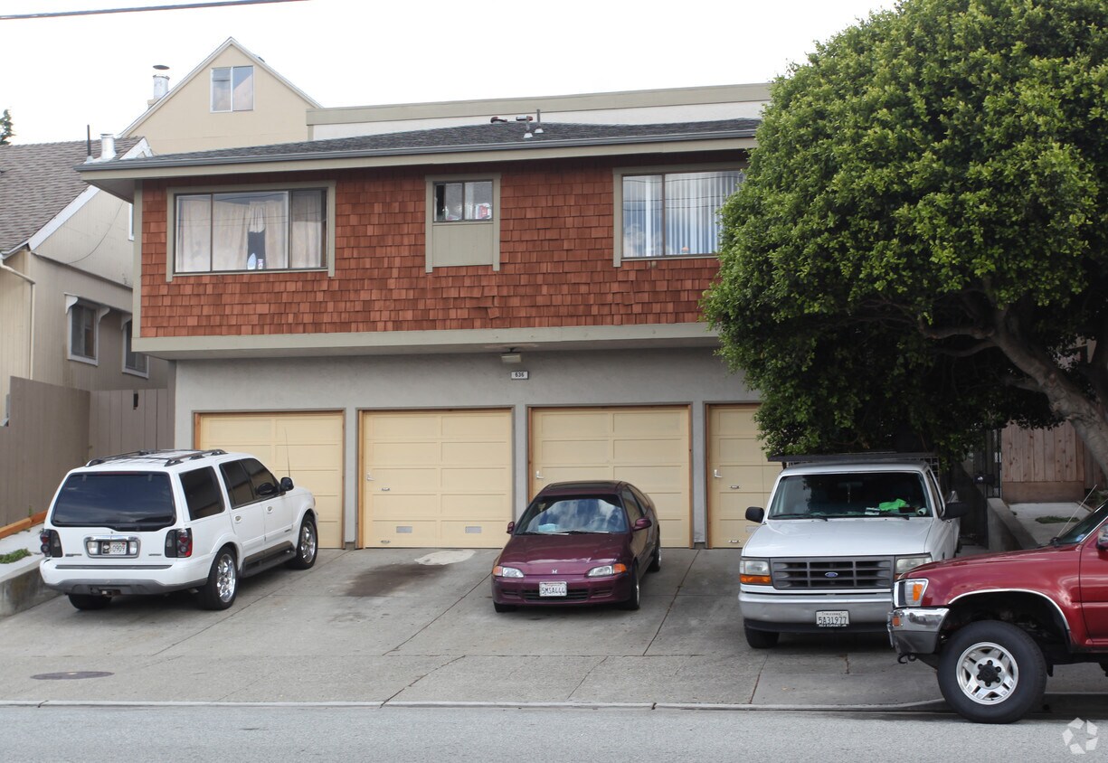

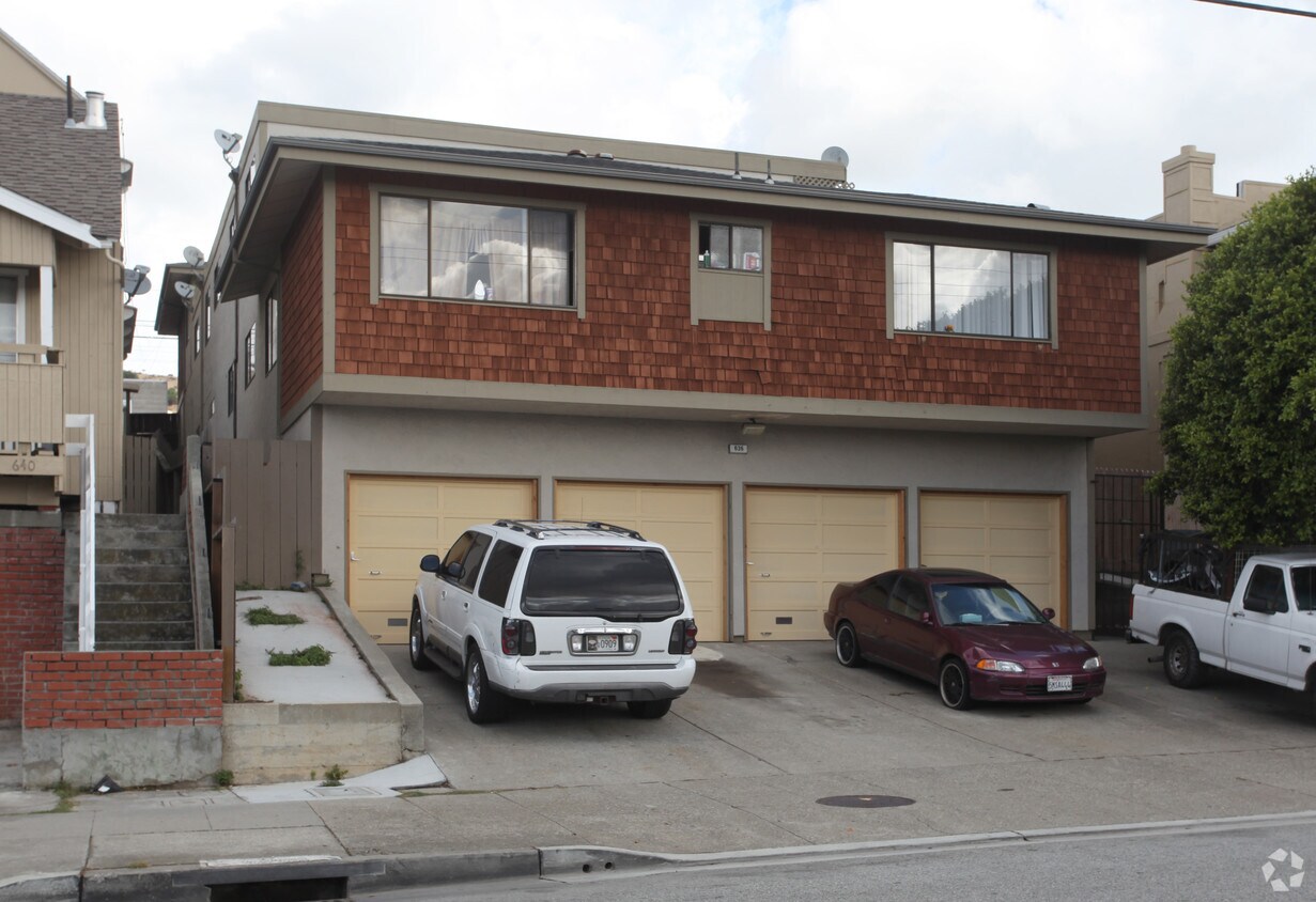
636 Commercial in South San Francisco, CA is ready for you to move in. This community can be found on Commercial Ave in South San Francisco. Come for a visit to view the available floorplans. At this community, you'll have access to a variety of amenities and features. Some of these include: high-speed internet access, curbside trash pick-up, and smoke free options. Drop by to schedule your tour.
636 Commercial is an apartment community located in San Mateo County and the 94080 ZIP Code. This area is served by the South San Francisco Unified School District attendance zone.
Air Conditioning
Dishwasher
High Speed Internet Access
Smoke Free
Downtown South San Francisco mixes a small-town feel with urban appeal. Walk down Grand Avenue and you’ll find rows of hip boutiques, diverse eateries, and cozy cafes in classic brick buildings. Outside of Grand Avenue, and a stretch of Linden Avenue, Downtown South San Francisco is mostly residential. Renters have their pick of numerous apartments, condos, and houses in the neighborhood.
A host of area parks and trails offer abundant opportunities to enjoy nature without having to sacrifice the convenience of living downtown. The neighborhood is proximate to the Bayshore Freeway, South San Francisco Caltrain Station, and San Francisco International Airport, connecting Downtown South San Francisco to the rest of the Bay Area and beyond.
Learn more about living in Downtown South San FranciscoCompare neighborhood and city base rent averages by bedroom.
| Downtown South San Francisco | South San Francisco, CA | |
|---|---|---|
| Studio | $3,177 | $2,593 |
| 1 Bedroom | $3,586 | $3,264 |
| 2 Bedrooms | $4,102 | $3,726 |
| 3 Bedrooms | $5,097 | $4,285 |
| Colleges & Universities | Distance | ||
|---|---|---|---|
| Colleges & Universities | Distance | ||
| Drive: | 11 min | 4.8 mi | |
| Drive: | 15 min | 7.9 mi | |
| Drive: | 15 min | 8.3 mi | |
| Drive: | 21 min | 10.4 mi |


Transportation options available in South San Francisco include San Bruno Station, located 1.8 miles from 636 Commercial. 636 Commercial is near San Francisco International, located 4.6 miles or 10 minutes away, and Metro Oakland International, located 29.1 miles or 43 minutes away.
| Transit / Subway | Distance | ||
|---|---|---|---|
| Transit / Subway | Distance | ||
|
|
Drive: | 5 min | 1.8 mi |
|
|
Drive: | 5 min | 2.0 mi |
| Drive: | 7 min | 2.5 mi | |
|
|
Drive: | 7 min | 3.4 mi |
|
|
Drive: | 9 min | 4.0 mi |
| Commuter Rail | Distance | ||
|---|---|---|---|
| Commuter Rail | Distance | ||
| Drive: | 3 min | 1.4 mi | |
| Drive: | 6 min | 2.7 mi | |
| Drive: | 9 min | 5.6 mi | |
| Drive: | 10 min | 5.8 mi | |
| Drive: | 10 min | 6.5 mi |
| Airports | Distance | ||
|---|---|---|---|
| Airports | Distance | ||
|
San Francisco International
|
Drive: | 10 min | 4.6 mi |
|
Metro Oakland International
|
Drive: | 43 min | 29.1 mi |
Scores provided by
Traffic
-Airport
-Businesses
-Scores provided by
HowLoud What is a Sound Score Rating? A Sound Score Rating aggregates noise caused by vehicle traffic, airplane traffic and local sources. How It WorksTime and distance from 636 Commercial.
| Shopping Centers | Distance | ||
|---|---|---|---|
| Shopping Centers | Distance | ||
| Walk: | 15 min | 0.8 mi | |
| Drive: | 3 min | 1.4 mi | |
| Drive: | 4 min | 1.4 mi |
| Parks and Recreation | Distance | ||
|---|---|---|---|
| Parks and Recreation | Distance | ||
|
Candlestick Point State Recreation Area
|
Drive: | 14 min | 6.7 mi |
|
Pacifica State Beach
|
Drive: | 15 min | 7.8 mi |
|
San Bruno Mountain State Park
|
Drive: | 17 min | 8.0 mi |
|
San Francisco State Univ. Observatory
|
Drive: | 16 min | 8.5 mi |
|
Charles F. Hagar Planetarium
|
Drive: | 16 min | 8.5 mi |
| Hospitals | Distance | ||
|---|---|---|---|
| Hospitals | Distance | ||
| Drive: | 3 min | 1.5 mi | |
| Drive: | 9 min | 4.3 mi | |
| Drive: | 9 min | 5.8 mi |
| Military Bases | Distance | ||
|---|---|---|---|
| Military Bases | Distance | ||
| Drive: | 28 min | 12.5 mi | |
| Drive: | 28 min | 13.0 mi | |
| Drive: | 39 min | 23.6 mi |
Pets Allowed Fitness Center In Unit Washer & Dryer Walk-In Closets Stainless Steel Appliances Hardwood Floors EV Charging
Pets Allowed Fitness Center In Unit Washer & Dryer Stainless Steel Appliances Business Center Package Service Elevator
What Are Walk Score®, Transit Score®, and Bike Score® Ratings?
Walk Score® measures the walkability of any address. Transit Score® measures access to public transit. Bike Score® measures the bikeability of any address.
What is a Sound Score Rating?
A Sound Score Rating aggregates noise caused by vehicle traffic, airplane traffic and local sources.
636 Commercial Ave
South San Francisco, CA 94080


