$1,850
/ Month
6340 Malvey Ave
Fort Worth, TX 76116
2 Weeks Ago
Favorites
6340 Malvey Ave

Favorites
Check Back Soon for Upcoming Availability
| Beds | Baths | Average SF |
|---|---|---|
| 3 Bedrooms 3 Bedrooms 3 Br | 2 Baths 2 Baths 2 Ba | 1,470 SF |
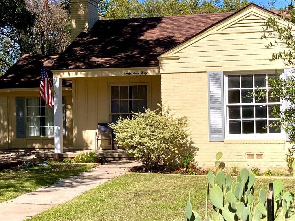
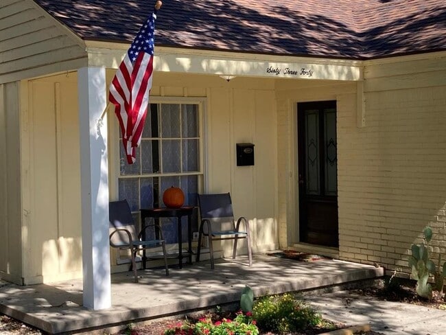
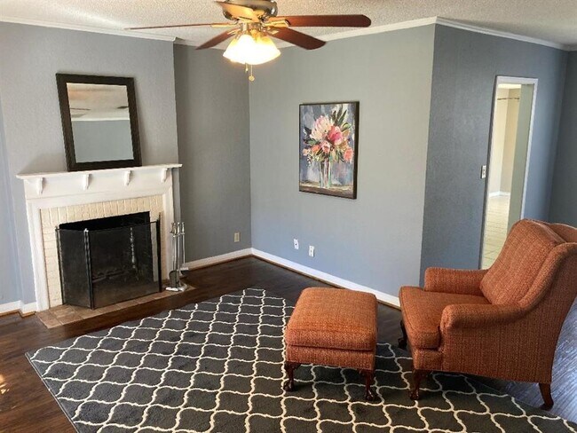
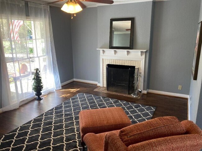
About This Property
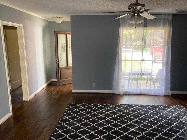
Charming, updated home in desirable Ridglea North. Newly hand scraped hardwood floors in living room and 2 bedrooms. New paint in living room and kitchen. Kitchen has granite counters and stainless appliances. Third bedroom has huge walk in closet. Private backyard with deck and canopy. Convenient location to I30 and downtown. Very walkable neighborhood. Lots of shops and restaurants at nearby Camp Bowie blvd. Refrigerator and lawncare included.
6340 Malvey Ave is a house located in Tarrant County and the 76116 ZIP Code. This area is served by the Fort Worth Independent attendance zone.
Location
Get Directions
Western Hills/ Ridglea is a populated area about 10 miles west of Downtown Fort Worth. This suburban neighborhood is popular for commuters as it’s bounded to the west by Interstate 820 and to the north by I-30. While the majority of town consists of residential areas, commercial developments dot the area too, especially along Camp Bowie Boulevard. Expansive community parks and a golf course are located within the neighborhood’s limits as well. Parks and trails along Clear Fork Trinity River and Walnut Creek provide residents with additional outdoor recreational opportunities. Renters have a variety of rental options in affordable to moderate price ranges. Outside of Western Hills/Ridglea, residents have access to all of the excitement offered by Fort Worth, including places like Kimbell Art Museum and the Fort Worth Botanic Garden.
Learn more about living in Western Hills/RidgleaBelow are rent ranges for similar nearby apartments
Education
| Colleges & Universities | Distance | ||
|---|---|---|---|
| Colleges & Universities | Distance | ||
| Drive: | 10 min | 6.1 mi | |
| Drive: | 11 min | 6.8 mi | |
| Drive: | 14 min | 9.8 mi | |
| Drive: | 18 min | 13.1 mi |
6340 Malvey Ave is within 10 minutes or 6.1 miles from Texas Christian University. It is also near Tarrant Co. Coll., Trinity and Tarrant Co. Coll., North West.
Schools


Public Elementary School
Grades PK-5
406 Students
Attendance Zone
Public Middle School
Grades 6-8
554 Students
Attendance Zone
Public High School
Grades 9-12
1,934 Students
Attendance Zone
Private Elementary, Middle & High School
Grades K-12
1,077 Students
Nearby
Private Elementary & Middle School
Grades PK-8
127 Students
Nearby
School data provided by
 The GreatSchools Rating helps parents compare schools within a state based on a variety of school quality indicators and provides a helpful picture of how effectively each school serves all of its students. Ratings are on a scale of 1 (below average) to 10 (above average) and can include test scores, college readiness, academic progress, advanced courses, equity, discipline and attendance data. We also advise parents to visit schools, consider other information on school performance and programs, and consider family needs as part of the school selection process.
View GreatSchools Rating Methodology
Data provided by GreatSchools.org © 2025. All rights reserved.
View GreatSchools Rating Methodology
Data provided by GreatSchools.org © 2025. All rights reserved.
Transportation options available in Fort Worth include Fort Worth T&P Station, located 6.3 miles from 6340 Malvey Ave. 6340 Malvey Ave is near Dallas-Fort Worth International, located 31.1 miles or 41 minutes away, and Dallas Love Field, located 39.8 miles or 51 minutes away.
| Transit / Subway | Distance | ||
|---|---|---|---|
| Transit / Subway | Distance | ||
| Drive: | 10 min | 6.3 mi | |
| Drive: | 11 min | 6.6 mi | |
| Drive: | 15 min | 8.8 mi | |
| Drive: | 20 min | 12.7 mi |
| Commuter Rail | Distance | ||
|---|---|---|---|
| Commuter Rail | Distance | ||
|
|
Drive: | 10 min | 6.3 mi |
|
|
Drive: | 11 min | 6.6 mi |
|
|
Drive: | 11 min | 6.6 mi |
|
|
Drive: | 19 min | 14.2 mi |
|
|
Drive: | 20 min | 14.7 mi |
| Airports | Distance | ||
|---|---|---|---|
| Airports | Distance | ||
|
Dallas-Fort Worth International
|
Drive: | 41 min | 31.1 mi |
|
Dallas Love Field
|
Drive: | 51 min | 39.8 mi |
Time and distance from 6340 Malvey Ave.
| Shopping Centers | Distance | ||
|---|---|---|---|
| Shopping Centers | Distance | ||
| Walk: | 9 min | 0.5 mi | |
| Walk: | 11 min | 0.6 mi | |
| Walk: | 13 min | 0.7 mi |
6340 Malvey Ave has 3 shopping centers within 0.7 mile, which is about a 13-minute walk. The miles and minutes will be for the farthest away property.
| Parks and Recreation | Distance | ||
|---|---|---|---|
| Parks and Recreation | Distance | ||
|
Fort Worth Museum of Science & History
|
Drive: | 6 min | 4.1 mi |
|
Fort Worth Botanic Garden
|
Drive: | 7 min | 4.5 mi |
|
Log Cabin Village
|
Drive: | 7 min | 4.6 mi |
|
Fort Worth Zoo
|
Drive: | 7 min | 4.7 mi |
|
Burger's Lake
|
Drive: | 13 min | 5.1 mi |
6340 Malvey Ave has 5 parks within 5.1 miles, including Fort Worth Museum of Science & History, Fort Worth Botanic Garden, and Fort Worth Zoo.
| Hospitals | Distance | ||
|---|---|---|---|
| Hospitals | Distance | ||
| Drive: | 7 min | 5.0 mi | |
| Drive: | 7 min | 5.0 mi | |
| Drive: | 9 min | 5.0 mi |
6340 Malvey Ave has 3 hospitals within 5.0 miles, the nearest is Medical City Fort Worth which is 5.0 miles away and a 7 minute drive.
| Military Bases | Distance | ||
|---|---|---|---|
| Military Bases | Distance | ||
| Drive: | 8 min | 4.1 mi | |
| Drive: | 40 min | 29.3 mi |
6340 Malvey Ave is 4.1 miles from NAS Fort Worth Joint Reserve Base, and is convenient to other military bases, including Dallas Naval Air Station.
You May Also Like
Similar Rentals Nearby
-
-
-
-
-
-
-
-
-
1 / 37

-
1 / 50


What Are Walk Score®, Transit Score®, and Bike Score® Ratings?
Walk Score® measures the walkability of any address. Transit Score® measures access to public transit. Bike Score® measures the bikeability of any address.
What is a Sound Score Rating?
A Sound Score Rating aggregates noise caused by vehicle traffic, airplane traffic and local sources

6340 Malvey Ave
Fort Worth, TX 76116