$2,976 / Month
6339 10th Ave Unit B
Los Angeles, CA 90043
2 Weeks Ago
Favorites
6339 10th Ave Unit B

Favorites
Check Back Soon for Upcoming Availability
| Beds | Baths | Average SF |
|---|---|---|
| 4 Bedrooms 4 Bedrooms 4 Br | 2 Baths 2 Baths 2 Ba | 1,300 SF |
Fees and Policies
Details
Property Information
-
10 units
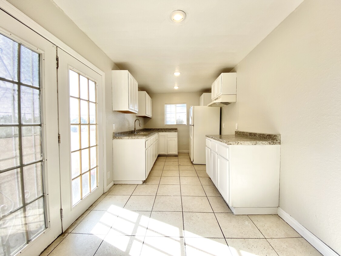
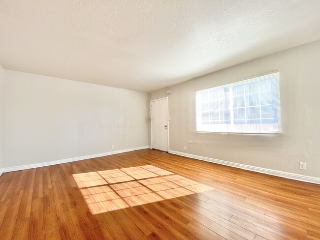
About This Property
6339 10th Ave is an apartment community located in Los Angeles County and the 90043 ZIP Code.
Location
Get Directions
Found in the Inglewood area of Los Angeles County, Park Mesa spans nearly three square miles between Downtown Los Angeles, which is 11 miles east, and Los Angeles International Airport, six miles west.
Park Mesa Heights hosts a variety of events and festivals. Inglewood's annual Dr. Martin Luther King Jr. Day Celebration brings residents out to commemorate, while the Slauson Indoor Swap Meet draws bargain hunters. With L.A. beaches lining the Pacific Ocean just eight miles away, Park Mesa Heights provides coastal breezes and easy access to sand and surf.
Learn more about living in Park Mesa HeightsBelow are rent ranges for similar nearby apartments
| Beds | Average Size | Lowest | Typical | Premium |
|---|---|---|---|---|
| Studio Studio Studio | 393 Sq Ft | $1,295 | $1,846 | $2,150 |
| 1 Bed 1 Bed 1 Bed | 690-698 Sq Ft | $850 | $1,904 | $3,500 |
| 2 Beds 2 Beds 2 Beds | 883 Sq Ft | $1,600 | $2,584 | $3,999 |
| 3 Beds 3 Beds 3 Beds | 1234-1235 Sq Ft | $1,250 | $3,294 | $5,795 |
| 4 Beds 4 Beds 4 Beds | 1643 Sq Ft | $1,125 | $5,272 | $9,950 |
Education
| Colleges & Universities | Distance | ||
|---|---|---|---|
| Colleges & Universities | Distance | ||
| Drive: | 10 min | 5.0 mi | |
| Drive: | 10 min | 5.6 mi | |
| Drive: | 12 min | 5.7 mi | |
| Drive: | 11 min | 6.7 mi |
6339 10th Ave Unit B is within 10 minutes or 5.0 miles from Los Angeles Southwest College. It is also near USC, University Park Campus and West Los Angeles College.
Transportation options available in Los Angeles include Hyde Park Station, located 0.6 mile from 6339 10th Ave Unit B. 6339 10th Ave Unit B is near Los Angeles International, located 6.4 miles or 13 minutes away, and Bob Hope, located 18.4 miles or 32 minutes away.
| Transit / Subway | Distance | ||
|---|---|---|---|
| Transit / Subway | Distance | ||
| Walk: | 10 min | 0.6 mi | |
| Drive: | 3 min | 1.3 mi | |
| Drive: | 3 min | 1.7 mi | |
| Drive: | 3 min | 2.0 mi | |
| Drive: | 5 min | 2.2 mi |
| Commuter Rail | Distance | ||
|---|---|---|---|
| Commuter Rail | Distance | ||
|
|
Drive: | 16 min | 10.0 mi |
|
|
Drive: | 18 min | 10.2 mi |
|
|
Drive: | 22 min | 12.1 mi |
| Drive: | 19 min | 14.0 mi | |
|
|
Drive: | 22 min | 14.6 mi |
| Airports | Distance | ||
|---|---|---|---|
| Airports | Distance | ||
|
Los Angeles International
|
Drive: | 13 min | 6.4 mi |
|
Bob Hope
|
Drive: | 32 min | 18.4 mi |
Time and distance from 6339 10th Ave Unit B.
| Shopping Centers | Distance | ||
|---|---|---|---|
| Shopping Centers | Distance | ||
| Walk: | 11 min | 0.6 mi | |
| Drive: | 4 min | 1.7 mi | |
| Drive: | 4 min | 1.8 mi |
6339 10th Ave Unit B has 3 shopping centers within 1.8 miles, which is about a 4-minute walk. The miles and minutes will be for the farthest away property.
| Parks and Recreation | Distance | ||
|---|---|---|---|
| Parks and Recreation | Distance | ||
|
Natural History Museum of LA County
|
Drive: | 9 min | 4.8 mi |
|
Kenneth Hahn State Recreation Area
|
Drive: | 12 min | 4.8 mi |
|
Exposition Park Rose Garden
|
Drive: | 9 min | 4.9 mi |
|
California Science Center
|
Drive: | 10 min | 5.0 mi |
|
Augustus Hawkins Natural Park
|
Drive: | 9 min | 5.2 mi |
6339 10th Ave Unit B has 5 parks within 5.2 miles, including Kenneth Hahn State Recreation Area, California Science Center, and Natural History Museum of LA County.
| Hospitals | Distance | ||
|---|---|---|---|
| Hospitals | Distance | ||
| Drive: | 7 min | 3.4 mi | |
| Drive: | 11 min | 6.4 mi | |
| Drive: | 12 min | 7.2 mi |
6339 10th Ave Unit B has 3 hospitals within 7.2 miles, the nearest is Centinela Hospital Medical Center which is 3.4 miles away and a 7 minute drive.
| Military Bases | Distance | ||
|---|---|---|---|
| Military Bases | Distance | ||
| Drive: | 13 min | 7.3 mi |
6339 10th Ave Unit B is 7.3 miles and a 13 minute drive from Los Angeles Air Force Base.
You May Also Like
Similar Rentals Nearby


What Are Walk Score®, Transit Score®, and Bike Score® Ratings?
Walk Score® measures the walkability of any address. Transit Score® measures access to public transit. Bike Score® measures the bikeability of any address.
What is a Sound Score Rating?
A Sound Score Rating aggregates noise caused by vehicle traffic, airplane traffic and local sources

6339 10th Ave
Los Angeles, CA 90043