$2,500
/ Month
6301 Southern Ave SE
Capitol Heights, MD 20743
1 Day Ago
|
Edit
Favorites
301-633-8686
-
Bedrooms
3
-
Bathrooms
1.5
-
Square Feet
832 sq ft
-
Available
Available Now
Highlights
- Contemporary Architecture
- Central Heating and Cooling System
6301 Southern Ave SE

Favorites
About This Home
Available Now
This is a limited listing. Please contact owner with questions.
6301 Southern Ave Se is a townhome located in Prince George's County and the 20743 ZIP Code. This area is served by the Prince George's County Public Schools attendance zone.
* Price shown is base rent. Excludes user-selected optional fees and variable or usage-based fees and required charges due at or prior to move-in or at move-out. Price, availability, fees, and any applicable rent special are subject to change without notice.
* Square footage definitions vary. Displayed square footage is approximate.
Home Details
Home Type
End Unit Townhome
Year Built
Built in 1954
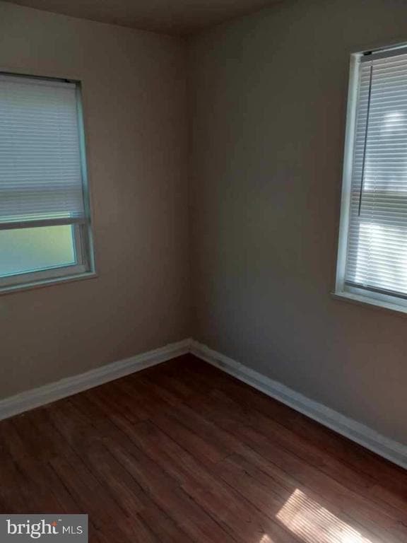
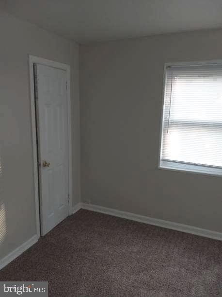
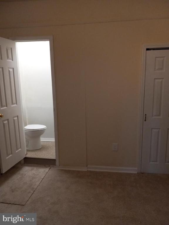
Bedrooms and Bathrooms
3 Bedrooms | 1 Main Level Bedroom
1.5 Bathrooms
Finished Basement
Connecting Stairway
Home Design
Contemporary Architecture
Brick Exterior Construction
Concrete Perimeter Foundation
Interior Spaces
832 Sq Ft Home
Property has 3 Levels
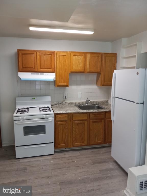
Kitchen
Stove
Range Hood
Disposal
Laundry
Dryer
Washer
Listing and Financial Details
Security Deposit $2,500
12-Month Lease Term
Available 9/6/25
Assessor Parcel Number 17181999481
Tenant pays for cable TV, electricity, gas, heat, hot water, internet, insurance, lawn/tree/shrub care, light bulbs/filters/fuses/alarm care, minor interior maintenance, snow removal, trash removal, all utilities, water
No Smoking Allowed
Coming Soon on 9/6/25
Residential Lease
Lot Details
4,703 Sq Ft Lot
Property is in good condition
Parking
On-Street Parking
Utilities
Central Heating and Cooling System
Heating System Uses Natural Gas
Natural Gas Water Heater
Vented Exhaust Fan
Community Details
Overview
No Home Owners Association
Capitol Heights Subdivision
Pet Policy
No Pets Allowed
Contact
- Listed by Michelle B Danson | Rice Premier Properties LLC
- Phone Number
- Contact
-
Source
 Bright MLS, Inc.
Copyright © 2026 Bright MLS, Inc.
Location
Get Directions
Capitol Heights -- named for its location near Washington, DC -- provides the perfect location: near DC, near the Capital Beltway, and minutes away from FedEx Field, home of the NFL's Washington Football Team. It is also close to the Anacostia River, the United States National Arboretum, and Joint Base Anacostia-Bolling. Nearby Fort Circle Park provides Capitol Heights residents with 10 miles of hiking trails -- it is also a popular concert venue and is home to Fort Dupont Ice Rink.
Capitol Heights is a terrific location for your DC-area apartment, only about seven miles southeast of downtown. Hop on the Metro at the Capitol Heights Metro Station for a fast, car-free commute. Despite being so close to the historic sites of DC, Capitol Heights was a rural area with no paved roads or streetlights. In 1910, the 200 residents in the area named their town "Capitol Heights," but it wasn't until 1980 and the arrival of the Metro Blue Line that the town began to grow.
Learn more about living in Capitol Heights
Amenities
- Basement
Education
| Colleges & Universities | Distance | ||
|---|---|---|---|
| Colleges & Universities | Distance | ||
| Drive: | 9 min | 5.0 mi | |
| Drive: | 10 min | 5.0 mi | |
| Drive: | 11 min | 5.7 mi | |
| Drive: | 11 min | 6.0 mi |
6301 Southern Ave SE is within 9 minutes or 5.0 miles from Univ. of Md. Univ. Coll.. It is also near Gallaudet University and Prince George's Comm. Coll..
Schools


Public Elementary School
Grades PK-6
331 Students
Attendance Zone
Public Middle School
Grades 6-8
867 Students
Attendance Zone
Public High School
Grades 9-12
877 Students
Attendance Zone
Private Elementary & Middle School
Grades PK-8
Nearby
Private High School
Grades 9-12
Nearby
School data provided by
 The GreatSchools Rating helps parents compare schools within a state based on a variety of school quality indicators and provides a helpful picture of how effectively each school serves all of its students. Ratings are on a scale of 1 (below average) to 10 (above average) and can include test scores, college readiness, academic progress, advanced courses, equity, discipline and attendance data. We also advise parents to visit schools, consider other information on school performance and programs, and consider family needs as part of the school selection process.
View GreatSchools Rating Methodology
Data provided by GreatSchools.org © 2026. All rights reserved.
View GreatSchools Rating Methodology
Data provided by GreatSchools.org © 2026. All rights reserved.
Transportation options available in Capitol Heights include Capitol Heights, Blue/Silver Line Center Platform, located 0.2 mile from 6301 Southern Ave SE. 6301 Southern Ave SE is near Ronald Reagan Washington Ntl, located 11.5 miles or 21 minutes away, and Baltimore/Washington International Thurgood Marshall, located 28.4 miles or 42 minutes away.
| Transit / Subway | Distance | ||
|---|---|---|---|
| Transit / Subway | Distance | ||
|
Capitol Heights, Blue/Silver Line Center Platform
|
Walk: | 4 min | 0.2 mi |
|
|
Drive: | 2 min | 1.2 mi |
|
|
Drive: | 3 min | 1.4 mi |
|
|
Drive: | 4 min | 2.1 mi |
|
|
Drive: | 7 min | 3.6 mi |
| Commuter Rail | Distance | ||
|---|---|---|---|
| Commuter Rail | Distance | ||
|
|
Drive: | 9 min | 5.3 mi |
|
|
Drive: | 11 min | 5.5 mi |
|
|
Drive: | 12 min | 6.2 mi |
| Drive: | 12 min | 7.6 mi | |
|
|
Drive: | 12 min | 7.6 mi |
| Airports | Distance | ||
|---|---|---|---|
| Airports | Distance | ||
|
Ronald Reagan Washington Ntl
|
Drive: | 21 min | 11.5 mi |
|
Baltimore/Washington International Thurgood Marshall
|
Drive: | 42 min | 28.4 mi |
Time and distance from 6301 Southern Ave SE.
| Shopping Centers | Distance | ||
|---|---|---|---|
| Shopping Centers | Distance | ||
| Walk: | 13 min | 0.7 mi | |
| Walk: | 14 min | 0.8 mi | |
| Drive: | 3 min | 1.1 mi |
6301 Southern Ave SE has 3 shopping centers within 1.1 miles, which is about a 3-minute drive. The miles and minutes will be for the farthest away property.
| Parks and Recreation | Distance | ||
|---|---|---|---|
| Parks and Recreation | Distance | ||
|
Fort Dupont Park
|
Drive: | 7 min | 2.7 mi |
|
Kingman and Heritage Island Park
|
Drive: | 6 min | 3.3 mi |
|
Walker Mill Regional Park
|
Drive: | 7 min | 4.3 mi |
|
Bladensburg Waterfront Park
|
Drive: | 7 min | 4.3 mi |
|
National Arboretum
|
Drive: | 11 min | 5.8 mi |
6301 Southern Ave SE has 5 parks within 5.8 miles, including Fort Dupont Park, Kingman and Heritage Island Park, and Walker Mill Regional Park.
| Hospitals | Distance | ||
|---|---|---|---|
| Hospitals | Distance | ||
| Drive: | 7 min | 3.6 mi | |
| Drive: | 14 min | 5.8 mi | |
| Drive: | 14 min | 6.0 mi |
6301 Southern Ave SE has 3 hospitals within 6.0 miles, the nearest is University of Maryland Prince George's Hospital Center which is 3.6 miles away and a 7 minute drive.
| Military Bases | Distance | ||
|---|---|---|---|
| Military Bases | Distance | ||
| Drive: | 12 min | 5.6 mi | |
| Drive: | 15 min | 7.8 mi |
6301 Southern Ave SE is 5.6 miles from Washington Navy Yard, and is convenient to other military bases, including Anacostia Naval Station.
You May Also Like
-
Kingsley Commons Townhouses
7308 Arlington Blvd
Falls Church, VA 22042
$2,730 - $3,095 Plus Fees
3 Br 12 Month Lease 15.5 mi
-
Fort Meade On-Post Housing
2965 2nd Army Dr
Fort Meade, MD 20755
$2,425 - $3,425
3-4 Br 17.8 mi
-
Somerset Woods Townhomes
1833 Richfield Dr
Severn, MD 21144
$1,704 - $2,352
3 Br 19.1 mi
Similar Rentals Nearby
-
-
-
3 Beds$5,165+Total Monthly PriceTotal Monthly Price NewPrices include base rent and required monthly fees of $125. Variable costs based on usage may apply.Base Rent:3 Beds$5,040+3 Months Free
Pets Allowed Fitness Center
-
3 Beds$7,191+Total Monthly PriceTotal Monthly Price NewPrices include required monthly fees of $142.Base Rent:3 Beds$7,049+2 Months Free
Pets Allowed Fitness Center Pool Dishwasher Refrigerator Kitchen
-
-
3 Beds$6,087+Total Monthly PriceTotal Monthly Price NewPrices include base rent and required monthly fees of $92. Variable costs based on usage may apply.Base Rent:3 Beds$5,995+2 Months Free
Pets Allowed Fitness Center Pool Dishwasher Refrigerator In Unit Washer & Dryer
-
3 Beds$3,941+Total Monthly PriceTotal Monthly Price NewPrices include base rent and required monthly fees of $100. Variable costs based on usage may apply.Base Rent:3 Beds$3,841+2 Months Free
Pets Allowed Fitness Center Pool Dishwasher In Unit Washer & Dryer Clubhouse Business Center
-
-
-
3 Beds$5,959+Total Monthly PriceTotal Monthly Price NewPrices include required monthly fees of $15.Base Rent:3 Beds$5,944+Specials
Pets Allowed Fitness Center Pool Dishwasher Refrigerator Kitchen


What Are Walk Score®, Transit Score®, and Bike Score® Ratings?
Walk Score® measures the walkability of any address. Transit Score® measures access to public transit. Bike Score® measures the bikeability of any address.
What is a Sound Score Rating?
A Sound Score Rating aggregates noise caused by vehicle traffic, airplane traffic and local sources

6301 Southern Ave SE
Capitol Heights, MD 20743