
355-363 63rd St Unit 1
Brooklyn, NY 11220
-
Bedrooms
1
-
Bathrooms
1
-
Square Feet
--
-
Available
Available May 15

About This Home
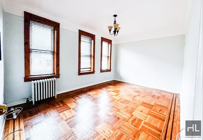
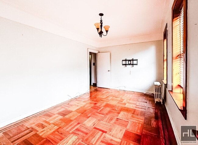
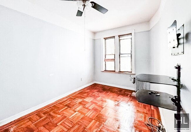
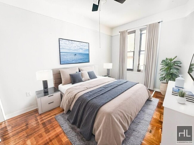
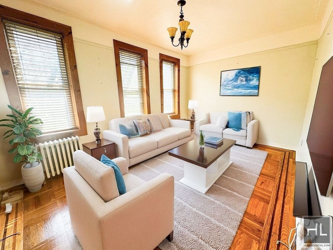
*Bright and Spacious 1 Bedroom Apartment in Sunset Park* *Apartment Features* - Spacious Living Room - Huge bedroom - Separate Kitchen - Hardwood Floor *Available for June 15th move-in* *Schedule a showing with me now! Please email/text for faster response* ===Ref:2329919===
63 STREET is an apartment community located in Kings County and the 11220 ZIP Code.
Contact
- Phone Number
- Website View Property Website
- Contact
-
Source

Situated on the Upper Bay of the Hudson River, Sunset Park is a vibrant neighborhood in southwestern Brooklyn. The neighborhood is home to a park of the same name, featuring 24.5 acres of space for outdoor recreation as well as stunning views of the Manhattan skyline.
Tucked between Park Slope and Bay Ridge, Sunset Park is known for its diverse restaurants, lively festivals, and numerous supermarkets. Sunset Park also contains Industry City, a complex of towering warehouses on cobblestone streets, which houses a slew of coffee shops, eateries, art galleries, and offices for hundreds of companies. Convenience to the D, N, and R subway lines places Sunset Park within minutes of all that NYC has to offer.
Learn more about living in Sunset Park| Colleges & Universities | Distance | ||
|---|---|---|---|
| Colleges & Universities | Distance | ||
| Drive: | 10 min | 5.2 mi | |
| Drive: | 14 min | 5.3 mi | |
| Drive: | 11 min | 5.4 mi | |
| Drive: | 13 min | 5.4 mi |
Transportation options available in Brooklyn include 59 Street (N,R Line), located 0.2 mile from 63 STREET. 63 STREET is near Laguardia, located 15.5 miles or 28 minutes away, and Newark Liberty International, located 18.9 miles or 32 minutes away.
| Transit / Subway | Distance | ||
|---|---|---|---|
| Transit / Subway | Distance | ||
|
|
Walk: | 4 min | 0.2 mi |
|
|
Walk: | 7 min | 0.4 mi |
|
|
Walk: | 10 min | 0.5 mi |
|
|
Walk: | 15 min | 0.8 mi |
|
|
Walk: | 15 min | 0.8 mi |
| Commuter Rail | Distance | ||
|---|---|---|---|
| Commuter Rail | Distance | ||
|
|
Drive: | 12 min | 4.4 mi |
|
|
Drive: | 12 min | 6.6 mi |
|
|
Drive: | 14 min | 7.3 mi |
|
|
Drive: | 16 min | 7.8 mi |
|
|
Drive: | 19 min | 8.4 mi |
| Airports | Distance | ||
|---|---|---|---|
| Airports | Distance | ||
|
Laguardia
|
Drive: | 28 min | 15.5 mi |
|
Newark Liberty International
|
Drive: | 32 min | 18.9 mi |
Time and distance from 63 STREET.
| Shopping Centers | Distance | ||
|---|---|---|---|
| Shopping Centers | Distance | ||
| Drive: | 3 min | 1.3 mi | |
| Drive: | 4 min | 1.6 mi | |
| Drive: | 5 min | 1.9 mi |
| Parks and Recreation | Distance | ||
|---|---|---|---|
| Parks and Recreation | Distance | ||
|
Owl's Head Park
|
Drive: | 4 min | 1.6 mi |
|
Sunset Park
|
Drive: | 4 min | 1.8 mi |
|
Dyker Beach Park
|
Drive: | 5 min | 2.5 mi |
|
Red Hook Park
|
Drive: | 7 min | 3.4 mi |
|
Narrows Botanical Gardens
|
Drive: | 9 min | 4.3 mi |
| Hospitals | Distance | ||
|---|---|---|---|
| Hospitals | Distance | ||
| Drive: | 5 min | 2.0 mi | |
| Drive: | 9 min | 3.7 mi | |
| Drive: | 12 min | 5.4 mi |
| Military Bases | Distance | ||
|---|---|---|---|
| Military Bases | Distance | ||
| Drive: | 7 min | 3.1 mi | |
| Drive: | 15 min | 7.4 mi |
You May Also Like
What Are Walk Score®, Transit Score®, and Bike Score® Ratings?
Walk Score® measures the walkability of any address. Transit Score® measures access to public transit. Bike Score® measures the bikeability of any address.
What is a Sound Score Rating?
A Sound Score Rating aggregates noise caused by vehicle traffic, airplane traffic and local sources
355-363 63rd St
Brooklyn, NY 11220