
-
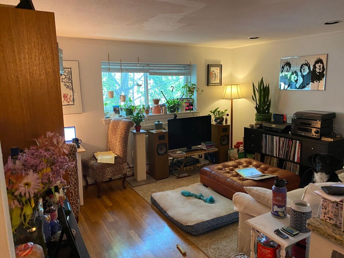
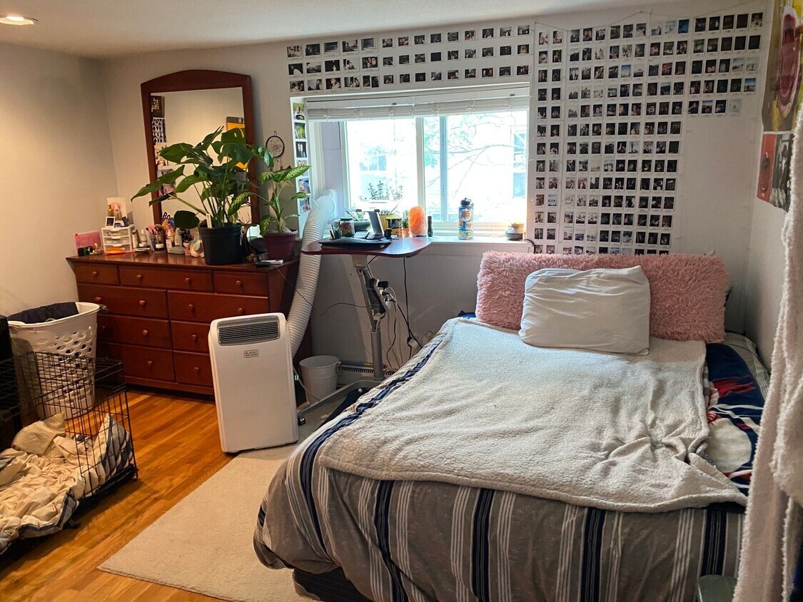
Brighton 1 bed with dishwasher for 9/1
-
-
-
$2,525 / Month
63 Euston Rd
Boston, MA 02135
Today
Favorites
-
Bedrooms
1
-
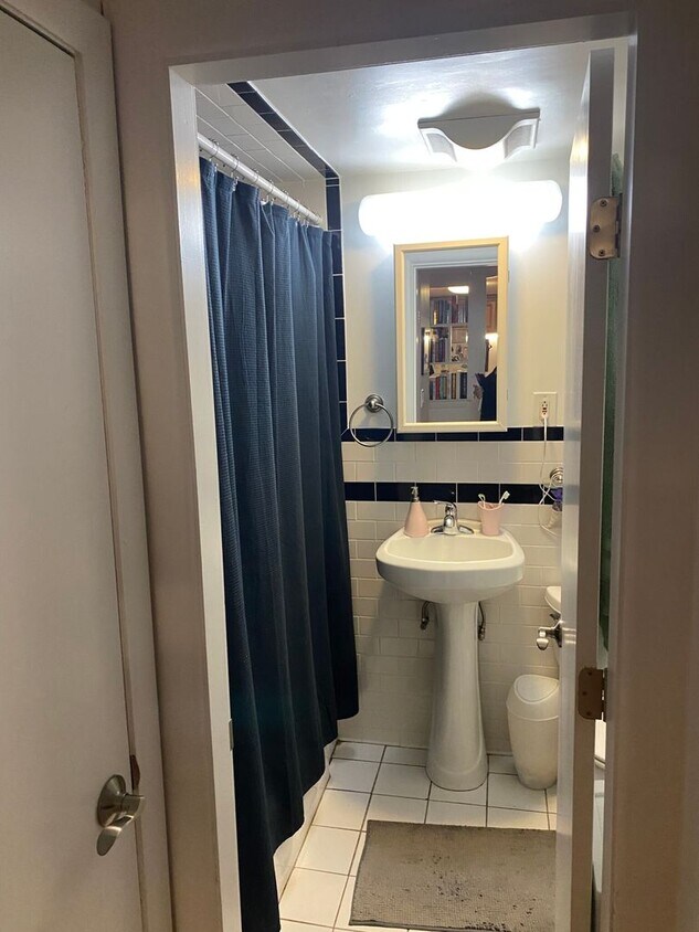
Bathrooms
1
-
Square Feet
650 sq ft
63 Euston Rd

Favorites
About This Home
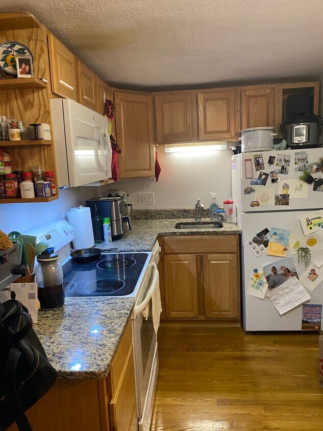
Brighton 1-bedroom unit with 650 square feet of living space and kitchen with dishwasher. Available for a September 1st move-in. Contact for more info/showings.
63 Euston Rd is a condo located in Suffolk County and the 02135 ZIP Code.
* Price shown is base rent and may not include non-optional fees and utilities.
Price, availability, fees, and any applicable rent special are subject to change without notice.
* Square footage definitions vary. Displayed square footage is approximate.
Contact
- Listed by Modern Real Estate (AD) | Modern Real Estate (AD)
Location
Get Directions
Saint Elizabeth’s is a Brighton neighborhood situated about 10 miles away from Boston. Thanks to Saint Elizabeth’s top border sitting on Highway 20, commuting in and out of Brighton is easy. Some residents travel by car, but buses and railways make commuting via public transportation a breeze.
The neighborhood’s best amenities are two world-renowned hospitals, Saint Elizabeth’s Medical Center and Franciscan Children’s, that sit on the edge of town. Other great amenities of Saint Elizabeth’s include many local parks like Ringer Playground and Chestnut Hill Reservoir, which has great trails and greenspace. This neighborhood is also equipped with cozy coffee shops, restaurants serving international and American classics, and shopping plazas with grocers and convenience stores.
Saint Elizabeth’s has several rental options ranging from apartments to single-family homes.
Learn more about living in St Elizabeth's
Education
| Colleges & Universities | Distance | ||
|---|---|---|---|
| Colleges & Universities | Distance | ||
| Drive: | 4 min | 1.8 mi | |
| Drive: | 4 min | 1.9 mi | |
| Drive: | 5 min | 2.3 mi | |
| Drive: | 6 min | 2.9 mi |
63 Euston Rd is within 4 minutes or 1.8 miles from Boston College, Brighton. It is also near Boston College and Boston University.
Transportation options available in Boston include Sutherland Street Station, located 0.1 mile from 63 Euston Rd. 63 Euston Rd is near General Edward Lawrence Logan International, located 9.4 miles or 17 minutes away.
| Transit / Subway | Distance | ||
|---|---|---|---|
| Transit / Subway | Distance | ||
|
|
Walk: | 2 min | 0.1 mi |
|
|
Walk: | 5 min | 0.3 mi |
|
|
Walk: | 7 min | 0.4 mi |
|
|
Walk: | 10 min | 0.6 mi |
|
|
Drive: | 3 min | 1.4 mi |
| Commuter Rail | Distance | ||
|---|---|---|---|
| Commuter Rail | Distance | ||
|
|
Drive: | 7 min | 3.5 mi |
|
|
Drive: | 8 min | 3.6 mi |
|
|
Drive: | 8 min | 3.7 mi |
| Drive: | 9 min | 4.5 mi | |
|
|
Drive: | 10 min | 5.5 mi |
| Airports | Distance | ||
|---|---|---|---|
| Airports | Distance | ||
|
General Edward Lawrence Logan International
|
Drive: | 17 min | 9.4 mi |
Time and distance from 63 Euston Rd.
| Shopping Centers | Distance | ||
|---|---|---|---|
| Shopping Centers | Distance | ||
| Walk: | 7 min | 0.4 mi | |
| Walk: | 14 min | 0.7 mi | |
| Drive: | 4 min | 1.4 mi |
63 Euston Rd has 3 shopping centers within 1.4 miles, which is about a 4-minute walk. The miles and minutes will be for the farthest away property.
| Parks and Recreation | Distance | ||
|---|---|---|---|
| Parks and Recreation | Distance | ||
|
Chestnut Hill Reservation
|
Drive: | 2 min | 1.2 mi |
|
John Fitzgerald Kennedy National Historic Site
|
Drive: | 3 min | 1.7 mi |
|
Frederick Law Olmsted National Historic Site
|
Drive: | 5 min | 2.0 mi |
|
Coit Observatory
|
Drive: | 6 min | 2.8 mi |
|
Hammond Pond Reservation
|
Drive: | 6 min | 3.0 mi |
63 Euston Rd has 5 parks within 3.0 miles, including Chestnut Hill Reservation, John Fitzgerald Kennedy National Historic Site, and Frederick Law Olmsted National Historic Site.
| Hospitals | Distance | ||
|---|---|---|---|
| Hospitals | Distance | ||
| Walk: | 11 min | 0.6 mi | |
| Walk: | 13 min | 0.7 mi | |
| Drive: | 3 min | 1.7 mi |
63 Euston Rd has 3 hospitals within 1.7 miles, the nearest is Franciscan Children's Hospital & Rehab Center which is 0.6 mile away and a 11 minute walk.
| Military Bases | Distance | ||
|---|---|---|---|
| Military Bases | Distance | ||
| Drive: | 28 min | 12.8 mi | |
| Drive: | 23 min | 13.7 mi |
63 Euston Rd is 12.8 miles from Hanscom Air Force Base, and is convenient to other military bases, including US Military Reservation.
You May Also Like
Similar Rentals Nearby
-
-

-

-

-

-

-
1 / 18

-
1 / 14

-
1 / 18

-
1 / 16

What Are Walk Score®, Transit Score®, and Bike Score® Ratings?
Walk Score® measures the walkability of any address. Transit Score® measures access to public transit. Bike Score® measures the bikeability of any address.
What is a Sound Score Rating?
A Sound Score Rating aggregates noise caused by vehicle traffic, airplane traffic and local sources

63 Euston Rd
Boston, MA 02135