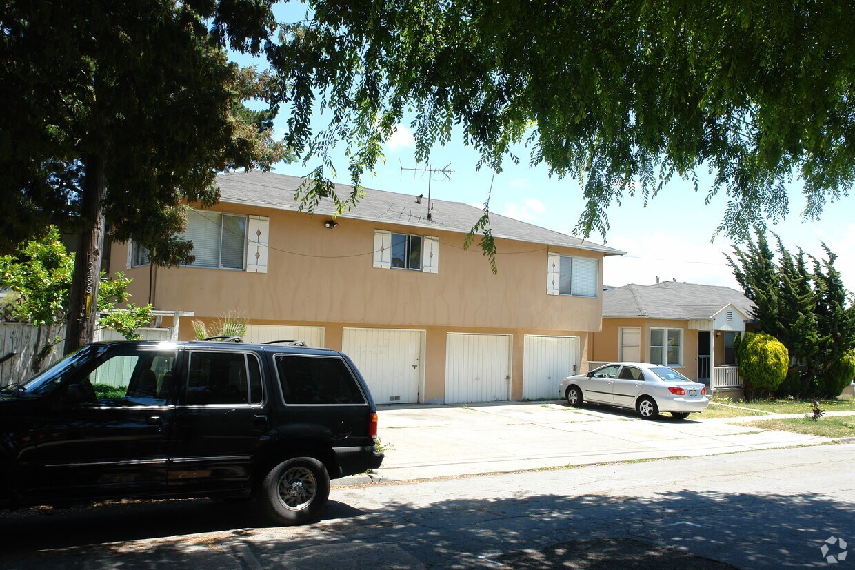
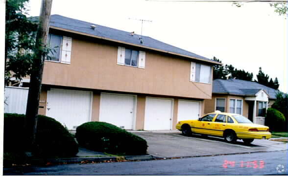
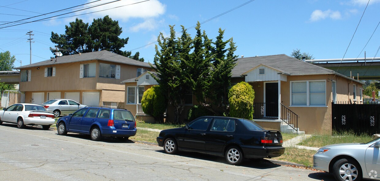
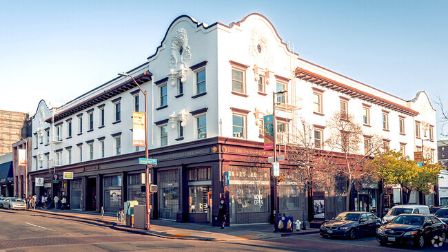
626-630 Liberty St
626-630 Liberty St,
El Cerrito,
CA
94530
2 Weeks Ago
Favorites
626-630 Liberty St
Favorites
Check Back Soon for Upcoming Availability
Fees and Policies
Details
Property Information
-
Built in 1949
-
6 units/2 stories
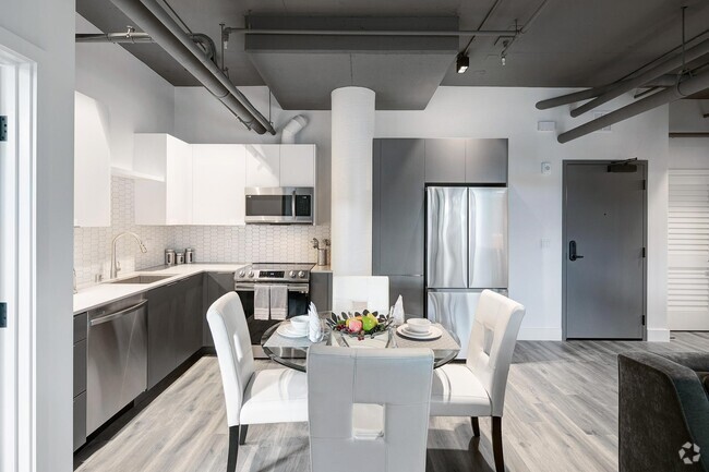
About 626-630 Liberty St El Cerrito, CA 94530
Visit 626-630 Liberty St. This apartment community is located in El Cerrito on Liberty St.. The knowledgeable leasing staff is waiting to show you all that this community has in store. Make a visit to check out the current floorplan options. Stop by 626-630 Liberty St today.
626-630 Liberty St is an apartment community located in Contra Costa County and the 94530 ZIP Code. This area is served by the West Contra Costa Unified attendance zone.
Location
Get Directions
El Cerrito is a suburban Bay Area city positioned right between Berkeley and Richmond. Predominately a residential community, the local rental market is huge, and ranges from luxury apartments to condos to single-family homes on quiet neighborhood streets. The area offers ample opportunities to spend quality time outdoors: Hillside Natural Area provides great views of San Francisco Bay, and the sprawling Wildcat Canyon Regional Park is loaded with trails through the unspoiled rolling hills. The close proximity to larger cities like San Francisco and Oakland makes El Cerrito a popular option for commuters, and BART rail service makes it easy to get around the area without having to drive.
Learn more about living in El Cerrito
Education
| Colleges & Universities | Distance | ||
|---|---|---|---|
| Colleges & Universities | Distance | ||
| Drive: | 11 min | 4.2 mi | |
| Drive: | 14 min | 4.6 mi | |
| Drive: | 11 min | 6.3 mi | |
| Drive: | 13 min | 8.2 mi |
626-630 Liberty St is within 11 minutes or 4.2 miles from Berkeley City College. It is also near UC Berkeley and Contra Costa College.
Schools


Public Elementary School
Grades K-5
270 Students
Nearby
Public Elementary School
Grades K-6
503 Students
Attendance Zone
Public Middle School
Grades 7-8
681 Students
Attendance Zone
Public High School
Grades 9-12
1,522 Students
Attendance Zone
Private Elementary & Middle School
Grades PK-8
55 Students
Nearby
Private Elementary & Middle School
Grades K-8
477 Students
Nearby
Private Middle & High School
Grades 6-12
141 Students
Nearby
School data provided by
 The GreatSchools Rating helps parents compare schools within a state based on a variety of school quality indicators and provides a helpful picture of how effectively each school serves all of its students. Ratings are on a scale of 1 (below average) to 10 (above average) and can include test scores, college readiness, academic progress, advanced courses, equity, discipline and attendance data. We also advise parents to visit schools, consider other information on school performance and programs, and consider family needs as part of the school selection process.
View GreatSchools Rating Methodology
View GreatSchools Rating Methodology
Transportation options available in El Cerrito include El Cerrito Plaza Station, located 0.4 mile from 626-630 Liberty St. 626-630 Liberty St is near Metro Oakland International, located 18.6 miles or 27 minutes away, and San Francisco International, located 26.2 miles or 39 minutes away.
| Transit / Subway | Distance | ||
|---|---|---|---|
| Transit / Subway | Distance | ||
|
|
Walk: | 6 min | 0.4 mi |
|
|
Drive: | 4 min | 2.1 mi |
|
|
Drive: | 9 min | 3.3 mi |
|
|
Drive: | 12 min | 3.9 mi |
|
|
Drive: | 8 min | 4.1 mi |
| Commuter Rail | Distance | ||
|---|---|---|---|
| Commuter Rail | Distance | ||
|
|
Drive: | 8 min | 4.2 mi |
|
|
Drive: | 10 min | 6.0 mi |
|
|
Drive: | 16 min | 10.1 mi |
| Drive: | 21 min | 13.8 mi | |
| Drive: | 23 min | 15.0 mi |
| Airports | Distance | ||
|---|---|---|---|
| Airports | Distance | ||
|
Metro Oakland International
|
Drive: | 27 min | 18.6 mi |
|
San Francisco International
|
Drive: | 39 min | 26.2 mi |
Time and distance from 626-630 Liberty St.
| Shopping Centers | Distance | ||
|---|---|---|---|
| Shopping Centers | Distance | ||
| Walk: | 6 min | 0.3 mi | |
| Walk: | 10 min | 0.5 mi | |
| Walk: | 11 min | 0.6 mi |
626-630 Liberty St has 3 shopping centers within 0.6 mile, which is about a 11-minute walk. The miles and minutes will be for the farthest away property.
| Parks and Recreation | Distance | ||
|---|---|---|---|
| Parks and Recreation | Distance | ||
|
Eddy Arboretum
|
Drive: | 5 min | 1.9 mi |
|
Point Isabel Regional Shoreline
|
Drive: | 7 min | 2.0 mi |
|
Contra Costa Rock Park
|
Drive: | 7 min | 2.4 mi |
|
Blake Garden
|
Drive: | 7 min | 2.8 mi |
|
Mortar Rock Park
|
Drive: | 8 min | 2.8 mi |
626-630 Liberty St has 5 parks within 2.8 miles, including Eddy Arboretum, Blake Garden, and Point Isabel Regional Shoreline.
| Hospitals | Distance | ||
|---|---|---|---|
| Hospitals | Distance | ||
| Drive: | 15 min | 7.2 mi | |
| Drive: | 13 min | 8.1 mi | |
| Drive: | 12 min | 8.1 mi |
626-630 Liberty St has 3 hospitals within 8.1 miles, the nearest is Alta Bates Summit Medical Center - Alta Bates Campus which is 7.2 miles away and a 15 minute drive.
| Military Bases | Distance | ||
|---|---|---|---|
| Military Bases | Distance | ||
| Drive: | 6 min | 2.4 mi | |
| Drive: | 10 min | 5.2 mi | |
| Drive: | 18 min | 9.2 mi |
626-630 Liberty St has 3 military bases within 9.2 miles, the nearest is Military Reservation which is 2.4 miles away and a 6 minute drive.
You May Also Like
Similar Rentals Nearby


What Are Walk Score®, Transit Score®, and Bike Score® Ratings?
Walk Score® measures the walkability of any address. Transit Score® measures access to public transit. Bike Score® measures the bikeability of any address.
What is a Sound Score Rating?
A Sound Score Rating aggregates noise caused by vehicle traffic, airplane traffic and local sources
Responded To This Review