
$2,095
/ Month
619 Westacre Rd
West Sacramento, CA 95691
2 Weeks Ago
|
Edit
Favorites
619 Westacre Rd

Favorites
Check Back Soon for Upcoming Availability
| Beds | Baths | Average SF |
|---|---|---|
| 2 Bedrooms 2 Bedrooms 2 Br | 1 Bath 1 Bath 1 Ba | 857 SF |
Fees and Policies
The fees below are based on community-supplied data and may exclude additional fees and utilities.
- Dogs Allowed
-
Fees not specified
- Cats Allowed
-
Fees not specified
- Parking
-
Garage--
Details
Utilities Included
-
Water
-
Trash Removal
-
Sewer
About This Property
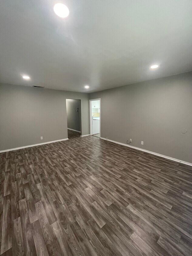
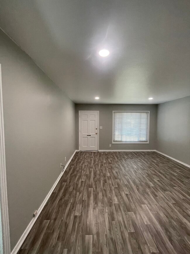
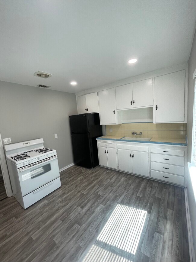
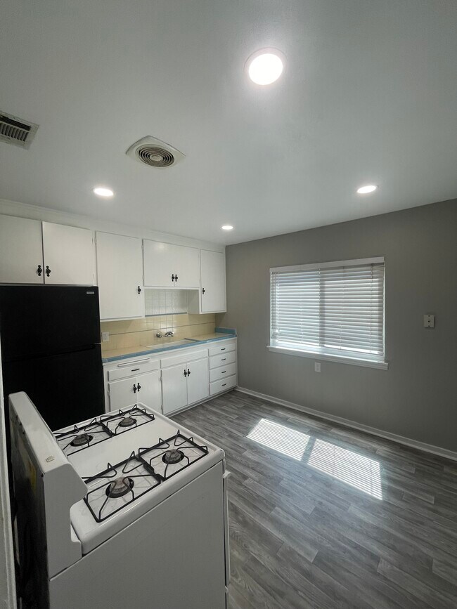
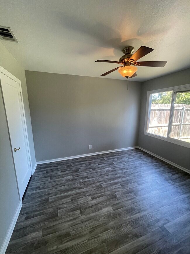
Available Now! Spacious 2 bedroom, 1 bath duplex for rent in West Sacramento. 1 car garage, backyard, kitchen with gas stove, oven, and refrigerator. The duplex includes central heat and air, a washer and dryer, and dual pane windows throughout. New paint and flooring. Pet friendly. Water, sewer, and garbage are included in the rent. Tenants pay all other utilities. Close to shopping, schools, freeway, and only an 7-minute drive to downtown. Rent $2,195 Deposit $2,195 $35 rental application.
619 Westacre Rd is a house located in Yolo County and the 95691 ZIP Code.
House Features
Washer/Dryer
Air Conditioning
Refrigerator
Oven
- Washer/Dryer
- Air Conditioning
- Kitchen
- Oven
- Refrigerator
Location
Get Directions
West Sacramento enjoys the unique privilege of being a fairly quiet residential community right next door to a thriving metropolis. Separated from the state capital only by the Sacramento River, West Sac (as the locals call it) shares virtually all of Sacramento’s resources, cultural and otherwise. The I Street Bridge and Tower Bridge both feed straight into Sacramento’s historic district and downtown entertainment district. On West Sacramento’s side of the river, one of the biggest attractions is the shopping, but scenic areas like River Walk Park and venues like Raley Field give folks plenty to do in their own neighborhood.
Learn more about living in West Sacramento
Amenities
- Washer/Dryer
- Air Conditioning
- Kitchen
- Oven
- Refrigerator
Expenses
Utilities Included
Water, Trash Removal, Sewer
Included
Education
| Colleges & Universities | Distance | ||
|---|---|---|---|
| Colleges & Universities | Distance | ||
| Drive: | 9 min | 4.7 mi | |
| Drive: | 13 min | 8.0 mi | |
| Drive: | 19 min | 12.5 mi | |
| Drive: | 21 min | 14.5 mi |
619 Westacre Rd is within 9 minutes or 4.7 miles from Sacramento City College. It is also near Sacramento State and Cosumnes River College.
Transportation options available in West Sacramento include 8Th & Capitol, located 2.2 miles from 619 Westacre Rd. 619 Westacre Rd is near Sacramento International, located 13.5 miles or 20 minutes away.
| Transit / Subway | Distance | ||
|---|---|---|---|
| Transit / Subway | Distance | ||
|
|
Drive: | 5 min | 2.2 mi |
|
|
Drive: | 5 min | 2.2 mi |
|
|
Drive: | 5 min | 2.2 mi |
|
|
Drive: | 5 min | 2.3 mi |
|
|
Drive: | 5 min | 2.4 mi |
| Commuter Rail | Distance | ||
|---|---|---|---|
| Commuter Rail | Distance | ||
| Drive: | 5 min | 2.2 mi | |
|
|
Drive: | 16 min | 12.7 mi |
|
|
Drive: | 31 min | 23.2 mi |
|
|
Drive: | 31 min | 25.3 mi |
|
|
Drive: | 46 min | 36.2 mi |
| Airports | Distance | ||
|---|---|---|---|
| Airports | Distance | ||
|
Sacramento International
|
Drive: | 20 min | 13.5 mi |
Time and distance from 619 Westacre Rd.
| Shopping Centers | Distance | ||
|---|---|---|---|
| Shopping Centers | Distance | ||
| Walk: | 3 min | 0.2 mi | |
| Walk: | 5 min | 0.3 mi | |
| Walk: | 8 min | 0.4 mi |
619 Westacre Rd has 3 shopping centers within 0.4 mile, which is about a 8-minute walk. The miles and minutes will be for the farthest away property.
| Parks and Recreation | Distance | ||
|---|---|---|---|
| Parks and Recreation | Distance | ||
|
Old Sacramento Historic District
|
Drive: | 4 min | 1.8 mi |
|
California State Railroad Museum
|
Drive: | 5 min | 1.9 mi |
|
California Native Plant Demonstration Garden
|
Drive: | 6 min | 2.5 mi |
|
California State Capitol Museum
|
Drive: | 5 min | 2.5 mi |
|
Natomas Oaks Park
|
Drive: | 9 min | 5.4 mi |
619 Westacre Rd has 5 parks within 5.4 miles, including Old Sacramento Historic District, California State Railroad Museum, and California Native Plant Demonstration Garden.
| Hospitals | Distance | ||
|---|---|---|---|
| Hospitals | Distance | ||
| Drive: | 7 min | 4.8 mi | |
| Drive: | 8 min | 4.9 mi | |
| Drive: | 8 min | 5.8 mi |
619 Westacre Rd has 3 hospitals within 5.8 miles, the nearest is Sutter Medical Center, Sacramento which is 4.8 miles away and a 7 minute drive.
| Military Bases | Distance | ||
|---|---|---|---|
| Military Bases | Distance | ||
| Drive: | 27 min | 14.5 mi |
619 Westacre Rd is 14.5 miles and a 27 minute drive from McClellan Air Force Base.
You May Also Like
Similar Rentals Nearby


What Are Walk Score®, Transit Score®, and Bike Score® Ratings?
Walk Score® measures the walkability of any address. Transit Score® measures access to public transit. Bike Score® measures the bikeability of any address.
What is a Sound Score Rating?
A Sound Score Rating aggregates noise caused by vehicle traffic, airplane traffic and local sources

619 Westacre Rd
West Sacramento, CA 95691