
$2,600 / Month
630-661 61st St Unit 4
Brooklyn, NY 11220
2 Weeks Ago
Favorites
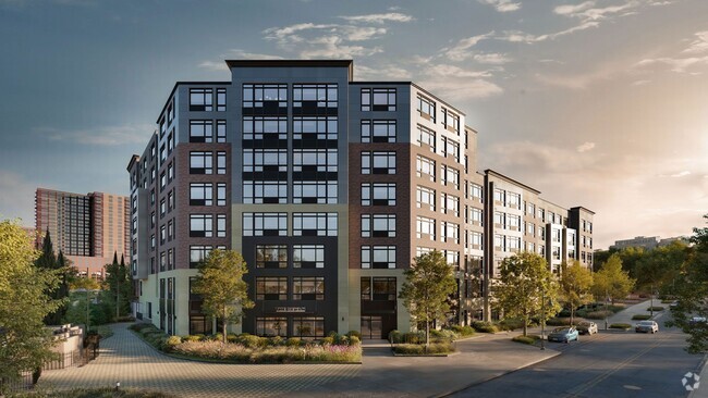
61 STREET

Favorites
Check Back Soon for Upcoming Availability
| Beds | Baths | Average SF |
|---|---|---|
| 3 Bedrooms 3 Bedrooms 3 Br | 1.5 Baths 1.5 Baths 1.5 Ba | — |
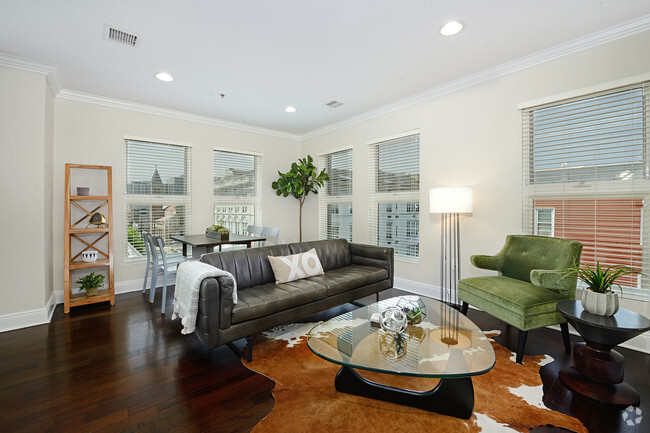
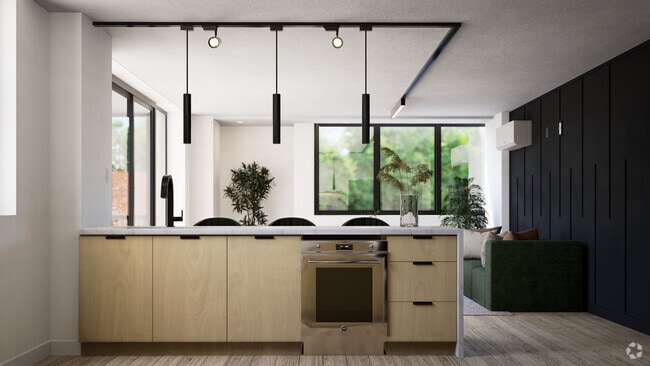
About This Property
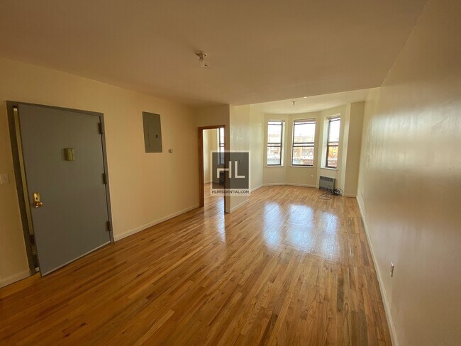
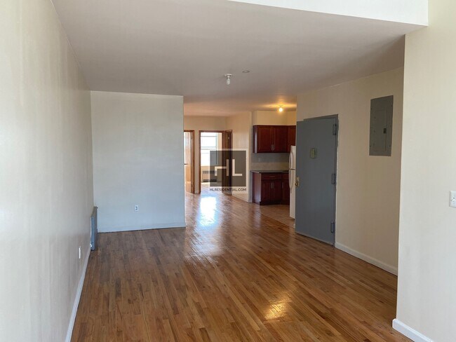
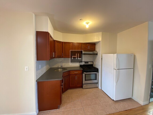
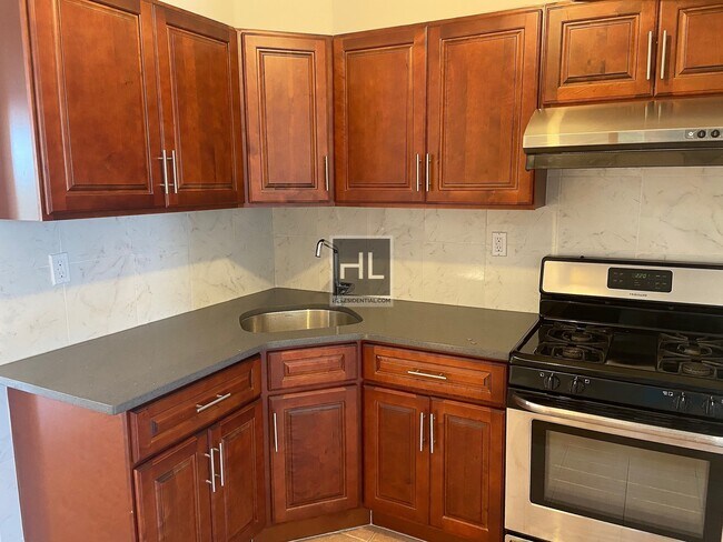
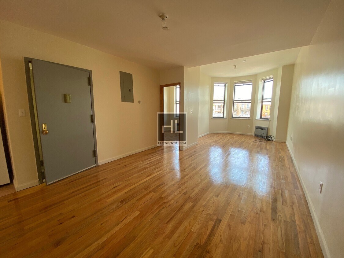
Apartment:- Newly renovated 3 Bedroom/1.5 Bath apartment located on 61 street between 6th and 7th avenue- 4th Floor walk up- Large windows/High ceiling/Skylight allowing for lots of natural light- Ready for immediate occupancy Location:- One block away from the 8th Avenue N Express train and two blocks from the 59th Street N and R line. 30 minutes to Canal St, and 45 minutes to Times Square on the N express- One block away from the b9 bus stop- Near to Brooklyn Army Terminal for the NYC Ferry- Minutes away from the BQE/Verrazzano bridge- Multiple laundromats located within a few blocks===Ref:727858===
61 STREET is an apartment community located in Kings County and the 11220 ZIP Code.
Location
Get Directions
Situated on the Upper Bay of the Hudson River, Sunset Park is a vibrant neighborhood in southwestern Brooklyn. The neighborhood is home to a park of the same name, featuring 24.5 acres of space for outdoor recreation as well as stunning views of the Manhattan skyline.
Tucked between Park Slope and Bay Ridge, Sunset Park is known for its diverse restaurants, lively festivals, and numerous supermarkets. Sunset Park also contains Industry City, a complex of towering warehouses on cobblestone streets, which houses a slew of coffee shops, eateries, art galleries, and offices for hundreds of companies. Convenience to the D, N, and R subway lines places Sunset Park within minutes of all that NYC has to offer.
Learn more about living in Sunset ParkBelow are rent ranges for similar nearby apartments
Education
| Colleges & Universities | Distance | ||
|---|---|---|---|
| Colleges & Universities | Distance | ||
| Drive: | 13 min | 4.9 mi | |
| Drive: | 13 min | 5.1 mi | |
| Drive: | 10 min | 5.3 mi | |
| Drive: | 10 min | 5.5 mi |
61 STREET is within 13 minutes or 4.9 miles from Brooklyn College. It is also near Medgar Evers College, CUNY and St. Francis College.
Transportation options available in Brooklyn include 8 Avenue, located 0.3 mile from 61 STREET. 61 STREET is near Laguardia, located 15.6 miles or 27 minutes away, and Newark Liberty International, located 19.0 miles or 31 minutes away.
| Transit / Subway | Distance | ||
|---|---|---|---|
| Transit / Subway | Distance | ||
|
|
Walk: | 5 min | 0.3 mi |
|
|
Walk: | 8 min | 0.5 mi |
|
|
Walk: | 12 min | 0.6 mi |
|
|
Walk: | 14 min | 0.7 mi |
|
|
Walk: | 14 min | 0.8 mi |
| Commuter Rail | Distance | ||
|---|---|---|---|
| Commuter Rail | Distance | ||
|
|
Drive: | 13 min | 4.7 mi |
|
|
Drive: | 11 min | 6.0 mi |
|
|
Drive: | 13 min | 6.7 mi |
|
|
Drive: | 15 min | 7.3 mi |
|
|
Drive: | 18 min | 7.9 mi |
| Airports | Distance | ||
|---|---|---|---|
| Airports | Distance | ||
|
Laguardia
|
Drive: | 27 min | 15.6 mi |
|
Newark Liberty International
|
Drive: | 31 min | 19.0 mi |
Time and distance from 61 STREET.
| Shopping Centers | Distance | ||
|---|---|---|---|
| Shopping Centers | Distance | ||
| Walk: | 13 min | 0.7 mi | |
| Drive: | 4 min | 1.5 mi | |
| Drive: | 5 min | 1.9 mi |
61 STREET has 3 shopping centers within 1.9 miles, which is about a 5-minute walk. The miles and minutes will be for the farthest away property.
| Parks and Recreation | Distance | ||
|---|---|---|---|
| Parks and Recreation | Distance | ||
|
Sunset Park
|
Drive: | 4 min | 1.5 mi |
|
Owl's Head Park
|
Drive: | 5 min | 1.8 mi |
|
Dyker Beach Park
|
Drive: | 4 min | 2.0 mi |
|
Red Hook Park
|
Drive: | 8 min | 3.7 mi |
|
Narrows Botanical Gardens
|
Drive: | 8 min | 4.4 mi |
61 STREET has 5 parks within 4.4 miles, including Sunset Park, Owl's Head Park, and Narrows Botanical Gardens.
| Hospitals | Distance | ||
|---|---|---|---|
| Hospitals | Distance | ||
| Drive: | 4 min | 1.6 mi | |
| Drive: | 10 min | 4.1 mi | |
| Drive: | 10 min | 4.7 mi |
61 STREET has 3 hospitals within 4.7 miles, the nearest is Maimonides Medical Center which is 1.6 miles away and a 4 minute drive.
| Military Bases | Distance | ||
|---|---|---|---|
| Military Bases | Distance | ||
| Drive: | 6 min | 2.6 mi | |
| Drive: | 14 min | 6.9 mi |
61 STREET is 2.6 miles from Fort Hamilton, and is convenient to other military bases, including Naval Station NY Stapleton Site.
You May Also Like
Similar Rentals Nearby


What Are Walk Score®, Transit Score®, and Bike Score® Ratings?
Walk Score® measures the walkability of any address. Transit Score® measures access to public transit. Bike Score® measures the bikeability of any address.
What is a Sound Score Rating?
A Sound Score Rating aggregates noise caused by vehicle traffic, airplane traffic and local sources
630-661 61st St
Brooklyn, NY 11220