$1,995 / Month
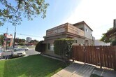
605-609 N Hollywood Way Unit 605-C
Burbank, CA 91505
2 Weeks Ago
Favorites
605-609

Favorites
Check Back Soon for Upcoming Availability
| Beds | Baths | Average SF |
|---|---|---|
| Studio Studio 0 Br | 1 Bath 1 Bath 1 Ba | 353 SF |
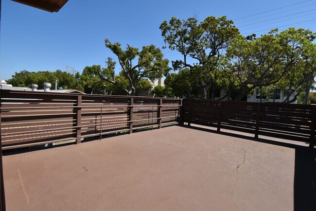
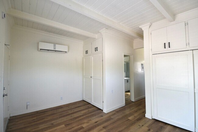
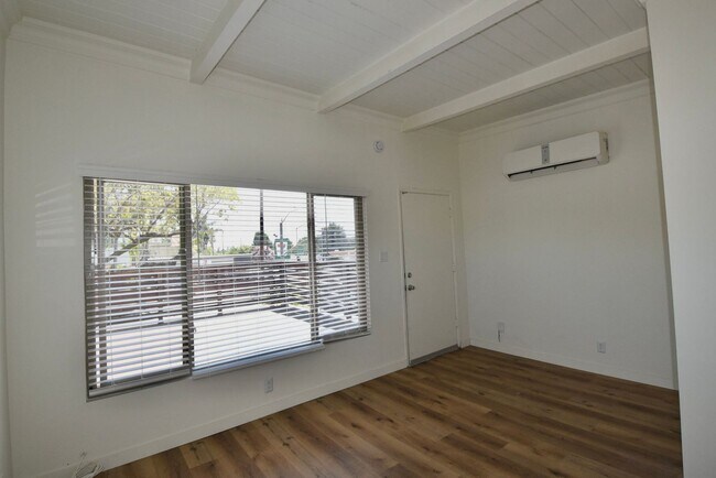
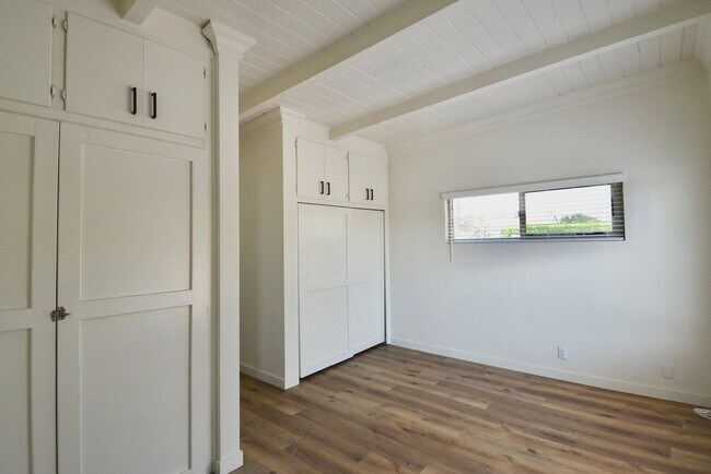
About This Property
If you're moving to Burbank, CA, this great property could be your new rental. Located at 605-609 N Hollywood Way in Burbank, this apartment unit for rent is perfectly situated for work or play. With this great space, you're right at home. Let us assist you! Contact us now to learn more about this property!
605-609 is an apartment community located in Los Angeles County and the 91505 ZIP Code.
Location
Get Directions
Magnolia Park is an eclectic neighborhood in west Burbank home to funky shops, art galleries, and thrift stores that sit side-by-side to create a charming oasis. This close-knit neighborhood and park-like community is just 14 miles northwest of Downtown Los Angeles and only two miles west of Downtown Burbank. Enjoy annual movie nights, seasonal events, and food truck festivals when you become a renter in Magnolia Park. Locals enjoy strolling or biking up to Magnolia Boulevard to grab a bite to eat. Porto’s Bakery and Café is a famous Cuban bakery that attracts people from all over the city. The single-family homes and apartments for rent in this neighborhood range from affordable to upscale, and locals regularly spend their leisure time in the very park that gives the neighborhood its name.
Learn more about living in Magnolia ParkBelow are rent ranges for similar nearby apartments
Education
| Colleges & Universities | Distance | ||
|---|---|---|---|
| Colleges & Universities | Distance | ||
| Walk: | 19 min | 1.0 mi | |
| Drive: | 9 min | 3.9 mi | |
| Drive: | 9 min | 4.8 mi | |
| Drive: | 10 min | 5.5 mi |
605-609 is within 19 minutes or 1.0 mile from New York Film Academy. It is also near Woodbury University and Musicians Institute.
Transportation options available in Burbank include North Hollywood Station, located 2.4 miles from 605-609. 605-609 is near Bob Hope, located 4.4 miles or 9 minutes away, and Los Angeles International, located 26.0 miles or 36 minutes away.
| Transit / Subway | Distance | ||
|---|---|---|---|
| Transit / Subway | Distance | ||
| Drive: | 5 min | 2.4 mi | |
| Drive: | 5 min | 2.5 mi | |
| Drive: | 9 min | 4.7 mi | |
| Drive: | 9 min | 5.2 mi | |
| Drive: | 10 min | 6.0 mi |
| Commuter Rail | Distance | ||
|---|---|---|---|
| Commuter Rail | Distance | ||
|
|
Drive: | 6 min | 2.4 mi |
| Drive: | 6 min | 2.9 mi | |
| Drive: | 7 min | 3.4 mi | |
| Drive: | 11 min | 5.3 mi | |
| Drive: | 11 min | 7.5 mi |
| Airports | Distance | ||
|---|---|---|---|
| Airports | Distance | ||
|
Bob Hope
|
Drive: | 9 min | 4.4 mi |
|
Los Angeles International
|
Drive: | 36 min | 26.0 mi |
Time and distance from 605-609.
| Shopping Centers | Distance | ||
|---|---|---|---|
| Shopping Centers | Distance | ||
| Walk: | 3 min | 0.2 mi | |
| Walk: | 11 min | 0.6 mi | |
| Walk: | 12 min | 0.6 mi |
605-609 has 3 shopping centers within 0.6 mile, which is about a 12-minute walk. The miles and minutes will be for the farthest away property.
| Parks and Recreation | Distance | ||
|---|---|---|---|
| Parks and Recreation | Distance | ||
|
Runyon Canyon
|
Drive: | 11 min | 5.2 mi |
|
Los Angeles Zoo
|
Drive: | 16 min | 6.2 mi |
|
Bird Sanctuary
|
Drive: | 14 min | 8.5 mi |
|
Griffith Observatory
|
Drive: | 18 min | 9.7 mi |
|
Griffith Park
|
Drive: | 27 min | 11.9 mi |
605-609 has 5 parks within 11.9 miles, including Los Angeles Zoo, Runyon Canyon, and Griffith Park.
| Hospitals | Distance | ||
|---|---|---|---|
| Hospitals | Distance | ||
| Drive: | 3 min | 1.4 mi | |
| Drive: | 10 min | 5.5 mi | |
| Drive: | 12 min | 7.0 mi |
605-609 has 3 hospitals within 7.0 miles, the nearest is Providence Saint Joseph Medical Center which is 1.4 miles away and a 3 minute drive.
| Military Bases | Distance | ||
|---|---|---|---|
| Military Bases | Distance | ||
| Drive: | 36 min | 19.7 mi |
605-609 is 19.7 miles and a 36 minute drive from Los Angeles Air Force Base.
You May Also Like
Similar Rentals Nearby
 - AVA Burbank")


 - Violet on Virgil")


What Are Walk Score®, Transit Score®, and Bike Score® Ratings?
Walk Score® measures the walkability of any address. Transit Score® measures access to public transit. Bike Score® measures the bikeability of any address.
What is a Sound Score Rating?
A Sound Score Rating aggregates noise caused by vehicle traffic, airplane traffic and local sources

605-609 N Hollywood Way
Burbank, CA 91505