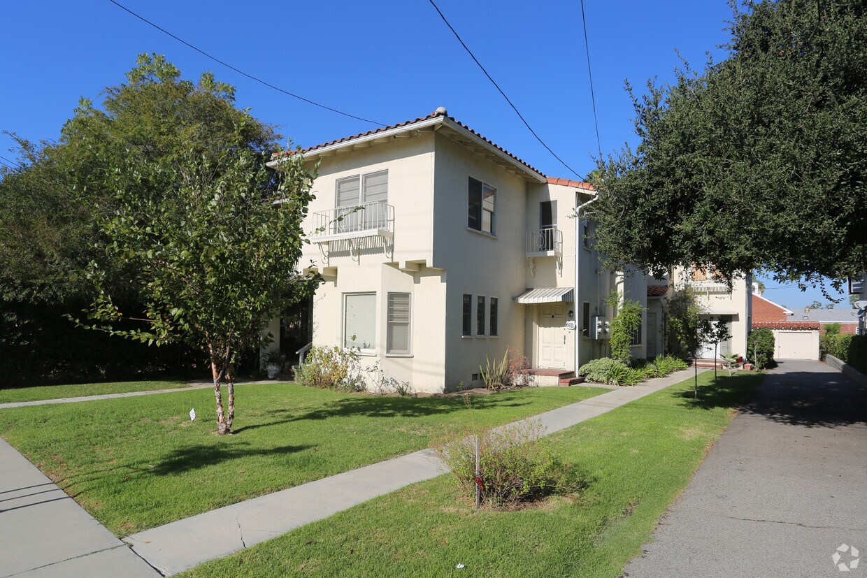
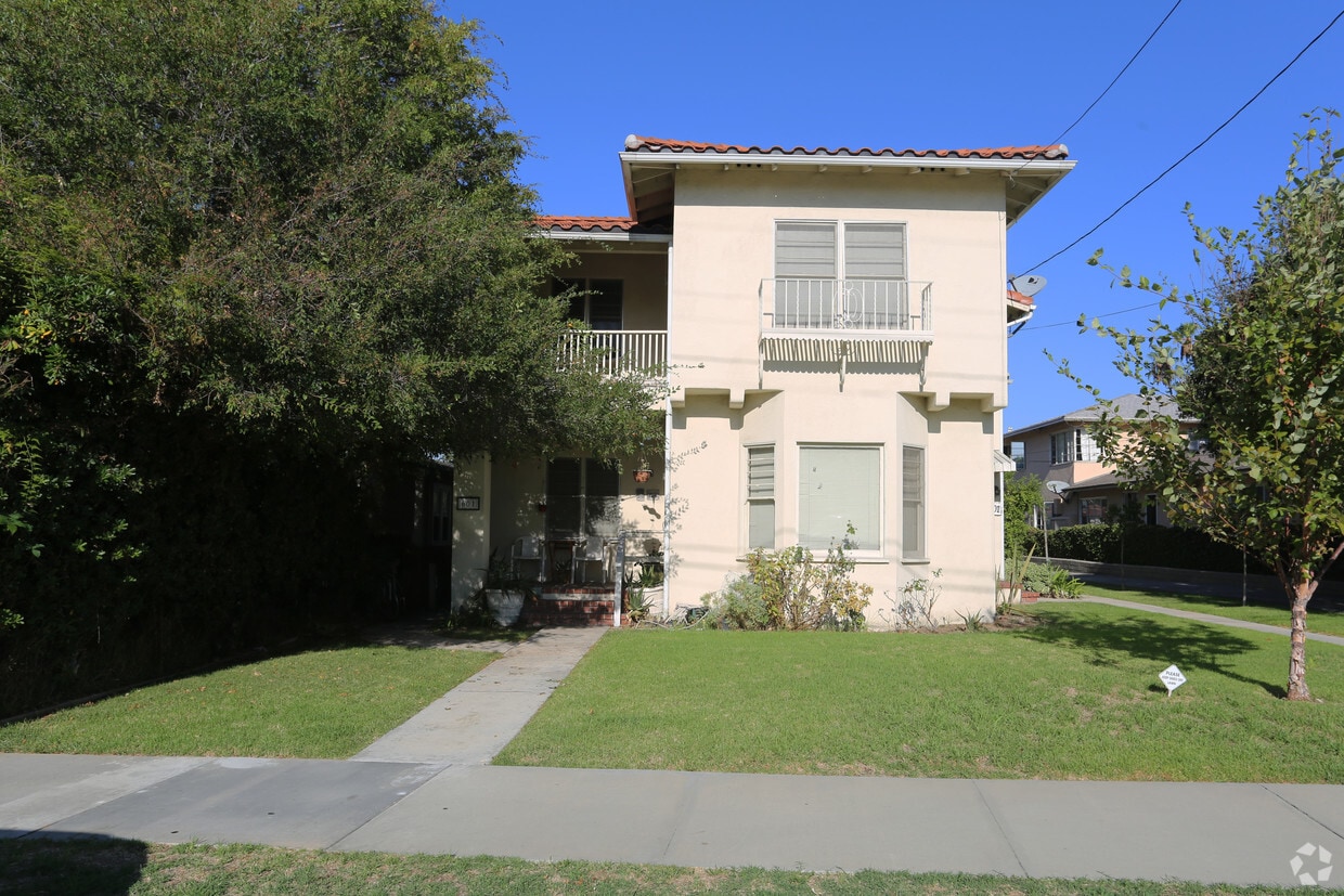
601 N Adams St
601 N Adams St,
Glendale,
CA
91206
2 Weeks Ago
Favorites
601 N Adams St
Favorites
Check Back Soon for Upcoming Availability
Fees and Policies
Details
Property Information
-
Built in 1937
-
4 units/2 stories
About 601 N Adams St Glendale, CA 91206
Experience Glendale living at 601 N Adams St. In a location on N. Adams St. in Glendale's 91206 Zip code, renters can easily connect with a number of nearby attractions. Be sure to come for a visit to see the available floorplan options. From availability to location, the leasing team is available to assist you in finding your new apartment. Drop by to ask about the current floorplan availability.
601 N Adams St is an apartment community located in Los Angeles County and the 91206 ZIP Code. This area is served by the Glendale Unified attendance zone.
Location
Get Directions
Located in the San Fernando Valley, Citrus Grove allows residents to enjoy some of the best Glendale and Los Angeles County has to offer. This palm-tree-lined, family-friendly neighborhood has excellent schools, several parks, and access to plenty of amenities. Along with its own restaurants and stores, Citrus Grove is only a mile east of Downtown Glendale, so residents live within minutes of a plethora of dining and shopping options, including Glendale Galleria and the Americana at Brand. Highways 2 and 32 connect the Citrus Grove neighborhood with Interstate 5, allowing trips up and down California in all directions, whether the aim is Los Angeles or the coast. The neighborhood is convenient to multiple local favorites including Dodger Stadium and the iconic Griffith Park. Complemented by views of the Verdugo Mountains, Citrus Grove has Mediterranean-style apartments, condos, townhouses, and houses available for rent.
Learn more about living in Citrus GroveBelow are rent ranges for similar nearby apartments
Education
| Colleges & Universities | Distance | ||
|---|---|---|---|
| Colleges & Universities | Distance | ||
| Drive: | 4 min | 1.5 mi | |
| Drive: | 8 min | 3.6 mi | |
| Drive: | 9 min | 6.0 mi | |
| Drive: | 14 min | 7.6 mi |
601 N Adams St is within 4 minutes or 1.5 miles from Glendale Community College. It is also near Occidental College and Art Center College of Design.
Schools


Public Elementary School
Grades K-5
956 Students
Attendance Zone
Public Elementary, Middle & High School
Grades K-12
143 Students
Nearby
Public Elementary School
Grades K-6
230 Students
Nearby
Public Elementary School
Grades K-6
756 Students
Nearby
Charter Elementary School
Grades K-5
75 Students
Nearby
Public Middle School
Grades 6-8
1,069 Students
Attendance Zone
Public High School
Grades 9-12
1,978 Students
Attendance Zone
Private Elementary School
Grades K-1
Nearby
Private Elementary, Middle & High School
Grades K-12
312 Students
Nearby
Private Elementary & Middle School
Grades PK-8
110 Students
Nearby
School data provided by
 The GreatSchools Rating helps parents compare schools within a state based on a variety of school quality indicators and provides a helpful picture of how effectively each school serves all of its students. Ratings are on a scale of 1 (below average) to 10 (above average) and can include test scores, college readiness, academic progress, advanced courses, equity, discipline and attendance data. We also advise parents to visit schools, consider other information on school performance and programs, and consider family needs as part of the school selection process.
View GreatSchools Rating Methodology
Data provided by GreatSchools.org © 2025. All rights reserved.
View GreatSchools Rating Methodology
Data provided by GreatSchools.org © 2025. All rights reserved.
Transportation options available in Glendale include Southwest Museum Station, located 5.6 miles from 601 N Adams St. 601 N Adams St is near Bob Hope, located 10.9 miles or 16 minutes away, and Los Angeles International, located 23.6 miles or 38 minutes away.
| Transit / Subway | Distance | ||
|---|---|---|---|
| Transit / Subway | Distance | ||
|
|
Drive: | 12 min | 5.6 mi |
|
|
Drive: | 12 min | 6.7 mi |
|
|
Drive: | 12 min | 6.9 mi |
|
|
Drive: | 12 min | 7.5 mi |
|
|
Drive: | 14 min | 7.8 mi |
| Commuter Rail | Distance | ||
|---|---|---|---|
| Commuter Rail | Distance | ||
|
|
Drive: | 7 min | 2.6 mi |
|
|
Drive: | 9 min | 5.4 mi |
|
|
Drive: | 13 min | 8.1 mi |
|
|
Drive: | 17 min | 9.3 mi |
|
|
Drive: | 16 min | 9.6 mi |
| Airports | Distance | ||
|---|---|---|---|
| Airports | Distance | ||
|
Bob Hope
|
Drive: | 16 min | 10.9 mi |
|
Los Angeles International
|
Drive: | 38 min | 23.6 mi |
Time and distance from 601 N Adams St.
| Shopping Centers | Distance | ||
|---|---|---|---|
| Shopping Centers | Distance | ||
| Walk: | 5 min | 0.3 mi | |
| Walk: | 10 min | 0.5 mi | |
| Walk: | 10 min | 0.5 mi |
601 N Adams St has 3 shopping centers within 0.5 mile, which is about a 10-minute walk. The miles and minutes will be for the farthest away property.
| Parks and Recreation | Distance | ||
|---|---|---|---|
| Parks and Recreation | Distance | ||
|
Elyria Canyon Park
|
Drive: | 11 min | 4.7 mi |
|
Descanso Gardens
|
Drive: | 10 min | 5.3 mi |
|
Marsh Park
|
Drive: | 11 min | 5.6 mi |
|
Los Angeles Zoo
|
Drive: | 15 min | 5.7 mi |
|
Griffith Park
|
Drive: | 26 min | 10.5 mi |
601 N Adams St has 5 parks within 10.5 miles, including Marsh Park, Elyria Canyon Park, and Descanso Gardens.
| Hospitals | Distance | ||
|---|---|---|---|
| Hospitals | Distance | ||
| Drive: | 4 min | 1.1 mi | |
| Drive: | 6 min | 2.4 mi | |
| Drive: | 8 min | 4.8 mi |
601 N Adams St has 3 hospitals within 4.8 miles, the nearest is Glendale Adventist Medical Center which is 1.1 miles away and a 4 minute drive.
| Military Bases | Distance | ||
|---|---|---|---|
| Military Bases | Distance | ||
| Drive: | 35 min | 25.2 mi |
601 N Adams St is 25.2 miles and a 35 minute drive from Los Angeles Air Force Base.
You May Also Like
What neighborhood is the property located in?
601 N Adams St Glendale, CA 91206 is in Citrus Grove in the city of Glendale. Here you’ll find three shopping centers within 0.5 mile of the property. Five parks are within 10.5 miles, including Marsh Park, Elyria Canyon Park, and Descanso Gardens.
Similar Rentals Nearby

 - AVA Burbank")


 - Violet on Virgil")


What Are Walk Score®, Transit Score®, and Bike Score® Ratings?
Walk Score® measures the walkability of any address. Transit Score® measures access to public transit. Bike Score® measures the bikeability of any address.
What is a Sound Score Rating?
A Sound Score Rating aggregates noise caused by vehicle traffic, airplane traffic and local sources
Responded To This Review