
$1,750
/ Month
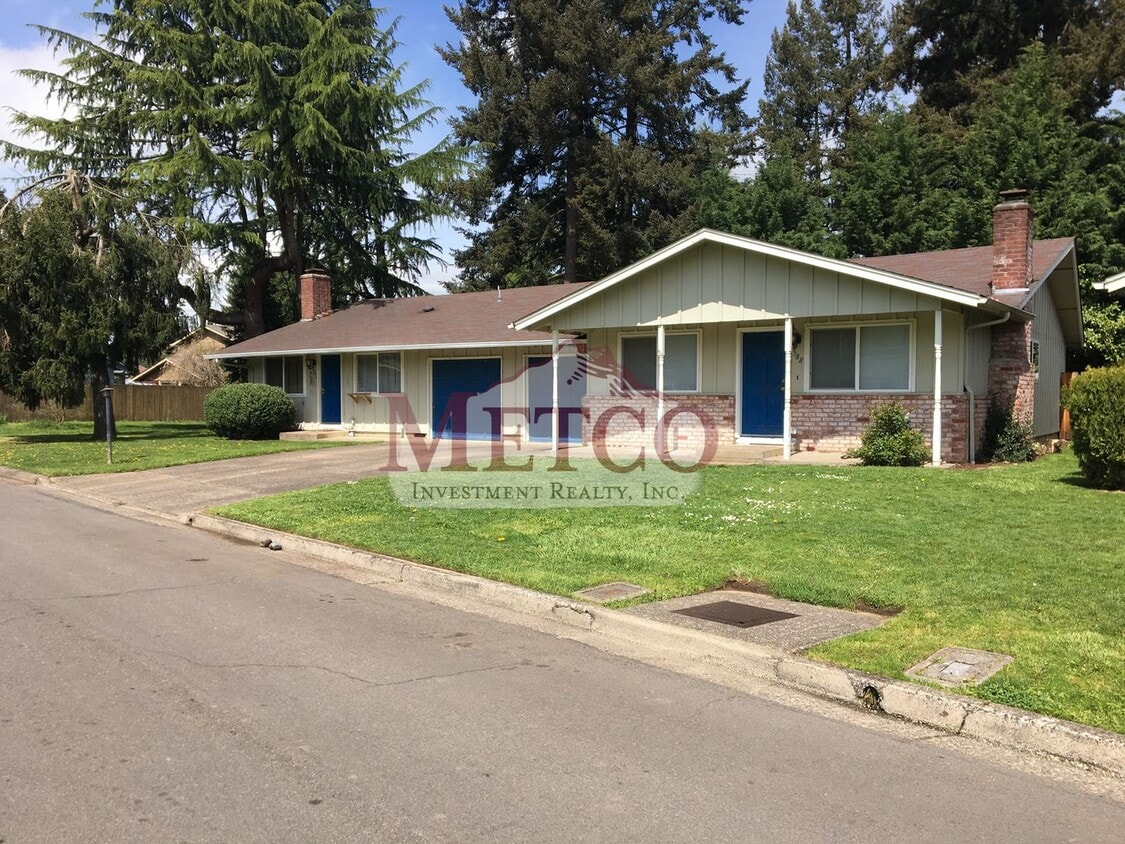
588-592 Cinderella Loop Unit A
Eugene, OR 97404
Today
|
Edit
Favorites
541-683-9001
-
Bedrooms
3
-
Bathrooms
1.5
-
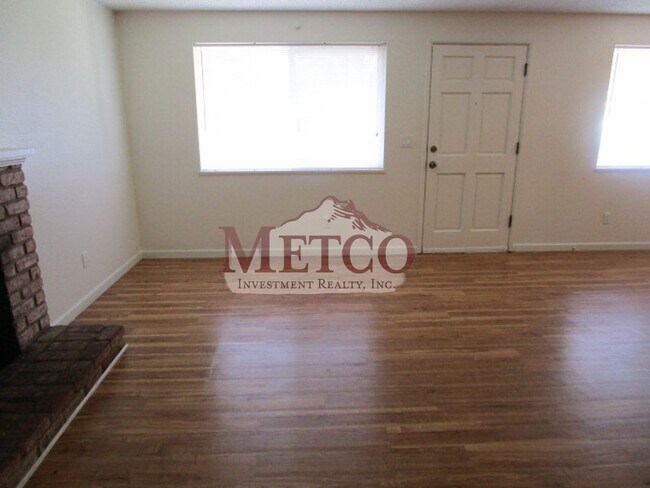
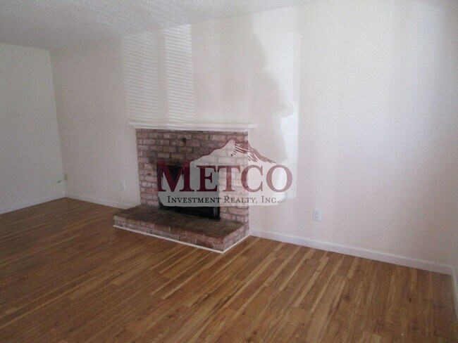
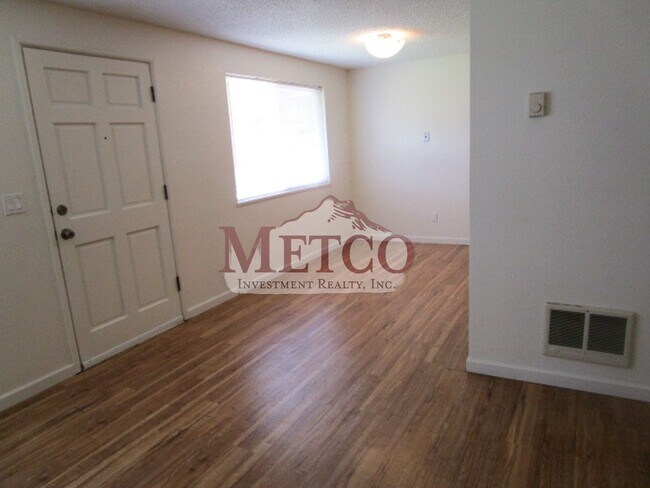
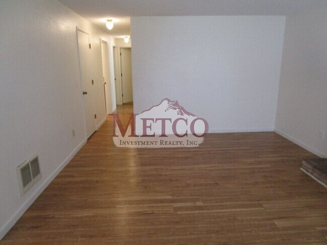
Square Feet
1,008 sq ft
-
Available
Available Apr 3
588-592 Cinderella Loop Unit A

Favorites
Contact
- Listed by Metco Investment Realty, Inc. | Metco Investment Realty, Inc.
- Phone Number
- Contact
Location
Get Directions
Located about seven miles northwest of Downtown Eugene along River Road, Santa Clara is a suburban residential neighborhood. This community provides residents with an oasis from the sounds of the city, while still being close to lively destinations. Santa Clara offers plenty of apartments and single-family houses for rent, with some even featuring views of the Willamette River.
Numerous city parks dot the landscape of this community, offering locals ample chances to enjoy the outdoors. Santa Clara residents ditch their cars and use the Riverbank Trails to get around their community and other parts of the city. Residents can bicycle on this urban path to commute to work, jog along the river and enjoy the view, or settle back on a bench and watch the world go by on a sunny morning.
Learn more about living in Santa Clara
Education
| Colleges & Universities | Distance | ||
|---|---|---|---|
| Colleges & Universities | Distance | ||
| Drive: | 16 min | 8.4 mi | |
| Drive: | 22 min | 13.5 mi | |
| Drive: | 57 min | 35.8 mi | |
| Drive: | 63 min | 47.6 mi |
588-592 Cinderella Loop Unit A is within 16 minutes or 8.4 miles from University of Oregon. It is also near Lane Community College and Oregon State University.
Getting Around
 What do Walkability, Transit, Drivability, and Bikeability mean?
Walkability measures the walking distance to day-to-day needs.
Transit measures access to public transportation.
Drivability measures congestion, parking availability, and access to major roads.
Bikeability measures the suitability for cycling.
How It Works
What do Walkability, Transit, Drivability, and Bikeability mean?
Walkability measures the walking distance to day-to-day needs.
Transit measures access to public transportation.
Drivability measures congestion, parking availability, and access to major roads.
Bikeability measures the suitability for cycling.
How It Works
Fairly Walkable
Walkability
40
/ 100
Limited Public Transit
Transit
30
/ 100
Very Drivable
Drivability
80
/ 100
Fairly Bikeable
Bikeability
50
/ 100
Scores provided by
-
Soundscore™
-
/ 100
Traffic
-Airport
-Businesses
-Scores provided by
HowLoud What is a Sound Score Rating? A Sound Score Rating aggregates noise caused by vehicle traffic, airplane traffic and local sources. How It WorksYou May Also Like
Similar Rentals Nearby
-
-
-
-
3 Beds$2,570Total Monthly PriceTotal Monthly Price NewPrices include base rent and required monthly fees. Variable costs based on usage may apply.Specials
Pets Allowed Fitness Center Pool Dishwasher Refrigerator In Unit Washer & Dryer
-
3 Beds$2,495Total Monthly PriceTotal Monthly Price NewPrices include base rent and required monthly fees of $30. Variable costs based on usage may apply.Base Rent:3 Beds$2,465Specials
Pets Allowed Fitness Center In Unit Washer & Dryer Stainless Steel Appliances Basketball Court
-
-
1 / 48

-
3 Beds$2,189+Total Monthly PriceTotal Monthly Price NewPrices include base rent and required monthly fees of $40. Variable costs based on usage may apply.Base Rent:3 Beds$2,149+Specials
Pets Allowed Fitness Center Pool Kitchen In Unit Washer & Dryer Clubhouse Balcony
-
-


What Are Walk Score®, Transit Score®, and Bike Score® Ratings?
Walk Score® measures the walkability of any address. Transit Score® measures access to public transit. Bike Score® measures the bikeability of any address.
What is a Sound Score Rating?
A Sound Score Rating aggregates noise caused by vehicle traffic, airplane traffic and local sources.
588-592 Cinderella Loop
Eugene, OR 97404