$2,500
/ Month
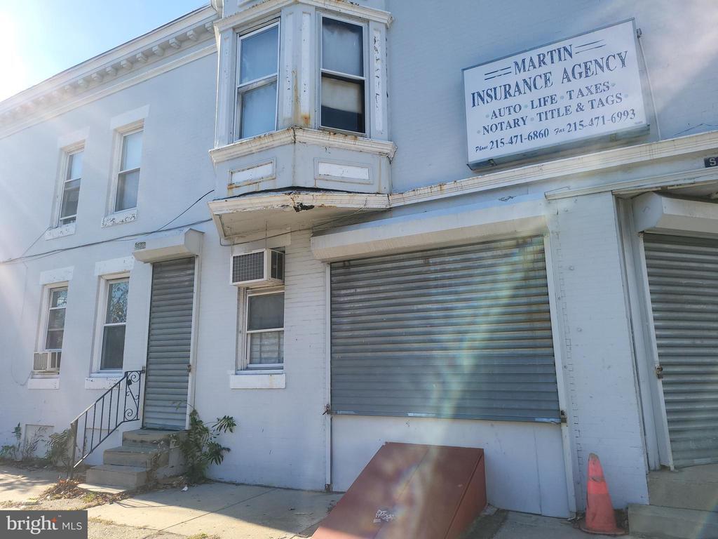
5700 Delancey St
Philadelphia, PA 19143
Today
|
Edit
Favorites
610-647-8300
-
Bedrooms
2
-
Bathrooms
1
-
Square Feet
--
-
Available
Available Now
Highlights
- Traditional Architecture
- Security Gate
- Ramp on the main level
- Radiator
5700 Delancey St

Favorites
About This Home
Available Now
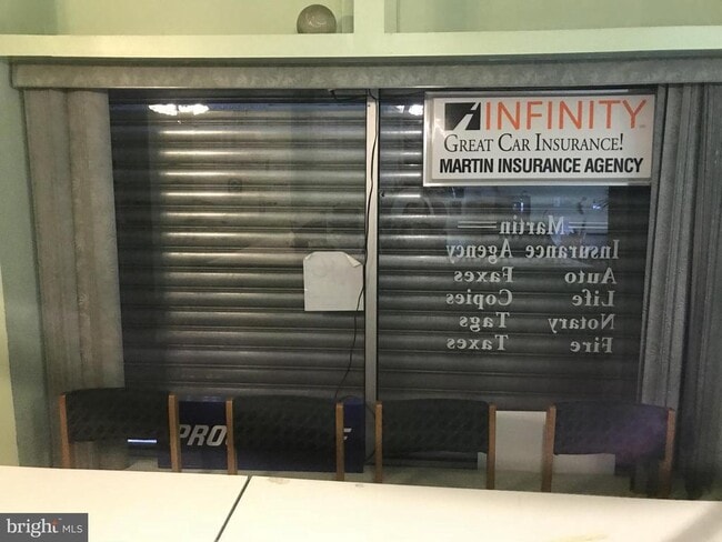
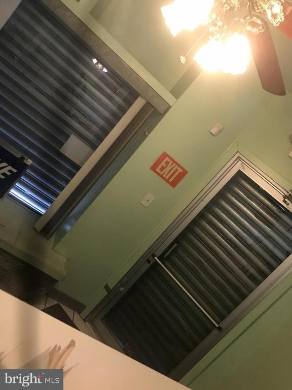
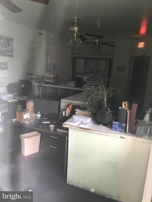
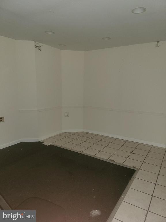
Step into a property with history and promise. This two-story building, once home to a thriving insurance agency, now awaits its next chapter. The structure carries the charm of a residential-style house while offering the flexibility of a professional office space. This property is a blank canvas. While it carries the echoes of its successful past, it’s ready for transformation. Tenants will need to bring their vision and do the work to tailor the space to their business needs—whether that means modernizing with sleek finishes, creating open-concept work areas, or preserving its warm, house-like character for a more personal client experience.
5700 Delancey St is a townhome located in Philadelphia County and the 19143 ZIP Code. This area is served by the The School District of Philadelphia attendance zone.
* Price shown is base rent. Excludes user-selected optional fees and variable or usage-based fees and required charges due at or prior to move-in or at move-out. Price, availability, fees, and any applicable rent special are subject to change without notice.
* Square footage definitions vary. Displayed square footage is approximate.
Home Details
Home Type
End Unit Townhome
Year Built
Built in 1925
Accessible Home Design
Ramp on the main level
Bedrooms and Bathrooms
1 Full Bathroom
2 Bedrooms
Home Design
Traditional Architecture
Masonry
Brick Foundation
Home Security
Security Gate
Interior Spaces
1,410 Sq Ft Home
Property has 2 Levels
Listing and Financial Details
Security Deposit $2,500
1-Month Min and 12-Month Max Lease Term
Available 11/17/25
Assessor Parcel Number 871581850
Residential Lease
Lot Details
953 Sq Ft Lot
Lot Dimensions are 15.00 x 64.00
Parking
On-Street Parking
Utilities
Radiator
Electric Water Heater
Community Details
Overview
Philadelphia Subdivision
Pet Policy
No Pets Allowed
Contact
- Listed by Kia C. Brown | Keller Williams Realty Devon-Wayne
- Phone Number
- Contact
-
Source
 Bright MLS, Inc.
Copyright © 2026 Bright MLS, Inc.
Location
Get Directions
Cobbs Creek, a tight-knit and up-and-coming community south of Market Street in West Philadelphia, lies about five miles from downtown. Its namesake, Cobbs Creek Park, offers a tranquil outdoor retreat with its trails, water views, and recreational activities. The area, settled by Lenape Indians and named after Quakers, mostly consists of townhomes and apartments that house families and students.
Cobbs Creek gives endless public transportation options. You can travel via trolley, Market-Frankford Line, or by bus to the downtown area. Students and faculty of nearby University of Pennsylvania and Drexel University appreciate the lower-cost housing options and a quick commute.
Learn more about living in Cobbs Creek
Amenities
- Basement
Education
| Colleges & Universities | Distance | ||
|---|---|---|---|
| Colleges & Universities | Distance | ||
| Drive: | 4 min | 1.6 mi | |
| Drive: | 6 min | 2.3 mi | |
| Drive: | 6 min | 2.4 mi | |
| Drive: | 9 min | 3.2 mi |
5700 Delancey St is within 4 minutes or 1.6 miles from C.C. of Philadelphia, W Ctr. It is also near University of the Sciences and University of Pennsylvania.
Schools


Public Elementary & Middle School
Grades PK-8
358 Students
Nearby
Public Elementary & Middle School
Grades K-8
346 Students
Attendance Zone
Public High School
Grades 9-12
355 Students
Attendance Zone
Private Elementary, Middle & High School
Grades PK-12
153 Students
Nearby
School data provided by
 The GreatSchools Rating helps parents compare schools within a state based on a variety of school quality indicators and provides a helpful picture of how effectively each school serves all of its students. Ratings are on a scale of 1 (below average) to 10 (above average) and can include test scores, college readiness, academic progress, advanced courses, equity, discipline and attendance data. We also advise parents to visit schools, consider other information on school performance and programs, and consider family needs as part of the school selection process.
View GreatSchools Rating Methodology
Data provided by GreatSchools.org © 2026. All rights reserved.
View GreatSchools Rating Methodology
Data provided by GreatSchools.org © 2026. All rights reserved.
Transportation options available in Philadelphia include 56Th Street, located 0.5 mile from 5700 Delancey St. 5700 Delancey St is near Philadelphia International, located 8.1 miles or 20 minutes away, and Trenton Mercer, located 38.2 miles or 59 minutes away.
| Transit / Subway | Distance | ||
|---|---|---|---|
| Transit / Subway | Distance | ||
|
|
Walk: | 10 min | 0.5 mi |
|
|
Walk: | 13 min | 0.7 mi |
|
|
Walk: | 14 min | 0.7 mi |
|
|
Walk: | 14 min | 0.7 mi |
|
|
Walk: | 15 min | 0.8 mi |
| Commuter Rail | Distance | ||
|---|---|---|---|
| Commuter Rail | Distance | ||
|
|
Drive: | 3 min | 1.2 mi |
|
|
Drive: | 5 min | 1.9 mi |
|
|
Drive: | 6 min | 2.1 mi |
|
|
Drive: | 8 min | 2.8 mi |
|
|
Drive: | 9 min | 3.3 mi |
| Airports | Distance | ||
|---|---|---|---|
| Airports | Distance | ||
|
Philadelphia International
|
Drive: | 20 min | 8.1 mi |
|
Trenton Mercer
|
Drive: | 59 min | 38.2 mi |
Time and distance from 5700 Delancey St.
| Shopping Centers | Distance | ||
|---|---|---|---|
| Shopping Centers | Distance | ||
| Walk: | 14 min | 0.7 mi | |
| Walk: | 16 min | 0.8 mi | |
| Drive: | 4 min | 1.3 mi |
5700 Delancey St has 3 shopping centers within 1.3 miles, which is about a 4-minute drive. The miles and minutes will be for the farthest away property.
| Parks and Recreation | Distance | ||
|---|---|---|---|
| Parks and Recreation | Distance | ||
|
Cobbs Creek Environmental Education Center
|
Walk: | 19 min | 1.0 mi |
|
Cobbs Creek Park
|
Drive: | 6 min | 2.4 mi |
|
Fairmount Park
|
Drive: | 9 min | 2.9 mi |
|
Please Touch Museum
|
Drive: | 8 min | 3.1 mi |
|
Bartram's Garden
|
Drive: | 9 min | 3.1 mi |
5700 Delancey St has 5 parks within 3.1 miles, including Cobbs Creek Environmental Education Center, Cobbs Creek Park, and Bartram's Garden.
| Hospitals | Distance | ||
|---|---|---|---|
| Hospitals | Distance | ||
| Drive: | 7 min | 2.5 mi | |
| Drive: | 8 min | 3.0 mi | |
| Drive: | 9 min | 3.2 mi |
5700 Delancey St has 3 hospitals within 3.2 miles, the nearest is Penn Presbyterian Medical Center which is 2.5 miles away and a 7 minute drive.
| Military Bases | Distance | ||
|---|---|---|---|
| Military Bases | Distance | ||
| Drive: | 17 min | 7.6 mi |
5700 Delancey St is 7.6 miles and a 17 minute drive from Philadelphia Naval Busi Center.
You May Also Like
Similar Rentals Nearby
-
-
-
-
-
-
-
-
-
-
2 Beds$1,499+3 Beds$1,699+Total Monthly PriceTotal Monthly Price NewPrices include all required monthly fees.


What Are Walk Score®, Transit Score®, and Bike Score® Ratings?
Walk Score® measures the walkability of any address. Transit Score® measures access to public transit. Bike Score® measures the bikeability of any address.
What is a Sound Score Rating?
A Sound Score Rating aggregates noise caused by vehicle traffic, airplane traffic and local sources

5700 Delancey St
Philadelphia, PA 19143