
The Vitagraph
1277 E 14th St,
Brooklyn, NY 11230
1-3 Beds $2,709 - $4,134
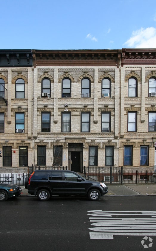
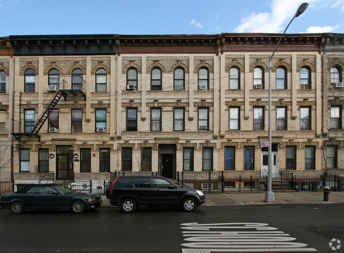

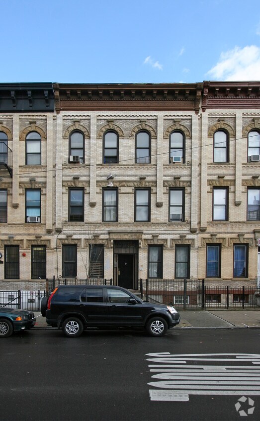
Meet your new home at 55 Irving Ave in Brooklyn, NY. These apartments are located on Irving Ave in the 11237 area of Brooklyn. From amenities to location, the professional leasing team is ready to help you find your perfect new home. Make a visit to check out the apartment floorplan options. It's time to find your next place. Contact or stop by 55 Irving Ave to find out the availability today!
55 Irving Ave is an apartment community located in Kings County and the 11237 ZIP Code. This area is served by the New York City Geographic District #32 attendance zone.
Neighboring Williamsburg to the east, Bushwick is a vibrant Brooklyn neighborhood known for its incredible street art, local shops, and diverse cuisine. Bushwick has historically served as a haven for immigrants, and now attracts scores of creative types to its many galleries and converted loft spaces.
In addition to a host of new local businesses, Bushwick offers residents exciting nightlife options and easy subway access. Colorful apartment buildings line quiet residential streets in Bushwick as well, providing plenty of rental opportunities to the community. Numerous neighborhood parks offer a tranquil reprieve from the big-city bustle.
Learn more about living in Bushwick| Colleges & Universities | Distance | ||
|---|---|---|---|
| Colleges & Universities | Distance | ||
| Drive: | 9 min | 3.0 mi | |
| Drive: | 10 min | 3.1 mi | |
| Drive: | 11 min | 3.8 mi | |
| Drive: | 10 min | 4.4 mi |


Transportation options available in Brooklyn include Jefferson Street, located 0.2 mile from 55 Irving Ave. 55 Irving Ave is near LaGuardia, located 6.7 miles or 15 minutes away, and John F Kennedy International, located 11.5 miles or 20 minutes away.
| Transit / Subway | Distance | ||
|---|---|---|---|
| Transit / Subway | Distance | ||
|
|
Walk: | 3 min | 0.2 mi |
|
|
Walk: | 7 min | 0.4 mi |
|
|
Walk: | 9 min | 0.5 mi |
|
|
Walk: | 11 min | 0.6 mi |
|
|
Walk: | 11 min | 0.6 mi |
| Commuter Rail | Distance | ||
|---|---|---|---|
| Commuter Rail | Distance | ||
|
|
Drive: | 8 min | 3.1 mi |
|
|
Drive: | 10 min | 3.3 mi |
|
|
Drive: | 9 min | 4.1 mi |
|
|
Drive: | 12 min | 4.3 mi |
|
|
Drive: | 11 min | 4.8 mi |
| Airports | Distance | ||
|---|---|---|---|
| Airports | Distance | ||
|
LaGuardia
|
Drive: | 15 min | 6.7 mi |
|
John F Kennedy International
|
Drive: | 20 min | 11.5 mi |
Time and distance from 55 Irving Ave.
| Shopping Centers | Distance | ||
|---|---|---|---|
| Shopping Centers | Distance | ||
| Drive: | 3 min | 1.1 mi | |
| Drive: | 4 min | 1.7 mi | |
| Drive: | 4 min | 2.2 mi |
| Parks and Recreation | Distance | ||
|---|---|---|---|
| Parks and Recreation | Distance | ||
|
Maria Hernandez Park
|
Walk: | 2 min | 0.1 mi |
|
Martinez Playground
|
Drive: | 6 min | 1.7 mi |
|
Sternberg Park
|
Drive: | 6 min | 1.8 mi |
|
Hattie Carthan Garden
|
Drive: | 8 min | 2.6 mi |
|
McCarren Park
|
Drive: | 8 min | 3.1 mi |
| Hospitals | Distance | ||
|---|---|---|---|
| Hospitals | Distance | ||
| Walk: | 9 min | 0.5 mi | |
| Drive: | 4 min | 1.6 mi | |
| Drive: | 9 min | 2.8 mi |
| Military Bases | Distance | ||
|---|---|---|---|
| Military Bases | Distance | ||
| Drive: | 21 min | 7.9 mi | |
| Drive: | 31 min | 12.1 mi |
What Are Walk Score®, Transit Score®, and Bike Score® Ratings?
Walk Score® measures the walkability of any address. Transit Score® measures access to public transit. Bike Score® measures the bikeability of any address.
What is a Sound Score Rating?
A Sound Score Rating aggregates noise caused by vehicle traffic, airplane traffic and local sources
55 Irving Ave
Brooklyn, NY 11237


