$1,700
/ Month
224-253 53rd St Unit 3R
Brooklyn, NY 11220
2 Weeks Ago
|
Edit
Favorites
53 STREET

Favorites
Check Back Soon for Upcoming Availability
| Beds | Baths | Average SF |
|---|---|---|
| 2 Bedrooms 2 Bedrooms 2 Br | 1 Bath 1 Bath 1 Ba | — |
About This Property
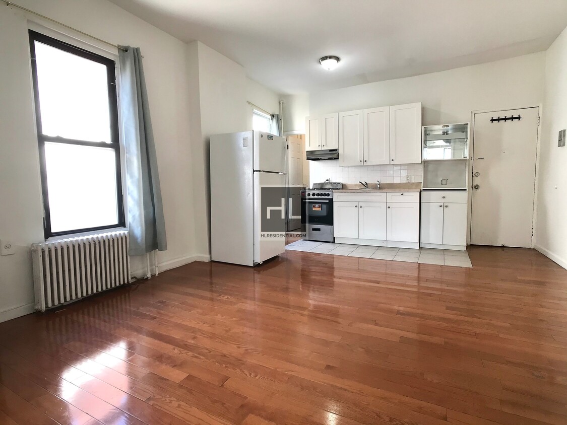
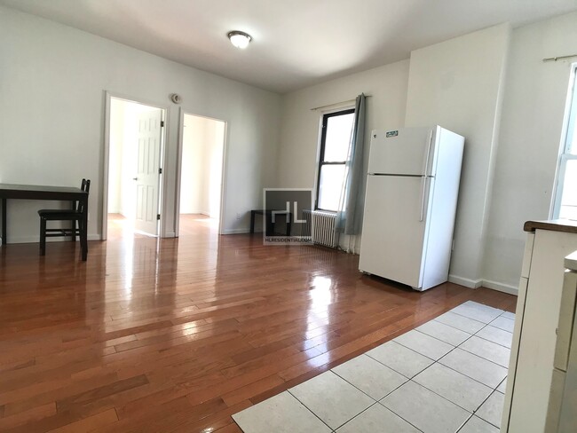
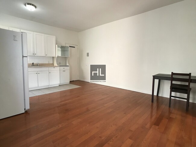
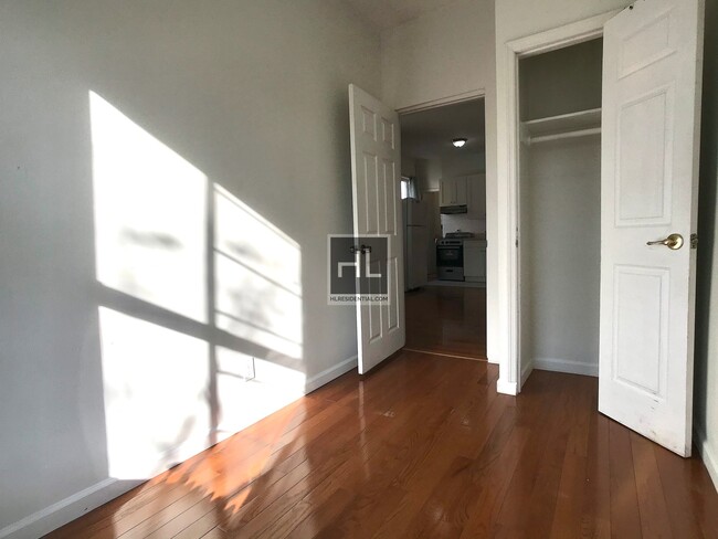
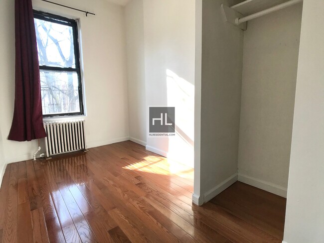
2Bed 1Bath LivingRoom / Kitchen Combo Includes the following: Both bedrooms can fit full-sized bedsHardwood floorsHeat and Hot water Multiple closets3rd floor walk up 2 Blocks from the R-Train1 Block away from NYU LANGONE Hospital===Ref:835115===
53 STREET is an apartment community located in Kings County and the 11220 ZIP Code.
Location
Get Directions
Situated on the Upper Bay of the Hudson River, Sunset Park is a vibrant neighborhood in southwestern Brooklyn. The neighborhood is home to a park of the same name, featuring 24.5 acres of space for outdoor recreation as well as stunning views of the Manhattan skyline.
Tucked between Park Slope and Bay Ridge, Sunset Park is known for its diverse restaurants, lively festivals, and numerous supermarkets. Sunset Park also contains Industry City, a complex of towering warehouses on cobblestone streets, which houses a slew of coffee shops, eateries, art galleries, and offices for hundreds of companies. Convenience to the D, N, and R subway lines places Sunset Park within minutes of all that NYC has to offer.
Learn more about living in Sunset ParkBelow are rent ranges for similar nearby apartments
Education
| Colleges & Universities | Distance | ||
|---|---|---|---|
| Colleges & Universities | Distance | ||
| Drive: | 10 min | 4.0 mi | |
| Drive: | 10 min | 4.0 mi | |
| Drive: | 10 min | 4.4 mi | |
| Drive: | 13 min | 5.1 mi |
53 STREET is within 10 minutes or 4.0 miles from ASA College Brooklyn. It is also near Brooklyn Law School and St. Francis College.
Transportation options available in Brooklyn include 53 Street, located 0.2 mile from 53 STREET. 53 STREET is near LaGuardia, located 14.6 miles or 28 minutes away, and Newark Liberty International, located 18.1 miles or 32 minutes away.
| Transit / Subway | Distance | ||
|---|---|---|---|
| Transit / Subway | Distance | ||
|
|
Walk: | 4 min | 0.2 mi |
|
|
Walk: | 13 min | 0.7 mi |
|
|
Drive: | 3 min | 1.1 mi |
|
|
Drive: | 3 min | 1.2 mi |
|
|
Drive: | 3 min | 1.2 mi |
| Commuter Rail | Distance | ||
|---|---|---|---|
| Commuter Rail | Distance | ||
|
|
Drive: | 11 min | 4.1 mi |
|
|
Drive: | 13 min | 7.0 mi |
|
|
Drive: | 15 min | 7.7 mi |
|
|
Drive: | 17 min | 8.3 mi |
|
|
Drive: | 20 min | 8.9 mi |
| Airports | Distance | ||
|---|---|---|---|
| Airports | Distance | ||
|
LaGuardia
|
Drive: | 28 min | 14.6 mi |
|
Newark Liberty International
|
Drive: | 32 min | 18.1 mi |
Time and distance from 53 STREET.
| Shopping Centers | Distance | ||
|---|---|---|---|
| Shopping Centers | Distance | ||
| Drive: | 4 min | 1.9 mi | |
| Drive: | 6 min | 2.0 mi | |
| Drive: | 6 min | 2.5 mi |
53 STREET has 3 shopping centers within 2.5 miles, which is about a 6-minute drive. The miles and minutes will be for the farthest away property.
| Parks and Recreation | Distance | ||
|---|---|---|---|
| Parks and Recreation | Distance | ||
|
Sunset Park
|
Drive: | 3 min | 1.4 mi |
|
Owl's Head Park
|
Drive: | 5 min | 1.7 mi |
|
Red Hook Park
|
Drive: | 7 min | 3.1 mi |
|
Waterfront Museum & Showboat Barge
|
Drive: | 9 min | 3.9 mi |
|
Narrows Botanical Gardens
|
Drive: | 10 min | 4.9 mi |
53 STREET has 5 parks within 4.9 miles, including Sunset Park, Owl's Head Park, and Narrows Botanical Gardens.
| Hospitals | Distance | ||
|---|---|---|---|
| Hospitals | Distance | ||
| Drive: | 5 min | 1.5 mi | |
| Drive: | 9 min | 3.4 mi | |
| Drive: | 12 min | 5.0 mi |
53 STREET has 3 hospitals within 5.0 miles, the nearest is Maimonides Medical Center which is 1.5 miles away and a 5 minute drive.
| Military Bases | Distance | ||
|---|---|---|---|
| Military Bases | Distance | ||
| Drive: | 8 min | 3.6 mi | |
| Drive: | 14 min | 6.7 mi | |
| Drive: | 16 min | 7.8 mi |
53 STREET has 3 military bases within 7.8 miles, the nearest is Fort Hamilton which is 3.6 miles away and a 8 minute drive.
You May Also Like
-
The East Hill: In-Unit Washer & Dryer, Heat, Hot & Cold Water Included, and Cat & Dog Friendly
14 Bliss Ave
Tenafly, NJ 07670
$3,450
2 Br 18.4 mi
-
Heritage Westminster
111 Hempstead Tpke
West Hempstead, NY 11552
$4,360 - $7,488
2-3 Br 20.1 mi
-
Durham Woods
32-N N Reading Rd
Edison, NJ 08817
$2,267 - $3,360
2 Br 20.9 mi
Similar Rentals Nearby


What Are Walk Score®, Transit Score®, and Bike Score® Ratings?
Walk Score® measures the walkability of any address. Transit Score® measures access to public transit. Bike Score® measures the bikeability of any address.
What is a Sound Score Rating?
A Sound Score Rating aggregates noise caused by vehicle traffic, airplane traffic and local sources

224-253 53rd St
Brooklyn, NY 11220