$1,595
/ Month
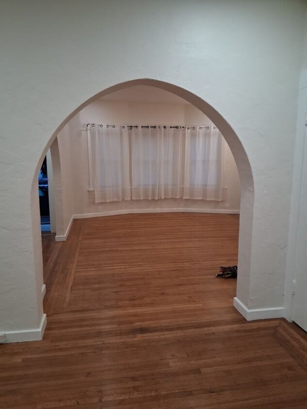
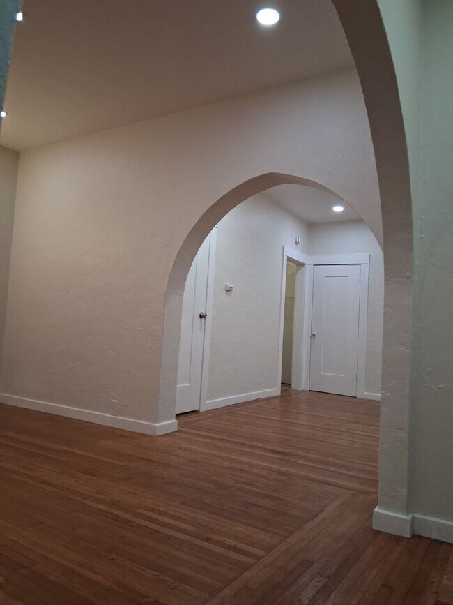
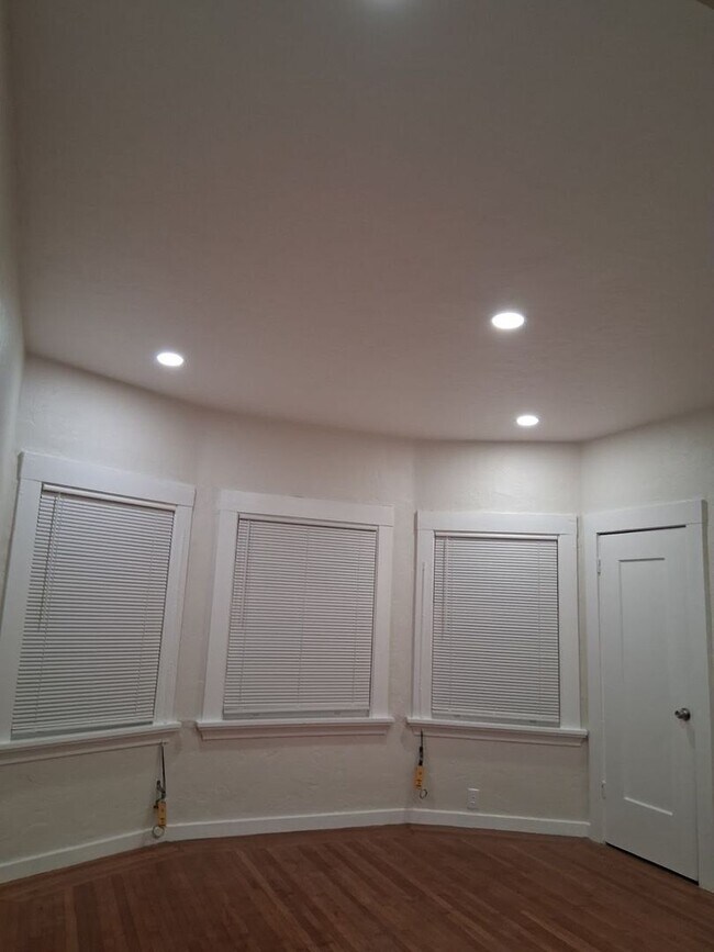
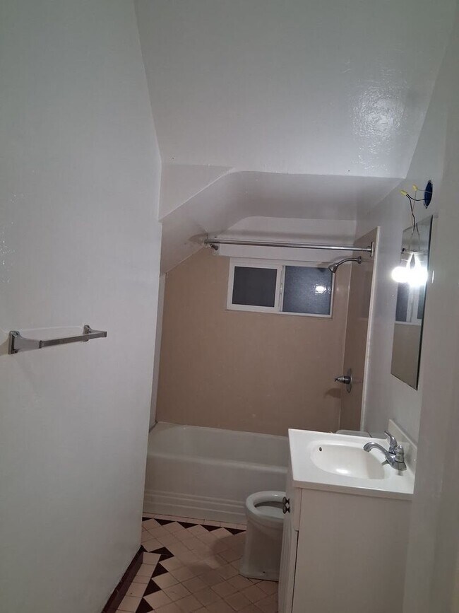
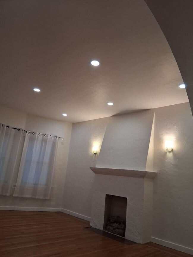
522-526 33rd St Unit 524
Oakland, CA 94609
Today
|
Edit
Favorites
925-956-7921
-
Bedrooms
1
-
Bathrooms
1
-
Square Feet
750 sq ft
-
Available
Available Now
522-526 33rd St Unit 524

Favorites
Contact
- Listed by Bay's | Bay's Elite Management Group, Inc.
- Phone Number
- Contact
Location
Get Directions
Pill Hill is a small neighborhood located about a mile north of Downtown Oakland. Various medical facilities are located in the neighborhood, hence the name. Along with pharmacies and doctor’s offices, Pill Hill is home to the Alta Bates Summit Medical Center. Pill Hill has apartments and condos available for rent. The iconic Telegraph Avenue runs through Pill Hill so residents have access to cafes, coffee shops, and grocery stores within walking distance, but many residents take advantage of the neighborhood’s central location by traveling into neighboring communities for more shopping, dining, and entertainment options. Explore eateries on Piedmont Avenue, or head to Adams Point to access Lake Merritt. Pill Hill is nestled between Interstate 580 and 980 so it’s a great choice for anyone who wants to be able to travel across the Bay Area with ease into other major cities like Berkeley and San Francisco.
Learn more about living in Pill Hill
Education
| Colleges & Universities | Distance | ||
|---|---|---|---|
| Colleges & Universities | Distance | ||
| Walk: | 4 min | 0.2 mi | |
| Drive: | 5 min | 1.5 mi | |
| Drive: | 7 min | 2.9 mi | |
| Drive: | 9 min | 3.4 mi |
522-526 33rd St Unit 524 is within 4 minutes or 0.2 mile from Samuel Merritt University. It is also near Lincoln University, Oakland and Laney College.
Transportation options available in Oakland include 19Th St Oakland Station, located 1.2 miles from 522-526 33rd St Unit 524. 522-526 33rd St Unit 524 is near Metro Oakland International, located 10.7 miles or 18 minutes away, and San Francisco International, located 22.7 miles or 35 minutes away.
| Transit / Subway | Distance | ||
|---|---|---|---|
| Transit / Subway | Distance | ||
|
|
Drive: | 3 min | 1.2 mi |
|
|
Drive: | 3 min | 1.4 mi |
|
|
Drive: | 3 min | 1.4 mi |
|
|
Drive: | 3 min | 1.4 mi |
|
|
Drive: | 6 min | 2.9 mi |
| Commuter Rail | Distance | ||
|---|---|---|---|
| Commuter Rail | Distance | ||
|
|
Drive: | 6 min | 2.2 mi |
|
|
Drive: | 6 min | 3.2 mi |
|
|
Drive: | 9 min | 5.3 mi |
| Drive: | 17 min | 10.3 mi | |
| Drive: | 17 min | 10.3 mi |
| Airports | Distance | ||
|---|---|---|---|
| Airports | Distance | ||
|
Metro Oakland International
|
Drive: | 18 min | 10.7 mi |
|
San Francisco International
|
Drive: | 35 min | 22.7 mi |
Time and distance from 522-526 33rd St Unit 524.
| Shopping Centers | Distance | ||
|---|---|---|---|
| Shopping Centers | Distance | ||
| Walk: | 9 min | 0.5 mi | |
| Walk: | 12 min | 0.6 mi | |
| Walk: | 16 min | 0.8 mi |
522-526 33rd St Unit 524 has 3 shopping centers within 0.8 mile, which is about a 16-minute walk. The miles and minutes will be for the farthest away property.
| Parks and Recreation | Distance | ||
|---|---|---|---|
| Parks and Recreation | Distance | ||
|
Lakeside Park Garden Center
|
Drive: | 3 min | 1.2 mi |
|
Lakeside Park
|
Drive: | 4 min | 1.6 mi |
|
Rotary Nature Center
|
Drive: | 5 min | 1.6 mi |
|
Morcom Rose Garden
|
Drive: | 4 min | 1.6 mi |
|
Juan Bautista de Anza National Historic Trail
|
Drive: | 5 min | 1.8 mi |
522-526 33rd St Unit 524 has 5 parks within 1.8 miles, including Lakeside Park Garden Center, Morcom Rose Garden, and Rotary Nature Center.
| Hospitals | Distance | ||
|---|---|---|---|
| Hospitals | Distance | ||
| Walk: | 5 min | 0.3 mi | |
| Walk: | 14 min | 0.7 mi | |
| Drive: | 3 min | 1.4 mi |
522-526 33rd St Unit 524 has 3 hospitals within 1.4 miles, the nearest is Alta Bates Summit Medical Center which is 0.3 mile away and a 5 minute walk.
| Military Bases | Distance | ||
|---|---|---|---|
| Military Bases | Distance | ||
| Drive: | 13 min | 4.7 mi | |
| Drive: | 13 min | 5.0 mi |
522-526 33rd St Unit 524 is 4.7 miles from Oakland Army Base, and is convenient to other military bases, including Alameda/US Naval Air Station Alameda.
You May Also Like
Similar Rentals Nearby


What Are Walk Score®, Transit Score®, and Bike Score® Ratings?
Walk Score® measures the walkability of any address. Transit Score® measures access to public transit. Bike Score® measures the bikeability of any address.
What is a Sound Score Rating?
A Sound Score Rating aggregates noise caused by vehicle traffic, airplane traffic and local sources

522-526 33rd St
Oakland, CA 94609