$1,300 / Month
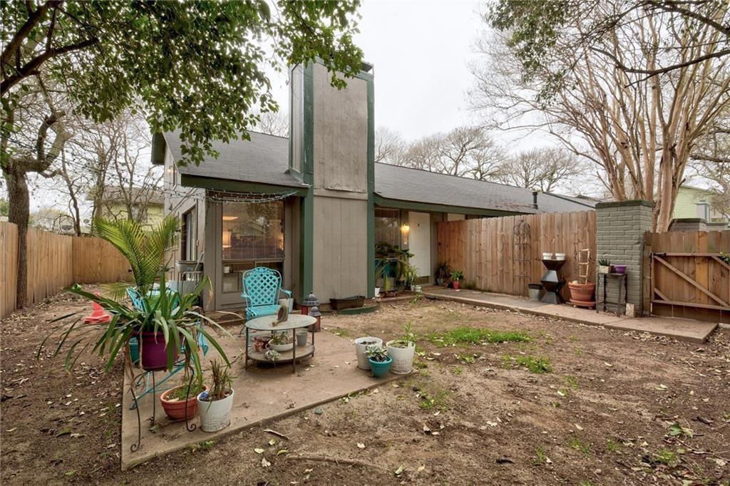
5215 Tahoe Trail
Austin, TX 78745
2 Weeks Ago
Favorites
5215 Tahoe Trail

Favorites
Check Back Soon for Upcoming Availability
| Beds | Baths | Average SF |
|---|---|---|
| 2 Bedrooms 2 Bedrooms 2 Br | 2 Baths 2 Baths 2 Ba | 2,630 SF |
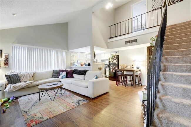
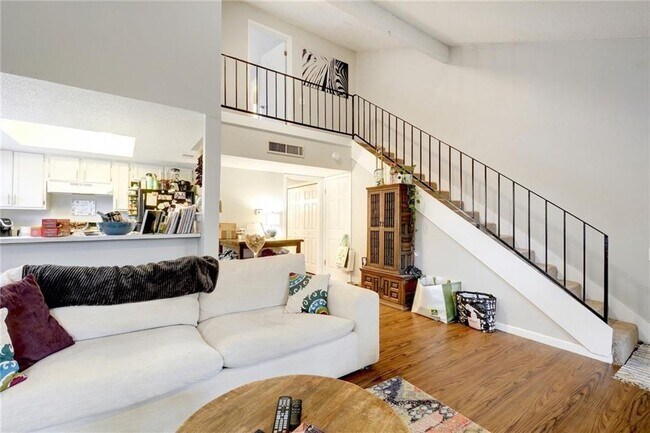
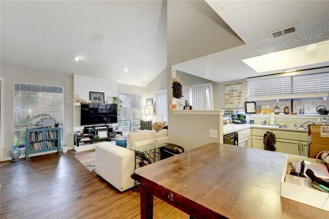
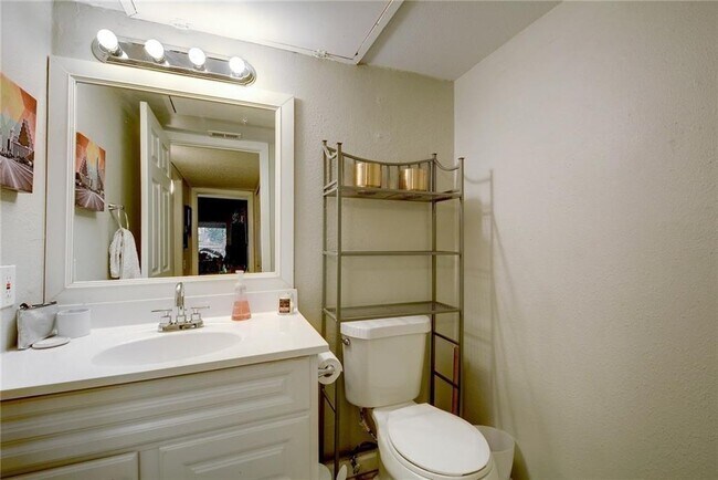
About This Property
lovely 2 bed unit 1 full bath/1 half downstairs - high ceilings. Located near Sunset Valley and just minutes away from shopping and fine dining.
5215 Tahoe Trail is a townhome located in Travis County and the 78745 ZIP Code. This area is served by the Austin Independent attendance zone.
Location
Get Directions
The Westgate neighborhood, located five miles south of downtown near Highway 71, epitomizes South Austin's comfortable yet hip lifestyle. The small enclave provides big city amenities with a small-town feel.
Often overlooked in favor of more urban locations closer to the city center, Westgate remains one of the last neighborhoods in Austin proper that offers its signature style at a more affordable price point. There’s colorful ranch-style homes and upscale modular apartments that will suit a variety of renter tastes. Though not as walkable as other areas, Westgate still offers many urban comforts, such as coffee shops, diverse restaurants, and specialty boutiques.
Westgate stands out as a safe, well-established community with a distinctly Austin vibe, and should you need to explore the city, it’s just a 20-minute drive away.
Learn more about living in WestgateBelow are rent ranges for similar nearby apartments
Education
| Colleges & Universities | Distance | ||
|---|---|---|---|
| Colleges & Universities | Distance | ||
| Drive: | 3 min | 1.3 mi | |
| Drive: | 7 min | 4.1 mi | |
| Drive: | 10 min | 5.8 mi | |
| Drive: | 11 min | 7.0 mi |
5215 Tahoe Trail is within 3 minutes or 1.3 miles from Austin C.C., South Austin. It is also near St. Edward's University and Austin C.C., Rio Grande Campus.
Schools


Public Elementary School
Grades PK-5
448 Students
Attendance Zone
Public Middle School
Grades 6-8
637 Students
Attendance Zone
Public High School
Grades 9-12
1,608 Students
Attendance Zone
Private Elementary & Middle School
Grades PK-9
350 Students
Nearby
Private Elementary School
Grades PK-3
88 Students
Nearby
Private Middle & High School
Grades 6-12
Nearby
School data provided by
 The GreatSchools Rating helps parents compare schools within a state based on a variety of school quality indicators and provides a helpful picture of how effectively each school serves all of its students. Ratings are on a scale of 1 (below average) to 10 (above average) and can include test scores, college readiness, academic progress, advanced courses, equity, discipline and attendance data. We also advise parents to visit schools, consider other information on school performance and programs, and consider family needs as part of the school selection process.
View GreatSchools Rating Methodology
Data provided by GreatSchools.org © 2025. All rights reserved.
View GreatSchools Rating Methodology
Data provided by GreatSchools.org © 2025. All rights reserved.
Transportation options available in Austin include Downtown Station, located 7.6 miles from 5215 Tahoe Trail. 5215 Tahoe Trail is near Austin-Bergstrom International, located 11.7 miles or 23 minutes away.
| Transit / Subway | Distance | ||
|---|---|---|---|
| Transit / Subway | Distance | ||
| Drive: | 12 min | 7.6 mi | |
| Drive: | 13 min | 8.3 mi | |
| Drive: | 15 min | 9.9 mi | |
| Drive: | 19 min | 11.3 mi | |
| Drive: | 18 min | 12.3 mi |
| Commuter Rail | Distance | ||
|---|---|---|---|
| Commuter Rail | Distance | ||
|
|
Drive: | 11 min | 4.9 mi |
|
|
Drive: | 38 min | 28.6 mi |
|
|
Drive: | 51 min | 42.0 mi |
| Airports | Distance | ||
|---|---|---|---|
| Airports | Distance | ||
|
Austin-Bergstrom International
|
Drive: | 23 min | 11.7 mi |
Time and distance from 5215 Tahoe Trail.
| Shopping Centers | Distance | ||
|---|---|---|---|
| Shopping Centers | Distance | ||
| Walk: | 12 min | 0.7 mi | |
| Walk: | 13 min | 0.7 mi | |
| Drive: | 3 min | 1.3 mi |
5215 Tahoe Trail has 3 shopping centers within 1.3 miles, which is about a 3-minute walk. The miles and minutes will be for the farthest away property.
| Parks and Recreation | Distance | ||
|---|---|---|---|
| Parks and Recreation | Distance | ||
|
Barton Creek Greenbelt (360 Access)
|
Drive: | 3 min | 1.7 mi |
|
Goat Cave Nature Preserve
|
Drive: | 6 min | 2.5 mi |
|
Umlauf Sculpture Garden and Museum
|
Drive: | 9 min | 3.9 mi |
|
Blunn Creek Nature Preserve
|
Drive: | 9 min | 4.6 mi |
|
Zilker Botanical Garden
|
Drive: | 8 min | 4.7 mi |
5215 Tahoe Trail has 5 parks within 4.7 miles, including Barton Creek Greenbelt (360 Access), Goat Cave Nature Preserve, and Umlauf Sculpture Garden and Museum.
| Hospitals | Distance | ||
|---|---|---|---|
| Hospitals | Distance | ||
| Drive: | 3 min | 1.6 mi | |
| Drive: | 4 min | 2.3 mi | |
| Drive: | 8 min | 4.2 mi |
5215 Tahoe Trail has 3 hospitals within 4.2 miles, the nearest is Austin Oaks Hospital which is 1.6 miles away and a 3 minute drive.
| Military Bases | Distance | ||
|---|---|---|---|
| Military Bases | Distance | ||
| Drive: | 80 min | 63.6 mi | |
| Drive: | 103 min | 80.2 mi |
5215 Tahoe Trail is 63.6 miles from Randolph Air Force Base, and is convenient to other military bases, including Camp Bullis Military Training Reservation.
You May Also Like
Similar Rentals Nearby
-
-
-
-
1 / 43

-
-
-
-
-
-


What Are Walk Score®, Transit Score®, and Bike Score® Ratings?
Walk Score® measures the walkability of any address. Transit Score® measures access to public transit. Bike Score® measures the bikeability of any address.
What is a Sound Score Rating?
A Sound Score Rating aggregates noise caused by vehicle traffic, airplane traffic and local sources

5215 Tahoe Trail
Austin, TX 78745