

$2,300
/ Month
51 Turner St
Yonkers, NY 10704
Today
|
Edit
Favorites
914-793-8800
-
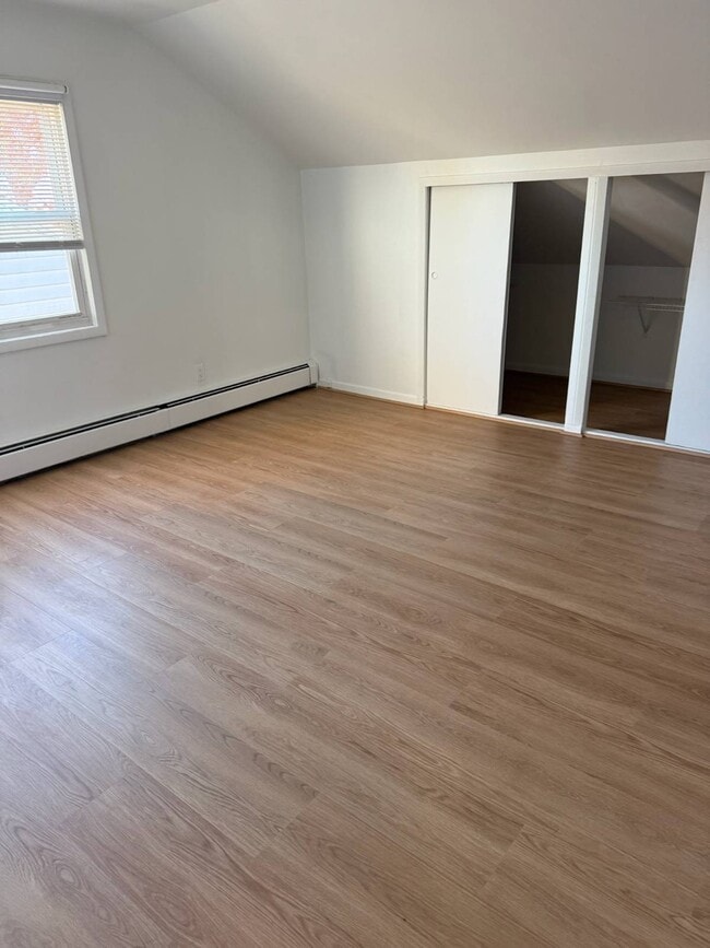
Bedrooms
2
-
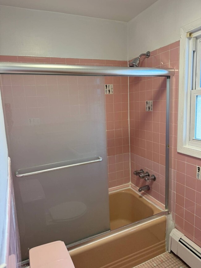
Bathrooms
1
-
Square Feet
1,930 sq ft
-
Available
Available Now
Highlights
- Colonial Architecture
- Property is near public transit
51 Turner St

Favorites
About This Home
Available Now
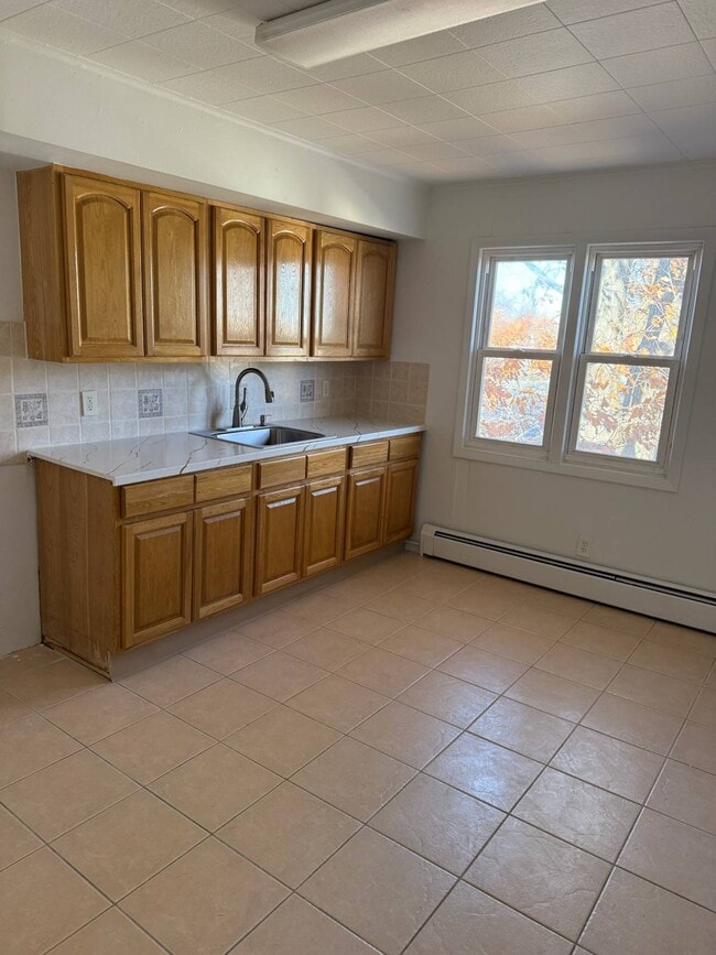
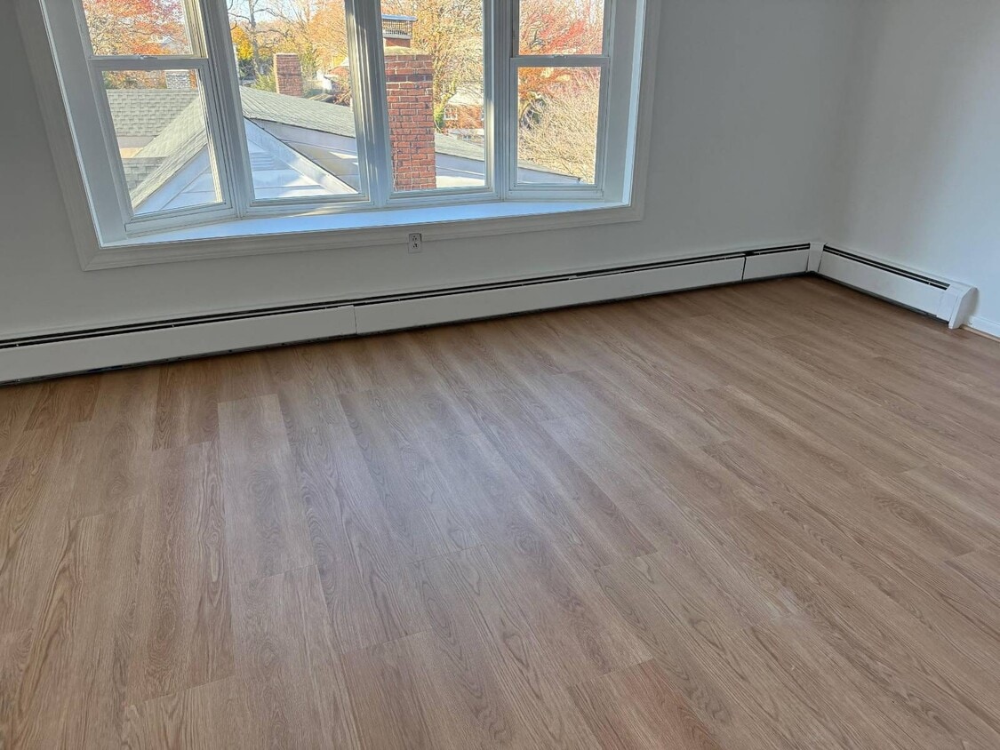
The sun-drenched main level features hardwood floors, a spacious living room with a large bay window, and a generous foyer with closets. The oversized eat-in kitchen 2 bedrooms , full bathroom, living room
51 Turner St is a house located in Westchester County and the 10704 ZIP Code. This area is served by the Yonkers City attendance zone.
* Price shown is base rent. Excludes user-selected optional fees and variable or usage-based fees and required charges due at or prior to move-in or at move-out. Price, availability, fees, and any applicable rent special are subject to change without notice.
* Square footage definitions vary. Displayed square footage is approximate.
Home Details
Year Built
Built in 1963
Bedrooms and Bathrooms
1 Full Bathroom
2 Bedrooms
Home Design
Colonial Architecture
Brick Exterior Construction
Asphalt Roof
Frame Construction
Interior Spaces
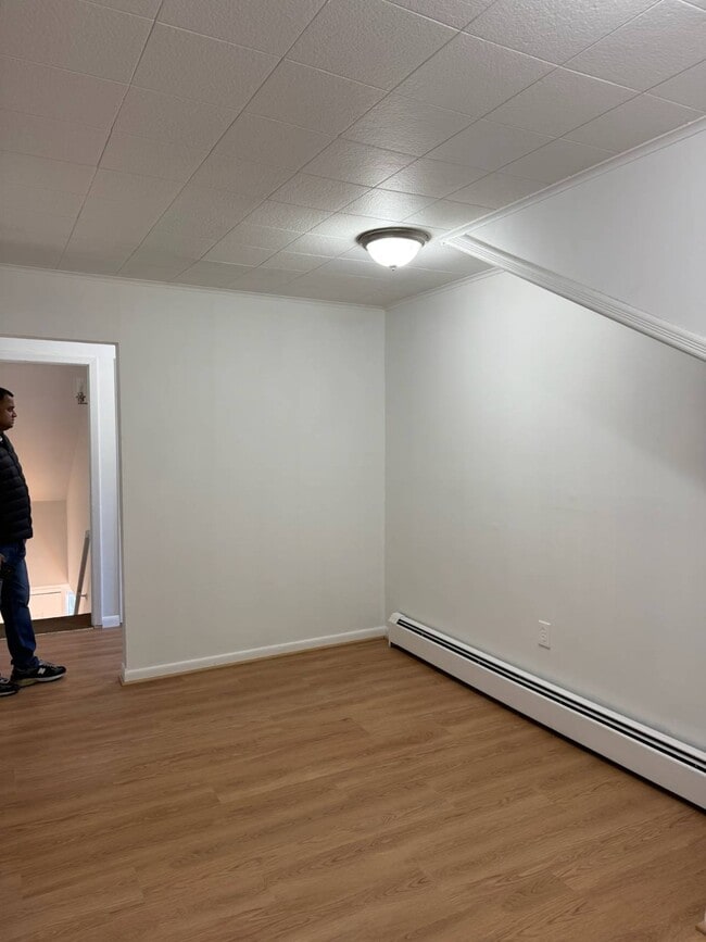
1,930 Sq Ft Home
2-Story Property
Location
Property is near public transit
Property is near a bus stop
Lot Details
5,663 Sq Ft Lot
Community Details
Contact
- Listed by Sufian Saha | NYStateMLS#NY
- Phone Number
- Contact
-
Source
NY State MLS
Copyright © 2025 NY State MLS. All rights reserved. All information provided by the listing agent/broker is deemed reliable but is not guaranteed and should be independently verified.
Location
Get Directions
Amenities
- Fireplace
Southeast Yonkers is situated between Bronx River Parkway and New York State Thruway. This neighborhood is part of the city of Yonkers and is located about 15 miles north of Manhattan off the Hudson River. Because of its ideal location, Southeast Yonkers is just a few train stops away from some of the best entertainment, bars, restaurants, and retailers in the country, but residents can enjoy great amenities closer to home as well. In the northern corner of the neighborhood there’s a large shopping complex that’s home to a variety of stores, chain eateries, grocers, gyms, and more.
The rest of the neighborhood is made up of mostly residential areas with local stores and grocers scattered throughout. Renters will find that there are many options for trendy apartments and condos located throughout the city with average prices for the New York area.
Learn more about living in Southeast Yonkers
Education
| Colleges & Universities | Distance | ||
|---|---|---|---|
| Colleges & Universities | Distance | ||
| Drive: | 3 min | 1.1 mi | |
| Drive: | 10 min | 4.3 mi | |
| Drive: | 11 min | 5.2 mi | |
| Drive: | 10 min | 5.2 mi |
51 Turner St is within 3 minutes or 1.1 miles from Sarah Lawrence College. It is also near Iona College and Manhattan College.
Schools

Public Elementary & Middle School
Grades PK-8
560 Students
Nearby
Public High School
Grades 9-12
80 Students
Nearby
Private Elementary School
Grades PK-4
105 Students
Nearby
Private Elementary, Middle & High School
Grades K-12
Nearby
School data provided by
 The GreatSchools Rating helps parents compare schools within a state based on a variety of school quality indicators and provides a helpful picture of how effectively each school serves all of its students. Ratings are on a scale of 1 (below average) to 10 (above average) and can include test scores, college readiness, academic progress, advanced courses, equity, discipline and attendance data. We also advise parents to visit schools, consider other information on school performance and programs, and consider family needs as part of the school selection process.
View GreatSchools Rating Methodology
Data provided by GreatSchools.org © 2025. All rights reserved.
View GreatSchools Rating Methodology
Data provided by GreatSchools.org © 2025. All rights reserved.
Transportation options available in Yonkers include Wakefield-241 Street, located 2.1 miles from 51 Turner St. 51 Turner St is near LaGuardia, located 15.7 miles or 29 minutes away, and Westchester County, located 17.3 miles or 27 minutes away.
| Transit / Subway | Distance | ||
|---|---|---|---|
| Transit / Subway | Distance | ||
|
|
Drive: | 5 min | 2.1 mi |
|
|
Drive: | 5 min | 2.5 mi |
|
|
Drive: | 6 min | 2.9 mi |
|
|
Drive: | 7 min | 3.3 mi |
|
|
Drive: | 9 min | 4.6 mi |
| Commuter Rail | Distance | ||
|---|---|---|---|
| Commuter Rail | Distance | ||
|
|
Walk: | 17 min | 0.9 mi |
|
|
Drive: | 5 min | 1.7 mi |
|
|
Drive: | 6 min | 2.3 mi |
|
|
Drive: | 8 min | 3.9 mi |
|
|
Drive: | 9 min | 4.4 mi |
| Airports | Distance | ||
|---|---|---|---|
| Airports | Distance | ||
|
LaGuardia
|
Drive: | 29 min | 15.7 mi |
|
Westchester County
|
Drive: | 27 min | 17.3 mi |
Time and distance from 51 Turner St.
| Shopping Centers | Distance | ||
|---|---|---|---|
| Shopping Centers | Distance | ||
| Walk: | 12 min | 0.6 mi | |
| Walk: | 12 min | 0.7 mi | |
| Walk: | 15 min | 0.8 mi |
51 Turner St has 3 shopping centers within 0.8 mile, which is about a 15-minute walk. The miles and minutes will be for the farthest away property.
| Parks and Recreation | Distance | ||
|---|---|---|---|
| Parks and Recreation | Distance | ||
|
Seton Falls Park
|
Drive: | 7 min | 3.5 mi |
|
Beczak Environmental Education Center
|
Drive: | 10 min | 4.3 mi |
|
Williamsbridge Oval
|
Drive: | 10 min | 4.4 mi |
|
Hudson River Museum
|
Drive: | 10 min | 5.0 mi |
|
Van Cortlandt Park
|
Drive: | 10 min | 5.8 mi |
51 Turner St has 5 parks within 5.8 miles, including Van Cortlandt Park, Seton Falls Park, and Beczak Environmental Education Center.
| Hospitals | Distance | ||
|---|---|---|---|
| Hospitals | Distance | ||
| Drive: | 5 min | 2.0 mi | |
| Drive: | 8 min | 4.2 mi | |
| Drive: | 9 min | 4.5 mi |
51 Turner St has 3 hospitals within 4.5 miles, the nearest is Montefiore Mount Vernon Hospital which is 2.0 miles away and a 5 minute drive.
| Military Bases | Distance | ||
|---|---|---|---|
| Military Bases | Distance | ||
| Drive: | 25 min | 13.7 mi |
51 Turner St is 13.7 miles and a 25 minute drive from Fort Totten US Govt Reservation.
You May Also Like
Similar Rentals Nearby


What Are Walk Score®, Transit Score®, and Bike Score® Ratings?
Walk Score® measures the walkability of any address. Transit Score® measures access to public transit. Bike Score® measures the bikeability of any address.
What is a Sound Score Rating?
A Sound Score Rating aggregates noise caused by vehicle traffic, airplane traffic and local sources
51 Turner St
Yonkers, NY 10704