
$2,100 / Month
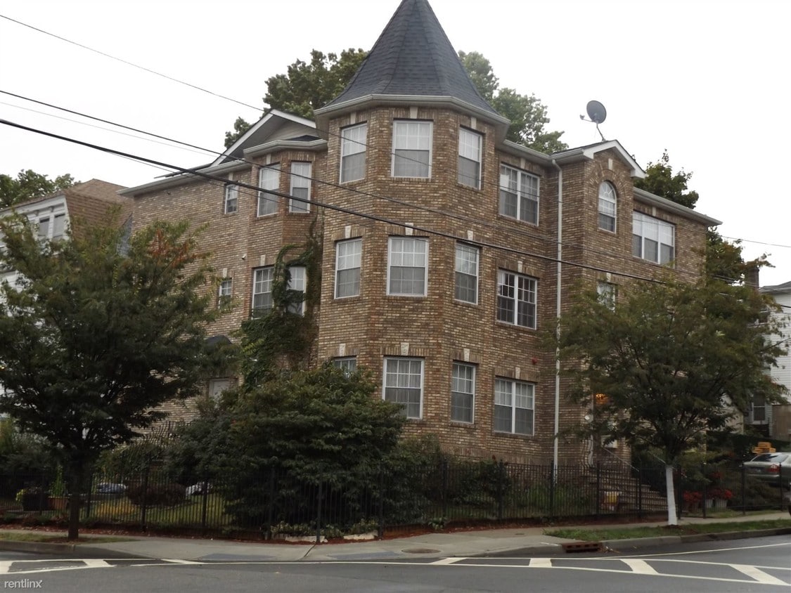
51-53 Farley Ave
Newark, NJ 07108
2 Weeks Ago
Favorites
51-53 Farley Ave

Favorites
Check Back Soon for Upcoming Availability
| Beds | Baths | Average SF |
|---|---|---|
| 3 Bedrooms 3 Bedrooms 3 Br | 2 Baths 2 Baths 2 Ba | 2,011 SF |
About This Property
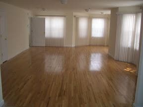
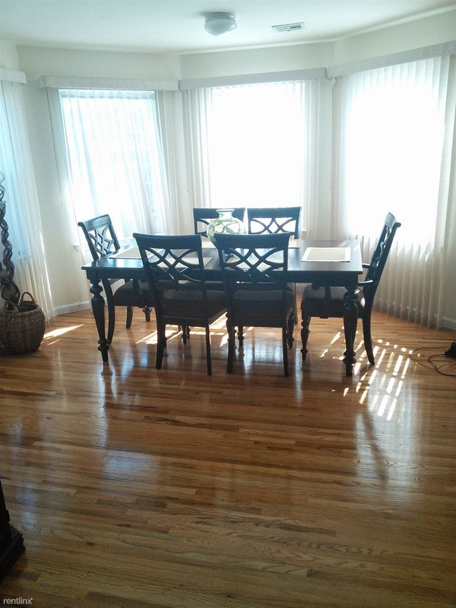
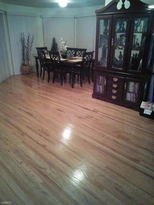
(862) 754-1899 - Sunny. Open-plan 2000+ sq. ft. 2nd floor in owner-occupied 3-family quiet corner bldg on tree-lined streets. Fully equipped large kitchen & in-unit laundry w/ linen closet. Intercom, security, smoke detectors & sprinkler system, window treatments, off-street gated parking. Master BR suite includes huge (2 car garage size) bedroom, full bath w/ jetted tub and large walk in closet. Two additional large bedrooms with generous closets share full bath. Kitchen flows into sunny, open-plan dining/living area, which has double window plus 5-window & 3-window bay alcoves. Oak floors and ceramic tiled kitchen and laundry. Apartment zoned central heat/AC. Use of garden space. Established residential community with new/renovated buildings. Minutes to NYC by PATH, NJ Transit. Easy to I-78, Garden State Parkway, NJ Turnpike. Close to Rutgers & Beth Israel Hospital, NJIT, Rutgers University & Seton Hall Law School. Very walkable. Frequent buses (70, 13, 99) 1 to 4 short blocks. . (RLNE2394920) Other Amenities - Unfurnished, Parking- gated off-street, Smoke Free, Garage, Yard. Appliances - Dishwasher, Air Conditioning, Refrigerator, Range, Oven, Washer & Dryer. Lease lengths - 12 Months- $50 discount w/24 month lease. Details regarding this property's Utilities - Resident Pays Heat, Resident Pays Electricity, Resident Pays Gas, Water Included, Other- in-unit security system, window treatments and sprinklers, Trash Pick-up Included. Pet policies - Small Dogs Allowed, Cats Allowed.
51-53 Farley Ave is a house located in Essex County and the 07108 ZIP Code. This area is served by the The Newark Public attendance zone.
House Features
- Air Conditioning
Location
Get Directions
Located just two miles outside of Downtown Newark, Upper Clinton Hill is a popular neighborhood in the city. Historic architecture and proximity to three major universities — the New Jersey Institute of Technology, Rutgers University-Newark, and Seton Hall University — combined with its easy access to medical centers, the Newark Liberty International Airport, the port, and Interstate 78 make Upper Clinton stand out. The neighborhood also sits less than 20 miles southwest of Manhattan. While Upper Clinton Hill is a primarily residential area, there are a few shops, restaurants, and businesses scattered throughout the neighborhood. This walkable community offers unique apartments, houses, condos, and townhomes available for rent ranging from affordable to upscale.
Learn more about living in Upper Clinton HillBelow are rent ranges for similar nearby apartments
Amenities
- Air Conditioning
Education
| Colleges & Universities | Distance | ||
|---|---|---|---|
| Colleges & Universities | Distance | ||
| Drive: | 4 min | 2.1 mi | |
| Drive: | 5 min | 2.3 mi | |
| Drive: | 5 min | 2.6 mi | |
| Drive: | 10 min | 3.8 mi |
51-53 Farley Ave is within 4 minutes or 2.1 miles from Essex County College. It is also near N.J. Inst. of Technology and Rutgers, Newark Campus.
Schools

Public Elementary School
Grades PK-5
405 Students
Nearby
Public Elementary & Middle School
Grades PK-8
563 Students
Nearby
Public Middle & High School
Grades 7-12
426 Students
Attendance Zone
Private Elementary, Middle & High School
Grades PK-12
Nearby
School data provided by
 The GreatSchools Rating helps parents compare schools within a state based on a variety of school quality indicators and provides a helpful picture of how effectively each school serves all of its students. Ratings are on a scale of 1 (below average) to 10 (above average) and can include test scores, college readiness, academic progress, advanced courses, equity, discipline and attendance data. We also advise parents to visit schools, consider other information on school performance and programs, and consider family needs as part of the school selection process.
View GreatSchools Rating Methodology
Data provided by GreatSchools.org © 2025. All rights reserved.
View GreatSchools Rating Methodology
Data provided by GreatSchools.org © 2025. All rights reserved.
Transportation options available in Newark include Warren Street, located 2.1 miles from 51-53 Farley Ave. 51-53 Farley Ave is near Newark Liberty International, located 5.0 miles or 8 minutes away, and LaGuardia, located 24.3 miles or 42 minutes away.
| Transit / Subway | Distance | ||
|---|---|---|---|
| Transit / Subway | Distance | ||
|
|
Drive: | 4 min | 2.1 mi |
|
|
Drive: | 4 min | 2.2 mi |
|
|
Drive: | 4 min | 2.2 mi |
|
|
Drive: | 4 min | 2.3 mi |
|
|
Drive: | 5 min | 2.4 mi |
| Commuter Rail | Distance | ||
|---|---|---|---|
| Commuter Rail | Distance | ||
|
|
Drive: | 5 min | 2.7 mi |
|
|
Drive: | 6 min | 2.9 mi |
|
|
Drive: | 9 min | 3.2 mi |
|
|
Drive: | 6 min | 3.5 mi |
|
|
Drive: | 11 min | 4.0 mi |
| Airports | Distance | ||
|---|---|---|---|
| Airports | Distance | ||
|
Newark Liberty International
|
Drive: | 8 min | 5.0 mi |
|
LaGuardia
|
Drive: | 42 min | 24.3 mi |
Time and distance from 51-53 Farley Ave.
| Shopping Centers | Distance | ||
|---|---|---|---|
| Shopping Centers | Distance | ||
| Walk: | 12 min | 0.7 mi | |
| Walk: | 16 min | 0.8 mi | |
| Drive: | 4 min | 1.7 mi |
51-53 Farley Ave has 3 shopping centers within 1.7 miles, which is about a 4-minute walk. The miles and minutes will be for the farthest away property.
| Parks and Recreation | Distance | ||
|---|---|---|---|
| Parks and Recreation | Distance | ||
|
Newark Museum and Dreyfuss Planetarium
|
Drive: | 5 min | 2.5 mi |
|
Branch Brook Park
|
Drive: | 9 min | 4.0 mi |
|
Kearny Marsh
|
Drive: | 12 min | 5.5 mi |
|
Edison National Historic Site
|
Drive: | 13 min | 6.1 mi |
|
Turtle Back Zoo
|
Drive: | 16 min | 8.2 mi |
51-53 Farley Ave has 5 parks within 8.2 miles, including Newark Museum and Dreyfuss Planetarium, Branch Brook Park, and Kearny Marsh.
| Hospitals | Distance | ||
|---|---|---|---|
| Hospitals | Distance | ||
| Drive: | 3 min | 1.3 mi | |
| Drive: | 3 min | 1.5 mi | |
| Drive: | 5 min | 2.6 mi |
51-53 Farley Ave has 3 hospitals within 2.6 miles, the nearest is Newark Beth Israel Medical Center which is 1.3 miles away and a 3 minute drive.
| Military Bases | Distance | ||
|---|---|---|---|
| Military Bases | Distance | ||
| Drive: | 13 min | 8.8 mi | |
| Drive: | 24 min | 12.7 mi | |
| Drive: | 30 min | 16.8 mi |
51-53 Farley Ave has 3 military bases within 16.8 miles, the nearest is Military Ocean Terminal which is 8.8 miles away and a 13 minute drive.
You May Also Like
Similar Rentals Nearby


What Are Walk Score®, Transit Score®, and Bike Score® Ratings?
Walk Score® measures the walkability of any address. Transit Score® measures access to public transit. Bike Score® measures the bikeability of any address.
What is a Sound Score Rating?
A Sound Score Rating aggregates noise caused by vehicle traffic, airplane traffic and local sources

51-53 Farley Ave
Newark, NJ 07108