
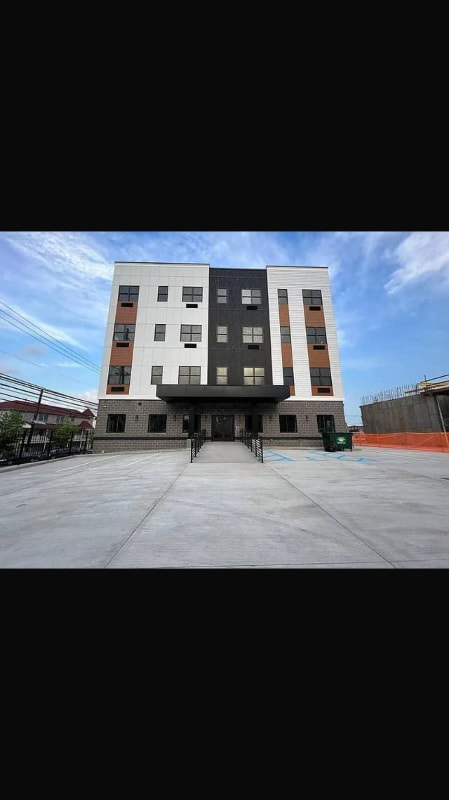
50 Norfolk St Unit 50 Norfolk Street Newark, New Jersey, 07103
Newark, NJ 07103
-
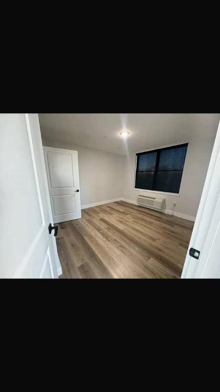
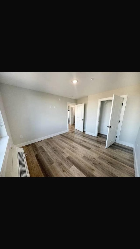
Bedrooms
1
-
Bathrooms
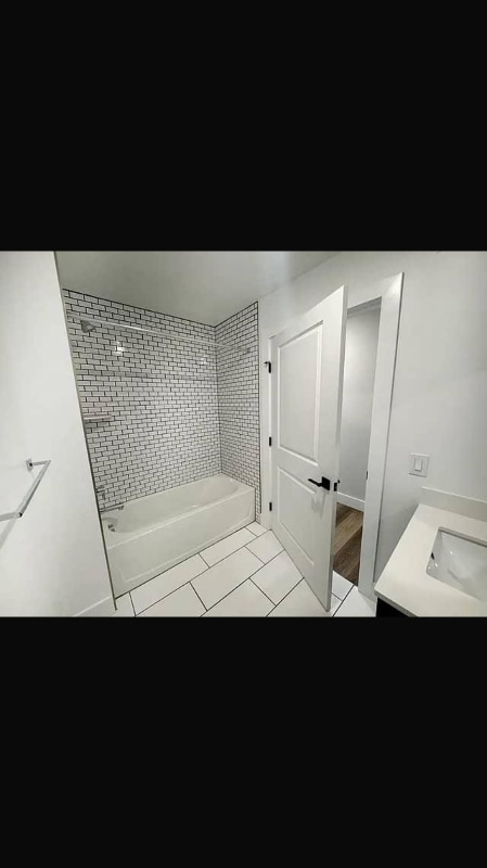
1
-
Square Feet
--
-
Available
Available Jul 17
Highlights
- Pets Allowed
- Hardwood Floors
- Security System

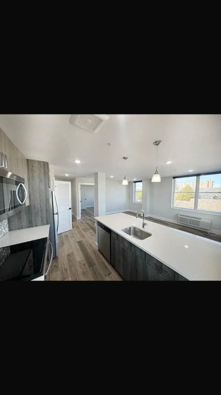
About This Home
Property Id: 2004552 Discover your new home at 50 Norfolk street perfectly situated in the vibrant University Highlights neighborhood. This inviting apartment is located near the exciting new developments of Arbil by Gomes and Envy by Gomes,offering a modern and dynamic living environment. The apartment is within walking distance of top institutions like Rutgers University making it an excellent choice for students and professionals alike. Enjoy the convenience of nearby dining options such as Kanela and Envy Bar & Grille, perfect for both casual outings and special occasions. This well-maintained building boasts an amazing atmosphere providing a comfortable and stylish living experience. With its prime location and easy access to local amenities,public transportation, and key educational institutions, 50 Norfolk St is the ideal place to call home in Newark. Don't miss out on this fantastic opportunity
50 Norfolk St is an apartment community located in Essex County and the 07103 ZIP Code.
Features
Dishwasher
Hardwood Floors
Microwave
Refrigerator
- Satellite TV
- Security System
- Dishwasher
- Microwave
- Oven
- Refrigerator
- Freezer
- Hardwood Floors
Fees and Policies
The fees below are based on community-supplied data and may exclude additional fees and utilities.
- Dogs Allowed
-
Fees not specified
- Cats Allowed
-
Fees not specified
- Parking
-
Garage--
Details
Utilities Included
-
Gas
-
Water
-
Electricity
-
Trash Removal
Contact
- Phone Number
- Contact
-
Source

- Satellite TV
- Security System
- Dishwasher
- Microwave
- Oven
- Refrigerator
- Freezer
- Hardwood Floors
As its name implies, University Heights houses several academic institutions. University Heights is home to Essex County College, the New Jersey Institute of Technology, and Rutgers University-Newark Campus. Sprawling campuses, along with several medical facilities like Saint Michael's Medical Center and Rutger’s University Hospital, dominate the neighborhood but there still plenty of rentals to choose from. Ideal for all renters, University Heights has affordable to upscale rentals available.
This urban neighborhood is nestled beside Downtown Newark, giving easy access to some of the city’s best dining, shopping, and entertainment options. Bike lanes and a light rail system provide transportation options that make it easy to get around, although you may opt to simply lace up your shoes in this walkable neighborhood. Locals enjoy being able to stroll downtown entertainment hubs like the New Jersey Performing Arts Center and Prudential Center.
Learn more about living in University Heights| Colleges & Universities | Distance | ||
|---|---|---|---|
| Colleges & Universities | Distance | ||
| Walk: | 9 min | 0.5 mi | |
| Walk: | 11 min | 0.6 mi | |
| Walk: | 15 min | 0.8 mi | |
| Drive: | 7 min | 3.8 mi |
Transportation options available in Newark include Norfolk Street, located 0.2 mile from 50 Norfolk St Unit 50 Norfolk Street Newark, New Jersey, 07103. 50 Norfolk St Unit 50 Norfolk Street Newark, New Jersey, 07103 is near Newark Liberty International, located 6.3 miles or 11 minutes away, and LaGuardia, located 27.2 miles or 40 minutes away.
| Transit / Subway | Distance | ||
|---|---|---|---|
| Transit / Subway | Distance | ||
|
|
Walk: | 3 min | 0.2 mi |
|
|
Walk: | 7 min | 0.4 mi |
|
|
Walk: | 8 min | 0.4 mi |
|
|
Walk: | 13 min | 0.7 mi |
|
|
Walk: | 15 min | 0.8 mi |
| Commuter Rail | Distance | ||
|---|---|---|---|
| Commuter Rail | Distance | ||
|
|
Walk: | 14 min | 0.7 mi |
|
|
Drive: | 3 min | 1.7 mi |
|
|
Drive: | 3 min | 1.9 mi |
|
|
Drive: | 4 min | 2.1 mi |
|
|
Drive: | 4 min | 2.5 mi |
| Airports | Distance | ||
|---|---|---|---|
| Airports | Distance | ||
|
Newark Liberty International
|
Drive: | 11 min | 6.3 mi |
|
LaGuardia
|
Drive: | 40 min | 27.2 mi |
Time and distance from 50 Norfolk St Unit 50 Norfolk Street Newark, New Jersey, 07103.
| Shopping Centers | Distance | ||
|---|---|---|---|
| Shopping Centers | Distance | ||
| Walk: | 11 min | 0.6 mi | |
| Walk: | 17 min | 0.9 mi | |
| Walk: | 18 min | 0.9 mi |
| Parks and Recreation | Distance | ||
|---|---|---|---|
| Parks and Recreation | Distance | ||
|
Newark Museum and Dreyfuss Planetarium
|
Walk: | 13 min | 0.7 mi |
|
Branch Brook Park
|
Drive: | 4 min | 1.8 mi |
|
Kearny Marsh
|
Drive: | 7 min | 3.7 mi |
|
Edison National Historic Site
|
Drive: | 9 min | 4.5 mi |
|
Richard W. DeKorte Park
|
Drive: | 13 min | 6.2 mi |
| Hospitals | Distance | ||
|---|---|---|---|
| Hospitals | Distance | ||
| Walk: | 9 min | 0.5 mi | |
| Walk: | 17 min | 0.9 mi | |
| Drive: | 3 min | 1.8 mi |
| Military Bases | Distance | ||
|---|---|---|---|
| Military Bases | Distance | ||
| Drive: | 16 min | 10.1 mi | |
| Drive: | 26 min | 12.8 mi | |
| Drive: | 32 min | 18.2 mi |
You May Also Like
What Are Walk Score®, Transit Score®, and Bike Score® Ratings?
Walk Score® measures the walkability of any address. Transit Score® measures access to public transit. Bike Score® measures the bikeability of any address.
What is a Sound Score Rating?
A Sound Score Rating aggregates noise caused by vehicle traffic, airplane traffic and local sources
50 Norfolk St
Newark, NJ 07103