

$2,350
/ Month
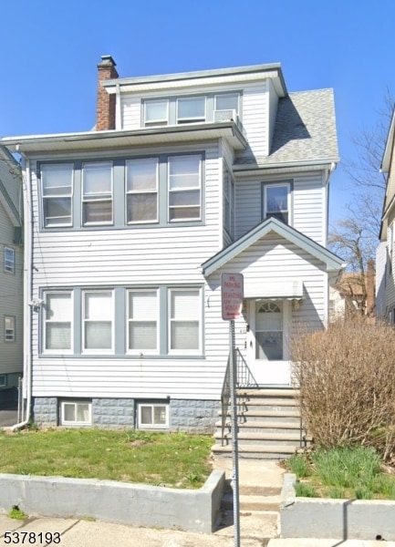
49 Monticello Ave
Newark, NJ 07106
Today
|
Edit
Favorites
862-686-4202
-
Bedrooms
2
-
Bathrooms
1
-
Square Feet
--
-
Available
Available Now
49 Monticello Ave

Favorites
About This Home
Available Now
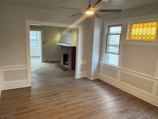
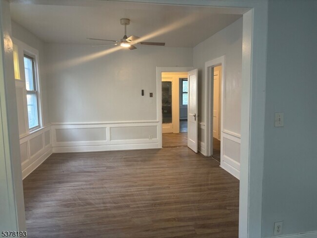
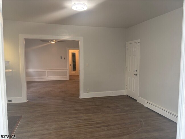
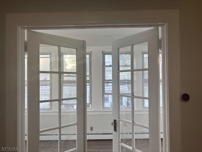
This bright and spacious unit offers a large kitchen with brand-new appliances, a generous living room, two comfortable bedrooms, and a modern bathroom. The apartment also includes a versatile den that?s perfect for an office or additional storage. An in-unit washer and dryer add to your convenience and comfort. Conveniently located near Seton Hall University with easy access to public transportation and local shops, this home provides both comfort and accessibility.
49 Monticello Ave is a house located in Essex County and the 07106 ZIP Code. This area is served by the The Newark Public attendance zone.
* Price shown is base rent. Excludes user-selected optional fees and variable or usage-based fees and required charges due at or prior to move-in or at move-out. Price, availability, fees, and any applicable rent special are subject to change without notice.
* Square footage definitions vary. Displayed square footage is approximate.
Home Details
Year Built
Built in 1975 | Remodeled
Bedrooms and Bathrooms
1 Full Bathroom
2 Bedrooms
Interior Spaces
2-Story Property
Laundry
Dryer
Laundry in unit
Washer
Listing and Financial Details
Assessor Parcel Number 1614-04184-0000-00022-0000-
Tenant pays for cable t.v., electric, gas, heat
Lot Details
3,920 Sq Ft Lot
Utilities
Window Unit Cooling System
Community Details
Contact
- Listed by JZANA DAWKINS | GardenStateMLS#NJ
- Phone Number
-
Source
Garden State Multiple Listing Service, LLC
Copyright © 2025 Garden State MLS, LLC. All rights reserved. All information provided by the listing agent/broker is deemed reliable but is not guaranteed and should be independently verified.
Location
Get Directions
Amenities
- Air Conditioning
Upper Vailsburg is a hilltop neighborhood in the city of Newark that features Victorian and Dutch colonial-style homes and a variety of local shops. The peninsula-shaped area sits on the eastern border of the city and neighbors Maplewood, South Orange, and Irvington. The neighborhood is just minutes from Seton Hall University and various medical facilities. Upper Vailsburg is known for its close-knit community and suits renters looking for a quiet neighborhood with quick commutes to greater Newark destinations and beyond, like New York City.
Learn more about living in Upper Vailsburg
Education
| Colleges & Universities | Distance | ||
|---|---|---|---|
| Colleges & Universities | Distance | ||
| Walk: | 15 min | 0.8 mi | |
| Drive: | 8 min | 3.6 mi | |
| Drive: | 7 min | 3.6 mi | |
| Drive: | 7 min | 3.9 mi |
49 Monticello Ave is within 15 minutes or 0.8 mile from Seton Hall University. It is also near Essex County College and N.J. Inst. of Technology.
Schools


Public Elementary & Middle School
Grades PK-8
377 Students
Attendance Zone
Public High School
Grades 9-12
609 Students
Attendance Zone
Public High School
Grades 9-12
141 Students
Attendance Zone
Private Elementary School
Grades 1-4
Nearby
Private Elementary & Middle School
Grades PK-8
234 Students
Nearby
Private Middle & High School
Grades 6-12
Nearby
School data provided by
 The GreatSchools Rating helps parents compare schools within a state based on a variety of school quality indicators and provides a helpful picture of how effectively each school serves all of its students. Ratings are on a scale of 1 (below average) to 10 (above average) and can include test scores, college readiness, academic progress, advanced courses, equity, discipline and attendance data. We also advise parents to visit schools, consider other information on school performance and programs, and consider family needs as part of the school selection process.
View GreatSchools Rating Methodology
Data provided by GreatSchools.org © 2025. All rights reserved.
View GreatSchools Rating Methodology
Data provided by GreatSchools.org © 2025. All rights reserved.
Transportation options available in Newark include Norfolk Street, located 3.4 miles from 49 Monticello Ave. 49 Monticello Ave is near Newark Liberty International, located 8.3 miles or 14 minutes away, and LaGuardia, located 31.0 miles or 48 minutes away.
| Transit / Subway | Distance | ||
|---|---|---|---|
| Transit / Subway | Distance | ||
|
|
Drive: | 7 min | 3.4 mi |
|
|
Drive: | 7 min | 3.4 mi |
|
|
Drive: | 7 min | 3.5 mi |
|
|
Drive: | 8 min | 4.0 mi |
|
|
Drive: | 9 min | 4.8 mi |
| Commuter Rail | Distance | ||
|---|---|---|---|
| Commuter Rail | Distance | ||
|
|
Drive: | 3 min | 1.5 mi |
|
|
Drive: | 6 min | 1.7 mi |
|
|
Drive: | 4 min | 1.9 mi |
|
|
Drive: | 5 min | 2.5 mi |
|
|
Drive: | 6 min | 2.8 mi |
| Airports | Distance | ||
|---|---|---|---|
| Airports | Distance | ||
|
Newark Liberty International
|
Drive: | 14 min | 8.3 mi |
|
LaGuardia
|
Drive: | 48 min | 31.0 mi |
Time and distance from 49 Monticello Ave.
| Shopping Centers | Distance | ||
|---|---|---|---|
| Shopping Centers | Distance | ||
| Drive: | 4 min | 1.6 mi | |
| Drive: | 5 min | 2.0 mi | |
| Drive: | 7 min | 2.6 mi |
49 Monticello Ave has 3 shopping centers within 2.6 miles, which is about a 7-minute drive. The miles and minutes will be for the farthest away property.
| Parks and Recreation | Distance | ||
|---|---|---|---|
| Parks and Recreation | Distance | ||
|
Newark Museum and Dreyfuss Planetarium
|
Drive: | 8 min | 3.9 mi |
|
Edison National Historic Site
|
Drive: | 9 min | 4.0 mi |
|
Greenwood Gardens
|
Drive: | 11 min | 5.1 mi |
|
Branch Brook Park
|
Drive: | 11 min | 5.2 mi |
|
Turtle Back Zoo
|
Drive: | 12 min | 5.5 mi |
49 Monticello Ave has 5 parks within 5.5 miles, including Edison National Historic Site, Newark Museum and Dreyfuss Planetarium, and Turtle Back Zoo.
| Hospitals | Distance | ||
|---|---|---|---|
| Hospitals | Distance | ||
| Drive: | 4 min | 2.0 mi | |
| Drive: | 5 min | 2.6 mi | |
| Drive: | 8 min | 3.7 mi |
49 Monticello Ave has 3 hospitals within 3.7 miles, the nearest is East Orange General Hospital which is 2.0 miles away and a 4 minute drive.
| Military Bases | Distance | ||
|---|---|---|---|
| Military Bases | Distance | ||
| Drive: | 19 min | 12.2 mi | |
| Drive: | 25 min | 13.2 mi | |
| Drive: | 23 min | 13.6 mi |
49 Monticello Ave has 3 military bases within 13.6 miles, the nearest is Military Ocean Terminal which is 12.2 miles away and a 19 minute drive.
You May Also Like
How do I access Social Services in New Jersey?
Statewide service is free, confidential, multilingual and always open. Three easy ways to reach Social Services in NJ: Dial 2-1-1; text your zip code to 898-211; or chat at https://www.nj211.org
Similar Rentals Nearby


What Are Walk Score®, Transit Score®, and Bike Score® Ratings?
Walk Score® measures the walkability of any address. Transit Score® measures access to public transit. Bike Score® measures the bikeability of any address.
What is a Sound Score Rating?
A Sound Score Rating aggregates noise caused by vehicle traffic, airplane traffic and local sources
49 Monticello Ave
Newark, NJ 07106