
$3,000
/ Month
4841 Larchwood Ave
Philadelphia, PA 19143
Today
|
Edit
Favorites
215-650-7830
-
Bedrooms
3
-
Bathrooms
3
-
Square Feet
2,400 sq ft
-
Available
Available Now
Highlights
- Traditional Architecture
- Forced Air Heating and Cooling System
4841 Larchwood Ave

Favorites
4841 Larchwood Ave is a townhome located in Philadelphia County and the 19143 ZIP Code. This area is served by the The School District of Philadelphia attendance zone.
* Price shown is base rent. Excludes user-selected optional fees and variable or usage-based fees and required charges due at or prior to move-in or at move-out. Price, availability, fees, and any applicable rent special are subject to change without notice.
* Square footage definitions vary. Displayed square footage is approximate.
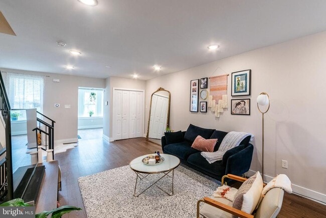
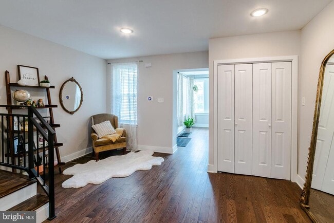
Home Details
Home Type
Interior Unit Townhome
Year Built
Built in 1925 | Remodeled in 2019
Bedrooms and Bathrooms
3 Full Bathrooms
3 Bedrooms
Home Design
Traditional Architecture
Brick Exterior Construction
Stone Siding
Stone Foundation
Interior Spaces
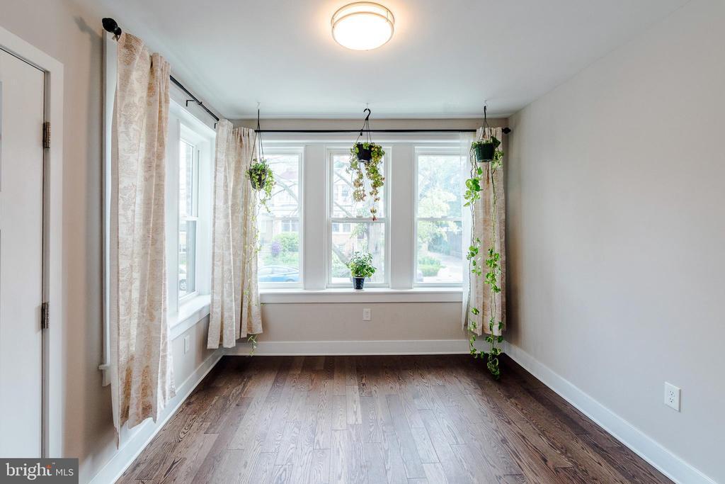
2,400 Sq Ft Home
Property has 2 Levels
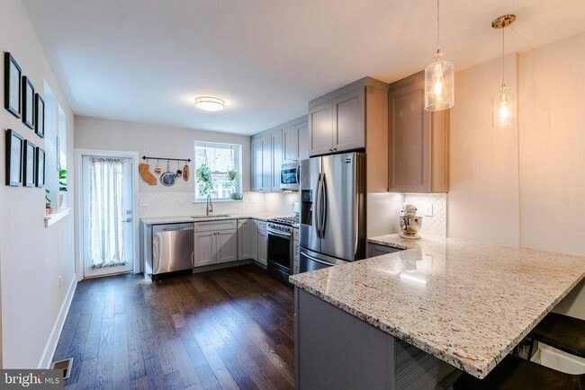
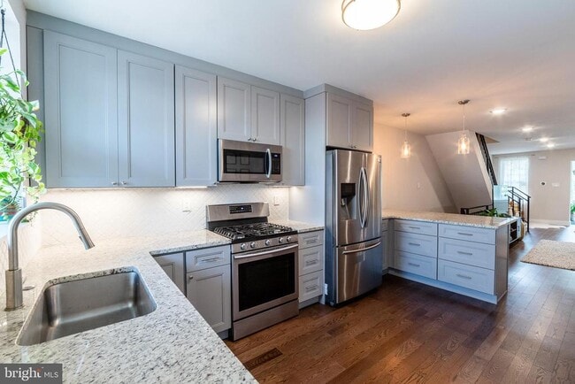
Kitchen
Built-In Range
Built-In Microwave
Dishwasher
Disposal
Laundry
Dryer
Washer
Listing and Financial Details
Security Deposit $3,000
6-Month Min and 12-Month Max Lease Term
Available 11/1/25
Assessor Parcel Number 461051500
Residential Lease
Lot Details
1,680 Sq Ft Lot
Parking
Off-Street Parking
Driveway
Schools
Henry C. Lea Elementary School
Utilities
Forced Air Heating and Cooling System
Electric Water Heater
Community Details
Overview
No Home Owners Association
Cedar Park Subdivision
Pet Policy
Pets allowed on a case-by-case basis
Contact
- Listed by Navid Aberg | KW Empower
- Phone Number
- Contact
-
Source
 Bright MLS, Inc.
Copyright © 2025 Bright MLS, Inc.
Location
Get Directions
Amenities
- Dishwasher
- Basement
Located in West Philadelphia, Cedar Park is a historic neighborhood that has undergone revitalization in recent years. Known as a “streetcar” suburb, Cedar Park boasts stunning architecture and many historic homes. Today, this diverse neighborhood is known as a quirky, urban locale with a bohemian vibe and vibrant culture. Located along Baltimore Avenue, Cedar Park maintains its own distinctive identity with a unique collection of galleries, shops, independent music, international restaurants, and a microbrewery.
Although the neighborhood is perfect for urbanites, Cedar Park is filled with trees and residents have access to several city parks including Clark Park and Malcolm X Park. Like most urban communities, Cedar Park is walkable, but residents also use public transit to travel to other major destinations in the city including the University of Pennsylvania and Center City. Great for renters of all ages, Cedar Park offers affordable to upscale rentals in every style.
Learn more about living in Cedar Park
Education
| Colleges & Universities | Distance | ||
|---|---|---|---|
| Colleges & Universities | Distance | ||
| Walk: | 11 min | 0.6 mi | |
| Walk: | 17 min | 0.9 mi | |
| Drive: | 4 min | 1.5 mi | |
| Drive: | 6 min | 2.3 mi |
4841 Larchwood Ave is within 11 minutes or 0.6 mile from C.C. of Philadelphia, W Ctr. It is also near University of the Sciences and University of Pennsylvania.
Schools


Public Elementary & Middle School
Grades PK-8
475 Students
Attendance Zone
Public High School
Grades 9-12
543 Students
Attendance Zone
Private Elementary & Middle School
Grades K-8
89 Students
Nearby
Private Elementary & Middle School
Grades PK-K & 3-8
Nearby
Private High School
Grades 9-12
420 Students
Nearby
School data provided by
 The GreatSchools Rating helps parents compare schools within a state based on a variety of school quality indicators and provides a helpful picture of how effectively each school serves all of its students. Ratings are on a scale of 1 (below average) to 10 (above average) and can include test scores, college readiness, academic progress, advanced courses, equity, discipline and attendance data. We also advise parents to visit schools, consider other information on school performance and programs, and consider family needs as part of the school selection process.
View GreatSchools Rating Methodology
Data provided by GreatSchools.org © 2025. All rights reserved.
View GreatSchools Rating Methodology
Data provided by GreatSchools.org © 2025. All rights reserved.
Transportation options available in Philadelphia include Baltimore Avenue And 49Th Street, located 0.3 mile from 4841 Larchwood Ave. 4841 Larchwood Ave is near Philadelphia International, located 7.7 miles or 18 minutes away, and Trenton Mercer, located 37.2 miles or 57 minutes away.
| Transit / Subway | Distance | ||
|---|---|---|---|
| Transit / Subway | Distance | ||
|
|
Walk: | 4 min | 0.3 mi |
|
|
Walk: | 5 min | 0.3 mi |
|
|
Walk: | 6 min | 0.4 mi |
|
|
Walk: | 6 min | 0.4 mi |
|
|
Walk: | 8 min | 0.4 mi |
| Commuter Rail | Distance | ||
|---|---|---|---|
| Commuter Rail | Distance | ||
|
|
Walk: | 13 min | 0.7 mi |
|
|
Drive: | 4 min | 1.6 mi |
| Drive: | 5 min | 1.9 mi | |
| Drive: | 5 min | 2.3 mi | |
|
|
Drive: | 7 min | 2.7 mi |
| Airports | Distance | ||
|---|---|---|---|
| Airports | Distance | ||
|
Philadelphia International
|
Drive: | 18 min | 7.7 mi |
|
Trenton Mercer
|
Drive: | 57 min | 37.2 mi |
Time and distance from 4841 Larchwood Ave.
| Shopping Centers | Distance | ||
|---|---|---|---|
| Shopping Centers | Distance | ||
| Drive: | 4 min | 1.5 mi | |
| Drive: | 5 min | 1.9 mi | |
| Drive: | 6 min | 2.0 mi |
4841 Larchwood Ave has 3 shopping centers within 2.0 miles, which is about a 6-minute drive. The miles and minutes will be for the farthest away property.
| Parks and Recreation | Distance | ||
|---|---|---|---|
| Parks and Recreation | Distance | ||
|
Cobbs Creek Environmental Education Center
|
Drive: | 5 min | 1.7 mi |
|
Penn Museum
|
Drive: | 5 min | 1.8 mi |
|
University of Pennsylvania Observatory
|
Drive: | 5 min | 1.8 mi |
|
Bartram's Garden
|
Drive: | 5 min | 1.9 mi |
|
Philadelphia Zoo
|
Drive: | 9 min | 3.2 mi |
4841 Larchwood Ave has 5 parks within 3.2 miles, including Penn Museum, University of Pennsylvania Observatory, and Cobbs Creek Environmental Education Center.
| Hospitals | Distance | ||
|---|---|---|---|
| Hospitals | Distance | ||
| Drive: | 5 min | 1.6 mi | |
| Drive: | 6 min | 2.1 mi | |
| Drive: | 11 min | 4.9 mi |
4841 Larchwood Ave has 3 hospitals within 4.9 miles, the nearest is Penn Presbyterian Medical Center which is 1.6 miles away and a 5 minute drive.
| Military Bases | Distance | ||
|---|---|---|---|
| Military Bases | Distance | ||
| Drive: | 14 min | 6.2 mi |
4841 Larchwood Ave is 6.2 miles and a 14 minute drive from Philadelphia Naval Busi Center.
You May Also Like
Similar Rentals Nearby
-
-
-
-
-
-
-
-
-
-
1 / 24


What Are Walk Score®, Transit Score®, and Bike Score® Ratings?
Walk Score® measures the walkability of any address. Transit Score® measures access to public transit. Bike Score® measures the bikeability of any address.
What is a Sound Score Rating?
A Sound Score Rating aggregates noise caused by vehicle traffic, airplane traffic and local sources
4841 Larchwood Ave
Philadelphia, PA 19143