$1,150
/ Month
4835 N Broad St
Philadelphia, PA 19141
Today
|
Edit
Favorites
215-627-3500
-
Bedrooms
2
-
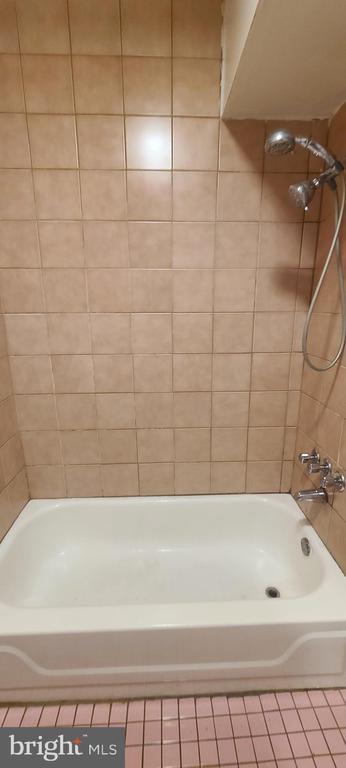
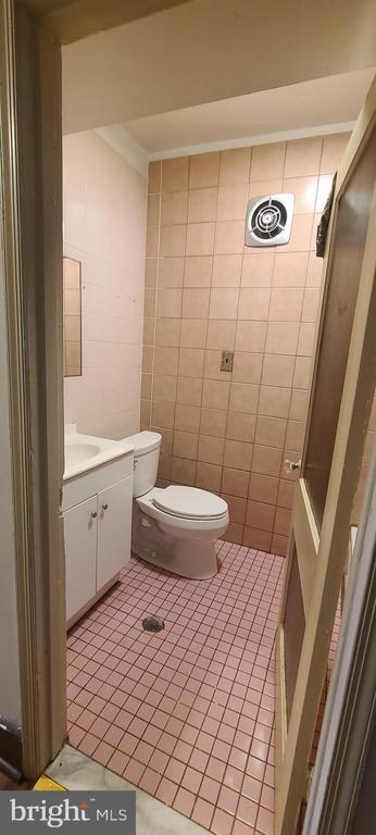
Bathrooms
1
-
Square Feet
2,730 sq ft
-
Available
Available Mar 11
4835 N Broad St

Favorites
About This Home
Available Mar 11
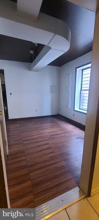
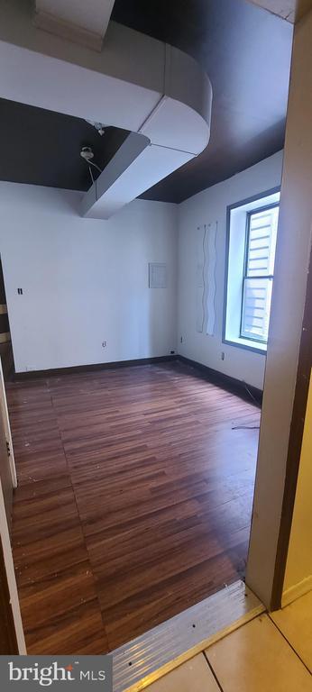
Welcome to this 2 bedroom apartment located in the logan section of the city. Convenient to everything in the city. Close to schools, restaurants, and public transportation. Background check and credit check a must. Schedule your tour today. Section 8 welcome.
4835 N Broad St is a townhome located in Philadelphia County and the 19141 ZIP Code. This area is served by the The School District of Philadelphia attendance zone.
* Price shown is base rent. Excludes user-selected optional fees and variable or usage-based fees and required charges due at or prior to move-in or at move-out. Price, availability, fees, and any applicable rent special are subject to change without notice.
* Square footage definitions vary. Displayed square footage is approximate.
Contact
- Listed by Janna Paris | KW Empower
- Phone Number
- Contact
-
Source
 Bright MLS, Inc.
Copyright © 2026 Bright MLS, Inc.
Location
Get Directions
Logan-Ogontz-Fern Rock, located about 10 miles north of the heart of Philadelphia, is a lively urban neighborhood full of residential areas, modern amenities, and exciting attractions. This city is popular for commuters since Route 611 and Highway 1 run through different parts of the neighborhood. Public transportation is also accessible via the Olney Transportation Center, located in the center of Logan-Ogontz-Fern Rock. The area is great for students as well because La Salle University, a small private Catholic university, sits on the western border of town.
Find family-friendly attractions at sprawling parks and historical sites, including the Wister Woods Park and the Stenton Mansion. A variety of local eateries are gathered along North 5th Street and North Broad Street while large shopping plazas with a plethora of stores can be found off these roads as well. Affordable rentals ranging in size and style can be found throughout the neighborhood.
Learn more about living in Logan-Ogontz-Fern Rock
Education
| Colleges & Universities | Distance | ||
|---|---|---|---|
| Colleges & Universities | Distance | ||
| Drive: | 3 min | 1.3 mi | |
| Drive: | 4 min | 1.6 mi | |
| Drive: | 4 min | 1.6 mi | |
| Drive: | 6 min | 2.8 mi |
4835 N Broad St is within 3 minutes or 1.3 miles from La Salle University. It is also near C.C. of Philadelphia, NW Ctr and Temple Univ., Health Center.
Schools

Public Elementary School
Grades PK-5
255 Students
Nearby
Public Elementary & Middle School
Grades K-8
369 Students
Attendance Zone
Charter High School
Grades 9-12
1,753 Students
Attendance Zone
Private Elementary & Middle School
Grades K-8
91 Students
Nearby
Private Elementary, Middle & High School
Grades PK-1, 3 & 5-12
16 Students
Nearby
School data provided by
 The GreatSchools Rating helps parents compare schools within a state based on a variety of school quality indicators and provides a helpful picture of how effectively each school serves all of its students. Ratings are on a scale of 1 (below average) to 10 (above average) and can include test scores, college readiness, academic progress, advanced courses, equity, discipline and attendance data. We also advise parents to visit schools, consider other information on school performance and programs, and consider family needs as part of the school selection process.
View GreatSchools Rating Methodology
Data provided by GreatSchools.org © 2026. All rights reserved.
View GreatSchools Rating Methodology
Data provided by GreatSchools.org © 2026. All rights reserved.
Transportation options available in Philadelphia include Wyoming, located 0.2 mile from 4835 N Broad St. 4835 N Broad St is near Philadelphia International, located 16.8 miles or 30 minutes away, and Trenton Mercer, located 28.6 miles or 49 minutes away.
| Transit / Subway | Distance | ||
|---|---|---|---|
| Transit / Subway | Distance | ||
|
|
Walk: | 3 min | 0.2 mi |
|
|
Walk: | 4 min | 0.2 mi |
|
|
Walk: | 12 min | 0.6 mi |
| Walk: | 16 min | 0.9 mi | |
| Drive: | 4 min | 1.5 mi |
| Commuter Rail | Distance | ||
|---|---|---|---|
| Commuter Rail | Distance | ||
|
|
Drive: | 2 min | 1.1 mi |
|
|
Drive: | 3 min | 1.3 mi |
| Drive: | 5 min | 1.3 mi | |
|
|
Drive: | 5 min | 1.7 mi |
|
|
Drive: | 5 min | 2.0 mi |
| Airports | Distance | ||
|---|---|---|---|
| Airports | Distance | ||
|
Philadelphia International
|
Drive: | 30 min | 16.8 mi |
|
Trenton Mercer
|
Drive: | 49 min | 28.6 mi |
Time and distance from 4835 N Broad St.
| Shopping Centers | Distance | ||
|---|---|---|---|
| Shopping Centers | Distance | ||
| Drive: | 4 min | 1.3 mi | |
| Drive: | 4 min | 1.8 mi | |
| Drive: | 4 min | 1.9 mi |
4835 N Broad St has 3 shopping centers within 1.9 miles, which is about a 4-minute drive. The miles and minutes will be for the farthest away property.
| Parks and Recreation | Distance | ||
|---|---|---|---|
| Parks and Recreation | Distance | ||
|
Awbury Arboretum
|
Drive: | 6 min | 2.5 mi |
|
Tacony Creek Park
|
Drive: | 9 min | 3.1 mi |
|
Wagner Free Institute of Science
|
Drive: | 10 min | 3.6 mi |
|
Edgar Allan Poe Nat'l Historic Site
|
Drive: | 13 min | 4.9 mi |
|
Philadelphia Zoo
|
Drive: | 13 min | 6.9 mi |
4835 N Broad St has 5 parks within 6.9 miles, including Awbury Arboretum, Tacony Creek Park, and Wagner Free Institute of Science.
| Hospitals | Distance | ||
|---|---|---|---|
| Hospitals | Distance | ||
| Walk: | 13 min | 0.7 mi | |
| Drive: | 4 min | 1.4 mi | |
| Drive: | 4 min | 1.6 mi |
4835 N Broad St has 3 hospitals within 1.6 miles, the nearest is Albert Einstein Medical Center which is 0.7 mile away and a 13 minute walk.
| Military Bases | Distance | ||
|---|---|---|---|
| Military Bases | Distance | ||
| Drive: | 23 min | 13.5 mi |
4835 N Broad St is 13.5 miles and a 23 minute drive from Philadelphia Naval Busi Center.
You May Also Like
Similar Rentals Nearby


What Are Walk Score®, Transit Score®, and Bike Score® Ratings?
Walk Score® measures the walkability of any address. Transit Score® measures access to public transit. Bike Score® measures the bikeability of any address.
What is a Sound Score Rating?
A Sound Score Rating aggregates noise caused by vehicle traffic, airplane traffic and local sources

4835 N Broad St
Philadelphia, PA 19141