
48 Englewood Ave
12 Month Lease
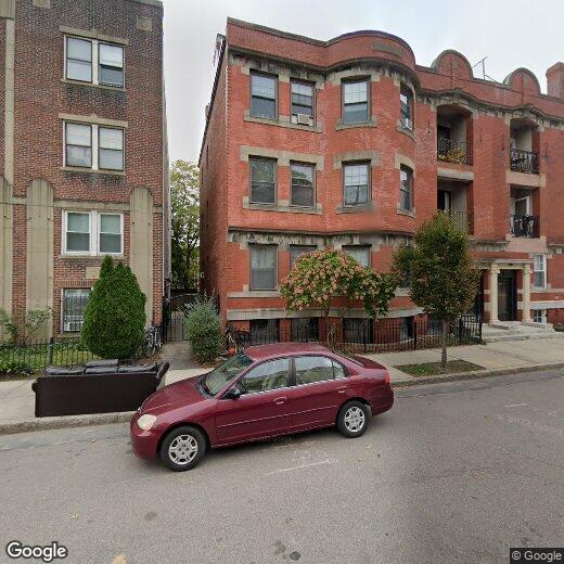
48 Englewood Ave
Boston, MA 02135
2 Weeks Ago
|
Edit
Favorites
48 Englewood Ave

Favorites
Check Back Soon for Upcoming Availability
48 Englewood Ave,
Boston,
MA
02135
Boston has been shaping American history since 1630, and living here means that past is never far from the present. As Massachusetts' capital and New England's cultural and financial center, the city carries real weight — intellectually, economically, and architecturally. More than 50 colleges and universities call the greater Boston area home, with institutions like Northeastern, Boston College, and Berklee College of Music woven directly into the city's neighborhoods. That academic presence fuels a steady demand for innovation, drawing employers in life sciences, technology, finance, and healthcare.
Neighborhoods here each carry a distinct personality. Beacon Hill delivers narrow gas-lit streets and Greek Revival rowhouses, while Back Bay is known for Victorian brownstones and the broad sweep of Commonwealth Avenue.
Learn more about living in Boston
Education
| Colleges & Universities | Distance | ||
|---|---|---|---|
| Colleges & Universities | Distance | ||
| Drive: | 4 min | 1.2 mi | |
| Drive: | 3 min | 1.3 mi | |
| Drive: | 6 min | 2.8 mi | |
| Drive: | 5 min | 2.9 mi |
48 Englewood Ave is within 4 minutes or 1.2 miles from Boston College, Brighton. It is also near Boston College and Boston University.
Transportation options available in Boston include Englewood Avenue Station, located 0.2 mile from 48 Englewood Ave. 48 Englewood Ave is near General Edward Lawrence Logan International, located 9.8 miles or 18 minutes away.
| Transit / Subway | Distance | ||
|---|---|---|---|
| Transit / Subway | Distance | ||
|
|
Walk: | 3 min | 0.2 mi |
|
|
Walk: | 5 min | 0.3 mi |
|
|
Walk: | 5 min | 0.3 mi |
|
|
Walk: | 7 min | 0.4 mi |
|
|
Walk: | 8 min | 0.4 mi |
| Commuter Rail | Distance | ||
|---|---|---|---|
| Commuter Rail | Distance | ||
|
|
Drive: | 7 min | 3.6 mi |
|
|
Drive: | 8 min | 3.9 mi |
|
|
Drive: | 9 min | 4.1 mi |
|
|
Drive: | 9 min | 4.7 mi |
| Drive: | 10 min | 5.0 mi |
| Airports | Distance | ||
|---|---|---|---|
| Airports | Distance | ||
|
General Edward Lawrence Logan International
|
Drive: | 18 min | 9.8 mi |
Walkability Near 48 Englewood Ave Boston, MA 02135
Getting Around
 What do Walkability, Transit, Drivability, and Bikeability mean?
Walkability measures the walking distance to day-to-day needs.
Transit measures access to public transportation.
Drivability measures congestion, parking availability, and access to major roads.
Bikeability measures the suitability for cycling.
How It Works
What do Walkability, Transit, Drivability, and Bikeability mean?
Walkability measures the walking distance to day-to-day needs.
Transit measures access to public transportation.
Drivability measures congestion, parking availability, and access to major roads.
Bikeability measures the suitability for cycling.
How It Works
Very Walkable
Walkability
80
/ 100
Good Public Transit
Transit
70
/ 100
Fairly Drivable
Drivability
40
/ 100
Moderately Bikeable
Bikeability
70
/ 100
Scores provided by
Active
Soundscore™
73
/ 100
Traffic
ActiveAirport
CalmBusinesses
ActiveScores provided by
HowLoud What is a Sound Score Rating? A Sound Score Rating aggregates noise caused by vehicle traffic, airplane traffic and local sources. How It WorksTime and distance from 48 Englewood Ave.
| Shopping Centers | Distance | ||
|---|---|---|---|
| Shopping Centers | Distance | ||
| Walk: | 12 min | 0.6 mi | |
| Walk: | 13 min | 0.7 mi | |
| Drive: | 5 min | 1.8 mi |
48 Englewood Ave has 3 shopping centers within 1.8 miles, which is about a 5-minute drive. The miles and minutes will be for the farthest away property.
| Parks and Recreation | Distance | ||
|---|---|---|---|
| Parks and Recreation | Distance | ||
|
Chestnut Hill Reservation
|
Walk: | 5 min | 0.3 mi |
|
Frederick Law Olmsted National Historic Site
|
Drive: | 4 min | 1.6 mi |
|
John Fitzgerald Kennedy National Historic Site
|
Drive: | 4 min | 1.8 mi |
|
Hammond Pond Reservation
|
Drive: | 4 min | 2.4 mi |
|
Coit Observatory
|
Drive: | 6 min | 3.3 mi |
48 Englewood Ave has 5 parks within 3.3 miles, including Chestnut Hill Reservation, Frederick Law Olmsted National Historic Site, and John Fitzgerald Kennedy National Historic Site.
| Hospitals | Distance | ||
|---|---|---|---|
| Hospitals | Distance | ||
| Drive: | 3 min | 1.3 mi | |
| Drive: | 3 min | 1.4 mi | |
| Drive: | 4 min | 2.1 mi |
48 Englewood Ave has 3 hospitals within 2.1 miles, the nearest is Franciscan Children's Hospital & Rehab Center which is 1.3 miles away and a 3 minute drive.
| Military Bases | Distance | ||
|---|---|---|---|
| Military Bases | Distance | ||
| Drive: | 22 min | 13.0 mi | |
| Drive: | 28 min | 15.7 mi |
48 Englewood Ave is 13.0 miles from US Military Reservation, and is convenient to other military bases, including Hanscom Air Force Base.
You May Also Like
Similar Rentals Nearby


What Are Walk Score®, Transit Score®, and Bike Score® Ratings?
Walk Score® measures the walkability of any address. Transit Score® measures access to public transit. Bike Score® measures the bikeability of any address.
What is a Sound Score Rating?
A Sound Score Rating aggregates noise caused by vehicle traffic, airplane traffic and local sources.