48 Dudley St
48 Dudley St,
Boston,
MA
02119
2 Weeks Ago
Favorites
48 Dudley St

Favorites
Check Back Soon for Upcoming Availability
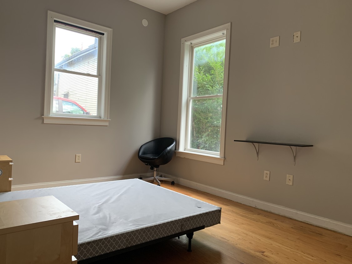
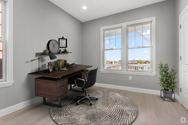
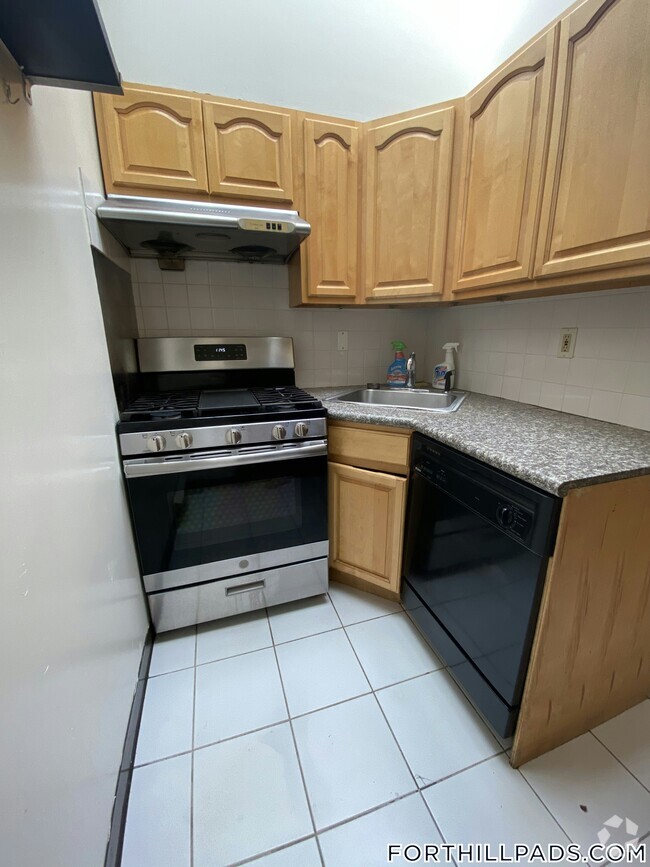
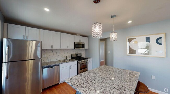
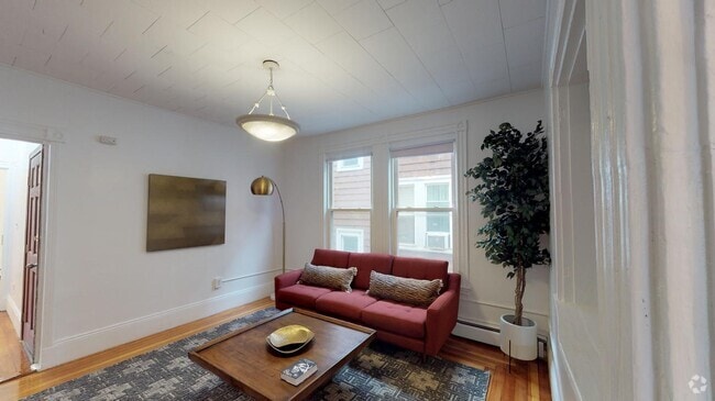
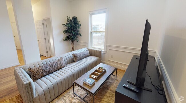
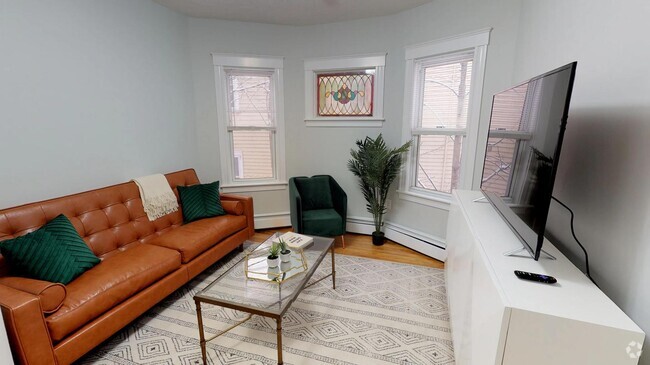
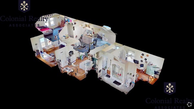
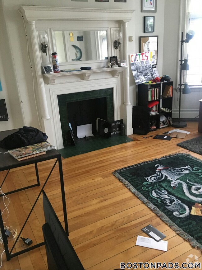
About 48 Dudley St Boston, MA 02119
ROOM FOR RENT IN SHARED APARTMENT LAUNDRY IN UNIT
48 Dudley St is a condo located in Suffolk County and the 02119 ZIP Code. This area is served by the Boston Public Schools attendance zone.
Condo Features
- Washer/Dryer
- Smoke Free
- Furnished
- Laundry Facilities
Fees and Policies
The fees below are based on community-supplied data and may exclude additional fees and utilities.
- Parking
-
Street--
Details
Lease Options
-
1 Month
Property Information
-
2 units
-
Furnished Units Available
Location
Get Directions
Situated between the South End and Dudley Square, Lower Roxbury is a predominantly residential neighborhood brimming with apartments and town houses available for rent. Residents enjoy a walkable urban environment filled with diverse historical architecture.
Warren Street and Washington Street are the neighborhood’s main commercial thoroughfares, touting rows of specialty shops, markets, and eateries in historic buildings. Northeastern University, Wentworth Institute of Technology, and Massachusetts College of Art and Design are all just northwest of Lower Roxbury, offering the community a bevy of cultural and educational amenities. Getting around from Lower Roxbury is easy with access to multiple T stops on the Orange Line.
Learn more about living in Lower RoxburyBelow are rent ranges for similar nearby apartments
| Beds | Average Size | Lowest | Typical | Premium |
|---|---|---|---|---|
| Studio Studio Studio | 5200 Sq Ft | $1,800 | $2,168 | $2,790 |
| 1 Bed 1 Bed 1 Bed | 3989-3998 Sq Ft | $1,900 | $2,453 | $3,699 |
| 2 Beds 2 Beds 2 Beds | 3623-3625 Sq Ft | $2,200 | $3,394 | $8,700 |
| 3 Beds 3 Beds 3 Beds | 5430 Sq Ft | $1,025 | $4,391 | $7,400 |
| 4 Beds 4 Beds 4 Beds | 6690 Sq Ft | $1,150 | $5,383 | $9,500 |
Amenities
- Washer/Dryer
- Smoke Free
- Furnished
- Laundry Facilities
Education
| Colleges & Universities | Distance | ||
|---|---|---|---|
| Colleges & Universities | Distance | ||
| Walk: | 18 min | 0.9 mi | |
| Drive: | 3 min | 1.3 mi | |
| Drive: | 3 min | 1.5 mi | |
| Drive: | 5 min | 1.7 mi |
48 Dudley St is within 18 minutes or 0.9 mile from Wentworth Inst. of Technology. It is also near MCPHS University, Boston and MassArt.
Schools


Public Elementary School
Grades PK-6
169 Students
Nearby
Public Middle School
Grades 6-8
205 Students
Nearby
Public Middle & High School
Grades 7-12
1,567 Students
Nearby
Private Elementary, Middle & High School
Grades 1-10
Nearby
Private Elementary & Middle School
Grades 5-8
Nearby
Private Elementary School
Grades PK-6
122 Students
Nearby
Private Middle & High School
Grades 7-12
292 Students
Nearby
School data provided by
 The GreatSchools Rating helps parents compare schools within a state based on a variety of school quality indicators and provides a helpful picture of how effectively each school serves all of its students. Ratings are on a scale of 1 (below average) to 10 (above average) and can include test scores, college readiness, academic progress, advanced courses, equity, discipline and attendance data. We also advise parents to visit schools, consider other information on school performance and programs, and consider family needs as part of the school selection process.
View GreatSchools Rating Methodology
View GreatSchools Rating Methodology
Transportation options available in Boston include Roxbury Crossing Station, located 0.5 mile from 48 Dudley St. 48 Dudley St is near General Edward Lawrence Logan International, located 6.0 miles or 12 minutes away.
| Transit / Subway | Distance | ||
|---|---|---|---|
| Transit / Subway | Distance | ||
|
|
Walk: | 9 min | 0.5 mi |
|
|
Drive: | 2 min | 1.2 mi |
|
|
Drive: | 3 min | 1.3 mi |
|
|
Drive: | 3 min | 1.4 mi |
|
|
Drive: | 4 min | 1.8 mi |
| Commuter Rail | Distance | ||
|---|---|---|---|
| Commuter Rail | Distance | ||
| Drive: | 3 min | 1.3 mi | |
|
|
Drive: | 3 min | 1.4 mi |
|
|
Drive: | 4 min | 1.7 mi |
|
|
Drive: | 8 min | 2.3 mi |
|
|
Drive: | 10 min | 5.1 mi |
| Airports | Distance | ||
|---|---|---|---|
| Airports | Distance | ||
|
General Edward Lawrence Logan International
|
Drive: | 12 min | 6.0 mi |
Time and distance from 48 Dudley St.
| Shopping Centers | Distance | ||
|---|---|---|---|
| Shopping Centers | Distance | ||
| Walk: | 18 min | 0.9 mi | |
| Drive: | 4 min | 1.7 mi | |
| Drive: | 6 min | 2.4 mi |
48 Dudley St has 3 shopping centers within 2.4 miles, which is about a 6-minute walk. The miles and minutes will be for the farthest away property.
| Parks and Recreation | Distance | ||
|---|---|---|---|
| Parks and Recreation | Distance | ||
|
Roxbury Heritage State Park
|
Walk: | 4 min | 0.2 mi |
|
Lower Neponset River Trail
|
Drive: | 4 min | 1.9 mi |
|
Franklin Park Zoo
|
Drive: | 4 min | 2.1 mi |
|
Charles River Reservation
|
Drive: | 6 min | 2.8 mi |
|
Coit Observatory
|
Drive: | 7 min | 3.2 mi |
48 Dudley St has 5 parks within 3.2 miles, including Roxbury Heritage State Park, Lower Neponset River Trail, and Franklin Park Zoo.
| Hospitals | Distance | ||
|---|---|---|---|
| Hospitals | Distance | ||
| Walk: | 17 min | 0.9 mi | |
| Drive: | 3 min | 1.2 mi | |
| Drive: | 3 min | 1.4 mi |
48 Dudley St has 3 hospitals within 1.4 miles, the nearest is Boston Medical Center which is 0.9 mile away and a 17 minute walk.
| Military Bases | Distance | ||
|---|---|---|---|
| Military Bases | Distance | ||
| Drive: | 32 min | 16.3 mi |
48 Dudley St is 16.3 miles and a 32 minute drive from Hanscom Air Force Base.
You May Also Like
Similar Rentals Nearby
What Are Walk Score®, Transit Score®, and Bike Score® Ratings?
Walk Score® measures the walkability of any address. Transit Score® measures access to public transit. Bike Score® measures the bikeability of any address.
What is a Sound Score Rating?
A Sound Score Rating aggregates noise caused by vehicle traffic, airplane traffic and local sources