

$3,300
Total Monthly Price
12 Month Lease
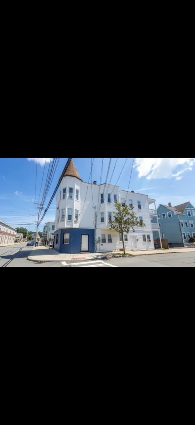
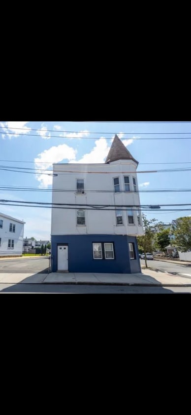
47 Nichols St Unit 2
Everett, MA 02149
Today
Favorites
857-386-7680
-
Bedrooms
3
-
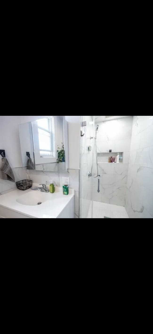
Bathrooms
1
-
Square Feet
1,350 sq ft
-
Available
Available Oct 15
Highlight
- Balcony
47 Nichols St Unit 2

Favorites
About This Home
12 Month Lease
,
Available Oct 15
Spacious 2/3 bedroom apartment with newly renovated bathroom. Gas heat and 2 parking spaces. Large dining room and living room. Available October 15. Owner pays water and sewer. Tenant pays gas and electric.
Large 2/3 bedrooms. 2 parking gas heat newly renovated bathroom. Available October 15.
47 Nichols St is an apartment community located in Middlesex County and the 02149 ZIP Code.
* Price shown is total price based on community-supplied monthly required fees. Excludes user-selected optional fees and variable or usage-based fees and required charges due at or prior to move-in or at move-out. Price, availability, fees, and any applicable rent special are subject to change without notice.
* Square footage definitions vary. Displayed square footage is approximate.
Apartment Features
Washer/Dryer
Dishwasher
Granite Countertops
Microwave
- Washer/Dryer
- Heating
- Tub/Shower
- Dishwasher
- Granite Countertops
- Kitchen
- Microwave
- Oven
- Refrigerator
- Dining Room
- High Ceilings
- Large Bedrooms
- Balcony
Fees and Policies
The fees below are based on community-supplied data and may exclude additional fees and utilities.
- Parking
-
Surface Lot--
Details
Utilities Included
-
Gas
-
Water
-
Sewer
Contact
- Phone Number
- Contact
Location
Get Directions
Characterized by rolling hills and historic row houses, the Glendale neighborhood in Everett maintains that rare suburban charm that harks back to simpler days of strolling in the park and gathering with neighbors. This neighborhood lies less than one mile north of Downtown Everett and just five miles north of downtown Boston, putting some of the state's hottest shopping and entertainment at your fingertips. With Everett High School at its core, this multicultural community draws in couples and families looking for an affordable home close to Boston. Urban professionals from diverse backgrounds also flock to Glendale for its well-executed public transportation system.
Learn more about living in Glendale
Education
| Colleges & Universities | Distance | ||
|---|---|---|---|
| Colleges & Universities | Distance | ||
| Drive: | 7 min | 3.3 mi | |
| Drive: | 9 min | 4.3 mi | |
| Drive: | 10 min | 5.8 mi | |
| Drive: | 11 min | 6.7 mi |
47 Nichols St Unit 2 is within 7 minutes or 3.3 miles from Bunker Hill Community College. It is also near Tufts Univ., Medford and Suffolk University.
Transportation options available in Everett include Wellington Station, located 2.2 miles from 47 Nichols St Unit 2. 47 Nichols St Unit 2 is near General Edward Lawrence Logan International, located 4.3 miles or 10 minutes away.
| Transit / Subway | Distance | ||
|---|---|---|---|
| Transit / Subway | Distance | ||
|
|
Drive: | 5 min | 2.2 mi |
|
|
Drive: | 4 min | 2.3 mi |
|
|
Drive: | 8 min | 3.2 mi |
| Drive: | 7 min | 3.4 mi | |
|
|
Drive: | 7 min | 3.9 mi |
| Commuter Rail | Distance | ||
|---|---|---|---|
| Commuter Rail | Distance | ||
| Drive: | 3 min | 1.1 mi | |
|
|
Drive: | 4 min | 2.3 mi |
|
|
Drive: | 7 min | 3.8 mi |
|
|
Drive: | 9 min | 4.4 mi |
|
|
Drive: | 8 min | 4.5 mi |
| Airports | Distance | ||
|---|---|---|---|
| Airports | Distance | ||
|
General Edward Lawrence Logan International
|
Drive: | 10 min | 4.3 mi |
Time and distance from 47 Nichols St Unit 2.
| Shopping Centers | Distance | ||
|---|---|---|---|
| Shopping Centers | Distance | ||
| Walk: | 10 min | 0.6 mi | |
| Walk: | 11 min | 0.6 mi | |
| Drive: | 3 min | 1.2 mi |
47 Nichols St Unit 2 has 3 shopping centers within 1.2 miles, which is about a 3-minute walk. The miles and minutes will be for the farthest away property.
| Parks and Recreation | Distance | ||
|---|---|---|---|
| Parks and Recreation | Distance | ||
|
Mystic River Reservation
|
Drive: | 7 min | 3.3 mi |
|
Museum of Science
|
Drive: | 9 min | 4.0 mi |
|
Belle Isle Marsh Reservation
|
Drive: | 8 min | 4.0 mi |
|
Revere Beach Reservation
|
Drive: | 8 min | 4.1 mi |
|
Boston National Historical Park
|
Drive: | 9 min | 5.6 mi |
47 Nichols St Unit 2 has 5 parks within 5.6 miles, including Mystic River Reservation, Belle Isle Marsh Reservation, and Revere Beach Reservation.
| Hospitals | Distance | ||
|---|---|---|---|
| Hospitals | Distance | ||
| Drive: | 8 min | 4.4 mi | |
| Drive: | 9 min | 4.5 mi | |
| Drive: | 9 min | 5.4 mi |
47 Nichols St Unit 2 has 3 hospitals within 5.4 miles, the nearest is MelroseWakefield Healthcare which is 4.4 miles away and a 8 minute drive.
| Military Bases | Distance | ||
|---|---|---|---|
| Military Bases | Distance | ||
| Drive: | 25 min | 13.9 mi | |
| Drive: | 26 min | 14.7 mi |
47 Nichols St Unit 2 is 13.9 miles from Fort Pickering, and is convenient to other military bases, including Fort Miller.
Amenities
- Washer/Dryer
- Heating
- Tub/Shower
- Dishwasher
- Granite Countertops
- Kitchen
- Microwave
- Oven
- Refrigerator
- Dining Room
- High Ceilings
- Large Bedrooms
- Balcony
47 Nichols St Unit 2 Photos
What Are Walk Score®, Transit Score®, and Bike Score® Ratings?
Walk Score® measures the walkability of any address. Transit Score® measures access to public transit. Bike Score® measures the bikeability of any address.
What is a Sound Score Rating?
A Sound Score Rating aggregates noise caused by vehicle traffic, airplane traffic and local sources
47 Nichols St
Everett, MA 02149