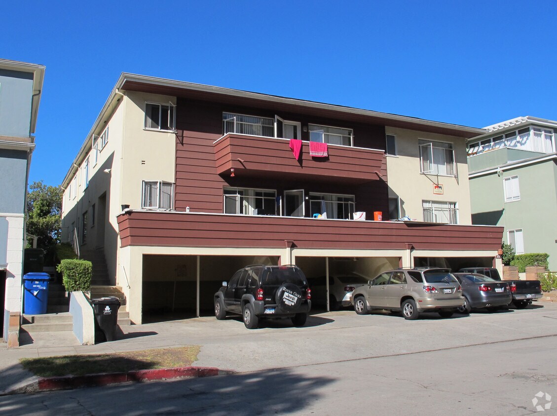
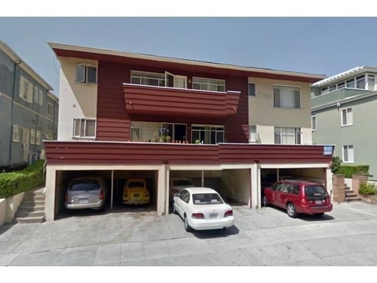
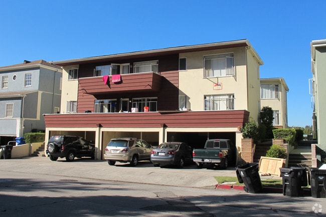
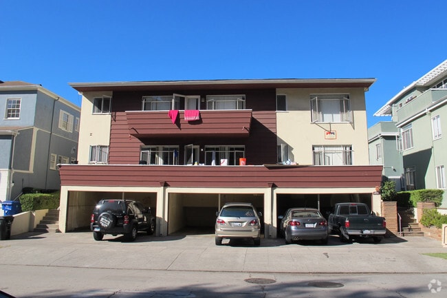
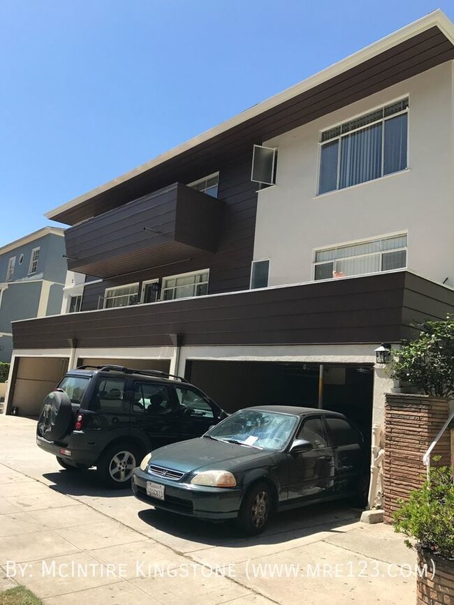
459 Landfair Ave
459 Landfair Ave,
Los Angeles,
CA
90024
2 Weeks Ago
Favorites
459 Landfair Ave
Favorites
No Unit Information Available for this Listing
Fees and Policies
Details
Property Information
-
Built in 1949
-
8 units/3 stories
About 459 Landfair Ave Los Angeles, CA 90024
---- SCHEDULE A SHOWING ONLINE AT: ---- *This unit is not currently available or ready to tour -- please call for an estimated ready date. Pricing is subject to change. This unit is a dream come true! It provides comfort like no other; located in a prime location -- just a short distance to public transportation, restaurants, shopping, coffee shops, fast food places, and more! Check out each unit for amenities and inclusions! Grocery Stores - Ralphs - Vons - Sprouts Farmers Market - Whole Foods Market - Trader Joe's Convenience Stores - 7-Eleven - Hill Top Shop - Duffl Cafes & Restaurants - Starbucks - Espresso Profeta - Peet's Coffee - La Colombe Coffee Roasters - BJ's Restaurant & Brewhouse - Eduardo's Border Grill - Pomodoro Trattoria - Fresh Corn Grill - Westwood Parks & Entertainment - Westwood Gardens Park - Holmby Park - Stoner Park - Coldwater Canyon Park - Westwood Recreation Center - Cheviot Hills Recreation Center *ASK FOR PARKING PRICING & AVAILABILITY *Renters Insurance Required *PHOTOS MAY OR MAY NOT BE OF EXACT UNIT(S), MAY OR MAY NOT HAVE SIMILAR FEATURES Water
459 Landfair Ave is an apartment community located in Los Angeles County and the 90024 ZIP Code. This area is served by the Los Angeles Unified attendance zone.
Unique Features
- Washer/Dryer
Contact
Apartment Features
- Washer/Dryer
Location
Get Directions
Amenities
- Washer/Dryer
- Washer/Dryer
Home to UCLA, Westwood lies on the west side of the city and is considered to be one of Los Angeles’ premier neighborhoods. Bordered by Beverly Hills, Bel Air, Brentwood, and Century City, multimillion dollar homes populate the landscape and students pay a premium to rent near campus.
The university itself serves as a major cultural center for the community, including on-campus attractions (such as the Fowler Museum and the Franklin D. Murphy Sculpture Garden) and university-affiliated venues off-campus (The Hammer Museum, the Geffen Playhouse), as well as the presence of thousands of students and faculty members throughout the neighborhood.
Directly south of campus, Westwood Village is a historic shopping district that features blocks of restaurants and businesses catering to both students and the neighborhood’s larger workforce. Many prominent corporations and law offices are found along Wilshire Boulevard, one of the busiest east-west transit corridors across the city.
Learn more about living in Westwood
Education
| Colleges & Universities | Distance | ||
|---|---|---|---|
| Colleges & Universities | Distance | ||
| Walk: | 12 min | 0.7 mi | |
| Drive: | 10 min | 3.9 mi | |
| Drive: | 14 min | 4.1 mi | |
| Drive: | 11 min | 4.9 mi |
459 Landfair Ave is within 12 minutes or 0.7 mile from UCLA. It is also near Santa Monica Coll., Academy and Mount St. Mary's Coll, Chalon.
Schools


Public Elementary School
Grades K-5
569 Students
Attendance Zone
Public Elementary School
Grades K-5
611 Students
Nearby
Charter Elementary School
Grades K-5
428 Students
Nearby
Charter Middle School
Grades 6-8
492 Students
Attendance Zone
Charter High School
Grades 9-12
1,338 Students
Attendance Zone
Private Elementary, Middle & High School
Grades PK-12
Nearby
Private High School
Grades 9-12
396 Students
Nearby
School data provided by
 The GreatSchools Rating helps parents compare schools within a state based on a variety of school quality indicators and provides a helpful picture of how effectively each school serves all of its students. Ratings are on a scale of 1 (below average) to 10 (above average) and can include test scores, college readiness, academic progress, advanced courses, equity, discipline and attendance data. We also advise parents to visit schools, consider other information on school performance and programs, and consider family needs as part of the school selection process.
View GreatSchools Rating Methodology
Data provided by GreatSchools.org © 2025. All rights reserved.
View GreatSchools Rating Methodology
Data provided by GreatSchools.org © 2025. All rights reserved.
Transportation options available in Los Angeles include Westwood/Rancho Park, located 2.9 miles from 459 Landfair Ave. 459 Landfair Ave is near Los Angeles International, located 11.4 miles or 19 minutes away, and Bob Hope, located 16.7 miles or 26 minutes away.
| Transit / Subway | Distance | ||
|---|---|---|---|
| Transit / Subway | Distance | ||
|
|
Drive: | 8 min | 2.9 mi |
| Drive: | 7 min | 3.1 mi | |
|
|
Drive: | 9 min | 4.6 mi |
|
|
Drive: | 11 min | 4.7 mi |
|
|
Drive: | 11 min | 5.9 mi |
| Commuter Rail | Distance | ||
|---|---|---|---|
| Commuter Rail | Distance | ||
|
|
Drive: | 20 min | 13.0 mi |
|
|
Drive: | 26 min | 16.7 mi |
|
|
Drive: | 26 min | 17.5 mi |
| Drive: | 27 min | 17.5 mi | |
|
|
Drive: | 27 min | 17.6 mi |
| Airports | Distance | ||
|---|---|---|---|
| Airports | Distance | ||
|
Los Angeles International
|
Drive: | 19 min | 11.4 mi |
|
Bob Hope
|
Drive: | 26 min | 16.7 mi |
Time and distance from 459 Landfair Ave.
| Shopping Centers | Distance | ||
|---|---|---|---|
| Shopping Centers | Distance | ||
| Walk: | 13 min | 0.7 mi | |
| Walk: | 13 min | 0.7 mi | |
| Walk: | 15 min | 0.8 mi |
459 Landfair Ave has 3 shopping centers within 0.8 mile, which is about a 15-minute walk. The miles and minutes will be for the farthest away property.
| Parks and Recreation | Distance | ||
|---|---|---|---|
| Parks and Recreation | Distance | ||
|
Mathias Botanical Garden
|
Walk: | 16 min | 0.9 mi |
|
Hannah Carter Japanese Garden
|
Drive: | 6 min | 2.2 mi |
|
Virginia Robinson Gardens
|
Drive: | 11 min | 3.9 mi |
|
Will Rogers State Historic Park
|
Drive: | 17 min | 6.6 mi |
|
Franklin Canyon Park
|
Drive: | 19 min | 6.8 mi |
459 Landfair Ave has 5 parks within 6.8 miles, including Mathias Botanical Garden, Hannah Carter Japanese Garden, and Virginia Robinson Gardens.
| Hospitals | Distance | ||
|---|---|---|---|
| Hospitals | Distance | ||
| Walk: | 13 min | 0.7 mi | |
| Walk: | 13 min | 0.7 mi | |
| Drive: | 10 min | 4.0 mi |
459 Landfair Ave has 3 hospitals within 4.0 miles, the nearest is Stewart and Lynda Resnick Neuropsychiatric Hospital at UCLA which is 0.7 mile away and a 13 minute walk.
| Military Bases | Distance | ||
|---|---|---|---|
| Military Bases | Distance | ||
| Drive: | 20 min | 14.0 mi |
459 Landfair Ave is 14.0 miles and a 20 minute drive from Los Angeles Air Force Base.
You May Also Like
Similar Rentals Nearby


 - AVA Burbank")
 - Violet on Virgil")

What Are Walk Score®, Transit Score®, and Bike Score® Ratings?
Walk Score® measures the walkability of any address. Transit Score® measures access to public transit. Bike Score® measures the bikeability of any address.
What is a Sound Score Rating?
A Sound Score Rating aggregates noise caused by vehicle traffic, airplane traffic and local sources
Responded To This Review