
Venue Residences
3688 Overland Ave,
Los Angeles, CA 90034
$3,550 - $4,795
1-2 Beds


At 451 S Bixel St, find a great place to live. This apartment community is located on S. Bixel St. in Los Angeles. Make sure you to view the available floorplans. At this community, you'll experience a wide variety in options of amenities and features. Some of these include: smoke free options and high-speed internet access. Get a head start on moving now. Contact or stop by 451 S Bixel St to check the current floorplan availability!
451 S Bixel St is an apartment community located in Los Angeles County and the 90017 ZIP Code. This area is served by the Los Angeles Unified Rocp School District attendance zone.
Acceso a Internet de alta velocidad
Libre de humo
Calefacción
Cocina
Nestled along State Route 11, City West is just what you’d expect it to be — it’s directly west of Downtown Los Angeles. Home to hospitals, public schools, and neighborhood parks, City West is the perfect suburb for renters wanting to stay close to the heart of Los Angeles. Apartments, houses, condos, and townhomes are available for rent in the area, ranging from affordable to upscale. This family-friendly sector of the city provides residents with a break from big-city living while still offering a quick commute for work or leisure. Enjoy scenic views of the city skyline from Vista Hermosa Natural Park or enjoy a free summer concert nearby at Levitt Pavilion.
Learn more about living in City WestCompare neighborhood and city base rent averages by bedroom.
| City West | Los Angeles, CA | |
|---|---|---|
| Studio | $1,551 | $1,712 |
| 1 Bedroom | $2,296 | $2,178 |
| 2 Bedrooms | $2,958 | $3,017 |
| 3 Bedrooms | $3,415 | $4,255 |
| Colleges & Universities | Distance | ||
|---|---|---|---|
| Colleges & Universities | Distance | ||
| Walk: | 12 min | 0.6 mi | |
| Walk: | 14 min | 0.8 mi | |
| Drive: | 2 min | 1.1 mi | |
| Drive: | 5 min | 2.0 mi |


Transportation options available in Los Angeles include 7Th Street/Metro Center Station, located 0.7 mile from 451 S Bixel St. 451 S Bixel St is near Los Angeles International, located 14.5 miles or 24 minutes away, and Bob Hope, located 15.7 miles or 24 minutes away.
| Transit / Subway | Distance | ||
|---|---|---|---|
| Transit / Subway | Distance | ||
|
|
Walk: | 13 min | 0.7 mi |
| Walk: | 13 min | 0.7 mi | |
|
|
Walk: | 19 min | 1.0 mi |
|
|
Drive: | 2 min | 1.2 mi |
| Drive: | 2 min | 1.2 mi |
| Commuter Rail | Distance | ||
|---|---|---|---|
| Commuter Rail | Distance | ||
|
|
Drive: | 5 min | 2.2 mi |
|
|
Drive: | 7 min | 2.3 mi |
|
|
Drive: | 10 min | 5.7 mi |
| Drive: | 9 min | 6.1 mi | |
|
|
Drive: | 17 min | 10.8 mi |
| Airports | Distance | ||
|---|---|---|---|
| Airports | Distance | ||
|
Los Angeles International
|
Drive: | 24 min | 14.5 mi |
|
Bob Hope
|
Drive: | 24 min | 15.7 mi |
Scores provided by
Traffic
-Airport
-Businesses
-Scores provided by
HowLoud What is a Sound Score Rating? A Sound Score Rating aggregates noise caused by vehicle traffic, airplane traffic and local sources. How It WorksTime and distance from 451 S Bixel St.
| Shopping Centers | Distance | ||
|---|---|---|---|
| Shopping Centers | Distance | ||
| Walk: | 10 min | 0.5 mi | |
| Walk: | 13 min | 0.7 mi | |
| Walk: | 14 min | 0.7 mi |
| Parks and Recreation | Distance | ||
|---|---|---|---|
| Parks and Recreation | Distance | ||
|
Vista Hermosa Natural Park
|
Walk: | 13 min | 0.7 mi |
|
MacArthur Park Lake
|
Drive: | 3 min | 1.3 mi |
|
Echo Park Lake
|
Drive: | 3 min | 1.4 mi |
|
Chavez Ravine Arboretum
|
Drive: | 6 min | 2.8 mi |
|
Elysian Park
|
Drive: | 10 min | 4.3 mi |
| Hospitals | Distance | ||
|---|---|---|---|
| Hospitals | Distance | ||
| Walk: | 7 min | 0.4 mi | |
| Walk: | 19 min | 1.0 mi | |
| Drive: | 2 min | 1.1 mi |
| Military Bases | Distance | ||
|---|---|---|---|
| Military Bases | Distance | ||
| Drive: | 21 min | 16.1 mi |
What Are Walk Score®, Transit Score®, and Bike Score® Ratings?
Walk Score® measures the walkability of any address. Transit Score® measures access to public transit. Bike Score® measures the bikeability of any address.
What is a Sound Score Rating?
A Sound Score Rating aggregates noise caused by vehicle traffic, airplane traffic and local sources.
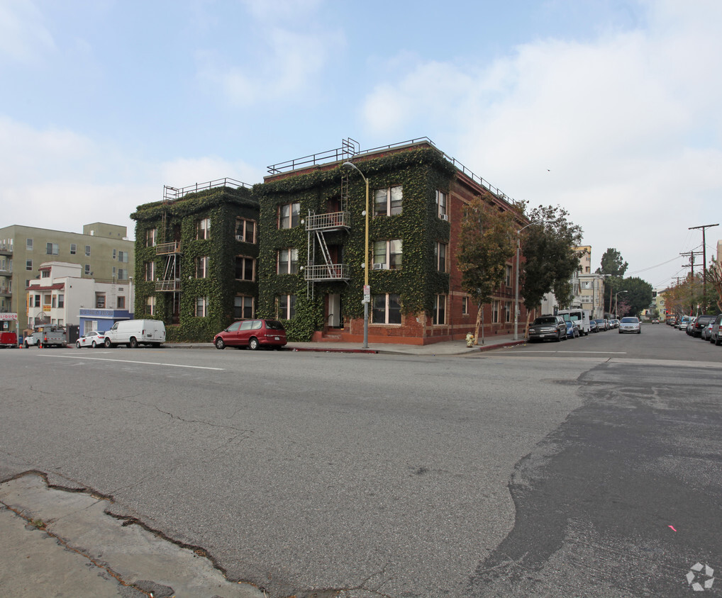
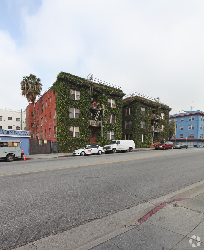
451 S Bixel St
Los Angeles, CA 90017


