
$2,800 / Month
219-245 45th St Unit 2
Brooklyn, NY 11220
2 Weeks Ago
Favorites
45 STREET

Favorites
Check Back Soon for Upcoming Availability
| Beds | Baths | Average SF |
|---|---|---|
| 3 Bedrooms 3 Bedrooms 3 Br | 1 Bath 1 Bath 1 Ba | — |
About This Property
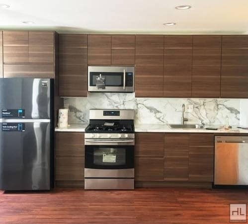
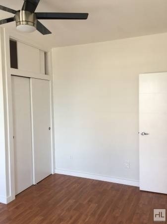
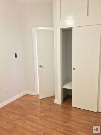
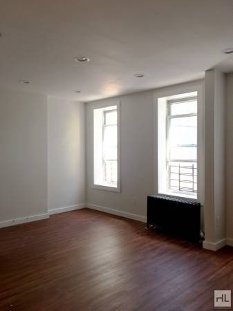
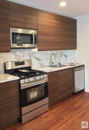
Available Now! Modern Open-Concept Apartment for Rent. ALL NEW! JUST RENOVATED!3 BedroomsStainless Steel AppliancesDISHWASHER included.Custom Kitchen Design. Near Industry City, Costco, Bush Terminal Park, DNR Trains, Micro Center, PetCo, ABC Home, Saks OFF 5th and more! Transportation:TRAIN45th street R train station 2 streets away36th street D, N, R train stationOnly 35 minutes away from lower Manhattan BUSB37, B63, B353 bus lines close by on 3rd avenue and on 5th avenue FERRYFerry only 10 min away. Wall St in 12 min.===Ref:558031===
45 STREET is an apartment community located in Kings County and the 11220 ZIP Code.
Location
Get Directions
Situated on the Upper Bay of the Hudson River, Sunset Park is a vibrant neighborhood in southwestern Brooklyn. The neighborhood is home to a park of the same name, featuring 24.5 acres of space for outdoor recreation as well as stunning views of the Manhattan skyline.
Tucked between Park Slope and Bay Ridge, Sunset Park is known for its diverse restaurants, lively festivals, and numerous supermarkets. Sunset Park also contains Industry City, a complex of towering warehouses on cobblestone streets, which houses a slew of coffee shops, eateries, art galleries, and offices for hundreds of companies. Convenience to the D, N, and R subway lines places Sunset Park within minutes of all that NYC has to offer.
Learn more about living in Sunset ParkBelow are rent ranges for similar nearby apartments
Education
| Colleges & Universities | Distance | ||
|---|---|---|---|
| Colleges & Universities | Distance | ||
| Drive: | 9 min | 3.6 mi | |
| Drive: | 9 min | 3.6 mi | |
| Drive: | 9 min | 4.0 mi | |
| Drive: | 12 min | 4.7 mi |
45 STREET is within 9 minutes or 3.6 miles from ASA College Brooklyn. It is also near Brooklyn Law School and St. Francis College.
Transportation options available in Brooklyn include 45 Street, located 0.3 mile from 45 STREET. 45 STREET is near LaGuardia, located 14.2 miles or 27 minutes away, and Newark Liberty International, located 17.7 miles or 31 minutes away.
| Transit / Subway | Distance | ||
|---|---|---|---|
| Transit / Subway | Distance | ||
|
|
Walk: | 5 min | 0.3 mi |
|
|
Walk: | 13 min | 0.7 mi |
|
|
Walk: | 14 min | 0.7 mi |
|
|
Drive: | 3 min | 1.3 mi |
|
|
Drive: | 3 min | 1.4 mi |
| Commuter Rail | Distance | ||
|---|---|---|---|
| Commuter Rail | Distance | ||
|
|
Drive: | 10 min | 3.7 mi |
|
|
Drive: | 13 min | 7.3 mi |
|
|
Drive: | 16 min | 8.0 mi |
|
|
Drive: | 18 min | 8.6 mi |
|
|
Drive: | 20 min | 9.2 mi |
| Airports | Distance | ||
|---|---|---|---|
| Airports | Distance | ||
|
LaGuardia
|
Drive: | 27 min | 14.2 mi |
|
Newark Liberty International
|
Drive: | 31 min | 17.7 mi |
Time and distance from 45 STREET.
| Shopping Centers | Distance | ||
|---|---|---|---|
| Shopping Centers | Distance | ||
| Drive: | 6 min | 1.9 mi | |
| Drive: | 5 min | 2.2 mi | |
| Drive: | 6 min | 2.8 mi |
45 STREET has 3 shopping centers within 2.8 miles, which is about a 6-minute drive. The miles and minutes will be for the farthest away property.
| Parks and Recreation | Distance | ||
|---|---|---|---|
| Parks and Recreation | Distance | ||
|
Sunset Park
|
Walk: | 13 min | 0.7 mi |
|
Owl's Head Park
|
Drive: | 6 min | 2.3 mi |
|
Red Hook Park
|
Drive: | 6 min | 2.6 mi |
|
Waterfront Museum & Showboat Barge
|
Drive: | 8 min | 3.5 mi |
|
Narrows Botanical Gardens
|
Drive: | 11 min | 5.2 mi |
45 STREET has 5 parks within 5.2 miles, including Sunset Park, Owl's Head Park, and Narrows Botanical Gardens.
| Hospitals | Distance | ||
|---|---|---|---|
| Hospitals | Distance | ||
| Drive: | 4 min | 1.4 mi | |
| Drive: | 8 min | 3.0 mi | |
| Drive: | 11 min | 4.6 mi |
45 STREET has 3 hospitals within 4.6 miles, the nearest is Maimonides Medical Center which is 1.4 miles away and a 4 minute drive.
| Military Bases | Distance | ||
|---|---|---|---|
| Military Bases | Distance | ||
| Drive: | 8 min | 3.8 mi | |
| Drive: | 13 min | 6.3 mi | |
| Drive: | 16 min | 8.1 mi |
45 STREET has 3 military bases within 8.1 miles, the nearest is Fort Hamilton which is 3.8 miles away and a 8 minute drive.
You May Also Like
Similar Rentals Nearby


What Are Walk Score®, Transit Score®, and Bike Score® Ratings?
Walk Score® measures the walkability of any address. Transit Score® measures access to public transit. Bike Score® measures the bikeability of any address.
What is a Sound Score Rating?
A Sound Score Rating aggregates noise caused by vehicle traffic, airplane traffic and local sources
219-245 45th St
Brooklyn, NY 11220