
$1,050
/ Month
4425 Chestnut St
Philadelphia, PA 19104
2 Weeks Ago
Favorites
4425 Chestnut St

Favorites
Check Back Soon for Upcoming Availability
| Beds | Baths | Average SF |
|---|---|---|
| 1 Bedroom 1 Bedroom 1 Br | 1 Bath 1 Bath 1 Ba | 650 SF |
About This Property
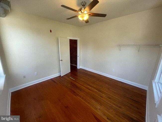
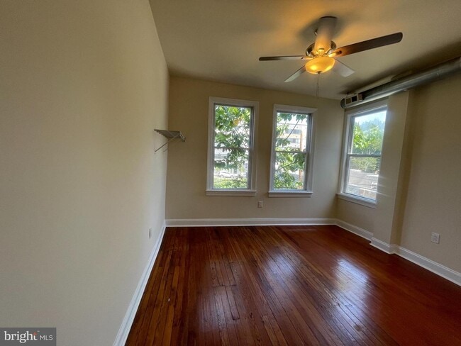
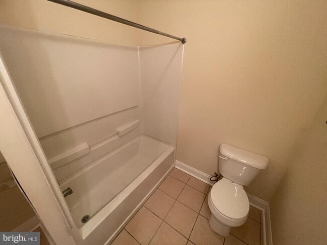
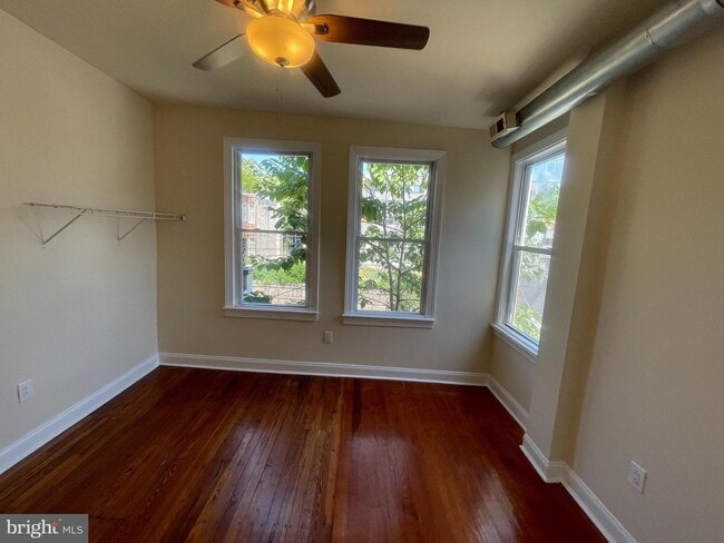
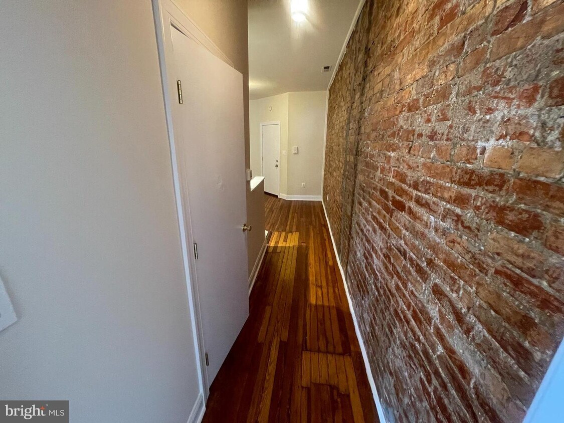
Gorgeous 1-Bedroom, 1-Bathroom loft style apartment in University City! The unit features hardwood floors throughout, exposed brick wall, and central air! Includes laundry room in building, as well as communal backyard space. Situated in University City, this apartment is a fantastic location for students or staff of University of Pennsylvania or Drexel University. There are plenty of restaurants, grocery stores, movie theater and more all within walking distance, and you are close to the 46th Street Market-Frankford (Blue Line) Subway stop. Pet friendly, with approval and pet fee. Apartments on this block do not stay on the market long, so contact us today to set up a showing! Contact us today to set up a showing!
4425 Chestnut St is a townhome located in Philadelphia County and the 19104 ZIP Code. This area is served by the The School District of Philadelphia attendance zone.
Location
Get Directions
Situated in West Philadelphia’s University City District, Spruce Hill is a charming neighborhood teeming with historic residences, multicultural eateries, and lush spruce trees. The scenic Clark Park serves as a tranquil reprieve from Spruce Hill’s dynamic urban environment, as well as a host to plenty of popular community events.
Close proximity to numerous hospitals and universities, including the prestigious University of Pennsylvania and Drexel University, makes the neighborhood a top choice for a diverse range of residents. Spruce Hill boasts a walkable environment along with convenient access to SEPTA bus routes and trolley lines. Center City sits just three miles east of the neighborhood, providing residents with a bevy of metropolitan amenities.
Learn more about living in Spruce HillBelow are rent ranges for similar nearby apartments
| Beds | Average Size | Lowest | Typical | Premium |
|---|---|---|---|---|
| Studio Studio Studio | 422-424 Sq Ft | $750 | $1,412 | $2,300 |
| 1 Bed 1 Bed 1 Bed | 591-597 Sq Ft | $1,100 | $1,829 | $2,950 |
| 2 Beds 2 Beds 2 Beds | 847-852 Sq Ft | $1,059 | $2,404 | $3,683 |
| 3 Beds 3 Beds 3 Beds | 1142-1148 Sq Ft | $805 | $1,908 | $3,200 |
| 4 Beds 4 Beds 4 Beds | 2223-2230 Sq Ft | $2,000 | $4,588 | $8,290 |
Education
| Colleges & Universities | Distance | ||
|---|---|---|---|
| Colleges & Universities | Distance | ||
| Walk: | 7 min | 0.4 mi | |
| Walk: | 17 min | 0.9 mi | |
| Drive: | 3 min | 1.1 mi | |
| Drive: | 4 min | 1.4 mi |
4425 Chestnut St is within 7 minutes or 0.4 mile from C.C. of Philadelphia, W Ctr. It is also near University of the Sciences and University of Pennsylvania.
Schools


Public Elementary & Middle School
Grades PK-8
475 Students
Nearby
Public Elementary & Middle School
Grades K-8
282 Students
Attendance Zone
Public High School
Grades 9-12
543 Students
Attendance Zone
Private Elementary & Middle School
Grades PK-8
114 Students
Nearby
Private High School
Grades 9-12
420 Students
Nearby
School data provided by
 The GreatSchools Rating helps parents compare schools within a state based on a variety of school quality indicators and provides a helpful picture of how effectively each school serves all of its students. Ratings are on a scale of 1 (below average) to 10 (above average) and can include test scores, college readiness, academic progress, advanced courses, equity, discipline and attendance data. We also advise parents to visit schools, consider other information on school performance and programs, and consider family needs as part of the school selection process.
View GreatSchools Rating Methodology
Data provided by GreatSchools.org © 2025. All rights reserved.
View GreatSchools Rating Methodology
Data provided by GreatSchools.org © 2025. All rights reserved.
Transportation options available in Philadelphia include 46Th Street, located 0.3 mile from 4425 Chestnut St. 4425 Chestnut St is near Philadelphia International, located 9.6 miles or 20 minutes away, and Trenton Mercer, located 36.4 miles or 54 minutes away.
| Transit / Subway | Distance | ||
|---|---|---|---|
| Transit / Subway | Distance | ||
|
|
Walk: | 6 min | 0.3 mi |
|
|
Walk: | 10 min | 0.6 mi |
| Walk: | 10 min | 0.6 mi | |
| Walk: | 11 min | 0.6 mi | |
|
|
Walk: | 11 min | 0.6 mi |
| Commuter Rail | Distance | ||
|---|---|---|---|
| Commuter Rail | Distance | ||
|
|
Drive: | 4 min | 1.1 mi |
| Drive: | 3 min | 1.4 mi | |
| Drive: | 4 min | 1.5 mi | |
|
|
Drive: | 5 min | 1.8 mi |
|
|
Drive: | 7 min | 2.5 mi |
| Airports | Distance | ||
|---|---|---|---|
| Airports | Distance | ||
|
Philadelphia International
|
Drive: | 20 min | 9.6 mi |
|
Trenton Mercer
|
Drive: | 54 min | 36.4 mi |
Time and distance from 4425 Chestnut St.
| Shopping Centers | Distance | ||
|---|---|---|---|
| Shopping Centers | Distance | ||
| Walk: | 20 min | 1.1 mi | |
| Drive: | 6 min | 1.9 mi | |
| Drive: | 6 min | 2.1 mi |
4425 Chestnut St has 3 shopping centers within 2.1 miles, which is about a 6-minute walk. The miles and minutes will be for the farthest away property.
| Parks and Recreation | Distance | ||
|---|---|---|---|
| Parks and Recreation | Distance | ||
|
Penn Museum
|
Drive: | 4 min | 1.4 mi |
|
University of Pennsylvania Observatory
|
Drive: | 3 min | 1.5 mi |
|
Please Touch Museum
|
Drive: | 6 min | 2.0 mi |
|
Schuylkill River Park
|
Drive: | 6 min | 2.1 mi |
|
Philadelphia Zoo
|
Drive: | 6 min | 2.3 mi |
4425 Chestnut St has 5 parks within 2.3 miles, including University of Pennsylvania Observatory, Penn Museum, and Please Touch Museum.
| Hospitals | Distance | ||
|---|---|---|---|
| Hospitals | Distance | ||
| Walk: | 13 min | 0.7 mi | |
| Drive: | 4 min | 1.7 mi | |
| Drive: | 9 min | 4.0 mi |
4425 Chestnut St has 3 hospitals within 4.0 miles, the nearest is Penn Presbyterian Medical Center which is 0.7 mile away and a 13 minute walk.
| Military Bases | Distance | ||
|---|---|---|---|
| Military Bases | Distance | ||
| Drive: | 13 min | 6.3 mi |
4425 Chestnut St is 6.3 miles and a 13 minute drive from Philadelphia Naval Busi Center.
You May Also Like
Similar Rentals Nearby


What Are Walk Score®, Transit Score®, and Bike Score® Ratings?
Walk Score® measures the walkability of any address. Transit Score® measures access to public transit. Bike Score® measures the bikeability of any address.
What is a Sound Score Rating?
A Sound Score Rating aggregates noise caused by vehicle traffic, airplane traffic and local sources
4425 Chestnut St
Philadelphia, PA 19104