$3,295 / Month
43 Mt Pleasant Ave
Boston, MA 02119
2 Weeks Ago
Favorites
43 Mt Pleasant Ave

Favorites
Check Back Soon for Upcoming Availability
| Beds | Baths | Average SF |
|---|---|---|
| 4 Bedrooms 4 Bedrooms 4 Br | 1 Bath 1 Bath 1 Ba | 1,182 SF |
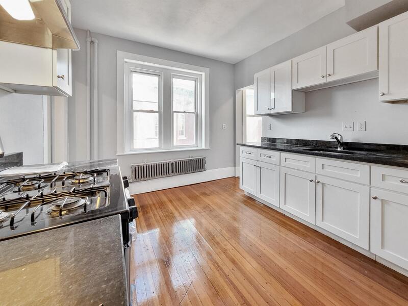
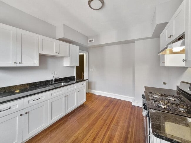
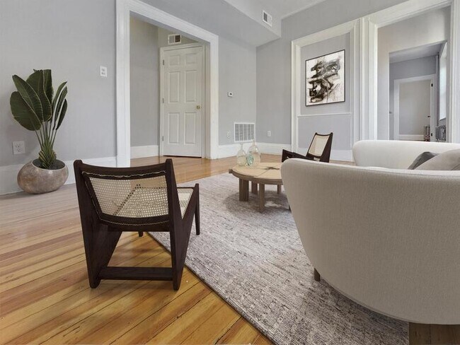
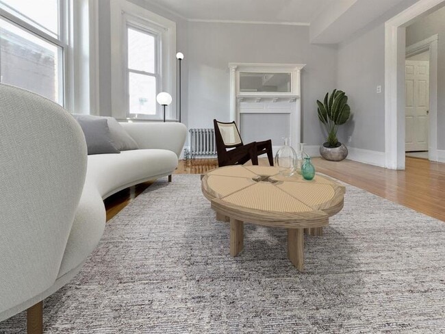
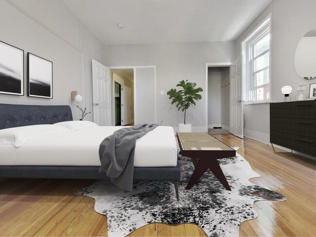
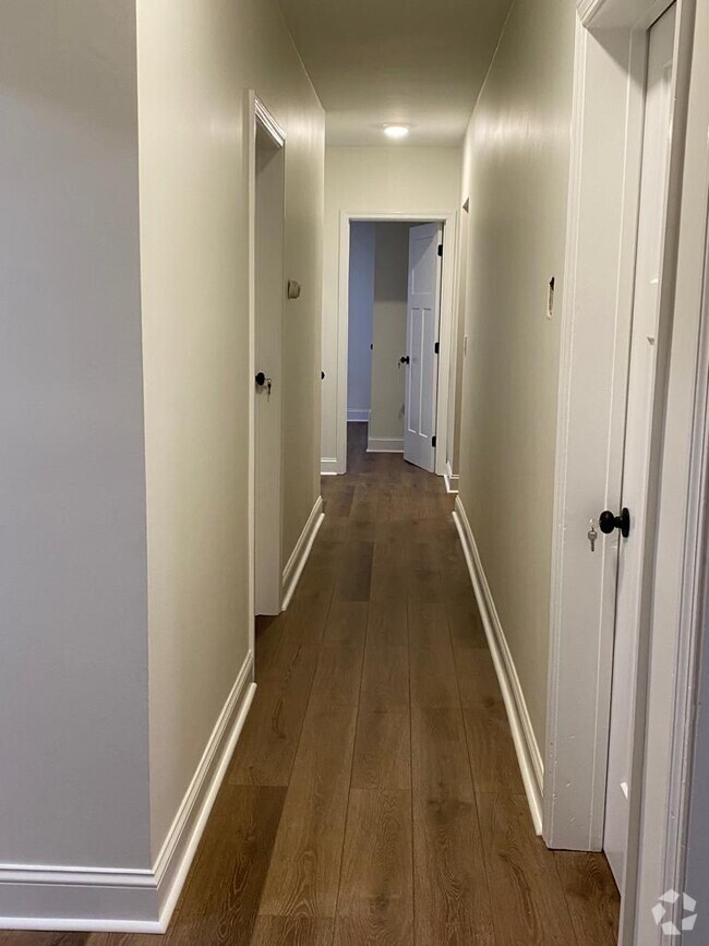
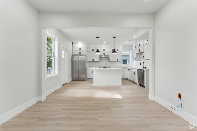
About This Property
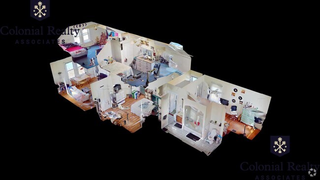
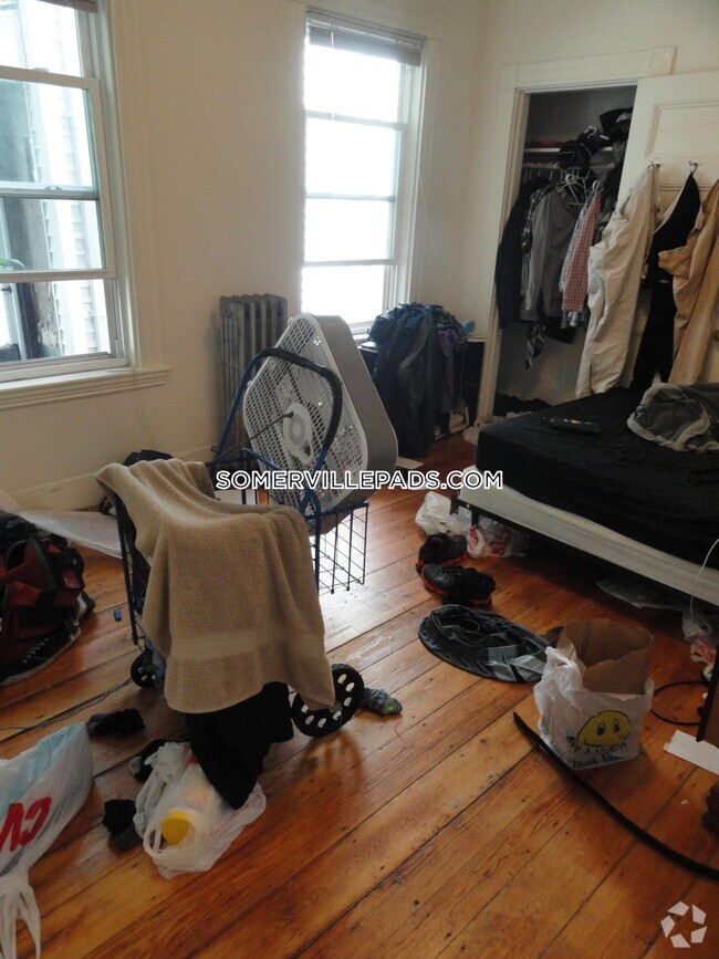
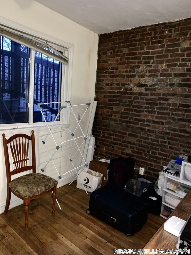
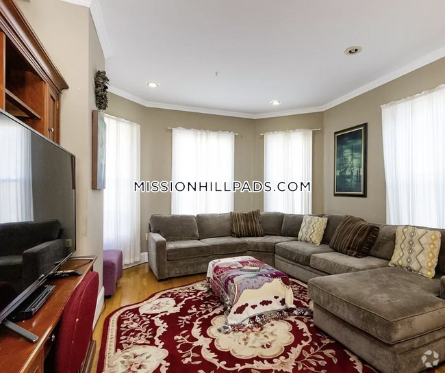
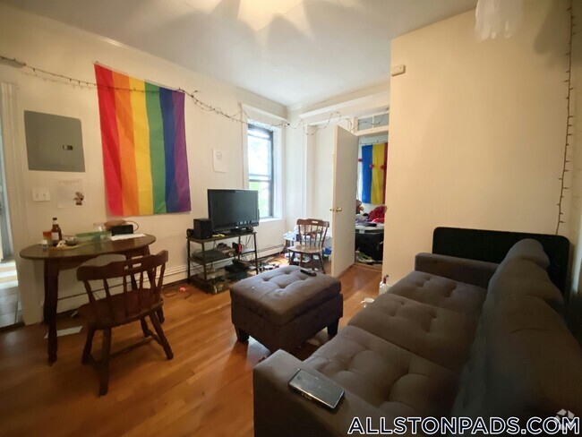
Take advantage of our $1,000 look and lease special - just complete your application with 48 hours of your tour! Welcome to 43 Mount Pleasant Ave, managed by Groma. These apartments are perfectly located for convenient commuter access to Downtown Boston as well as South End and the Franklin Park Zoo. Additionally, this property is conveniently located for a variety of universities and academic centers including Northeastern University, Wentworth, and Emmanuel College. Groma is a Boston-based management, investment, and development company with a focus on smart-living all around the greater Boston area. We take pride in delivering the highest standard of management care possible to those who choose to make our apartments their home. This apartment's marketing is representative of this unit's layout, appearance, and amenities, however, the images shown may be of a similar unit and not the actual apartment. Take a 3D Virtual Tour of this apartment: Renting at a Groma Property Always Includes: - No Broker Fee Paid to Groma - Security Deposit Discount Evaluation - Groma's in-house Maintenance Team - 24/7 Emergency Contact - Snow Removal Service - Cleaning Service Partner Discount - Resident Center Portal - Option to spread out last month's prepayment Not Included in Rent: - Rubbish Removal Service - Water & Sewage
43 Mt Pleasant Ave is a condo located in Suffolk County and the 02119 ZIP Code. This area is served by the Boston Public Schools attendance zone.
Location
Get Directions
Situated between the South End and Dudley Square, Lower Roxbury is a predominantly residential neighborhood brimming with apartments and town houses available for rent. Residents enjoy a walkable urban environment filled with diverse historical architecture.
Warren Street and Washington Street are the neighborhood’s main commercial thoroughfares, touting rows of specialty shops, markets, and eateries in historic buildings. Northeastern University, Wentworth Institute of Technology, and Massachusetts College of Art and Design are all just northwest of Lower Roxbury, offering the community a bevy of cultural and educational amenities. Getting around from Lower Roxbury is easy with access to multiple T stops on the Orange Line.
Learn more about living in Lower RoxburyBelow are rent ranges for similar nearby apartments
| Beds | Average Size | Lowest | Typical | Premium |
|---|---|---|---|---|
| Studio Studio Studio | 5722 Sq Ft | $1,800 | $2,106 | $2,709 |
| 1 Bed 1 Bed 1 Bed | 4236-4245 Sq Ft | $1,900 | $2,503 | $3,699 |
| 2 Beds 2 Beds 2 Beds | 3806-3807 Sq Ft | $2,200 | $3,367 | $8,700 |
| 3 Beds 3 Beds 3 Beds | 5329 Sq Ft | $1,025 | $4,334 | $7,400 |
| 4 Beds 4 Beds 4 Beds | 6392 Sq Ft | $1,150 | $5,310 | $9,000 |
Expenses
Utilities Included
Water, Trash Removal
Included
Education
| Colleges & Universities | Distance | ||
|---|---|---|---|
| Colleges & Universities | Distance | ||
| Drive: | 3 min | 1.4 mi | |
| Drive: | 3 min | 1.6 mi | |
| Drive: | 5 min | 1.7 mi | |
| Drive: | 4 min | 1.7 mi |
43 Mt Pleasant Ave is within 5 minutes or 1.7 miles from Northeastern University. It is also near Wentworth Inst. of Technology and MCPHS University, Boston.
Schools


Public Elementary & Middle School
Grades PK-8
724 Students
Nearby
Charter High School
Grades 9-10 & 12
321 Students
Nearby
Private Elementary School
Grades PK-6
128 Students
Nearby
Private Middle & High School
Grades 7-12
292 Students
Nearby
School data provided by
 The GreatSchools Rating helps parents compare schools within a state based on a variety of school quality indicators and provides a helpful picture of how effectively each school serves all of its students. Ratings are on a scale of 1 (below average) to 10 (above average) and can include test scores, college readiness, academic progress, advanced courses, equity, discipline and attendance data. We also advise parents to visit schools, consider other information on school performance and programs, and consider family needs as part of the school selection process.
View GreatSchools Rating Methodology
View GreatSchools Rating Methodology
Transportation options available in Boston include Roxbury Crossing Station, located 1.0 miles from 43 Mt Pleasant Ave. 43 Mt Pleasant Ave is near General Edward Lawrence Logan International, located 5.6 miles or 11 minutes away.
| Transit / Subway | Distance | ||
|---|---|---|---|
| Transit / Subway | Distance | ||
|
|
Walk: | 20 min | 1.0 mi |
|
|
Drive: | 3 min | 1.4 mi |
|
|
Drive: | 3 min | 1.5 mi |
|
|
Drive: | 4 min | 1.6 mi |
|
|
Drive: | 4 min | 1.7 mi |
| Commuter Rail | Distance | ||
|---|---|---|---|
| Commuter Rail | Distance | ||
| Walk: | 18 min | 1.0 mi | |
|
|
Walk: | 20 min | 1.1 mi |
|
|
Drive: | 4 min | 1.7 mi |
|
|
Drive: | 7 min | 2.2 mi |
|
|
Drive: | 6 min | 2.6 mi |
| Airports | Distance | ||
|---|---|---|---|
| Airports | Distance | ||
|
General Edward Lawrence Logan International
|
Drive: | 11 min | 5.6 mi |
Time and distance from 43 Mt Pleasant Ave.
| Shopping Centers | Distance | ||
|---|---|---|---|
| Shopping Centers | Distance | ||
| Walk: | 14 min | 0.8 mi | |
| Drive: | 3 min | 1.4 mi | |
| Drive: | 4 min | 1.8 mi |
43 Mt Pleasant Ave has 3 shopping centers within 1.8 miles, which is about a 4-minute walk. The miles and minutes will be for the farthest away property.
| Parks and Recreation | Distance | ||
|---|---|---|---|
| Parks and Recreation | Distance | ||
|
Roxbury Heritage State Park
|
Walk: | 14 min | 0.7 mi |
|
Lower Neponset River Trail
|
Drive: | 4 min | 1.9 mi |
|
Franklin Park Zoo
|
Drive: | 4 min | 2.2 mi |
|
Boston Public Garden
|
Drive: | 6 min | 2.5 mi |
|
Charles River Reservation
|
Drive: | 6 min | 2.9 mi |
43 Mt Pleasant Ave has 5 parks within 2.9 miles, including Roxbury Heritage State Park, Lower Neponset River Trail, and Franklin Park Zoo.
| Hospitals | Distance | ||
|---|---|---|---|
| Hospitals | Distance | ||
| Walk: | 13 min | 0.7 mi | |
| Walk: | 16 min | 0.9 mi | |
| Drive: | 4 min | 1.7 mi |
43 Mt Pleasant Ave has 3 hospitals within 1.7 miles, the nearest is Boston Medical Center which is 0.7 mile away and a 13 minute walk.
| Military Bases | Distance | ||
|---|---|---|---|
| Military Bases | Distance | ||
| Drive: | 32 min | 16.9 mi |
43 Mt Pleasant Ave is 16.9 miles and a 32 minute drive from Hanscom Air Force Base.
You May Also Like
Similar Rentals Nearby


What Are Walk Score®, Transit Score®, and Bike Score® Ratings?
Walk Score® measures the walkability of any address. Transit Score® measures access to public transit. Bike Score® measures the bikeability of any address.
What is a Sound Score Rating?
A Sound Score Rating aggregates noise caused by vehicle traffic, airplane traffic and local sources

43 Mt Pleasant Ave
Boston, MA 02119