$2,750
/ Month
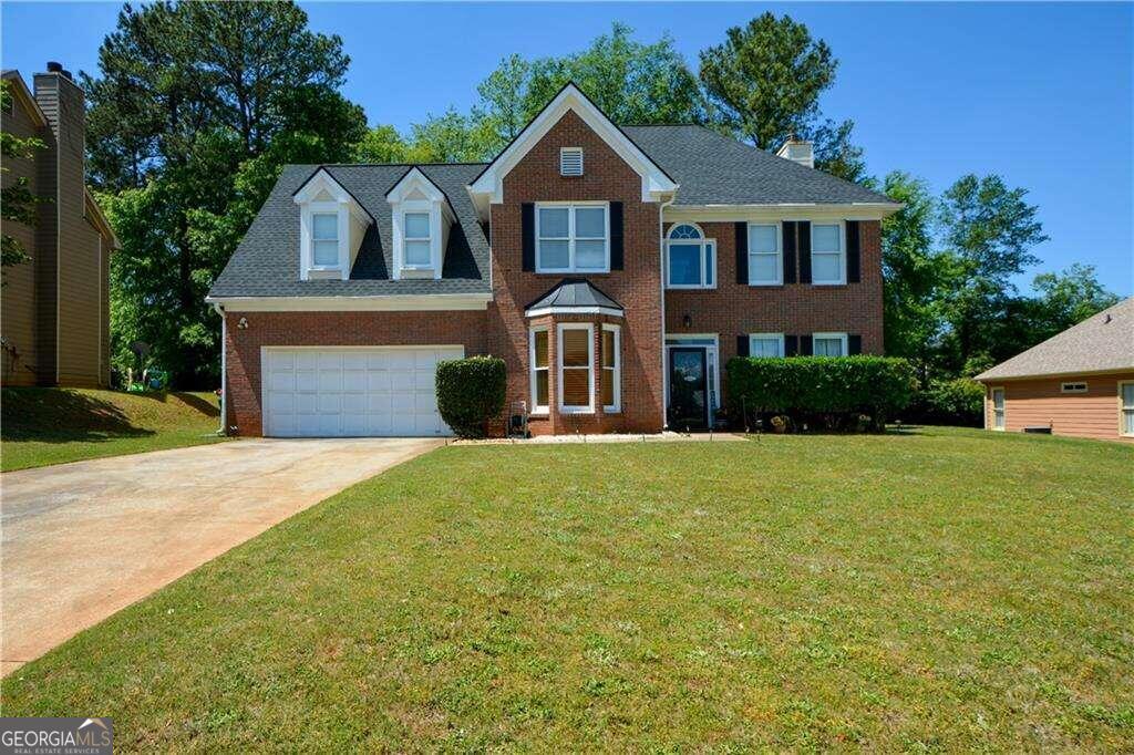
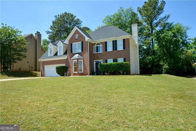
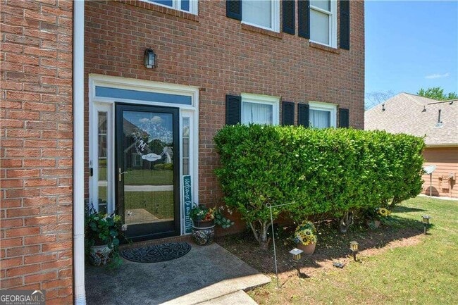
4267 Azalea Walk
Ellenwood, GA 30294
2 Weeks Ago
|
Edit
Favorites
4267 Azalea Walk

Favorites
Check Back Soon for Upcoming Availability
| Beds | Baths | Average SF |
|---|---|---|
| 4 Bedrooms 4 Bedrooms 4 Br | 2.5 Baths 2.5 Baths 2.5 Ba | 2,912 SF |
Fees and Policies
The fees below are based on community-supplied data and may exclude additional fees and utilities.
- One-Time Move-In Fees
-
Application Fee$100
- Parking
-
Garage--
-
Other--
About This Property
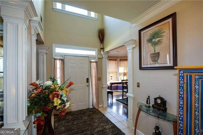
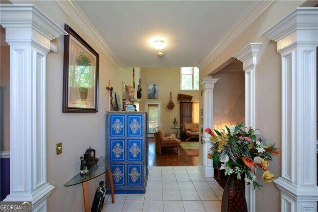
Well maintained traditional home with an open floor plan, is in a perfectly manicured and quiet neighborhood and boasts an open floor plan a huge primary suite with sitting room, an additional secondary primary suite. Large kitchen with island, gas stove and stained cabinets, beautiful hardwood floors , gas cooking, 2-story family room and a 2-story foyer, New paint. A must see!
4267 Azalea Walk is a house located in DeKalb County and the 30294 ZIP Code. This area is served by the DeKalb County attendance zone.
House Features
Dishwasher
Microwave
Refrigerator
Breakfast Nook
- Dishwasher
- Microwave
- Refrigerator
- Breakfast Nook
- Family Room
- Clubhouse
Location
Get Directions
Southeast DeKalb refers to a sprawling region in the southeastern portion of DeKalb County. Among the many communities in this area are the communities of Clarkston, Stone Mountain, Lithonia, Panthersville, Gresham Park, and Sheffield Woods.
Each community in this region has its own distinct character. Southeast DeKalb offers ample opportunities for outdoor recreation at destinations such as Stone Mountain Park, Panola Mountain State Park, and Arabia Mountain National Heritage Area. Southeast DeKalb sits within easy driving distance of all that Greater Atlanta has to offer, with close proximity to major thoroughfares like I-285, I-20, and U.S. 278.
Learn more about living in Southeast DeKalb
Amenities
- Dishwasher
- Microwave
- Refrigerator
- Breakfast Nook
- Family Room
- Clubhouse
Education
| Colleges & Universities | Distance | ||
|---|---|---|---|
| Colleges & Universities | Distance | ||
| Drive: | 13 min | 5.1 mi | |
| Drive: | 23 min | 10.2 mi | |
| Drive: | 22 min | 10.3 mi | |
| Drive: | 23 min | 12.3 mi |
4267 Azalea Walk is within 13 minutes or 5.1 miles from Georgia Perim. Coll., Decatur. It is also near Clayton State University and Agnes Scott College.
Schools


Public Elementary School
Grades PK-5
559 Students
Attendance Zone
Public Middle School
Grades 6-8
988 Students
Attendance Zone
Public High School
Grades 9-12
1,440 Students
Attendance Zone
Private Elementary, Middle & High School
Grades PK-12
Nearby
School data provided by
 The GreatSchools Rating helps parents compare schools within a state based on a variety of school quality indicators and provides a helpful picture of how effectively each school serves all of its students. Ratings are on a scale of 1 (below average) to 10 (above average) and can include test scores, college readiness, academic progress, advanced courses, equity, discipline and attendance data. We also advise parents to visit schools, consider other information on school performance and programs, and consider family needs as part of the school selection process.
View GreatSchools Rating Methodology
Data provided by GreatSchools.org © 2026. All rights reserved.
View GreatSchools Rating Methodology
Data provided by GreatSchools.org © 2026. All rights reserved.
Transportation options available in Ellenwood include Indian Creek, located 9.9 miles from 4267 Azalea Walk. 4267 Azalea Walk is near Hartsfield - Jackson Atlanta International, located 16.6 miles or 30 minutes away.
| Transit / Subway | Distance | ||
|---|---|---|---|
| Transit / Subway | Distance | ||
|
|
Drive: | 18 min | 9.9 mi |
|
|
Drive: | 20 min | 10.2 mi |
|
|
Drive: | 23 min | 11.2 mi |
|
|
Drive: | 24 min | 11.7 mi |
|
|
Drive: | 22 min | 11.8 mi |
| Commuter Rail | Distance | ||
|---|---|---|---|
| Commuter Rail | Distance | ||
|
|
Drive: | 32 min | 18.6 mi |
| Airports | Distance | ||
|---|---|---|---|
| Airports | Distance | ||
|
Hartsfield - Jackson Atlanta International
|
Drive: | 30 min | 16.6 mi |
Time and distance from 4267 Azalea Walk.
| Shopping Centers | Distance | ||
|---|---|---|---|
| Shopping Centers | Distance | ||
| Drive: | 6 min | 2.5 mi | |
| Drive: | 7 min | 2.6 mi | |
| Drive: | 7 min | 2.6 mi |
4267 Azalea Walk has 3 shopping centers within 2.6 miles, which is about a 7-minute drive. The miles and minutes will be for the farthest away property.
| Parks and Recreation | Distance | ||
|---|---|---|---|
| Parks and Recreation | Distance | ||
|
Panola Mountain State Park
|
Drive: | 11 min | 4.1 mi |
|
Ferns of the World Garden
|
Drive: | 11 min | 4.5 mi |
|
Arabia Mountain Heritage Area and Nature Center
|
Drive: | 21 min | 10.0 mi |
|
Wylde Center and Oakhurst Community Garden
|
Drive: | 21 min | 10.1 mi |
|
Bradley Observatory
|
Drive: | 21 min | 10.6 mi |
4267 Azalea Walk has 5 parks within 10.6 miles, including Panola Mountain State Park, Ferns of the World Garden, and Arabia Mountain Heritage Area and Nature Center.
| Hospitals | Distance | ||
|---|---|---|---|
| Hospitals | Distance | ||
| Drive: | 12 min | 4.9 mi | |
| Drive: | 17 min | 9.3 mi |
4267 Azalea Walk is 4.9 miles from Georgia Regional Hospital Atlanta, and is convenient to other hospitals, including Emory Hillandale Hospital.
| Military Bases | Distance | ||
|---|---|---|---|
| Military Bases | Distance | ||
| Drive: | 21 min | 9.4 mi | |
| Drive: | 32 min | 18.9 mi |
4267 Azalea Walk is 9.4 miles from Fort Gillem, and is convenient to other military bases, including Fort McPherson.
You May Also Like
Similar Rentals Nearby


What Are Walk Score®, Transit Score®, and Bike Score® Ratings?
Walk Score® measures the walkability of any address. Transit Score® measures access to public transit. Bike Score® measures the bikeability of any address.
What is a Sound Score Rating?
A Sound Score Rating aggregates noise caused by vehicle traffic, airplane traffic and local sources

4267 Azalea Walk
Ellenwood, GA 30294