

$3,050
/ Month
42 Purser Pl
Yonkers, NY 10705
Today
|
Edit
Favorites
-
Bedrooms
4
-
Bathrooms
1
-
Square Feet
1,600 sq ft
-
Available
Available Now
Highlights
- Property is near public transit and bus stop
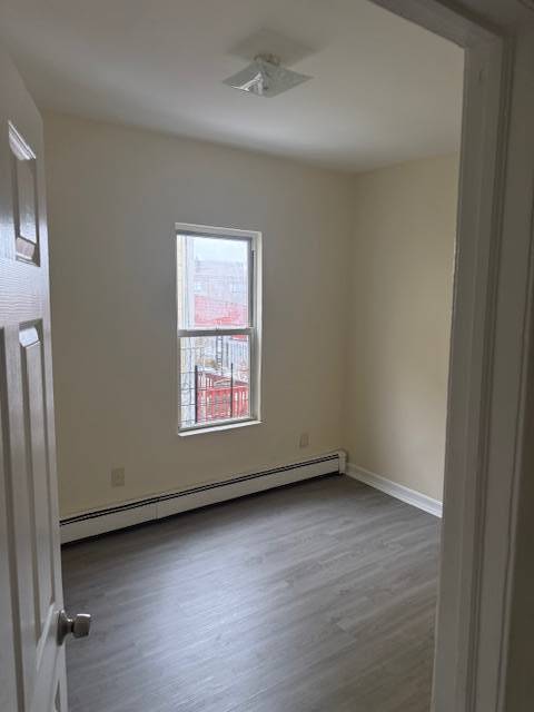
- Main Floor Primary Bedroom
- Granite Countertops
- Galley Kitchen
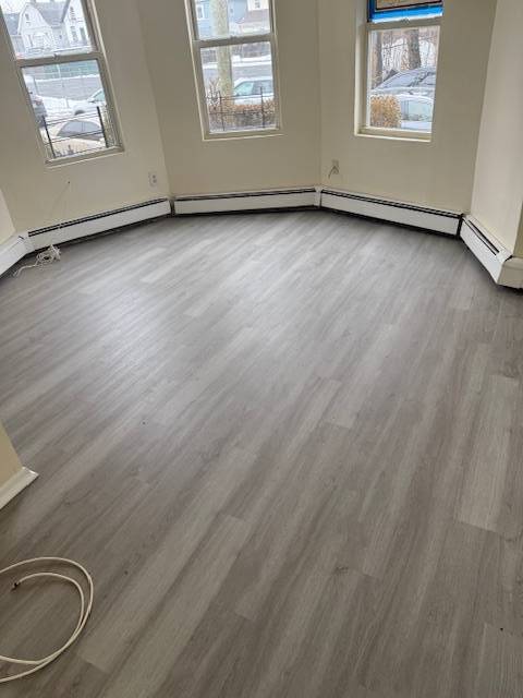
- Living Room
- Family Room
42 Purser Pl

Favorites
About This Home
Available Now
Comfortable Three Bedroom near Shopping, Banking, Post Office, Public Transportation ( (Buses and Metro North)
42 Purser Pl is a house located in Westchester County and the 10705 ZIP Code. This area is served by the Yonkers City attendance zone.
* Price shown is base rent. Excludes user-selected optional fees and variable or usage-based fees and required charges due at or prior to move-in or at move-out. Price, availability, fees, and any applicable rent special are subject to change without notice.
* Square footage definitions vary. Displayed square footage is approximate.
Home Details
Year Built
Built in 1949 | Remodeled in 2025
Bedrooms and Bathrooms
Primary Bedroom on Main
1 Full Bathroom
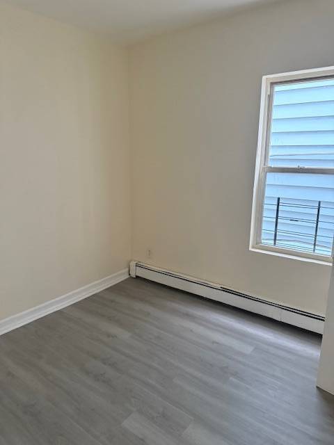
4 Bedrooms
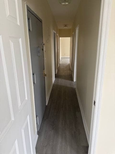
Home Design
Garden Apartment
Interior Spaces
Living Room
Family Room
Laminate Flooring
1,600 Sq Ft Home
3-Story Property
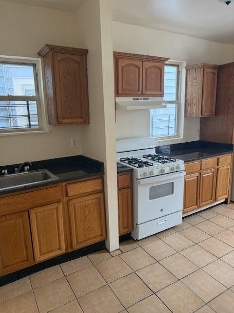
Kitchen
Granite Countertops
Galley Kitchen
Oven
Listing and Financial Details
1-Month Minimum Lease Term
Location
Property is near public transit and bus stop
Utilities
Radiant Heating System
Cooling System Mounted To A Wall/Window
Community Details
Overview
Ludlow Community
Contact
- Listed by Bruce Lord | GRAND WEST ASSOCIATES INC
- Contact
-
Source
NY State MLS
Copyright © 2026 NY State MLS. All rights reserved. All information provided by the listing agent/broker is deemed reliable but is not guaranteed and should be independently verified.
Location
Get Directions
Ludlow is a scenic neighborhood nestled alongside the eastern banks of the Hudson River in southwest Yonkers. Residents in Ludlow enjoy the best of urban and suburban lifestyles, from the neighborhood’s tree-lined residential streets to the vibrant commercial offerings on Broadway.
Ludlow provides a diverse range of rental options, from longstanding apartments in red-brick buildings to charming houses brimming with historic character. Many of the community’s rentals lie within walking distance of shops and restaurants on Broadway to the east as well as picturesque views of the Hudson River to the west. Yonkers’ Main Street neighbors Ludlow to the north, while Ludlow Station lies at the heart of the community, connecting residents to Grand Central Station via the Hudson Line within 30 minutes.
Learn more about living in Ludlow
Amenities
- Air Conditioning
- Smoke Free
- Fireplace
- Oven
- Refrigerator
- Vinyl Flooring
- Family Room
Education
| Colleges & Universities | Distance | ||
|---|---|---|---|
| Colleges & Universities | Distance | ||
| Drive: | 5 min | 2.7 mi | |
| Drive: | 9 min | 4.5 mi | |
| Drive: | 9 min | 4.6 mi | |
| Drive: | 11 min | 5.7 mi |
42 Purser Pl is within 5 minutes or 2.7 miles from Manhattan College. It is also near Lehman College and Sarah Lawrence College.
Schools


Public Elementary & Middle School
Grades PK-8
588 Students
Nearby
Public High School
Grades 9-12
1,111 Students
Nearby
Private Elementary, Middle & High School
Grades 1-12
212 Students
Nearby
Private Elementary & Middle School
Grades PK-8
215 Students
Nearby
School data provided by
 The GreatSchools Rating helps parents compare schools within a state based on a variety of school quality indicators and provides a helpful picture of how effectively each school serves all of its students. Ratings are on a scale of 1 (below average) to 10 (above average) and can include test scores, college readiness, academic progress, advanced courses, equity, discipline and attendance data. We also advise parents to visit schools, consider other information on school performance and programs, and consider family needs as part of the school selection process.
View GreatSchools Rating Methodology
Data provided by GreatSchools.org © 2026. All rights reserved.
View GreatSchools Rating Methodology
Data provided by GreatSchools.org © 2026. All rights reserved.
Transportation options available in Yonkers include Van Cortlandt Park-242 Street, located 2.6 miles from 42 Purser Pl. 42 Purser Pl is near LaGuardia, located 15.1 miles or 28 minutes away, and Westchester County, located 21.0 miles or 32 minutes away.
| Transit / Subway | Distance | ||
|---|---|---|---|
| Transit / Subway | Distance | ||
|
|
Drive: | 5 min | 2.6 mi |
|
|
Drive: | 6 min | 3.0 mi |
|
|
Drive: | 7 min | 3.4 mi |
|
|
Drive: | 10 min | 3.7 mi |
|
|
Drive: | 8 min | 4.3 mi |
| Commuter Rail | Distance | ||
|---|---|---|---|
| Commuter Rail | Distance | ||
|
|
Walk: | 9 min | 0.5 mi |
|
|
Drive: | 3 min | 1.3 mi |
|
|
Drive: | 6 min | 1.9 mi |
|
|
Drive: | 8 min | 2.9 mi |
|
|
Drive: | 12 min | 5.0 mi |
| Airports | Distance | ||
|---|---|---|---|
| Airports | Distance | ||
|
LaGuardia
|
Drive: | 28 min | 15.1 mi |
|
Westchester County
|
Drive: | 32 min | 21.0 mi |
Time and distance from 42 Purser Pl.
| Shopping Centers | Distance | ||
|---|---|---|---|
| Shopping Centers | Distance | ||
| Walk: | 11 min | 0.6 mi | |
| Drive: | 3 min | 1.1 mi | |
| Drive: | 6 min | 2.4 mi |
42 Purser Pl has 3 shopping centers within 2.4 miles, which is about a 6-minute drive. The miles and minutes will be for the farthest away property.
| Parks and Recreation | Distance | ||
|---|---|---|---|
| Parks and Recreation | Distance | ||
|
Beczak Environmental Education Center
|
Drive: | 4 min | 1.4 mi |
|
Wave Hill
|
Drive: | 6 min | 2.1 mi |
|
Riverdale Park
|
Drive: | 6 min | 2.5 mi |
|
Van Cortlandt Park
|
Drive: | 8 min | 4.6 mi |
|
Tenafly Nature Center
|
Drive: | 22 min | 12.7 mi |
42 Purser Pl has 5 parks within 12.7 miles, including Beczak Environmental Education Center, Wave Hill, and Riverdale Park.
| Hospitals | Distance | ||
|---|---|---|---|
| Hospitals | Distance | ||
| Walk: | 15 min | 0.8 mi | |
| Drive: | 6 min | 3.5 mi | |
| Drive: | 9 min | 4.4 mi |
42 Purser Pl has 3 hospitals within 4.4 miles, the nearest is St. Joseph's Medical Center which is 0.8 mile away and a 15 minute walk.
| Military Bases | Distance | ||
|---|---|---|---|
| Military Bases | Distance | ||
| Drive: | 29 min | 15.2 mi |
42 Purser Pl is 15.2 miles and a 29 minute drive from Fort Totten US Govt Reservation.
You May Also Like
Similar Rentals Nearby
-
-

-

-

-

-

-
 5 Beds, 4 Baths, 3,800 sq ft$12,500Total Monthly PriceTotal Monthly Price NewPrices include all required monthly fees.46 McGuiness Ln
 -
 4 Beds, 1 Bath, 1,000 sq ft$3,400Total Monthly PriceTotal Monthly Price NewPrices include all required monthly fees.31-16 81st St
 -
 4 Beds, 1 Bath, 1,200 sq ft$4,300Total Monthly PriceTotal Monthly Price NewPrices include all required monthly fees.86-18 57th Ave
 -

What Are Walk Score®, Transit Score®, and Bike Score® Ratings?
Walk Score® measures the walkability of any address. Transit Score® measures access to public transit. Bike Score® measures the bikeability of any address.
What is a Sound Score Rating?
A Sound Score Rating aggregates noise caused by vehicle traffic, airplane traffic and local sources
42 Purser Pl
Yonkers, NY 10705