$2,763
/ Month
411 29th St
Oakland, CA 94609
2 Weeks Ago
|
Edit
Favorites
411 29th St

Favorites
Check Back Soon for Upcoming Availability
| Beds | Baths | Average SF |
|---|---|---|
| 2 Bedrooms 2 Bedrooms 2 Br | 1 Bath 1 Bath 1 Ba | 1,052 SF |
Fees and Policies
The fees below are based on community-supplied data and may exclude additional fees and utilities.
- Dogs Allowed
-
Fees not specified
- Cats Allowed
-
Fees not specified
- Parking
-
Garage--
About This Property
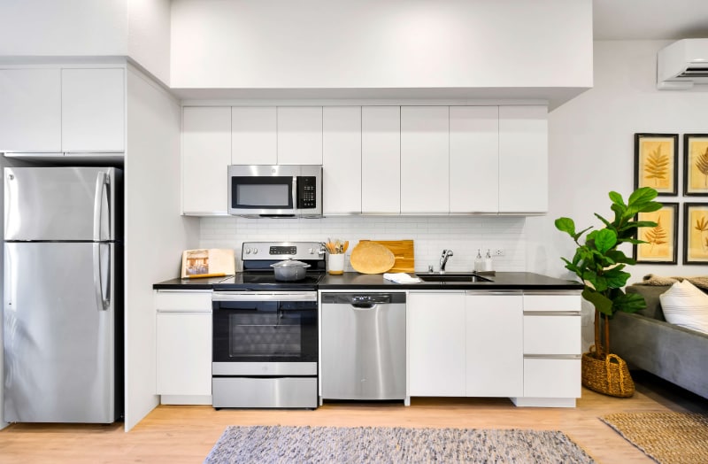
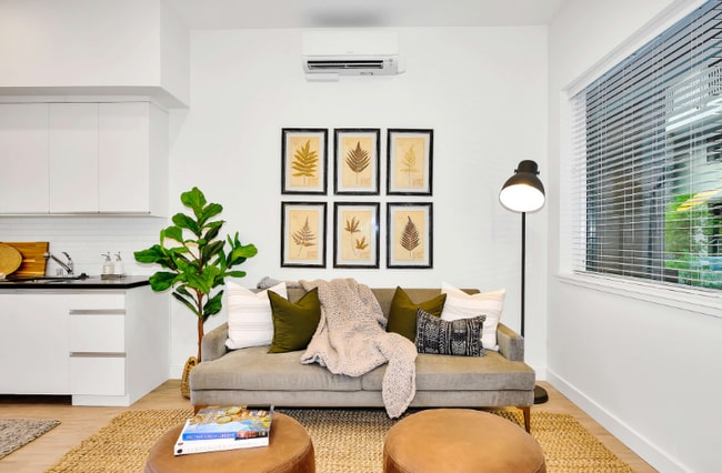
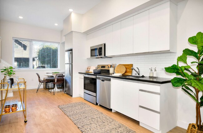
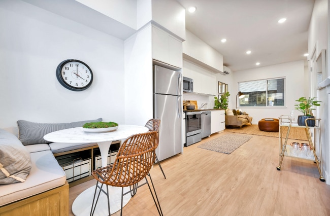
Property Id: 1068444 Beautiful 2-bedroom apartments and stunning amenities are available in Temescal! Outside your spacious apartment, you'll enjoy access to a furnished rooftop deck, courtyard, on-site pet spa, and more! Details: - 2 bed/1 bath units (unfurnished) - Modern kitchen and bathroom - In-unit laundry (washer and dryer) - Central air conditioning/heating - Oversized windows + beautiful finishes - Roof deck w/ bbq and courtyard - Parking, elevator, and bike storage - Pet friendly, w/ on-site pet spa - Exclusive member perks + discounts - Curated community events and activities This prime location puts you within walking distance of everything you'll need for easy city living, including restaurants, grocery stores, coffee shops, and everyday necessities. *Quoted price is based on a 12 month lease (subject to change). Please inquire for short term rates (minimum 3 months)
411 29th St is an apartment community located in Alameda County and the 94609 ZIP Code.
Features
Washer/Dryer
Dishwasher
Microwave
Refrigerator
- Washer/Dryer
- Dishwasher
- Microwave
- Oven
- Refrigerator
- Freezer
- Bicycle Storage
Location
Get Directions
Pill Hill is a small neighborhood located about a mile north of Downtown Oakland. Various medical facilities are located in the neighborhood, hence the name. Along with pharmacies and doctor’s offices, Pill Hill is home to the Alta Bates Summit Medical Center. Pill Hill has apartments and condos available for rent. The iconic Telegraph Avenue runs through Pill Hill so residents have access to cafes, coffee shops, and grocery stores within walking distance, but many residents take advantage of the neighborhood’s central location by traveling into neighboring communities for more shopping, dining, and entertainment options. Explore eateries on Piedmont Avenue, or head to Adams Point to access Lake Merritt. Pill Hill is nestled between Interstate 580 and 980 so it’s a great choice for anyone who wants to be able to travel across the Bay Area with ease into other major cities like Berkeley and San Francisco.
Learn more about living in Pill HillBelow are rent ranges for similar nearby apartments
Amenities
- Washer/Dryer
- Dishwasher
- Microwave
- Oven
- Refrigerator
- Freezer
- Bicycle Storage
Education
| Colleges & Universities | Distance | ||
|---|---|---|---|
| Colleges & Universities | Distance | ||
| Walk: | 5 min | 0.3 mi | |
| Drive: | 4 min | 1.4 mi | |
| Drive: | 6 min | 2.8 mi | |
| Drive: | 8 min | 3.3 mi |
411 29th St is within 5 minutes or 0.3 mile from Samuel Merritt University. It is also near Lincoln University, Oakland and Laney College.
Transportation options available in Oakland include 19Th St Oakland Station, located 0.8 mile from 411 29th St. 411 29th St is near Metro Oakland International, located 10.5 miles or 17 minutes away, and San Francisco International, located 22.5 miles or 35 minutes away.
| Transit / Subway | Distance | ||
|---|---|---|---|
| Transit / Subway | Distance | ||
|
|
Walk: | 14 min | 0.8 mi |
|
|
Drive: | 3 min | 1.2 mi |
|
|
Drive: | 3 min | 1.2 mi |
|
|
Drive: | 2 min | 1.2 mi |
|
|
Drive: | 6 min | 3.7 mi |
| Commuter Rail | Distance | ||
|---|---|---|---|
| Commuter Rail | Distance | ||
|
|
Drive: | 5 min | 2.1 mi |
|
|
Drive: | 7 min | 3.5 mi |
|
|
Drive: | 10 min | 5.6 mi |
| Drive: | 16 min | 10.1 mi | |
| Drive: | 16 min | 10.1 mi |
| Airports | Distance | ||
|---|---|---|---|
| Airports | Distance | ||
|
Metro Oakland International
|
Drive: | 17 min | 10.5 mi |
|
San Francisco International
|
Drive: | 35 min | 22.5 mi |
Time and distance from 411 29th St.
| Shopping Centers | Distance | ||
|---|---|---|---|
| Shopping Centers | Distance | ||
| Walk: | 5 min | 0.3 mi | |
| Walk: | 19 min | 1.0 mi | |
| Drive: | 3 min | 1.2 mi |
411 29th St has 3 shopping centers within 1.2 miles, which is about a 3-minute drive. The miles and minutes will be for the farthest away property.
| Parks and Recreation | Distance | ||
|---|---|---|---|
| Parks and Recreation | Distance | ||
|
Lakeside Park Garden Center
|
Walk: | 16 min | 0.8 mi |
|
Lakeside Park
|
Drive: | 3 min | 1.2 mi |
|
Rotary Nature Center
|
Drive: | 4 min | 1.2 mi |
|
Morcom Rose Garden
|
Drive: | 4 min | 1.2 mi |
|
Juan Bautista de Anza National Historic Trail
|
Drive: | 4 min | 1.7 mi |
411 29th St has 5 parks within 1.7 miles, including Lakeside Park Garden Center, Rotary Nature Center, and Lakeside Park.
| Hospitals | Distance | ||
|---|---|---|---|
| Hospitals | Distance | ||
| Walk: | 6 min | 0.3 mi | |
| Walk: | 14 min | 0.7 mi | |
| Drive: | 4 min | 1.8 mi |
411 29th St has 3 hospitals within 1.8 miles, the nearest is Alta Bates Summit Medical Center which is 0.3 mile away and a 6 minute walk.
| Military Bases | Distance | ||
|---|---|---|---|
| Military Bases | Distance | ||
| Drive: | 13 min | 4.7 mi | |
| Drive: | 12 min | 4.8 mi |
411 29th St is 4.7 miles from Oakland Army Base, and is convenient to other military bases, including Alameda/US Naval Air Station Alameda.
You May Also Like
Similar Rentals Nearby


What Are Walk Score®, Transit Score®, and Bike Score® Ratings?
Walk Score® measures the walkability of any address. Transit Score® measures access to public transit. Bike Score® measures the bikeability of any address.
What is a Sound Score Rating?
A Sound Score Rating aggregates noise caused by vehicle traffic, airplane traffic and local sources

411 29th St
Oakland, CA 94609