$1,500
/ Month
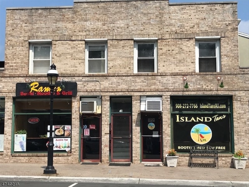
41 N Ave E
Cranford, NJ 07016
2 Weeks Ago
|
Edit
Favorites
41 N Ave E

Favorites
Check Back Soon for Upcoming Availability
| Beds | Baths | Average SF |
|---|---|---|
| 1 Bedroom 1 Bedroom 1 Br | 1 Bath 1 Bath 1 Ba | 6,607 SF |
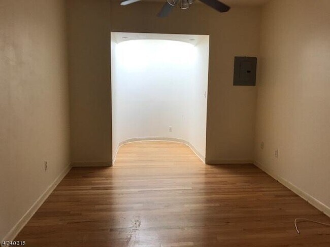
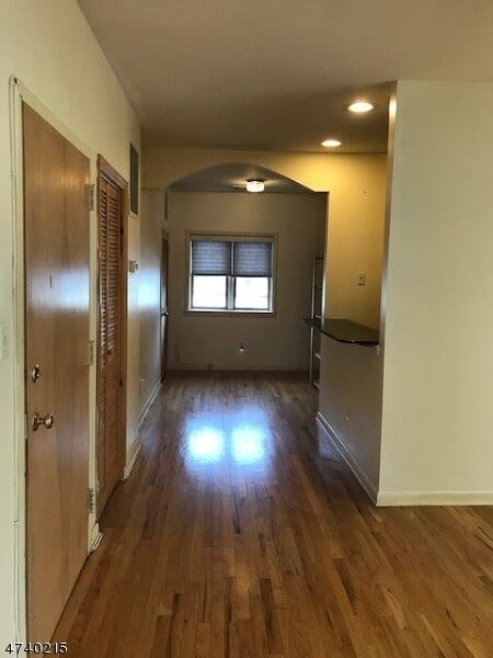
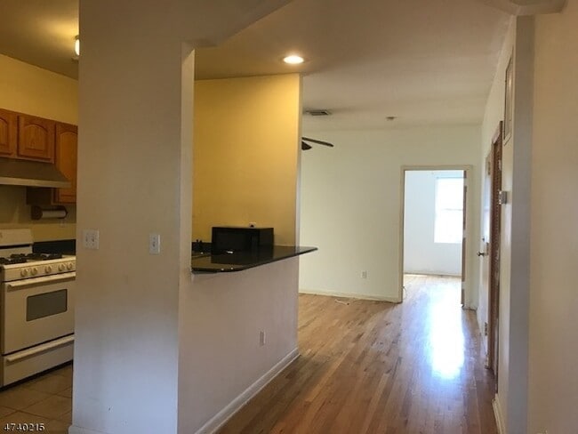
About This Property
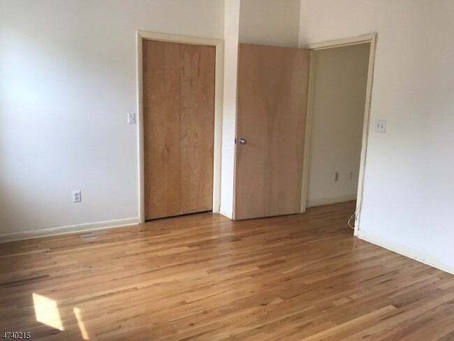
1 Hab apartamento cerca de la estación de trenes Cranf + del centro de la ciudad. Excelente 2nd piso apto. Con techos altos y & claraboyas, hwd los pisos thruout,cac,LR/DR combinación. Los apartamentos en izquierda, no hay estacionamiento en el lugar.
41 N Ave E is an apartment community located in Union County and the 07016 ZIP Code.
Location
Get Directions
Cranford is a peaceful suburb situated in the heart of Union County. Lush with township and county parks as well as the Rahway River Parkway, Cranford offers ample opportunities to engage in outdoor recreation and connect with nature. Cranford is also home to the last working farm in Union County, Dreyer Farms, which provides fresh produce in addition to hosting a variety of special events.
Cranford’s vibrant downtown area contains a slew of restaurants, specialty shops, cafes, and art galleries in colorful buildings, serving as a gathering place for the close-knit community. Commuting and traveling from Cranford is easy with access to the NJ Transit bus, Raritan Valley train line, and the Garden State Parkway. New York City and its many dynamic amenities are less than an hour’s drive or train ride away from Cranford.
Learn more about living in Cranford
Education
| Colleges & Universities | Distance | ||
|---|---|---|---|
| Colleges & Universities | Distance | ||
| Drive: | 5 min | 1.6 mi | |
| Drive: | 11 min | 4.8 mi | |
| Drive: | 12 min | 6.0 mi | |
| Drive: | 17 min | 9.5 mi |
41 N Ave E is within 5 minutes or 1.6 miles from Union County College, Cranford. It is also near Kean University and Union County Coll., Elizabeth.
Transportation options available in Cranford include Warren Street, located 9.9 miles from 41 N Ave E. 41 N Ave E is near Newark Liberty International, located 11.6 miles or 16 minutes away, and LaGuardia, located 30.8 miles or 50 minutes away.
| Transit / Subway | Distance | ||
|---|---|---|---|
| Transit / Subway | Distance | ||
|
|
Drive: | 16 min | 9.9 mi |
|
|
Drive: | 16 min | 9.9 mi |
|
|
Drive: | 16 min | 10.0 mi |
|
|
Drive: | 16 min | 10.4 mi |
|
|
Drive: | 16 min | 10.7 mi |
| Commuter Rail | Distance | ||
|---|---|---|---|
| Commuter Rail | Distance | ||
|
|
Walk: | 2 min | 0.2 mi |
|
|
Drive: | 3 min | 1.3 mi |
|
|
Drive: | 6 min | 2.6 mi |
|
|
Drive: | 6 min | 2.6 mi |
|
|
Drive: | 9 min | 3.9 mi |
| Airports | Distance | ||
|---|---|---|---|
| Airports | Distance | ||
|
Newark Liberty International
|
Drive: | 16 min | 11.6 mi |
|
LaGuardia
|
Drive: | 50 min | 30.8 mi |
Time and distance from 41 N Ave E.
| Shopping Centers | Distance | ||
|---|---|---|---|
| Shopping Centers | Distance | ||
| Walk: | 7 min | 0.4 mi | |
| Walk: | 16 min | 0.9 mi | |
| Walk: | 20 min | 1.0 mi |
41 N Ave E has 3 shopping centers within 1.0 miles, which is about a 20-minute walk. The miles and minutes will be for the farthest away property.
| Parks and Recreation | Distance | ||
|---|---|---|---|
| Parks and Recreation | Distance | ||
|
William Miller Sperry Observatory
|
Drive: | 3 min | 1.4 mi |
|
Hawk Rise Sanctuary
|
Drive: | 14 min | 5.7 mi |
|
Trailside Museum Watchung Reservation
|
Drive: | 13 min | 6.4 mi |
|
Cora Hartshorn Arboretum
|
Drive: | 17 min | 6.9 mi |
|
Liberty State Park
|
Drive: | 17 min | 8.1 mi |
41 N Ave E has 5 parks within 8.1 miles, including William Miller Sperry Observatory, Trailside Museum Watchung Reservation, and Hawk Rise Sanctuary.
| Hospitals | Distance | ||
|---|---|---|---|
| Hospitals | Distance | ||
| Drive: | 9 min | 4.1 mi | |
| Drive: | 12 min | 5.1 mi | |
| Drive: | 15 min | 6.9 mi |
41 N Ave E has 3 hospitals within 6.9 miles, the nearest is Robert Wood Johnson University Hospital at Rahway which is 4.1 miles away and a 9 minute drive.
| Military Bases | Distance | ||
|---|---|---|---|
| Military Bases | Distance | ||
| Drive: | 14 min | 4.0 mi | |
| Drive: | 12 min | 5.0 mi | |
| Drive: | 22 min | 15.4 mi |
41 N Ave E has 3 military bases within 15.4 miles, the nearest is Tamdques Reservation which is 4.0 miles away and a 14 minute drive.
You May Also Like
How do I access Social Services in New Jersey?
Statewide service is free, confidential, multilingual and always open. Three easy ways to reach Social Services in NJ: Dial 2-1-1; text your zip code to 898-211; or chat at https://www.nj211.org
Similar Rentals Nearby


What Are Walk Score®, Transit Score®, and Bike Score® Ratings?
Walk Score® measures the walkability of any address. Transit Score® measures access to public transit. Bike Score® measures the bikeability of any address.
What is a Sound Score Rating?
A Sound Score Rating aggregates noise caused by vehicle traffic, airplane traffic and local sources

41 N Ave E
Cranford, NJ 07016